Fishing near Louisville, Kentucky
City, Jefferson County. Census 2020 residents: 246,161.
- 2 milesCherokee Park
- 8ramps within 15 mi
- 2rivers within 20 mi
 Pick for rainbow troutPiscifun Carbon X ultralight spinning reel28% OFFSale $57.99
Photo: William Alden, CC BY-SA 2.0
What Louisville offers anyone with a rod
Louisville sits in Jefferson County as a city of 246,161 residents, per the 2020 Census. It is where Jefferson County keeps its county offices. No lake page is closer than Cherokee Park, some 2 miles northeast. McNeely Lake covers the most water close by: 55 acres.
Boats go in at George Rogers Clark Homesite Boat Ramp on Ohio River (Louisville), around 5 miles from town. Moving water starts with the Ohio River (Louisville), roughly 7 miles out. Without a boat, Cherokee Park is about 3 miles away. The closest neighborhood-program lake is Cherokee Park, 2 miles out.
U.S. Census Bureau, 2020 Census counts (TIGERweb) and the 2023 Gazetteer, read November 10, 2026. Straight-line miles from the Census place point.
Closest impoundments to Louisville
| Lake | From Louisville | Size | KDFWR ramps | Kind | Fish in the KDFWR table |
|---|---|---|---|---|---|
| Cherokee Park | 2 miles northeast | 4.3 acres | 0 | FINs lake | largemouth bass, rainbow trout, bluegill |
| Watterson Lake | 4 miles southwest | 3.7 acres | 0 | lake | bluegill, largemouth bass |
| Chickasaw Park | 5 miles west | 0.8 acres | 0 | lake | none in the table |
| Waverly Park | 8 miles southwest | 4.4 acres | 0 | FINs lake | largemouth bass, rainbow trout, bluegill |
| Tom Wallace Park | 10 miles south | 4.7 acres | 0 | FINs lake | largemouth bass, rainbow trout, bluegill |
| McNeely Lake | 10 miles southeast | 55 acres | 1 | lake | largemouth bass |
Acreage as KDFWR notes it on the this water waterbody page (KDFWR), read November 10, 2026. Waters with no KDFWR acre note print their mapped outline instead.
 For the rainbow trout herePiscifun Carbon XT ultralight spinning reel25% OFFSale $59.99
Creeks a quick drive from Louisville
- Ohio River (Louisville)7 miles, special limits, state-line water, 16 KDFWR access sites, 4 USGS gauges
- Floyd's Fork13 miles, guide trout stream, Blue Water Trail, special limits, 8 KDFWR access sites, 4 USGS gauges
How the streams near Louisville are running
| USGS gauge | Latest reading | Time (ET) |
|---|---|---|
| S Fk Beargrass Creek At E Oak St At Louisville, Ky | 2 cfs, 3.09 ft gage height | Nov 11 8:45 pm |
| M Fk Beargrass Cr At Lexington Rd At Louisville,ky | 5 cfs, 2.18 ft gage height | Nov 11 8:15 pm |
| South Fork Beargrass Creek At Louisville, Ky | 4 cfs, 1.53 ft gage height | Nov 11 8:45 pm |
US Geological Survey provisional data, retrieved Nov 11, 2026 9:33 pm ET. Provisional readings can be revised.
KDFWR fishing waterbody list (app.fw.ky.gov), read November 10, 2026. USGS Water Data for the Nation, live through the site, retrieved on page view.
Charted fishing spots around Louisville
KDFWR Fishing Access Sites in Kentucky layer (ArcGIS service), read November 10, 2026. Census place point.
Where Louisville boaters back in
- George Rogers Clark Homesite Boat Ramp on Ohio River (Louisville)5 miles, Ohio River (Louisville), boat ramp, paved, single lane
- Cox's Park Boat Ramp on Ohio River (Louisville)5 miles, Ohio River (Louisville), boat ramp, paved, multiple lanes, courtesy dock
- Duffy's Landing on Ohio River (Louisville)5 miles, Ohio River (Louisville), boat ramp, paved, multiple lanes
- Jaycees Boat Ramp on Ohio River (Louisville)6 miles, Ohio River (Louisville), boat ramp, paved, single lane
- Middle Creek Boat Ramp on Ohio River (Louisville)6 miles, Ohio River (Louisville), boat ramp, paved, multiple lanes
- McNeely Boat Ramp10 miles, McNeely Lake, boat ramp, paved, single lane, courtesy dock
- Greenwood Ramp on Ohio River (Louisville)10 miles, Ohio River (Louisville), boat ramp, paved, multiple lanes
- Broad Run Valley Paddling Access on Floyd's Fork13 miles, Floyd's Fork, carry-down launch
KDFWR no-boat fishing around Louisville
- Cherokee Park3 miles, Cherokee Park, bank access
- Bandman Park on Ohio River (Louisville)3 miles, Ohio River (Louisville), bank access
- Watterson Lake Bank Access4 miles, Watterson Lake, bank access
- McAlpine Lock and Dam Bank Access on Ohio River (Louisville)5 miles, Ohio River (Louisville), bank access
- Shippingport Island Fishing Access on Ohio River (Louisville)5 miles, Ohio River (Louisville), bank access
- Chickasaw Park5 miles, Chickasaw Park, bank access
KDFWR Fishing Access Sites in Kentucky layer (ArcGIS service), read November 10, 2026.
Park lakes KDFWR stocks near Louisville
| Lake | Distance | Trout by month | Catfish by month |
|---|---|---|---|
| Cherokee Park | 2 miles | Feb 750, Mar 750, Oct 750 | Apr 800, Jun 800 |
| Waverly Park | 8 miles | Feb 1,500, Mar 1,500, Oct 1,500 | Mar 900, Apr 900, May 900, Jun 900 |
| Tom Wallace Park | 10 miles | Feb 1,500, Mar 1,500, Oct 1,500 | Mar 1,000, Apr 1,000, May 1,000, Jun 1,000 |
2026 Kentucky Fishing & Boating Guide (Regulations Summary March 2026 to February 2027, updated September 2026, p. 6; KDFWR PDF), read November 10, 2026.
Statewide figures for Louisville anglers
Anglers based in Louisville work from these statewide figures. An annual Kentucky license runs $24.31 for residents; nonresidents are charged $58.14.
| Species | Daily | Possession | Minimum size |
|---|---|---|---|
| Largemouth Bass | 6* | 12* | 12" |
| Smallmouth Bass | 6* | 12* | 12" |
| Kentucky (Spotted) Bass | 6* | 12* | none |
| Coosa Bass | 6* | 12* | none |
| Rock Bass | 15 | 30 | none |
| Redear Sunfish | 20 | 40 | none |
| Walleye, Sauger, and their Hybrids | 6* | 12* | 14" |
| Muskellunge | 1 | 2 | 30" |
| Chain Pickerel | 5 | 10 | none |
| White & Hybrid Striped Bass | 15** | 30** | none** |
- Cherokee ParkLargemouth Bass: Must be 15 inches or over – Limit 1 per angler
- Watterson LakeBluegill: Statewide Regulations Apply
- Waverly ParkLargemouth Bass: Must be 15 inches or over – Limit 1 per angler
- Tom Wallace ParkLargemouth Bass: Must be 15 inches or over – Limit 1 per angler
- McNeely LakeLargemouth Bass: 12-15 inch protective slot limit. All fish between 12 and 15 inches must be released. Limit 6 black bass per angler.
2026 Kentucky Fishing & Boating Guide (Regulations Summary March 2026 to February 2027, updated September 2026; KDFWR PDF), read November 10, 2026. License prices as printed in the 2026 Kentucky Fishing & Boating Guide, p. 2 (2026 CPI-adjusted fees; KDFWR PDF), read November 10, 2026.
Kentucky record-book fish close to Louisville
| Species | Weight as listed | Water | Date |
|---|---|---|---|
| White Catfish | 5.27 lbs | Guist Creek Lake | 10/11/2016 |
Kentucky state record fish as listed by KDFWR (record list), read November 10, 2026. Record waters within 50 miles.
Where Louisville anglers shop for tackle
Tackle counters worth a stop before Louisville
- Academy Sports + Outdoors, 4901 Outer Loop Ste 144bait and tackle shop, Louisville, 7 miles
- Dick's Sporting Goods, 7900 Shelbyville Rdbait and tackle shop, Louisville, 7 miles
- Dick's Sporting Goods, 3500 S Hurstbourne Pkwybait and tackle shop, Louisville, 8 miles
- Catfish Jeff Bait & Tacklebait and tackle shop, Louisville, 8 miles
- Smyrna Bait N Tacklebait and tackle shop, Louisville, 8 miles
- Captains Quarters Yacht Clubmarina, Prospect, 9 miles
- Karem's Bait Storebait and tackle shop, Louisville, 10 miles
- County Line Pay Lakebait and tackle shop, Louisville, 10 miles
Booking a hired guide for Louisville
- Driftwood Fishing Guide Service LLCfishing guide, Louisville, (502) 873-6312
Yellow Pages and Kentucky tourism listings; miles only where the listing gives an exact address point, read November 10, 2026.
Handy to Louisville
Neighboring towns to Louisville
- Audubon Park2 miles, 2020 count 1,433
- Watterson Park4 miles, 2020 count 1,004
- Shively4 miles, 2020 count 15,636
- West Buechel4 miles, 2020 count 1,370
- Indian Hills6 miles, 2020 count 2,860
More lakes once Louisville is fished out
- Cherokee Park2 miles
- Watterson Lake4 miles
- Chickasaw Park5 miles
- Waverly Park8 miles
- Jefferson Countycounty page
Piscifun reels and line worth loading before Louisville


Piscifun and Amazon links are affiliate links; the site earns a commission on qualifying purchases.
Limestone banks and lake coves by Louisville through a camera
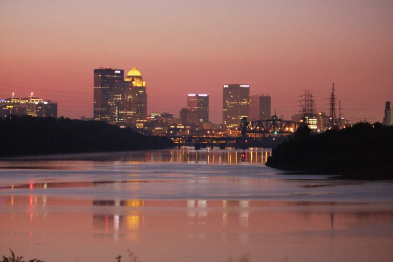
Photo: LouisvilleUSACE, CC BY 2.0

Photo: Warren LeMay, CC BY-SA 2.0
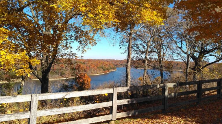
Photo: LouisvilleUSACE, CC BY 2.0

Photo: Alberto Cabello, CC BY 2.0
What travelers with rods ask in Louisville
Which lake is a short drive from Louisville, Kentucky?
Cherokee Park, about 2 miles northeast.
Where do Louisville boaters put in on KDFWR ramps?
George Rogers Clark Homesite Boat Ramp on Ohio River (Louisville), 5 miles away, on Ohio River (Louisville).
Which shore spots are near Louisville?
Cherokee Park, 3 miles away (bank access).
Which stores near Louisville sell gear for Kentucky lakes?
Academy Sports + Outdoors, 4901 Outer Loop Ste 144, one of 8 listings nearby.
Which Kentucky county holds Louisville?
Jefferson County. It is also a county seat.
Do I need a KDFWR fishing license near Louisville?
Kentuckians 16 and up pay $24.31 for a yearly license, while visitors pay $58.14.
Which towns are a short drive from Louisville?
Audubon Park (2 miles), Watterson Park (4 miles) and Shively (4 miles).
How many largemouth may an angler near Louisville keep?
Statewide daily limit 6*, possession 12*, minimum size 12". Lakes with a special regulation differ.
What KDFWR stream runs near Louisville?
Ohio River (Louisville) lies roughly 7 miles from town.
Is there a neighborhood fishing lake near Louisville?
Cherokee Park, 2 miles away, on the FINs stocking table.
Plan a Bluegrass trip from Louisville
Lake pages carry KDFWR ramps, rule tables and Corps readings.