Fishing in Montgomery County, Kentucky
County seat: Mount Sterling. Census 2020 residents: 28,114.
- 1lake pages
- 1launch sites
- 1river pages
 Pick for rainbow troutPiscifun Carbon X ultralight spinning reel28% OFFSale $57.99
Photo of Red River: Cindy Stuntz, CC BY 2.0
Montgomery County: the essentials
Montgomery County runs its courthouse out of Mount Sterling, and the 2020 Census found 28,114 people living there. The Census Gazetteer measures it at 197 square miles of land and 1.5 of water. The county holds 1 lake with full pages, led on size by Easy Walker Park Pond.
Count 1 launch site and 2 pier or bank sites on KDFWR's access map of the county. River pages for the county cover Slate Creek. KDFWR marks Slate Creek as a Blue Water Trail through the county. Easy Walker Park Pond is one of 1 lake the FINs program stocks in the county.
U.S. Census Bureau, 2020 Census counts (TIGERweb) and the 2023 Gazetteer, read November 10, 2026. KDFWR Fishing Access Sites in Kentucky layer (ArcGIS service), read November 10, 2026.
The Montgomery County fishing map, KDFWR layers only
KDFWR Fishing Access Sites in Kentucky layer (ArcGIS service), read November 10, 2026. Lake points are the mean of each water’s KDFWR access sites.
Lakes and farm-country ponds in Montgomery County
| Lake | Size | KDFWR ramps | Kind | Fish in the KDFWR table |
|---|---|---|---|---|
| Easy Walker Park Pond | 1.6 acres | 0 | FINs lake | largemouth bass, rainbow trout, bluegill |
Closest lake pages to Mount Sterling, all outside Montgomery County.
| Lake | From Mount Sterling | Size | KDFWR ramps | Kind | Fish in the KDFWR table |
|---|---|---|---|---|---|
| Rebel Trace Lake | 16 miles east | 21 acres | 1 | lake | none in the table |
| Clear Creek Lake | 19 miles east | 39 acres | 1 | lake | none in the table |
| Lake Carnico | 20 miles north | 112 acres | 1 | lake | largemouth bass, bluegill, redear sunfish |
| Cave Run Lake | 25 miles east | 7,880 acres | 16 | Corps reservoir | smallmouth bass, black crappie, spotted bass |
| Natural Bridge State Park | 25 miles southeast | 31 acres | 1 | lake | rainbow trout, largemouth bass |
| Jacobson Park Lake | 27 miles west | 46 acres | 1 | FINs lake | largemouth bass, rainbow trout, bluegill |
Acreage as KDFWR notes it on the this water waterbody page (KDFWR), read November 10, 2026. Waters with no KDFWR acre note print their mapped outline instead. KDFWR fishing waterbody list (app.fw.ky.gov), read November 10, 2026.
 For the rainbow trout herePiscifun Carbon XT ultralight spinning reel25% OFFSale $59.99
Fish the Montgomery County rule tables keep naming
Lake tables within 40 miles of Mount Sterling name largemouth bass most often.
KDFWR Special Fishing Regulations tables and guide stocking tables, counted per lake page within 40 miles; a regulation list, not a catch survey. KDFWR fishing waterbody list (app.fw.ky.gov), read November 10, 2026.
Named ponds of Montgomery County without a full write-up
KDFWR and its Named Lakes layer list 2 more lakes in Montgomery County that lack enough published facts for a page.
| Water | Size | Listed by |
|---|---|---|
| Greenbriar Reservoir | about 137 acres of mapped outline | Named Lakes layer |
| Lake Vough | about 14 acres of mapped outline | Named Lakes layer |
Outline area from the KDFWR Named Lakes in Kentucky layer (ArcGIS service; GIS polygon area, not a KDFWR surface-acre figure), read November 10, 2026. KDFWR fishing waterbody list (app.fw.ky.gov), read November 10, 2026.
Forks and branches threading Montgomery County
- Slate CreekBlue Water Trail, 5 KDFWR access sites, 1 USGS gauge
Real-time creek and river gauges in Montgomery County
| USGS gauge | Latest reading | Time (ET) |
|---|---|---|
| Slate Creek At Highway 713 Nr Mt. Sterling, Ky | 11 cfs, 1.34 ft gage height | Nov 13 7:15 pm |
US Geological Survey provisional data, retrieved Nov 13, 2026 8:32 pm ET. Provisional readings can be revised.
KDFWR fishing waterbody list (app.fw.ky.gov), read November 10, 2026. USGS Water Data for the Nation, live through the site, retrieved on page view.
Canoe water marked in Montgomery County
- Slate Creek36.1 miles as KDFWR lists them
KDFWR fishing waterbody list (app.fw.ky.gov), read November 10, 2026. KDFWR Blue Water Trails layer (ArcGIS service; miles as KDFWR lists them), read November 10, 2026.
Catfish and trout ponds of Montgomery County
| Lake as printed | County | Trout by month | Catfish by month |
|---|---|---|---|
| Easy Walker Park Pond | Montgomery | Feb 500, Mar 500, Nov 500 | Mar 400, Apr 400, May 400, Jun 400 |
2026 Kentucky Fishing & Boating Guide (Regulations Summary March 2026 to February 2027, updated September 2026, p. 6; KDFWR PDF), read November 10, 2026.
KDFWR boat ramps inside Montgomery County
- Howards Mill Dam Carry-Down Launch on Slate CreekSlate Creek, carry-down launch
Piers and bank access across Montgomery County
- Easy Walker Park PondEasy Walker Park Pond, bank access
- Easy Walker Park Pond Fishing PierEasy Walker Park Pond, fishing pier
KDFWR Fishing Access Sites in Kentucky layer (ArcGIS service), read November 10, 2026. KDFWR publishes fees as yes or no and lanes as single or multiple.
Nearest listed tackle to Montgomery County
- Winchester Bait & Tacklebait and tackle shop, Winchester, 13 miles
- Fryman's Boat Dockmarina, Paris, 14 miles
- Cabin Creek Baitsbait and tackle shop, Winchester, 15 miles
- Red River Boat Dock and Campgroundsmarina, Winchester, 16 miles
- Outpost R V Park & Campgroundbait and tackle shop, Salt Lick, 21 miles
Yellow Pages and tourism listings; straight-line miles only where the listing gives an exact address point.
Daily and size limits across Montgomery County
Anglers in Montgomery County use these statewide figures except on waters the guide singles out. The 2026 guide prices the resident annual fishing license at $24.31 and the nonresident annual at $58.14.
| Species | Daily | Possession | Minimum size |
|---|---|---|---|
| Largemouth Bass | 6* | 12* | 12" |
| Smallmouth Bass | 6* | 12* | 12" |
| Kentucky (Spotted) Bass | 6* | 12* | none |
| Coosa Bass | 6* | 12* | none |
| Rock Bass | 15 | 30 | none |
| Redear Sunfish | 20 | 40 | none |
| Walleye, Sauger, and their Hybrids | 6* | 12* | 14" |
| Muskellunge | 1 | 2 | 30" |
| Chain Pickerel | 5 | 10 | none |
| White & Hybrid Striped Bass | 15** | 30** | none** |
| Striped Bass | 5 | 10 | 15" |
| Yellow Bass | none | none | none |
Guide entries for Montgomery County waters
- Easy Walker Park PondLargemouth Bass: Must be 15 inches or over – Limit 1 per angler
Kentucky special-regulation waters
2026 Kentucky Fishing & Boating Guide (Regulations Summary March 2026 to February 2027, updated September 2026; KDFWR PDF), read November 10, 2026. License prices as printed in the 2026 Kentucky Fishing & Boating Guide, p. 2 (2026 CPI-adjusted fees; KDFWR PDF), read November 10, 2026.
Where Montgomery County turns up on the KDFWR record list
Montgomery County itself is absent from the record list; these waters inside 70 miles are on it.
| Species | Weight as listed | Water | Date |
|---|---|---|---|
| Muskellunge | 47.00 lbs | Cave Run Lake | 11/02/2008 |
| Golden Redhorse | 4.31 lbs | Red River | 04/22/1998 |
| Bighead Carp | 65.06 lbs | Kentucky River (Lower) | 07/18/2020 |
| Goldeye | 2.64 lbs | Kentucky River (Lower) | 04/21/2001 |
Kentucky state record fish as listed by KDFWR (record list), read November 10, 2026.
Plotted beside Montgomery County on the KDFWR map
Lodging towns across Montgomery County
- Mount Sterling2020 count 7,558
- Jeffersonville2020 count 1,708
- Camargo2020 count 1,020
Kentucky counties abutting Montgomery County
- Bath County12 miles northeast
- Clark County14 miles west
- Powell County16 miles south
- Menifee County19 miles east
A Piscifun kit for the drive out to Montgomery County


Piscifun and Amazon links are affiliate links; the site earns a commission on qualifying purchases.
Field-guide photos for fish at Montgomery County
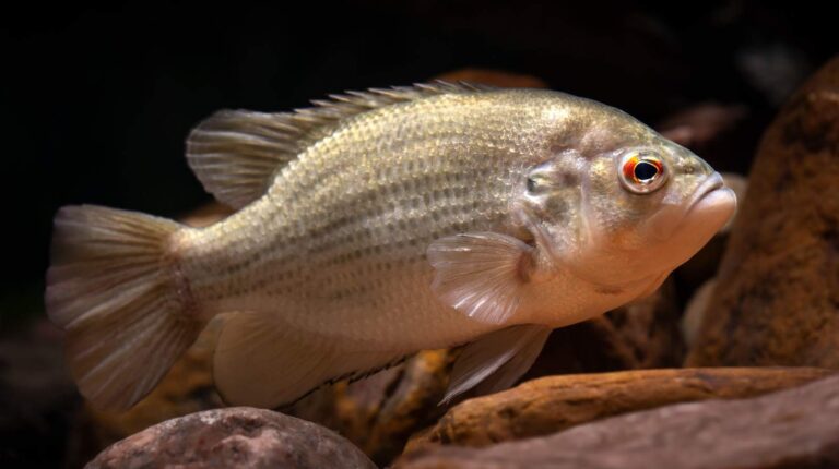
Photo: USFWS Mountain-Prairie, Public domain
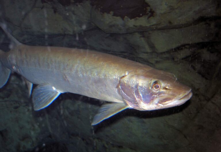
Photo: James St. John, CC BY 2.0

Photo: Under the same moon, CC BY 2.0
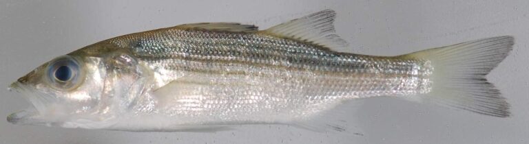
Photo: Smithsonian Environmental Research Center, CC BY 2.0

Fast answers on fishing Montgomery County
How many KDFWR launch sites does Montgomery County have?
The KDFWR layer shows 1 launch site.
Which Montgomery County lake tops the KDFWR size figures?
On size, Easy Walker Park Pond (1.6 acres).
Which species keep showing up in KDFWR tables around Montgomery County?
KDFWR tables on lakes within 40 miles name largemouth bass most often, then rainbow trout, redear sunfish and bluegill.
Does Montgomery County have a marina or bait store?
None inside; the list above has the closest.
Which Bluegrass town is the seat of Montgomery County?
County offices sit in Mount Sterling.
Do I need a KDFWR license to fish in Montgomery County?
A year on Kentucky water costs $24.31 with residency and $58.14 without it, per the 2026 guide.
Which counties are near Montgomery County?
Bath County, Clark County and Powell County sit nearest.
What crappie figures apply to Montgomery County water?
Statewide daily limit 20*, possession 40*, minimum size none. Special-regulation waters can differ.
Which waters in Montgomery County break from the statewide table?
1 water with a page here carry their own rules, beginning with Easy Walker Park Pond.
Is there a FINs lake in Montgomery County?
Easy Walker Park Pond, on the FINs stocking table.
Hitch up the boat for Kentucky water in Montgomery County
Open a lake for its launches, limits and Corps readings.