Fishing in Jefferson County, Kentucky
County seat: Louisville. Census 2020 residents: 782,969.
- 10lake pages
- 15launch sites
- 2river pages
 Pick for rainbow troutPiscifun Carbon X ultralight spinning reel28% OFFSale $57.99
Photo of Kentucky River: ksblack99, Public domain
An overview of the lakes and creeks of Jefferson County
Jefferson County, governed from Louisville, recorded 782,969 people in the 2020 Census. Inside its lines lie 381 square miles of land and 16.8 of water, per the Gazetteer. Of the county's 10 lakes with a page, McNeely Lake spreads the widest.
Boaters get 15 launch sites in the KDFWR layer; shore anglers get 21 pier or bank sites. Stream anglers can look at Floyd's Fork and Ohio River (Louisville). For a float, KDFWR lists Floyd's Fork – North Beckley to Cane Run Access and Floyd's Fork – Walnut Grove to Cliffside Center as a Blue Water Trail. City-park stocking under FINs reaches 5 lakes in the county, Cherokee Park among them.
U.S. Census Bureau, 2020 Census counts (TIGERweb) and the 2023 Gazetteer, read November 10, 2026. KDFWR Fishing Access Sites in Kentucky layer (ArcGIS service), read November 10, 2026.
Where the KDFWR access points sit in Jefferson County
KDFWR Fishing Access Sites in Kentucky layer (ArcGIS service), read November 10, 2026. Lake points are the mean of each water’s KDFWR access sites.
Ponds and reservoirs within Jefferson County
| Lake | Size | KDFWR ramps | Kind | Fish in the KDFWR table |
|---|---|---|---|---|
| McNeely Lake | 55 acres | 1 | lake | largemouth bass |
| Long Run Park | 29 acres | 1 | lake | none in the table |
| Tom Wallace Park | 4.7 acres | 0 | FINs lake | largemouth bass, rainbow trout, bluegill |
| Waverly Park | 4.4 acres | 0 | FINs lake | largemouth bass, rainbow trout, bluegill |
| Cherokee Park | 4.3 acres | 0 | FINs lake | largemouth bass, rainbow trout, bluegill |
| Watterson Lake | 3.7 acres | 0 | lake | bluegill, largemouth bass |
| Charlie Vettiner Park Lake | 3.2 acres | 0 | lake | none in the table |
| Chickasaw Park | 0.8 acres | 0 | lake | none in the table |
| Fisherman's Park | no KDFWR figure | 0 | FINs lake | largemouth bass, rainbow trout, bluegill |
| William F. Miles Park | no KDFWR figure | 0 | FINs lake | largemouth bass, rainbow trout, bluegill |
Acreage as KDFWR notes it on the this water waterbody page (KDFWR), read November 10, 2026. Waters with no KDFWR acre note print their mapped outline instead. KDFWR fishing waterbody list (app.fw.ky.gov), read November 10, 2026.
 For the rainbow trout herePiscifun Carbon XT ultralight spinning reel25% OFFSale $59.99
Regulated species near Jefferson County, by lake count
Counting KDFWR tables on lakes up to 40 miles from Louisville, largemouth bass comes first.
KDFWR Special Fishing Regulations tables and guide stocking tables, counted per lake page within 40 miles; a regulation list, not a catch survey. KDFWR fishing waterbody list (app.fw.ky.gov), read November 10, 2026.
Lakes in Jefferson County still thin on published facts
Beyond the paged lakes, Jefferson County has 25 named waters on KDFWR maps.
| Water | Size | Listed by |
|---|---|---|
| Silver Lake | about 16 acres of mapped outline | Named Lakes layer |
| Fisherman's Park Lakes | about 15 acres of mapped outline | Named Lakes layer |
| Cow Lake | about 12 acres of mapped outline | Named Lakes layer |
| Dreamland Lake | about 12 acres of mapped outline | Named Lakes layer |
| Riggs Lake | about 11 acres of mapped outline | Named Lakes layer |
| Crystal Lake | about 8.4 acres of mapped outline | Named Lakes layer |
| Willow Lake | about 6.7 acres of mapped outline | Named Lakes layer |
| Cardinal Hill Reservoir | about 5.1 acres of mapped outline | Named Lakes layer |
| Tucker Lake | about 4.3 acres of mapped outline | Named Lakes layer |
| William F. Miles Angler Lake | about 4 acres of mapped outline | Named Lakes layer |
| Watterson Park Lake | about 3.7 acres of mapped outline | Named Lakes layer |
| Chenoweth Park Ponds | about 3.2 acres of mapped outline | Named Lakes layer |
| Waggners Lake | about 3 acres of mapped outline | Named Lakes layer |
| Chenoweth Park Ponds | about 2.2 acres of mapped outline | Named Lakes layer |
| William F. Miles Wood Duck Lake | about 1.6 acres of mapped outline | Named Lakes layer |
| William F. Miles Green Heron Lake | about 1.2 acres of mapped outline | Named Lakes layer |
| Cow Lake | about 1.1 acres of mapped outline | Named Lakes layer |
| Lakeside Pool | about 1.1 acres of mapped outline | Named Lakes layer |
| Lighthouse Lake | about 0.9 acres of mapped outline | Named Lakes layer |
| William F. Miles Snapping Turtle Lake | about 0.9 acres of mapped outline | Named Lakes layer |
| Iroquois Park Lake | about 0.8 acres of mapped outline | Named Lakes layer |
| William F. Miles Dragonfly Lake | about 0.6 acres of mapped outline | Named Lakes layer |
| Oakwood Lake | about 0.5 acres of mapped outline | Named Lakes layer |
| LaClara Lakes | no figure | Named Lakes layer |
| Miles Park Lake #6 | no figure | Named Lakes layer |
Outline area from the KDFWR Named Lakes in Kentucky layer (ArcGIS service; GIS polygon area, not a KDFWR surface-acre figure), read November 10, 2026. KDFWR fishing waterbody list (app.fw.ky.gov), read November 10, 2026.
River write-ups for Jefferson County
- Floyd's Forkguide trout stream, Blue Water Trail, special limits, 8 KDFWR access sites, 4 USGS gauges
- Ohio River (Louisville)special limits, state-line water, 16 KDFWR access sites, 4 USGS gauges
USGS stream gauges inside Jefferson County
| USGS gauge | Latest reading | Time (ET) |
|---|---|---|
| Ohio River At Louisville, Ky | 35,700 cfs, 11.86 ft gage height | Nov 13 7:45 pm |
| Ohio River At Water Tower At Louisville, Ky | 39,800 cfs, 13.27 ft gage height | Nov 13 8:00 pm |
| Beargrass Creek At River Road At Louisville, Ky | -66 cfs, 8.12 ft gage height | Nov 13 7:45 pm |
| Floyds Fork Near Mt Washington, Ky | 77 cfs, 4.30 ft gage height | Nov 13 8:15 pm |
| Floyds Fork At Fisherville, Ky | 62 cfs, 1.19 ft gage height | Nov 13 8:20 pm |
| Pond Creek At Pendleton Road Near Louisville, Ky | 26 cfs, 4.39 ft gage height | Nov 13 7:45 pm |
US Geological Survey provisional data, retrieved Nov 13, 2026 8:32 pm ET. Provisional readings can be revised.
KDFWR fishing waterbody list (app.fw.ky.gov), read November 10, 2026. USGS Water Data for the Nation, live through the site, retrieved on page view.
KDFWR paddling routes in Jefferson County
- Floyd's Fork – North Beckley to Cane Run Access10.7 miles as KDFWR lists them
- Floyd's Fork – Walnut Grove to Cliffside Center8.8 miles as KDFWR lists them
KDFWR fishing waterbody list (app.fw.ky.gov), read November 10, 2026. KDFWR Blue Water Trails layer (ArcGIS service; miles as KDFWR lists them), read November 10, 2026.
Fishing in Neighborhoods sites in Jefferson County
| Lake as printed | County | Trout by month | Catfish by month |
|---|---|---|---|
| Cherokee Park Lake | Jefferson | Feb 750, Mar 750, Oct 750 | Apr 800, Jun 800 |
| Fisherman's Park Lake #3 | Jefferson | Feb 500, Mar 500, Oct 500 | Apr 400, Jun 400 |
| Fisherman's Park Lake #4 | Jefferson | Feb 500, Mar 500, Oct 500 | Apr 400, Jun 400 |
| Tom Wallace Park Lake | Jefferson | Feb 1,500, Mar 1,500, Oct 1,500 | Mar 1,000, Apr 1,000, May 1,000, Jun 1,000 |
| Waverly Park Lake | Jefferson | Feb 1,500, Mar 1,500, Oct 1,500 | Mar 900, Apr 900, May 900, Jun 900 |
| William F. Miles Angler Lake | Jefferson | Feb 750, Mar 750, Oct 750 | Mar 700, Apr 700, May 700, Jun 700 |
| William F. Miles Green Heron Lake | Jefferson | Feb 500, Mar 500, Oct 500 | Mar 200, Apr 200, May 200, Jun 200 |
2026 Kentucky Fishing & Boating Guide (Regulations Summary March 2026 to February 2027, updated September 2026, p. 6; KDFWR PDF), read November 10, 2026.
Put-ins listed for Jefferson County
- Broad Run Valley Paddling Access on Floyd's ForkFloyd's Fork, carry-down launch
- Cane Run Canoe Access on Floyd's ForkFloyd's Fork, carry-down launch
- Cliffside Paddling Access on Floyd's ForkFloyd's Fork, carry-down launch
- Cox's Park Boat Ramp on Ohio River (Louisville)Ohio River (Louisville), boat ramp, paved, multiple lanes, courtesy dock
- Creekside Canoe Access on Floyd's ForkFloyd's Fork, carry-down launch
- Duffy's Landing on Ohio River (Louisville)Ohio River (Louisville), boat ramp, paved, multiple lanes
- Fisherville Canoe Access on Floyd's ForkFloyd's Fork, carry-down launch
- George Rogers Clark Homesite Boat Ramp on Ohio River (Louisville)Ohio River (Louisville), boat ramp, paved, single lane
- Greenwood Ramp on Ohio River (Louisville)Ohio River (Louisville), boat ramp, paved, multiple lanes
- Jaycees Boat Ramp on Ohio River (Louisville)Ohio River (Louisville), boat ramp, paved, single lane
- Long Run Park Boat RampLong Run Park, boat ramp, paved, single lane, courtesy dock
- McNeely Boat RampMcNeely Lake, boat ramp, paved, single lane, courtesy dock
- Middle Creek Boat Ramp on Ohio River (Louisville)Ohio River (Louisville), boat ramp, paved, multiple lanes
- North Beckley Canoe Access on Floyd's ForkFloyd's Fork, carry-down launch
- Seaton Valley Paddling Access on Floyd's ForkFloyd's Fork, carry-down launch
KDFWR bank fishing sites in Jefferson County
- Bandman Park on Ohio River (Louisville)Ohio River (Louisville), bank access
- Boulder Pond on Floyd's ForkFloyd's Fork, bank access
- Chenoweth Park on Charlie Vettiner Park LakeCharlie Vettiner Park Lake, bank access
- Cherokee ParkCherokee Park, bank access
- Chickasaw ParkChickasaw Park, bank access
- Fisherman's Park LakesFisherman's Park, bank access
- McAlpine Lock and Dam Bank Access on Ohio River (Louisville)Ohio River (Louisville), bank access
- Shawnee Park on Ohio River (Louisville)Ohio River (Louisville), bank access
- Shippingport Island Fishing Access on Ohio River (Louisville)Ohio River (Louisville), bank access
- Tom Wallace Park LakeTom Wallace Park, bank access
- Tom Wallace Park Lake Fishing PierTom Wallace Park, fishing pier
- Watterson Lake Bank AccessWatterson Lake, bank access
- Waverly Park LakeWaverly Park, bank access
- Waverly Park Lake Fishing PierWaverly Park, fishing pier
- William F. Miles Angler Lake Bank Access on William F. Miles ParkWilliam F. Miles Park, bank access
- William F. Miles Dragonfly Lake Bank Access on William F. Miles ParkWilliam F. Miles Park, bank access
- William F. Miles Green Heron Lake Bank Access on William F. Miles ParkWilliam F. Miles Park, bank access
- William F. Miles Green Heron Lake Fishing Pier on William F. Miles ParkWilliam F. Miles Park, fishing pier
- William F. Miles Snapping Turtle Lake Bank Access on William F. Miles ParkWilliam F. Miles Park, bank access
- William F. Miles Wood Duck Lake Bank Access on William F. Miles ParkWilliam F. Miles Park, bank access
- Iroquois ParkIroquois Park, bank access
KDFWR Fishing Access Sites in Kentucky layer (ArcGIS service), read November 10, 2026. KDFWR publishes fees as yes or no and lanes as single or multiple.
The guide limits behind Jefferson County fishing
Statewide creel and size rows govern Jefferson County unless a water has an exception of its own. An annual Kentucky license runs $24.31 for residents; nonresidents are charged $58.14.
| Species | Daily | Possession | Minimum size |
|---|---|---|---|
| Largemouth Bass | 6* | 12* | 12" |
| Smallmouth Bass | 6* | 12* | 12" |
| Kentucky (Spotted) Bass | 6* | 12* | none |
| Coosa Bass | 6* | 12* | none |
| Rock Bass | 15 | 30 | none |
| Redear Sunfish | 20 | 40 | none |
| Walleye, Sauger, and their Hybrids | 6* | 12* | 14" |
| Muskellunge | 1 | 2 | 30" |
| Chain Pickerel | 5 | 10 | none |
| White & Hybrid Striped Bass | 15** | 30** | none** |
| Striped Bass | 5 | 10 | 15" |
| Yellow Bass | none | none | none |
Special-regulation waters of Jefferson County
- Cherokee ParkLargemouth Bass: Must be 15 inches or over – Limit 1 per angler
- Fisherman's ParkLargemouth Bass: Must be 15 inches or over – Limit 1 per angler
- Floyd's ForkRainbow Trout: From October 1 through March 31, all trout shall be immediately released and only artificial baits may be used during this time
- McNeely LakeLargemouth Bass: 12-15 inch protective slot limit. All fish between 12 and 15 inches must be released. Limit 6 black bass per angler.
- Ohio River (Louisville)Hybrid Striped Bass: Limit 30 per angler of White Bass, Yellow Bass, Striped Bass and their Hybrids, singly or combined, No more than 4 fish may be over 15 inches
- Tom Wallace ParkLargemouth Bass: Must be 15 inches or over – Limit 1 per angler
- Watterson LakeBluegill: Statewide Regulations Apply
- Waverly ParkLargemouth Bass: Must be 15 inches or over – Limit 1 per angler
- William F. Miles ParkLargemouth Bass: Must be 15 inches or over – Limit 1 per angler
Kentucky special-regulation waters
2026 Kentucky Fishing & Boating Guide (Regulations Summary March 2026 to February 2027, updated September 2026; KDFWR PDF), read November 10, 2026. License prices as printed in the 2026 Kentucky Fishing & Boating Guide, p. 2 (2026 CPI-adjusted fees; KDFWR PDF), read November 10, 2026.
Record-book fish with a Jefferson County connection
No KDFWR record names water in Jefferson County, so record waters within 70 miles are shown instead.
| Species | Weight as listed | Water | Date |
|---|---|---|---|
| White Catfish | 5.27 lbs | Guist Creek Lake | 10/11/2016 |
| Bighead Carp | 65.06 lbs | Kentucky River (Lower) | 07/18/2020 |
| Goldeye | 2.64 lbs | Kentucky River (Lower) | 04/21/2001 |
| Bowfin | 15.08 lbs | Green River (Upper) | 05/31/1999 |
Kentucky state record fish as listed by KDFWR (record list), read November 10, 2026.
Bait counters across Jefferson County
Where Jefferson County anglers buy nightcrawlers
- Academy Sports + Outdoors, 13401 Shelbyville Rd Ste 140bait and tackle shop, Louisville
- Academy Sports + Outdoors, 4901 Outer Loop Ste 144bait and tackle shop, Louisville
- Bass Pro Shopsbait and tackle shop, Louisville
- Cabela's, 5100 Norton Healthcare Blvdbait and tackle shop, Louisville
- Catfish Jeff Bait & Tacklebait and tackle shop, Louisville
- Dick's Sporting Goods, 3500 S Hurstbourne Pkwybait and tackle shop, Louisville
- Dick's Sporting Goods, 7601 Trade Port Drbait and tackle shop, Louisville
- Dick's Sporting Goods, 7900 Shelbyville Rdbait and tackle shop, Louisville
- Karem's Bait Storebait and tackle shop, Louisville
- Pepper Tackle Shopbait and tackle shop, Louisville
- Smyrna Bait N Tacklebait and tackle shop, Louisville
- Captains Quarters Yacht Clubmarina, Prospect
- Harrodsmarina, Louisville
Yellow Pages and Kentucky tourism listings (city of business), read November 10, 2026.
Handy to Jefferson County
Cities of Jefferson County
- Louisville2020 count 246,161
- Jeffersontown2020 count 28,474
- St. Matthews2020 count 17,534
- Shively2020 count 15,636
- Lyndon2020 count 11,008
- Middletown2020 count 9,706
- Douglass Hills2020 count 5,456
- Hurstbourne2020 count 4,683
- Prospect2020 count 4,592
- Indian Hills2020 count 2,860
- Graymoor-Devondale2020 count 2,853
- Anchorage2020 count 2,500
- Windy Hills2020 count 2,427
- Hurstbourne Acres2020 count 1,957
- Worthington Hills2020 count 1,563
- St. Regis Park2020 count 1,438
Bordering Jefferson County
- Bullitt County15 miles south
- Oldham County18 miles northeast
- Spencer County22 miles southeast
- Shelby County24 miles east
Piscifun reels and line worth loading before Jefferson County


Piscifun and Amazon links are affiliate links; the site earns a commission on qualifying purchases.
Sorting out the Jefferson County fish by eye

Photo: Free Public Domain Illustrations by rawpixel, CC BY 2.0
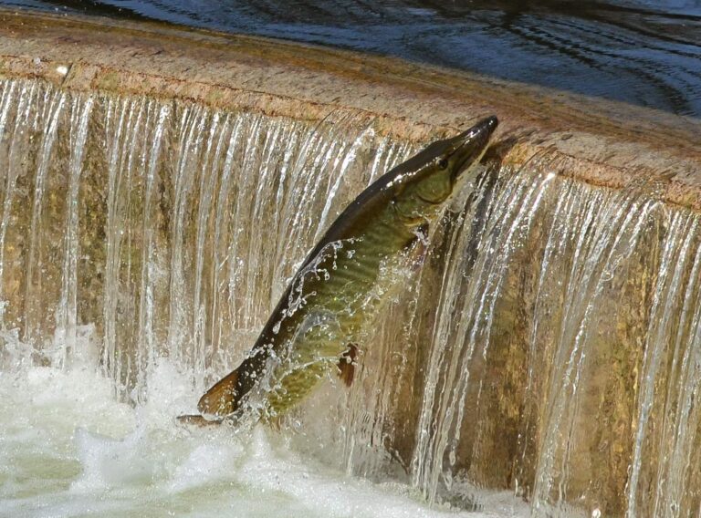
Photo: Richard Hurd, CC BY 2.0

Photo: Under the same moon, CC BY 2.0

Photo: USFWS Pacific Southwest Region, Public domain
Lakes, creeks and ramps of Jefferson County, asked and answered
Which KDFWR launches serve Jefferson County?
15 launch sites appear in the KDFWR access layer for the county.
Where is the widest KDFWR lake in Jefferson County?
McNeely Lake comes first with 55 acres.
What fish get regulated attention near Jefferson County?
KDFWR tables on lakes within 40 miles name largemouth bass most often, then channel catfish, blue catfish and bluegill.
Which Jefferson County stores sell fishing gear for Kentucky lakes?
Academy Sports + Outdoors, 13401 Shelbyville Rd Ste 140 heads a list of 13.
Where does Jefferson County keep its Kentucky courthouse?
Louisville has it.
What does a Kentucky fishing license cost for Jefferson County?
Kentuckians 16 and up pay $24.31 for a yearly license, while visitors pay $58.14.
Which counties should I check near Jefferson County?
The closest county pages are Bullitt County, Oldham County and Spencer County.
How many crappie may an angler in Jefferson County take home?
Statewide daily limit 20*, possession 40*, minimum size none. Special-regulation waters can differ.
Does the guide list exceptions for Jefferson County water?
9 waters with a page here carry their own rules, beginning with Cherokee Park.
Which park lake in Jefferson County does KDFWR stock?
Cherokee Park, Fisherman's Park and Tom Wallace Park, on the FINs stocking table.
Plan a Bluegrass day in Jefferson County
Lake pages carry KDFWR ramps, rule tables and any guide exception.