Fishing near Fishers, Indiana
Hamilton County, population 98,977 (2020 Census).
- 2 milesto nearest lake page
- 8ramps nearby
 Pick for largemouthPiscifun Chaos Pro CNC baitcasting reel25% OFFSale $97.99
Photo: Tom Britt, CC BY 2.0
What Fishers offers a Hoosier angler
Fishers is a city of Hamilton County; 2020 Census population 98,977. Geist Reservoir sits around 2 miles to the south, the first lake with a page. Geist Reservoir boat ramp, roughly 3 miles off, is the nearest ramp on the DNR layer.
Lantern Woods Pond (Cheeney Creek Natural Area) on Latern Woods Pond offers shore fishing 3 miles out.
Census 2020 population and Gazetteer point for Fishers; miles are straight lines.
Lakes in reach of Fishers
| Lake | Distance | Area | Max depth | Kind | Ramps | Fish the DNR names |
|---|---|---|---|---|---|---|
| Geist Reservoir | 2 miles south | 1,153 acres (NHD outline area) | reservoir | 1 | bluegill, largemouth bass | |
| Latern Woods Pond | 3 miles west | pond | 0 | bluegill, largemouth bass | ||
| Flat Fork Creek Park Pond A | 5 miles southeast | pond | 1 | bluegill, channel catfish, largemouth bass | ||
| Flat Fork Creek Park Pond B | 5 miles east | pond | 1 | bluegill, channel catfish, largemouth bass | ||
| Founders Park Pond | 6 miles west | pond | 0 | redear sunfish, largemouth bass, channel catfish | ||
| Duck Pond | 6 miles south | pond | 0 | bluegill, largemouth bass, hybrid sunfish |
Acres are the NHD outline area of the mapped lake (USGS National Hydrography Dataset via IndianaMap), not a DNR survey figure. Depths from DNR Status & Trends surveys with the survey year. Indiana DNR Fishing Access Sites layer (shown on the DNR Where to Fish map; attributes as recorded, blank where not recorded), read November 5, 2026.
 For the largemouth herePiscifun AlinoX 300 low profile baitcaster34% OFFSale $104.99
Rivers near Fishers
- Fall Creek (Delaware and Hamilton Counties)8 miles, 1 DNR access site, 4 USGS gauges
- Sugar Creek (Hancock and Henry Counties)14 miles, NRC Outstanding River (2013 list), 1 DNR access site, 3 USGS gauges
Stream readings around Fishers
| USGS gauge | Latest reading | Time (ET) |
|---|---|---|
| Sand Creek At 116th Street At Fishers, In | 1 cfs, 1.84 ft gage height | Nov 6 10:15 pm |
| Mud Creek At Fishers, In | 47 cfs, 3.11 ft gage height | Nov 6 9:45 pm |
| White River At Conner Prairie Near Noblesville, In | 388 cfs, 3.31 ft gage height | Nov 6 9:30 pm |
US Geological Survey provisional data, retrieved Nov 6, 2026 10:33 pm ET. Provisional readings can be revised.
NHD named flowlines, DNR river designations and USGS gauges (live readings); read November 5, 2026.
Ramps, piers and lakes plotted around Fishers
- Geist Reservoir boat rampGeist Reservoir, concrete ramp, courtesy dock, ADA access, lights, fee: Entry Fee, 3 miles
- Prather Park on White RiverWhite River, concrete ramp, restrooms, lights, 4 miles
- 116th Street boat ramp on White RiverWhite River, boat ramp, no fee recorded, 5 miles
- Flat Fork Creek Park Pond AFlat Fork Creek Park Pond A, gravel ramp, fishing pier, ADA access, restrooms, lights, 5 miles
- Flat Fork Creek Park Pond BFlat Fork Creek Park Pond B, gravel ramp, fishing pier, ADA access, restrooms, lights, 5 miles
- Noblesville boat ramp on White RiverWhite River, concrete ramp, ADA access, restrooms, lights, no fee recorded, 6 miles
- Forest Park on White RiverWhite River, concrete ramp, ADA access, restrooms, lights, no fee recorded, 6 miles
- Fall Creek Parkway boat rampFall Creek (Delaware and Hamilton Counties), concrete ramp, no fee recorded, 8 miles
Boatless options around Fishers
- Lantern Woods Pond (Cheeney Creek Natural Area) on Latern Woods Pondfishing pier, ADA access, fee: Entry Fee, 3 miles
- Geist Park on Fall Creek (Delaware and Hamilton Counties)shore access, restrooms, lights, no fee recorded, 4 miles
- McCord Square Park Pondshore access, no fee recorded, 5 miles
- Hazel Dell Landing on White Rivershore access, no fee recorded, 6 miles
- Founders Parkshore access, lights, no fee recorded, 6 miles
- Town Run Trail Park on White Rivershore access, no fee recorded, 6 miles
Indiana DNR Fishing Access Sites layer (shown on the DNR Where to Fish map; attributes as recorded, blank where not recorded), read November 5, 2026.
Fishers bait and guide listings
Hooks and line for Fishers anglers
- Corp Fishers Rcrbait and tackle shop, Fishers, 1 mile
- Pine Crest Marinemarina, Fishers, 2 miles
- Geist Marinamarina, Indianapolis, 2 miles
- Cabela's Noblesvillesporting goods store, Noblesville, 3 miles
- Dick's Sporting Goods Noblesvillesporting goods store, Noblesville, 3 miles
- Dick's Sporting Goods Indianapolis, 6020 E 82nd Streetsporting goods store, Indianapolis, 6 miles
- Schwartz's Bait & Tacklebait and tackle shop, Noblesville, 6 miles
- Flymasters of Indianapolisbait and tackle shop, Indianapolis, 7 miles
Hiring a guide out of Fishers
- White River Guide Servicefishing guide, (317) 691-7388
Yellow Pages, chain store and DNR property listings (miles only for shops with an exact point); DNR licensed guide list and tourism bureau charter listings; read November 5, 2026.
Record lines for lakes by Fishers
| Species | Weight | Water | County | Year |
|---|---|---|---|---|
| Yellow Bass | 2 lb. 15 oz. | Morse Reservoir | Hamilton County | 2000 |
| Rock Bass | 3 lb. | Sugar Creek (Hancock and Henry Counties) | Hancock County | 1969 |
Indiana DNR Indiana Record Fish Program list (keeper: Indiana DNR Division of Fish & Wildlife (Indiana Record Fish Program); angler names left off here), read November 5, 2026. Waters within 40 miles.
Guide rows for Fishers visitors
Hoosiers 18 and up pay $23 for a year of fishing; anglers from other states pay $60.
| Species | Daily limit | Size limit |
|---|---|---|
| Bluegill | Unlimited | no size limit |
| Redear Sunfish | 25 | no size limit |
| Black Bass: largemouth, smallmouth, and spotted bass (in lakes) | 5, any combination of largemouth, smallmouth, or spotted bass | 14 inches |
| Black Bass: largemouth, smallmouth, and spotted bass (in rivers and streams) | 5, any combination of largemouth, smallmouth, or spotted bass | No fish 12 to 15 inches may be kept, and no more than two fish over 15 inches may be kept |
| Black Bass: largemouth, smallmouth, and spotted bass (in Lake Michigan) | 3, any combination of largemouth, smallmouth, or spotted bass | 14 inches |
| Yellow Bass | Unlimited | no size limit |
| White Bass, Hybrid Striped Bass | 12, any combination of white bass or hybrid striped bass | No more than two fish may exceed 17 inches |
| Striped Bass | 2 | no size limit |
| Rock Bass | 25 | no size limit |
| Crappie | 25 | no size limit |
| Walleye, Walleye-Sauger Hybrid (Saugeye), Sauger | 6, any combination of walleye, walleye-sauger hybrid, and sauger | For walleye: 14 inches south of SR 26; 16 inches north of SR 26 For sauger and saugeye: No size limit |
| Muskellunge and Tiger Muskellunge | 1 muskellunge or 1 tiger muskellunge | 36 inches |
| Northern Pike | 3 | 24 inches; no more than one 30 inches or longer |
| Yellow Perch | Unlimited (15 only on Lake Michigan) | no size limit |
| Catfish: Channel, Blue, Flathead (in rivers and streams) | Unlimited | 13 inches; not more than one blue catfish that’s at least 35 inches, one flathead catfish at least 35 inches, and one channel catfish at least 28 inches or longer may be kept |
| Catfish: Channel, Blue, Flathead (in lakes) | 10 | None; not more than one blue catfish that’s at least 35 inches, one flathead catfish at least 35 inches, and one channel catfish at least 28 inches or longer may be kept |
| Bullhead | Unlimited | no size limit |
| Shovelnose Sturgeon | Unlimited | 25 inches (fork length) |
Statewide limits as printed, 2026-2027 Indiana Fishing Regulations Guide (eRegulations, linked from the Indiana DNR), read November 5, 2026. Lake and river pages print any special regulation entry. Indiana DNR license fees (license year April 1 to March 31), read November 5, 2026.
Close to Fishers
Neighbouring places to Fishers
- McCordsville5 miles
- Noblesville5 miles
- Lawrence7 miles
- Fortville7 miles
- Lapel8 miles
County fishing page covering Fishers
- Hamilton Countyseat: Noblesville
Piscifun reels to toss in the boat for Fishers


Piscifun and Amazon links are affiliate links; the site earns a commission on qualifying purchases.
Hoosier lakes and creeks near Fishers, on camera
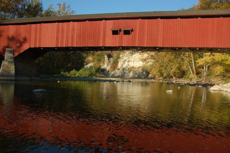
Photo: bob, CC BY 2.0
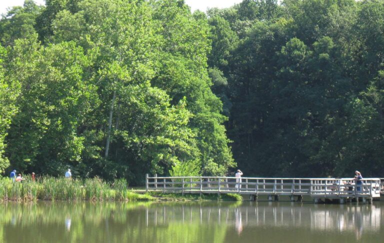
Photo: pepplerchristine, CC BY-SA 2.0

Photo: Carmel Central, CC BY-SA 2.0
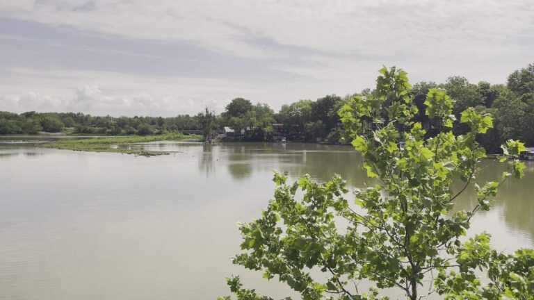
Photo: Sarah Stierch, CC BY 2.0
Fishing near Fishers, answered
Which paged lake can Fishers anglers reach soonest?
Geist Reservoir, 2 miles south.
How many miles separate Fishers from a public ramp?
Geist Reservoir boat ramp is the nearest, 3 miles away.
Where can kids try a pier close to Fishers?
It is Lantern Woods Pond (Cheeney Creek Natural Area) on Latern Woods Pond, some 3 miles off.
Which shop near Fishers keeps a minnow tank?
Corp Fishers Rcr is listed 1 mile from town.
Inside which county line is Fishers?
Hamilton County; its county page maps every DNR ramp.
What does the DNR charge a Fishers visitor to fish?
Out-of-state anglers buy a $60 annual Indiana license, or $15 for a single day.
Which lake around Fishers maps the widest?
Geist Reservoir maps at 1,153 acres (NHD outline area) and lies 2 miles off.
Which Hoosier towns flank Fishers?
The nearest town guides: McCordsville (5 miles), Noblesville (5 miles) and Lawrence (7 miles).
Which record list lines name water around Fishers?
Yellow Bass, 2 lb. 15 oz., 2000, from Morse Reservoir.
Leave Fishers at first light
Each lake or river named above opens its own Indiana guide.