Muscatatuck River Fishing
An Indiana river through Jackson County and 4 other counties; NRC Outstanding River (2013 list).
 Pick for catfishPiscifun LumiCat II catfish rod48% OFFSale $114.99
Photo of Madison: Warren LeMay, CC0 1.0
The Muscatatuck River, the Hoosier rundown
The Muscatatuck River covers 49 miles of NHD-mapped channel in Jackson County and 4 other counties. State lists class it as NRC Outstanding River (2013 list). Crothersville is the nearest Census place, about 5 miles from the mapped point.
The DNR access layer maps 4 ramps on it. You can check 1 USGS gauge for today.
USGS NHD named flowlines (mapped length in Indiana, not a DNR figure); Indiana DNR stream designation layers and Fishing Access Sites, read November 5, 2026.
What the state lists the Muscatatuck River as
- DesignationNRC Outstanding River (2013 list)
- Reach as listedConfluence of Graham Creek and Big Washington Creek to confluence with East Fork White River
- Reach as listedFrom confluence with Vernon River (12d boundary) approximately 5 miles west of Millport to confluence with Graham Cr. and Big Creek
- Navigableon the Indiana navigable waterways list
For the Muscatatuck River, the reach notes are the wording of the source lists.
Natural Resources Commission Outstanding Rivers list (2013), DNR put-and-take and salmonid stream layers, Indiana navigable waterways list; read November 5, 2026.
What the Muscatatuck River is doing right now
| USGS gauge | Latest reading | Time (ET) |
|---|---|---|
| Muscatatuck River Near Deputy, In | 3.34 ft gage height | Nov 6 10:30 pm |
US Geological Survey provisional data, retrieved Nov 6, 2026 11:34 pm ET. Provisional readings can be revised.
Live USGS data on the Muscatatuck River may still be revised.
NWS stage figures for the Muscatatuck River
| NWS gauge | Reading | Flow | Flood category | Time (UTC) |
|---|---|---|---|---|
| Muscatatuck River at Deputy | 3.42 ft | 0.024 kcfs | no flooding | 2026-11-05 19:30:00 UTC |
NOAA National Water Prediction Service gauge readings (water.noaa.gov), read November 5, 2026; dated readings, not live (kcfs = thousand cubic feet per second).
USGS instantaneous values, provisional.
The fish the DNR records for the Muscatatuck River
DNR lists produced this the Muscatatuck River species line.
Indiana DNR Fishing Access Sites species fields, Indiana DNR fish stocking dashboard (year, month, water, species, number and average length as listed; repeat stockings summed by DNR), read November 5, 2026; Indiana DNR Indiana Record Fish Program list (keeper: Indiana DNR Division of Fish & Wildlife (Indiana Record Fish Program); angler names left off here), read November 5, 2026.
 For the catfish herePiscifun Chaos XS round baitcaster36% OFFSale $57.99
Getting onto the Muscatatuck River
| Site | Type | Recorded attributes | Managed by |
|---|---|---|---|
| Low Water Bridge boat ramp on Muscatatuck River | boat ramp | concrete ramp, ADA access, no fee recorded | Division of Fish & Wildlife, Public Access South |
| Milport boat ramp on Muscatatuck River | boat ramp | concrete ramp, no fee recorded | Division of Fish & Wildlife, Public Access South |
| Sages Ferry boat ramp on Muscatatuck River | boat ramp | boat ramp, ADA access, no fee recorded | Division of Fish & Wildlife, Public Access South |
| White-Muscatatuck boat ramp | boat ramp | concrete ramp, ADA access, no fee recorded | Division of Fish & Wildlife, Public Access South |
| The Commons shore access on Muscatatuck River | shore access | no fee recorded | Jennings County Parks |
Indiana DNR Fishing Access Sites layer (shown on the DNR Where to Fish map; attributes as recorded, blank where not recorded), read November 5, 2026.
Stocking dashboard lines for the Muscatatuck River
| Year | Month | Species as listed | Number | Avg length (in) |
|---|---|---|---|---|
| 1997 | April | Rainbow Trout | 500 | 10.3 |
| 1996 | April | Rainbow Trout | 500 | 11.15 |
Indiana DNR fish stocking dashboard (year, month, water, species, number and average length as listed; repeat stockings summed by DNR), read November 5, 2026.
Bag and size rules on the Muscatatuck River
| Species as printed | Daily limit | Size limit |
|---|---|---|
| Black Bass: largemouth, smallmouth, and spotted bass (in rivers and streams) | 5, any combination of largemouth, smallmouth, or spotted bass | No fish 12 to 15 inches may be kept, and no more than two fish over 15 inches may be kept |
| Catfish: Channel, Blue, Flathead (in rivers and streams) | Unlimited | 13 inches; not more than one blue catfish that’s at least 35 inches, one flathead catfish at least 35 inches, and one channel catfish at least 28 inches or longer may be kept |
| Bluegill | Unlimited | no size limit |
| Redear Sunfish | 25 | no size limit |
| White Bass, Hybrid Striped Bass | 12, any combination of white bass or hybrid striped bass | No more than two fish may exceed 17 inches |
| Walleye, Walleye-Sauger Hybrid (Saugeye), Sauger | 6, any combination of walleye, walleye-sauger hybrid, and sauger | For walleye: 14 inches south of SR 26; 16 inches north of SR 26 For sauger and saugeye: No size limit |
| Northern Pike | 3 | 24 inches; no more than one 30 inches or longer |
Bass and catfish in the Muscatatuck River fall under the river and stream rows of the guide.
- 12-inch river bass countiesAll rivers and streams in Posey, Vanderburgh, Warrick, Spencer, Perry, Crawford, Harrison, Floyd, Clark, Jefferson, Switzerland, Ohio, and Dearborn counties (with the exception of the Blue River, where the slot limit applies in Crawford, Harrison, and Washington counties).
Anglers 18 and older carry an Indiana fishing license ($23 a year for residents, $60 for nonresidents).
Statewide limits as printed, 2026-2027 Indiana Fishing Regulations Guide (eRegulations, linked from the Indiana DNR), read November 5, 2026. Indiana DNR license fees (license year April 1 to March 31), read November 5, 2026.
The Muscatatuck River in a table with nearby streams
Next over from the Muscatatuck River: West Fork Blue River, around 14 miles away.
| Stream | Distance | Mapped NHD miles in IN | USGS gauges | DNR ramps |
|---|---|---|---|---|
| Muscatatuck River | this stream | 49 | 1 | 4 |
| West Fork Blue River | 14 miles southwest | 14 | 1 | 0 |
| Vernon Fork Muscatatuck River | 22 miles northeast | 79 | 1 | 2 |
| Big Creek (Jefferson and Jennings Counties) | 23 miles east | 40 | 1 | 0 |
| Silver Creek (Clark and Floyd Counties) | 24 miles south | 35 | 1 | 0 |
| Graham Creek (Jefferson and Jennings Counties) | 26 miles northeast | 48 | 0 | 0 |
USGS NHD and gauges, Indiana DNR Fishing Access Sites; read November 5, 2026.
A few Hoosier miles off Muscatatuck River
Other lakes a state-road drive from Muscatatuck River
- Delaney Creek Park Lake7 miles
- Potter Lake8 miles
- Elk Creek Lake8 miles
- Spurgeon Hollow Lake8 miles
Topping off the minnow bucket near Muscatatuck River
- Anglers Denfly shop, Scottsburg, 9 miles
- Red Barn Bait Shopbait and tackle shop, Salem, 12 miles
- Four Seasons Market & Baitbait and tackle shop, Borden, 22 miles
- Bait and Tacklebait and tackle shop, North Vernon, 22 miles
- Monday's Sporting Goodsbait and tackle shop, North Vernon, 23 miles
- Adams Marinamarina, Madison
Towns with a motel near Muscatatuck River
- Crothersville5 miles
- Austin6 miles
- Scottsburg9 miles
Indiana streams near the Muscatatuck River
- West Fork Blue River14 miles
- Vernon Fork Muscatatuck River22 miles
- Big Creek (Jefferson and Jennings Counties)23 miles
- Silver Creek (Clark and Floyd Counties)24 miles
- Graham Creek (Jefferson and Jennings Counties)26 miles
Indiana counties along Muscatatuck River
- Jackson County
- Jefferson County
- Jennings County
- Scott County
- Washington County
Piscifun tackle for the next run to Muscatatuck River


Piscifun and Amazon links are affiliate links; the site earns a commission on qualifying purchases.
Picture ID for the fish swimming at Muscatatuck River
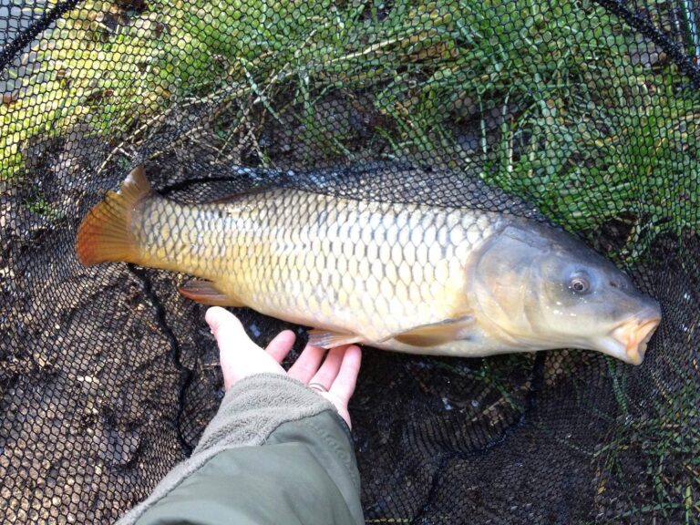
Photo: Craig Chew-Moulding, CC BY-SA 2.0
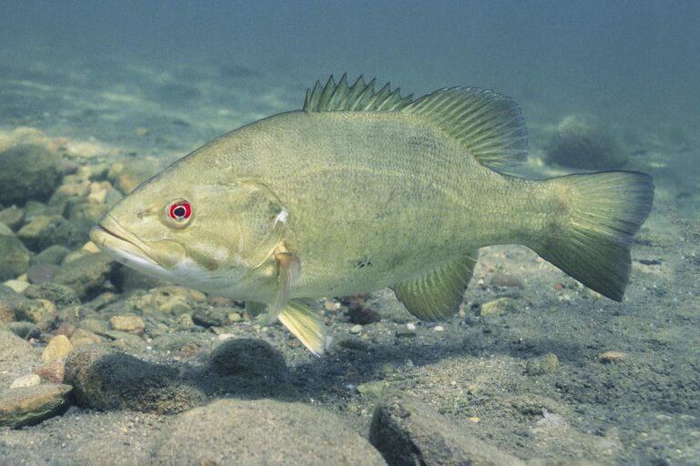
Photo: Yellowstone National Park, Public domain
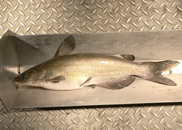
Photo: Oregon Department of Fish & Wildlife, CC BY-SA 2.0
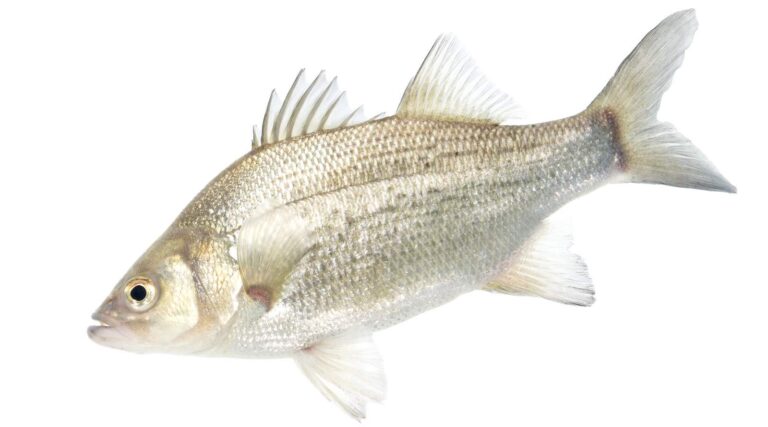
Photo: USFWS Mountain-Prairie, Public domain
The Muscatatuck River, one question at a time
Where in Indiana is the Muscatatuck River?
It crosses Jackson County and 4 other counties, and its mapped point is about 5 miles from Crothersville.
How many miles of the Muscatatuck River are in Indiana?
The NHD map shows 49 miles of line in Indiana; that is a mapping figure, not a DNR survey.
Which DNR access site puts me on the Muscatatuck River?
5 access sites are mapped, Low Water Bridge boat ramp on Muscatatuck River among them.
What swims in the Muscatatuck River?
The DNR lists common carp, catfish, smallmouth bass, bluegill and rainbow trout.
May I keep a 13-inch bass from the Muscatatuck River?
The guide row for rivers and streams reads: 5, any combination of largemouth, smallmouth, or spotted bass; No fish 12 to 15 inches may be kept, and no more than two fish over 15 inches may be kept In this county set the 12-inch river rule applies instead, per the guide.
What will an Indiana license run me for the Muscatatuck River?
Anglers 18 and older carry an Indiana fishing license ($23 a year for residents, $60 for nonresidents).
Where can I check the flow of the Muscatatuck River?
See Muscatatuck River Near Deputy, IN above.
What tackle store is closest on the drive to the Muscatatuck River?
Anglers Den, about 9 miles away, heads the list.
Is the Muscatatuck River an Outstanding River?
State lists name it: NRC Outstanding River (2013 list).
Wade into the Muscatatuck River this season
The flow panel tells you when to go.