Waubee Lake Fishing
DNR-listed lake water in Kosciusko County, 199 acres (NHD outline area).
 Pick for redear sunfishPiscifun Carbon X ultralight spinning reel28% OFFSale $57.99
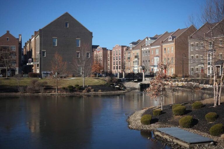
Photo of Warsaw: Brad P, CC BY 2.0
What an Indiana angler should know about Waubee Lake
Kosciusko County holds Waubee Lake, a lake measured at 199 acres (NHD outline area). Its deepest sounding on the 2010 DNR survey was 50 feet. From the DNR point it is roughly 2 miles to Milford.
Trailer boaters get 1 boat ramp on the DNR access map. The dashboard names it in 13 stocking rows.
Acres are the NHD outline area of the mapped lake (USGS National Hydrography Dataset via IndianaMap), not a DNR survey figure. Indiana DNR public lakes layer (county, owner, fisheries district number, location text), read November 5, 2026. Indiana DNR Status & Trends lake survey points (2010 survey), read November 5, 2026. Census 2023 places.
Where Waubee Lake sits, by the DNR layer
- Location (DNR)0.75 mi. S of Milford on SR 15 to CR 1150. Go 1 mile east on CR 1150 and turn right on Camp Mack Dr.
- Owner (DNR)State
- DNR districtDNR fisheries district 3
- Public freshwater lakeon the Indiana list of public freshwater lakes
For Waubee Lake, the rows come straight from DNR map attributes.
Indiana DNR public lakes layer (county, owner, fisheries district number, location text), read November 5, 2026.
What swims in Waubee Lake, per the DNR
For Waubee Lake, these names come from DNR layers and tables only.
Clarity, plants and fish counts at Waubee Lake
One 2010 visit to Waubee Lake gave the DNR these numbers.
Indiana DNR lake layer and Fishing Access Sites species fields, Indiana DNR fish stocking dashboard (year, month, water, species, number and average length as listed; repeat stockings summed by DNR), read November 5, 2026; Indiana DNR Indiana Record Fish Program list (keeper: Indiana DNR Division of Fish & Wildlife (Indiana Record Fish Program); angler names left off here), read November 5, 2026. Indiana DNR Status & Trends lake survey points (2010 survey), read November 5, 2026.
 For the redear sunfish herePiscifun Carbon XT ultralight spinning reel25% OFFSale $59.99
Trailer ramps serving Waubee Lake
| Site | Type | Recorded attributes | Managed by |
|---|---|---|---|
| Waubee Lake boat ramp | boat ramp | boat ramp, fee: Entry Fee | Town of Milford |
Launches worth knowing near Waubee Lake
- Dewart Lake boat rampDewart Lake, 3 miles southeast
- Syracuse Lake boat rampSyracuse Lake, 5 miles northeast
- Oswego Lake (Use Grassy Creek Ramp)Oswego Lake, 6 miles southeast
- James Lake (Use Grassy Creek Ramp)James Lake, 7 miles southeast
- Shock Lake boat rampShock Lake, 8 miles east
- Grassy Creek boat rampGrassy Creek (Kosciusko and Whitley Counties), 8 miles southeast
Indiana DNR Fishing Access Sites layer (shown on the DNR Where to Fish map; attributes as recorded, blank where not recorded), read November 5, 2026.
DNR bathymetry of Waubee Lake
DNR bathymetry for Waubee Lake: 2 contour maps.
Indiana DNR lake depth maps (PDF bathymetry by lake), read November 5, 2026.
Hatchery fish released into Waubee Lake
| Year | Month | Species as listed | Number | Avg length (in) |
|---|---|---|---|---|
| 2017 | October | Walleye | 1,900 | 7.0 |
| 2016 | October | Walleye | 1,900 | 7.0 |
| 2015 | October | Walleye | 1,900 | 9.0 |
| 2008 | August | Smallmouth Bass | 300 | 4.0 |
| 2000 | October | Walleye | 1,200 | |
| 1996 | June | Walleye | 20,600 | 1.7 |
| 1988 | September | Northern Pike | 1,005 | 8.81 |
| 1986 | September | Northern Pike | 620 | 10.6 |
| 1985 | October | Walleye | 2,035 | |
| 1982 | September | Northern Pike | 987 | |
| 1980 | September | Northern Pike | 987 | |
| 1979 | September | Northern Pike | 885 |
Year, month, species and count for Waubee Lake as the dashboard lists them.
Indiana DNR fish stocking dashboard (year, month, water, species, number and average length as listed; repeat stockings summed by DNR), read November 5, 2026.
How many fish leave Waubee Lake in your cooler
| Species as printed | Daily limit | Size limit |
|---|---|---|
| Bluegill | Unlimited | no size limit |
| Redear Sunfish | 25 | no size limit |
| Black Bass: largemouth, smallmouth, and spotted bass (in lakes) | 5, any combination of largemouth, smallmouth, or spotted bass | 14 inches |
| Black Bass: largemouth, smallmouth, and spotted bass (in rivers and streams) | 5, any combination of largemouth, smallmouth, or spotted bass | No fish 12 to 15 inches may be kept, and no more than two fish over 15 inches may be kept |
| Black Bass: largemouth, smallmouth, and spotted bass (in Lake Michigan) | 3, any combination of largemouth, smallmouth, or spotted bass | 14 inches |
| Yellow Bass | Unlimited | no size limit |
| White Bass, Hybrid Striped Bass | 12, any combination of white bass or hybrid striped bass | No more than two fish may exceed 17 inches |
| Striped Bass | 2 | no size limit |
| Rock Bass | 25 | no size limit |
| Crappie | 25 | no size limit |
| Walleye, Walleye-Sauger Hybrid (Saugeye), Sauger | 6, any combination of walleye, walleye-sauger hybrid, and sauger | For walleye: 14 inches south of SR 26; 16 inches north of SR 26 For sauger and saugeye: No size limit |
| Muskellunge and Tiger Muskellunge | 1 muskellunge or 1 tiger muskellunge | 36 inches |
| Northern Pike | 3 | 24 inches; no more than one 30 inches or longer |
| Yellow Perch | Unlimited (15 only on Lake Michigan) | no size limit |
| Catfish: Channel, Blue, Flathead (in rivers and streams) | Unlimited | 13 inches; not more than one blue catfish that’s at least 35 inches, one flathead catfish at least 35 inches, and one channel catfish at least 28 inches or longer may be kept |
| Catfish: Channel, Blue, Flathead (in lakes) | 10 | None; not more than one blue catfish that’s at least 35 inches, one flathead catfish at least 35 inches, and one channel catfish at least 28 inches or longer may be kept |
| Bullhead | Unlimited | no size limit |
| Shovelnose Sturgeon | Unlimited | 25 inches (fork length) |
Unless the guide names Waubee Lake for a species, the statewide row decides.
- Walleye size lineWalleye taken from all public waters (lakes, rivers, and streams) south of State Road 26 must be 14 inches or longer. Walleye taken north of State Road 26 must be 16 inches in length or longer, except for: Bass Lake (Starke County) and Wolf Lake (Lake County); minimum size 14 inches Lake George (Steuben County); minimum size 15 inches Wall Lake (LaGrange County); minimum size 16 inches with a daily bag limit of two walleye There is no minimum size requirement for saugeye on all state waters, except for Huntingburg Lake (Dubois County), Glenn Flint Lake (Putnam County), and Sullivan Lake …
Anglers 18 and older carry an Indiana fishing license ($23 a year for residents, $60 for nonresidents).
Statewide limits as printed, 2026-2027 Indiana Fishing Regulations Guide (eRegulations, linked from the Indiana DNR), read November 5, 2026. Indiana DNR license fees (license year April 1 to March 31), read November 5, 2026.
Sizing Waubee Lake against nearby Indiana lakes
Tippecanoe Lake tops this table next to Waubee Lake with 840 acres (NHD outline area).
| Lake | Distance | Size | DNR ramps | Stocking rows |
|---|---|---|---|---|
| Waubee Lake | this lake | 199 acres (NHD outline area) | 1 | 13 |
| Dewart Lake | 3 miles southeast | 550 acres (NHD outline area) | 1 | 13 |
| Oswego Lake | 5 miles southeast | not printed | 1 | 0 |
| Syracuse Lake | 5 miles northeast | not printed | 1 | 0 |
| Tippecanoe Lake | 6 miles southeast | 840 acres (NHD outline area) | 0 | 34 |
| Shoe Lake | 7 miles southeast | 44 acres (NHD outline area) | 0 | 3 |
Indiana DNR lake layer, NHD outline areas, DNR Fishing Access Sites and stocking dashboard; read November 5, 2026.
Down the state road from Waubee Lake
A second lake to try after Waubee Lake
- Dewart Lake3 miles southeast
- Oswego Lake5 miles southeast
- Syracuse Lake5 miles northeast
- Tippecanoe Lake6 miles southeast
- Shoe Lake7 miles southeast
Bait counters along the drive to Waubee Lake
- Dewart Lake Tackle Companybait and tackle shop, Syracuse, 3 miles
- Pinkys Bait Shopbait and tackle shop, Milford, 4 miles
- Main Channel Marinamarina, Syracuse, 5 miles
- Track & Channel Bait & Tacklebait and tackle shop, Syracuse, 5 miles
- Premier Bait & Tacklebait and tackle shop, Syracuse, 5 miles
- Allan's Mobile Marinemarina, Syracuse, 5 miles
Beds and diners within reach of Waubee Lake
- Milford2 miles
- Syracuse5 miles
- Nappanee9 miles
Each county touching Waubee Lake, linked
- Kosciusko Countyseat: Warsaw
Spinning reels from Piscifun suited to Waubee Lake


Piscifun and Amazon links are affiliate links; the site earns a commission on qualifying purchases.


Waubee Lake, one question at a time
What part of Indiana holds Waubee Lake?
0.75 mi. S of Milford on SR 15 to CR 1150. Go 1 mile east on CR 1150 and turn right on Camp Mack Dr. Aim for Kosciusko County, about 2 miles from Milford.
What surface area goes with Waubee Lake on the Indiana map?
It covers 199 acres (NHD outline area); the 2010 DNR survey found 50 feet at the deepest point.
Is there a public ramp at Waubee Lake?
A single DNR launch serves it, Waubee Lake boat ramp.
What fish live in Waubee Lake?
Expect bluegill, redear sunfish, largemouth bass, northern pike, smallmouth bass and walleye, by DNR records.
Do I need to measure bass at Waubee Lake?
The statewide lake row reads: 5, any combination of largemouth, smallmouth, or spotted bass, size 14 inches.
Which permit do I carry at Waubee Lake?
Anglers 18 and older carry an Indiana fishing license ($23 a year for residents, $60 for nonresidents). Anglers under 18 need none.
Is there walk-in shoreline along Waubee Lake?
The DNR has no shore site on file for it.
Where do I get minnows for Waubee Lake?
Head to Dewart Lake Tackle Company, about 3 miles away,.
Which fish has the DNR released into Waubee Lake?
The latest dashboard row: 1,900 Walleye, 7.0 in average (October 2017).
Point the truck toward Waubee Lake
Know what goes in the cooler before launching.