Fishing in Steuben County, Indiana
County seat: Angola. Population 34,435 (2020 Census).
- 40lake pages
- 23DNR boat ramps
- 4river pages
 Pick for largemouth bassPiscifun Chaos Pro CNC baitcasting reel25% OFFSale $97.99
Photo of Fort Wayne: brian kelly, CC BY 2.0
Steuben County for the angler, in short
At the 2020 count Steuben County had 34,435 residents, with county offices in Angola. Lakes inside the county show DNR fisheries district 2 in DNR data.
Lake James is the largest of the 40 county lakes with a page here. The DNR Fishing Access Sites layer places 23 boat ramps inside the county. DNR access data also shows 2 piers and shore sites. DNR stocking data lists 137 stocking rows for lakes and streams here.
Census 2020 population; Indiana DNR public lakes layer (county, owner, fisheries district number, location text), read November 5, 2026. Indiana DNR Fishing Access Sites layer (shown on the DNR Where to Fish map; attributes as recorded, blank where not recorded), read November 5, 2026. Indiana DNR fish stocking dashboard (year, month, water, species, number and average length as listed; repeat stockings summed by DNR), read November 5, 2026.
Every DNR access point across Steuben County, pinned
Indiana DNR Fishing Access Sites layer (shown on the DNR Where to Fish map; attributes as recorded, blank where not recorded), read November 5, 2026. Lake points from the Indiana DNR public lakes layer (county, owner, fisheries district number, location text), read November 5, 2026.
The paged lakes of Steuben County
| Lake | Area | Max depth | Kind | Ramps | Fish the DNR names |
|---|---|---|---|---|---|
| Lake James | 1,884 acres (NHD outline area) | lake | 0 | ||
| Hamilton Lake | 835 acres (NHD outline area) | lake | 1 | crappie, largemouth bass, northern pike | |
| Clear Lake (Steuben County) | 815 acres (NHD outline area) | lake | 1 | trout, walleye, yellow perch | |
| Crooked Lake (Steuben County) | 801 acres (NHD outline area) | 93 ft maximum depth (DNR Status & Trends survey, 2016) | lake | 1 | bluegill, redear sunfish, catfish |
| Big Turkey Lake | 470 acres (NHD outline area) | lake | 1 | bluegill, redear sunfish, catfish | |
| Lake Gage | 337 acres (NHD outline area) | 69 ft maximum depth (DNR Status & Trends survey, 2015) | lake | 0 | rainbow trout, steelhead trout, brown trout |
| Lake George (Steuben County) | 335 acres (NHD outline area) | lake | 0 | ||
| Silver Lake (Steuben County) | 214 acres (NHD outline area) | 39 ft maximum depth (DNR Status & Trends survey, 2014) | lake | 0 | |
| Golden Lake | 152 acres (NHD outline area) | lake | 1 | bluegill, redear sunfish, largemouth bass | |
| Fox Lake (Steuben County) | 146 acres (NHD outline area) | 58 ft maximum depth (DNR Status & Trends survey, 2015) | lake | 1 | bluegill, redear sunfish, largemouth bass |
| Wall Lake | 140 acres (NHD outline area) | 34 ft maximum depth (DNR Status & Trends survey, 2017) | lake | 1 | bluegill, redear sunfish, crappie |
| Little Turkey Lake | 139 acres (NHD outline area) | lake | 2 | bluegill, redear sunfish, largemouth bass | |
| Lake of the Woods (LaGrange County) | 133 acres (NHD outline area) | 84 ft maximum depth (DNR Status & Trends survey, 2018) | lake | 0 | |
| Loon Lake (Steuben County) | 131 acres (NHD outline area) | lake | 1 | bluegill, redear sunfish, largemouth bass | |
| Otter Lake | 121 acres (NHD outline area) | 29 ft maximum depth (DNR Status & Trends survey, 2015) | lake | 1 | bluegill, redear sunfish, crappie |
| Barton Lake | 100 acres (NHD outline area) | 33 ft maximum depth (DNR Status & Trends survey, 2018) | lake | 0 | |
| Ball Lake | 89 acres (NHD outline area) | 64 ft maximum depth (DNR Status & Trends survey, 2013) | lake | 1 | muskellunge, tiger muskellunge, rainbow trout |
| Lttle Long Lake | 84 acres (NHD outline area) | 37 ft maximum depth (DNR Status & Trends survey, 2017) | lake | 0 | |
| Big Otter Lake | 70 acres (NHD outline area) | 41 ft maximum depth (DNR Status & Trends survey, 2015) | lake | 1 | bluegill, redear sunfish, catfish |
| Marsh Lake (Steuben County) | 61 acres (NHD outline area) | 36 ft maximum depth (DNR Status & Trends survey, 2020) | lake | 1 | bluegill, redear sunfish, largemouth bass |
| Pigeon Lake | 58 acres (NHD outline area) | lake | 1 | bluegill, redear sunfish, crappie | |
| Beaver Dam Lake (Steuben County) | 57 acres (NHD outline area) | 26 ft maximum depth (DNR Status & Trends survey, 2013) | lake | 1 | bluegill, redear sunfish, largemouth bass |
| Lime Lake | 57 acres (NHD outline area) | lake | 1 | bluegill, redear sunfish, largemouth bass | |
| Fish Lake (Steuben County) | 57 acres (NHD outline area) | lake | 1 | bluegill, redear sunfish, largemouth bass | |
| Bell Lake | 48 acres (NHD outline area) | 27 ft maximum depth (DNR Status & Trends survey, 2015) | lake | 0 | |
| Mud Lake (LaGrange County) | 40 acres (NHD outline area) | 23 ft maximum depth (DNR Status & Trends survey, 2019) | lake | 0 | |
| McClish Lake | 36 acres (NHD outline area) | 57 ft maximum depth (DNR Status & Trends survey, 2017) | lake | 0 | walleye, rainbow trout, brown trout |
| Round Lake (Steuben County) | 34 acres (NHD outline area) | 24 ft maximum depth (DNR Status & Trends survey, 2011) | lake | 1 | bluegill, redear sunfish, largemouth bass |
| Little Otter Lake | 33 acres (NHD outline area) | 36 ft maximum depth (DNR Status & Trends survey, 2011) | lake | 1 | bluegill, redear sunfish, largemouth bass |
| Round Lake (Otsego) | 33 acres (NHD outline area) | 62 ft maximum depth (DNR Status & Trends survey, 2014) | lake | 0 | |
| Green Lake | 25 acres (NHD outline area) | 35 ft maximum depth (DNR Status & Trends survey, 2016) | lake | 0 | |
| Failing Lake | 24 acres (NHD outline area) | lake | 0 | bluegill, largemouth bass | |
| Gooseneck Lake | 24 acres (NHD outline area) | lake | 0 | ||
| Henry Lake | 24 acres (NHD outline area) | 20 ft maximum depth (DNR Status & Trends survey, 2010) | lake | 0 | |
| Meserve Lake | 20 acres (NHD outline area) | lake | 0 | ||
| Lake Arrowhead | 16 acres (NHD outline area) | 34 ft maximum depth (DNR Status & Trends survey, 2014) | lake | 0 | |
| Stayner Lake | 9 acres (NHD outline area) | lake | 1 | bluegill, redear sunfish, catfish | |
| Bower Lake | lake | 1 | bluegill, redear sunfish, catfish | ||
| Crane Marsh | lake | 0 | bluegill, redear sunfish, largemouth bass | ||
| Jimmerson Lake | 55 ft maximum depth (DNR Status & Trends survey, 2020) | lake | 1 | bluegill, redear sunfish, largemouth bass |
Acres are the NHD outline area of the mapped lake (USGS National Hydrography Dataset via IndianaMap), not a DNR survey figure. Maximum depths from DNR Status & Trends surveys with the survey year. Indiana DNR Fishing Access Sites layer (shown on the DNR Where to Fish map; attributes as recorded, blank where not recorded), read November 5, 2026.
 For the largemouth bass herePiscifun AlinoX 300 low profile baitcaster34% OFFSale $104.99
Most-named fish on water close to Steuben County
Bars count lake guides within 50 miles of Angola where the DNR names each fish; bluegill comes up most.
Species the DNR names on lakes and access sites, the DNR stocking dashboard and record list, counted per lake page within 50 miles; not a survey of fish numbers.
Smaller lakes on the Steuben County roll
These 39 Steuben County waters are listed until the DNR publishes more on them.
| Water | Kind | Area | Nearest town |
|---|---|---|---|
| Lake Pleasant | lake | 354 acres (NHD outline area) | Fremont |
| Deep Lake | lake | 164 acres (NHD outline area) | Angola |
| Hogback Lake | lake | 148 acres (NHD outline area) | Angola |
| Walters Lake | lake | 130 acres (NHD outline area) | Fremont |
| Long Lake (Steuben County) | lake | 93 acres (NHD outline area) | Angola |
| Bass Lake (Steuben County) | lake | 62 acres (NHD outline area) | Angola |
| Mud Lake (Jamestown) | lake | 59 acres (NHD outline area) | Angola |
| Pleasant Lake (Steuben County) | lake | 54 acres (NHD outline area) | Ashley |
| Tamarack Lake (Steuben County) | lake | 48 acres (NHD outline area) | Angola |
| Center Lake | lake | 44 acres (NHD outline area) | Angola |
| Howard Lake | lake | 32 acres (NHD outline area) | Angola |
| Warner Lake | lake | 30 acres (NHD outline area) | Angola |
| Limekiln Lake | lake | 28 acres (NHD outline area) | Ashley |
| Handy Lake | lake | 22 acres (NHD outline area) | Fremont |
| Johnson Lake | lake | 22 acres (NHD outline area) | Hamilton |
| Buck Lake | lake | 22 acres (NHD outline area) | Angola |
| Lake Charles East | lake | 22 acres (NHD outline area) | Fremont |
| Mud Lake (Moonlight) | lake | 20 acres (NHD outline area) | Angola |
| Mud Lake (at Snow lake) | lake | 20 acres (NHD outline area) | Fremont |
| Black Lake | lake | 19 acres (NHD outline area) | Angola |
| Lake Anne | lake | 18 acres (NHD outline area) | Fremont |
| Lake Syl-Van | lake | 16 acres (NHD outline area) | Angola |
| Lake Charles West | lake | 16 acres (NHD outline area) | Fremont |
| Little Bower Lake | lake | 14 acres (NHD outline area) | Angola |
| Chair Factory Lake | lake | 13 acres (NHD outline area) | Angola |
| Booth Lake | lake | 11 acres (NHD outline area) | Angola |
| Jackson Lake | lake | 10 acres (NHD outline area) | Hamilton |
| Mirror Lake | lake | 10 acres (NHD outline area) | Fremont |
| Hog Lake | lake | 9 acres (NHD outline area) | Fremont |
| Middle Center Lake | lake | 8 acres (NHD outline area) | Angola |
| Little Center Lake | lake | 7 acres (NHD outline area) | Angola |
| Cemetery Lake | lake | 5 acres (NHD outline area) | Fremont |
| Eaton Lake | lake | 3 acres (NHD outline area) | Fremont |
| Lake of the Woods (Steuben County) | lake | Ashley | |
| Little Stayner Lake | lake | Angola | |
| Milldam Lake | lake | Angola | |
| Seven Sisters Lakes | lake | Fremont | |
| Shallow Lake | lake | Angola | |
| Snow Lake | lake | Fremont |
Indiana DNR public lakes layer (county, owner, fisheries district number, location text), read November 5, 2026. Acres are the NHD outline area of the mapped lake (USGS National Hydrography Dataset via IndianaMap), not a DNR survey figure.
Steuben County creeks with a guide
- Turkey Creek (LaGrange and Steuben Counties)DNR put-and-take salmonid stream, 2 USGS gauges
- Fish Creek (DeKalb and Steuben Counties)NRC Outstanding River (2013 list), 1 USGS gauge
- Pigeon Creek (LaGrange and Steuben Counties)DNR put-and-take salmonid stream, 1 USGS gauge
- Fawn River (LaGrange and Steuben Counties)NRC Outstanding River (2013 list), DNR put-and-take salmonid stream
Steuben County stream gauges, live
| USGS gauge | Latest reading | Time (ET) |
|---|---|---|
| Pigeon Creek Nr Angola, In | 24 cfs, 5.27 ft gage height | Nov 11 10:30 pm |
| Fish Creek At Hamilton, In | 4 cfs, 3.20 ft gage height | Nov 11 10:45 pm |
US Geological Survey provisional data, retrieved Nov 11, 2026 11:33 pm ET. Provisional readings can be revised.
NHD named flowlines (mapped length in Indiana), DNR Outstanding River, put-and-take and salmonid stream lists, DNR access sites and USGS gauges (live readings); read November 5, 2026.
Stage and discharge notes by Steuben County
| Gauge | Reading | Flow | Flood category | Time (UTC) |
|---|---|---|---|---|
| Pigeon Creek near Angola | 5.29 ft | 0.0253 kcfs | no flooding | 2026-11-05 19:30:00 UTC |
| Northern Indiana Lakes at Hamilton Lake at Hamilton | 8.52 ft | – | not defined | 2026-11-05 19:00:00 UTC |
| Fish Creek (IN) at Hamilton | 3.37 ft | 0.0043 kcfs | no flooding | 2026-11-05 19:45:00 UTC |
| Cedar Creek (IN) at 18th Street Auburn | 2.8 ft | 0.025 kcfs | no flooding | 2026-11-05 20:00:00 UTC |
| St. Joseph River (OH/IN) near Newville | 3.94 ft | 0.126 kcfs | no flooding | 2026-11-05 20:00:00 UTC |
The forecast-service figures show when they were taken and do not update.
NOAA National Water Prediction Service gauge readings (water.noaa.gov), read November 5, 2026; dated readings, not live (kcfs = thousand cubic feet per second).
Steuben County launch sites on the DNR layer
- Ball Lake boat rampBall Lake, concrete ramp, courtesy dock, ADA access, restrooms, no fee recorded
- Beaver Dam Lake boat ramp (north), Steuben CountyBeaver Dam Lake, boat ramp, no fee recorded, Electric only
- Big Bower Lake boat rampBower Lake, concrete ramp, ADA access, restrooms, no fee recorded
- Big Otter Lake boat rampBig Otter Lake, concrete ramp, ADA access, restrooms, no fee recorded
- Big Turkey Lake boat rampBig Turkey Lake, concrete ramp, ADA access, restrooms, no fee recorded
- Clear Lake boat ramp (east)Clear Lake, concrete ramp, courtesy dock, ADA access, restrooms, no fee recorded
- Crooked Lake boat ramp (north)Crooked Lake, boat ramp, courtesy dock, restrooms, no fee recorded
- Fish Lake boat ramp (east)Fish Lake, boat ramp, ADA access, no fee recorded
- Fox Lake boat ramp (north)Fox Lake, concrete ramp, restrooms, no fee recorded
- Golden Lake boat rampGolden Lake, concrete ramp, ADA access, restrooms, no fee recorded
- Hamilton Lake boat rampHamilton Lake, concrete ramp, ADA access, restrooms, no fee recorded
- Jimmerson Lake boat rampJimmerson Lake, concrete ramp, courtesy dock, ADA access, restrooms, no fee recorded
- Lime Lake – use Lake Gage public access rampLime Lake, concrete ramp, ADA access, no fee recorded
- Little Otter (Use Big Otter Ramp)Little Otter Lake, other ramp, ADA access, no fee recorded, Speed Limit
- Little Turkey Lake boat ramp (east)Little Turkey Lake, concrete ramp, ADA access, no fee recorded
- Loon Lake boat ramp (north)Loon Lake, concrete ramp, ADA access, no fee recorded
- Marsh Lake boat rampMarsh Lake, gravel ramp, no fee recorded, Electric only
- Pigeon Lake boat rampPigeon Lake, concrete ramp, ADA access, no fee recorded
- Pigeon River (175 North) boat rampPigeon River, boat ramp, no fee recorded
- Pigeon River (SR 327) boat rampPigeon River, boat ramp, no fee recorded
- Round Lake (Use Clear Lake Ramp)Round Lake, other ramp, ADA access, no fee recorded
- Stayner Lake boat rampStayner Lake, dirt ramp, no fee recorded, Electric only
- West Otter Lake Public Access SiteOtter Lake, concrete ramp, ADA access, restrooms, no fee recorded
Piers and shore access across Steuben County
- Failing Lake (Trine Recreation Area)Failing Lake, fishing pier, ADA access, restrooms, lights, fee: Entry Fee, Rentals only
- Crane Marsh shore accessCrane Marsh, shore access, no fee recorded
Indiana DNR Fishing Access Sites layer (shown on the DNR Where to Fish map; attributes as recorded, blank where not recorded), read November 5, 2026.
Steuben County stocking history
| Year | Month | Water | Species (as listed) | Number | Avg length (in) |
|---|---|---|---|---|---|
| 2026 | February | Lake Gage | Rainbow Trout | 2,131 | 10.5 |
| 2025 | March | Lake Gage | Rainbow Trout | 3,224 | 9.54 |
| 2024 | November | Stayner Lake | Channel Catfish | 350 | 8.6 |
| 2024 | March | Lake Gage | Rainbow Trout | 3,222 | 9.02 |
| 2023 | March | Lake Gage | Rainbow Trout | 2,413 | 10.5 |
| 2022 | November | Stayner Lake | Channel Catfish | 350 | 9.44 |
| 2022 | March | Lake Gage | Rainbow Trout | 3,202 | 9.49 |
| 2021 | March | Lake Gage | Rainbow Trout | 3,202 | 9.45 |
| 2020 | October | Stayner Lake | Channel Catfish | 350 | 9.27 |
| 2020 | March | Lake Gage | Rainbow Trout | 3,200 | 9.9 |
| 2019 | October | Stayner Lake | Channel Catfish | 301 | 10.28 |
| 2019 | March | Lake Gage | Rainbow Trout | 3,208 | 9.0 |
| 2018 | November | Stayner Lake | Channel Catfish | 500 | 8.3 |
| 2018 | March | Lake Gage | Rainbow Trout | 3,229 | 9.2 |
| 2017 | October | Stayner Lake | Channel Catfish | 250 | 12.3 |
| 2017 | March | Lake Gage | Rainbow Trout | 3,297 | 9.42 |
| 2016 | March | Lake Gage | Rainbow Trout | 3,369 | 9.17 |
| 2015 | Multiple | Lake Gage | Rainbow Trout | 9,100 | 9.39 |
| 2014 | October | Golden Lake | Walleye | 1,200 | 7.0 |
| 2014 | October | Stayner Lake | Channel Catfish | 500 | 9.1 |
| 2014 | April | Lake Gage | Rainbow Trout | 3,200 | 9.73 |
| 2013 | October | Golden Lake | Walleye | 1,200 | 7.0 |
| 2013 | April | Lake Gage | Steelhead | 3,200 | 6.95 |
| 2013 | Multiple | Lake Gage | Rainbow Trout | 26,296 | 3.1 |
| 2012 | October | Golden Lake | Walleye | 1,200 | 7.0 |
| 2012 | October | Stayner Lake | Channel Catfish | 520 | 11.7 |
| 2012 | March | Lake Gage | Rainbow Trout | 38,202 | 3.04 |
| 2011 | March | Lake Gage | Rainbow Trout | 19,569 | 3.52 |
| 2010 | October | Stayner Lake | Channel Catfish | 500 | 10.53 |
| 2010 | March | Lake Gage | Rainbow Trout | 24,040 | 3.0 |
Trout plan targets in Steuben County
| Season | Water as printed | Location | Planned number | Species |
|---|---|---|---|---|
| Spring lakes (mid-March to mid-April) | Green Lake | 200 | Rainbow Trout | |
| Spring lakes (mid-March to mid-April) | Lake Gage | 2,000 | Rainbow Trout | |
| Opening day streams, north | Fawn River | 600 | Rainbow Trout | |
| Opening day streams, north | Pigeon River | 3,000 | Rainbow Trout | |
| Opening day streams, north | Pigeon River | 1,250 | Brown Trout | |
| Second weekend after opening day | Pigeon River | CR 175 North | 250 | Rainbow Trout |
| Second weekend after opening day | Pigeon River | CR 1100 West | 250 | Rainbow Trout |
| Memorial Day weekend | Pigeon River | CR 175 North | 250 | Rainbow Trout |
| Memorial Day weekend | Pigeon River | CR 1100 West | 250 | Rainbow Trout |
Indiana DNR fish stocking dashboard (year, month, water, species, number and average length as listed; repeat stockings summed by DNR), read November 5, 2026; rows reach the county through the water they name. Indiana DNR 2026 trout stocking plan (updated March 20, 2026; planned targets, DNR notes actual numbers may vary), read November 5, 2026.
Guide limits that cover Steuben County
The statewide limits cover Steuben County except where the guide lists a water by name. Indiana residents buy the annual license for $23; out-of-state anglers spend $60.
| Species | Daily limit | Size limit |
|---|---|---|
| Bluegill | Unlimited | no size limit |
| Redear Sunfish | 25 | no size limit |
| Black Bass: largemouth, smallmouth, and spotted bass (in lakes) | 5, any combination of largemouth, smallmouth, or spotted bass | 14 inches |
| Black Bass: largemouth, smallmouth, and spotted bass (in rivers and streams) | 5, any combination of largemouth, smallmouth, or spotted bass | No fish 12 to 15 inches may be kept, and no more than two fish over 15 inches may be kept |
| Black Bass: largemouth, smallmouth, and spotted bass (in Lake Michigan) | 3, any combination of largemouth, smallmouth, or spotted bass | 14 inches |
| Yellow Bass | Unlimited | no size limit |
| White Bass, Hybrid Striped Bass | 12, any combination of white bass or hybrid striped bass | No more than two fish may exceed 17 inches |
| Striped Bass | 2 | no size limit |
| Rock Bass | 25 | no size limit |
| Crappie | 25 | no size limit |
| Walleye, Walleye-Sauger Hybrid (Saugeye), Sauger | 6, any combination of walleye, walleye-sauger hybrid, and sauger | For walleye: 14 inches south of SR 26; 16 inches north of SR 26 For sauger and saugeye: No size limit |
| Muskellunge and Tiger Muskellunge | 1 muskellunge or 1 tiger muskellunge | 36 inches |
| Northern Pike | 3 | 24 inches; no more than one 30 inches or longer |
| Yellow Perch | Unlimited (15 only on Lake Michigan) | no size limit |
| Catfish: Channel, Blue, Flathead (in rivers and streams) | Unlimited | 13 inches; not more than one blue catfish that’s at least 35 inches, one flathead catfish at least 35 inches, and one channel catfish at least 28 inches or longer may be kept |
| Catfish: Channel, Blue, Flathead (in lakes) | 10 | None; not more than one blue catfish that’s at least 35 inches, one flathead catfish at least 35 inches, and one channel catfish at least 28 inches or longer may be kept |
| Bullhead | Unlimited | no size limit |
| Shovelnose Sturgeon | Unlimited | 25 inches (fork length) |
Special regulation waters of Steuben County (4)
| Water (counties) | Species | Rule as printed |
|---|---|---|
| Hamilton Lake (Steuben) | Northern Pike | No more than 6 per day; no minimum size limit, with no more than 1 per day more than 30 inches long |
| Lake George (Steuben) | Walleye | Minimum size 15 inches |
| Failing Lake (Gentian Lake) (Steuben) | Channel Catfish | 5 per day |
| Failing Lake (Gentian Lake) (Steuben) | Largemouth Bass | 2 per day; must be at least 18 inches long |
| Failing Lake (Gentian Lake) (Steuben) | Bluegill, redear sunfish and crappie | 15 per day in any combination |
| Ball Lake (Steuben) | Largemouth Bass | 18-inch minimum size limit and two fish daily bag limit |
Statewide limits as printed, 2026-2027 Indiana Fishing Regulations Guide (eRegulations, linked from the Indiana DNR), read November 5, 2026. Special regulation waters as printed, 2026-2027 Indiana Fishing Regulations Guide (eRegulations, linked from the Indiana DNR), read November 5, 2026. Indiana DNR license fees (license year April 1 to March 31), read November 5, 2026.
Record Fish Program lines naming Steuben County
| Species | Weight | Water | County | Year |
|---|---|---|---|---|
| Brook Trout | 3 lb. 15.5 oz. | Lake Gage | Steuben County | 1973 |
| Northern Pike | 30 lb. 2 oz. | Clear Lake (Steuben County) | Steuben County | 1992 |
| Rainbow Trout | 18 lb. 8 oz. | Clear Lake (Steuben County) | Steuben County | 1988 |
Indiana DNR Indiana Record Fish Program list (keeper: Indiana DNR Division of Fish & Wildlife (Indiana Record Fish Program); angler names left off here), read November 5, 2026.
Bass club tournaments across Steuben County
Steuben County lakes host 7 posted events; 7 have not been fished yet.
| Date | Event | Water | Organizer |
|---|---|---|---|
| April 10, 2027 | Potato Creek Bass Club at Lake James (10 Apr 2027) | Lake James | Potato Creek Bass Club |
| April 17, 2027 | Zone 1 Regional Championship at Lake James (17 Apr 2027) | Lake James | Zone 1 Regional Championship |
| April 18, 2027 | Zone 1 Regional Championship at Lake James (18 Apr 2027) | Lake James | Zone 1 Regional Championship |
| June 6, 2027 | Anglers Choice Northeast Indiana at Hamilton Lake (6 Jun 2027) | Hamilton Lake | Anglers Choice Northeast Indiana |
| June 26, 2027 | Premier Bass Tournaments at Hamilton Lake (26 Jun 2027) | Hamilton Lake | Premier Bass Tournaments |
| July 10, 2027 | IBF Youth North at Hamilton Lake (10 Jul 2027) | Hamilton Lake | IBF Youth North |
| Sept. 12, 2027 | Anglers Choice Northeast Indiana at Crooked Lake (Steuben County) (12 Sep 2027) | Crooked Lake (Steuben County) | Anglers Choice Northeast Indiana |
Organizer schedule and results pages (the DNR publishes no tournament calendar); most listings are Indiana Bass Federation member club events; checked November 2026.
Gear and guide listings for Steuben County
Steuben County bait shops and marinas
- Angler Enterprises Incfly shop, Hudson
- Big D's Bait and Tackle/Archerybait and tackle shop, Angola
- Corner Landingbait and tackle shop, Angola
- Hamilton Outfittersbait and tackle shop, Hamilton
- The Complete Fishermanbait and tackle shop, Fremont
- Tri-State Outdoorsbait and tackle shop, Fremont
- Clark's Landing Marinamarina, Hamilton
- Clausen's Boat Housemarina, Angola
- Diamond Marine Servicesmarina, Angola
- Hamilton Lake Marine Incmarina, Hamilton
- Lake Pleasant Marinemarina, Orland
- Marina Giftsmarina, Angola
Steuben County fishing guides
- Monsters on the Maumee, LLCfishing guide, (419) 966-1120
Yellow Pages, chain store and DNR property listings; the DNR licensed fishing guide list and tourism bureau charter listings (matched by the waters they list or their county), read November 5, 2026.
Neighbouring pages for Steuben County
Town pages for Steuben County
- Angolapop. 9,340
- Fremontpop. 2,034
- Hamiltonpop. 1,529
Neighbours of Steuben County
- DeKalb County17 miles south
- LaGrange County22 miles west
- Noble County27 miles southwest
- Allen County38 miles south
Spinning reels from Piscifun suited to Steuben County


Piscifun and Amazon links are affiliate links; the site earns a commission on qualifying purchases.
Lakes and stream bends close to Steuben County, in pictures
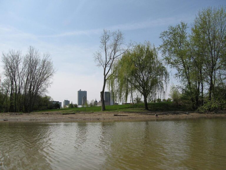
Photo: brian kelly, CC BY 2.0
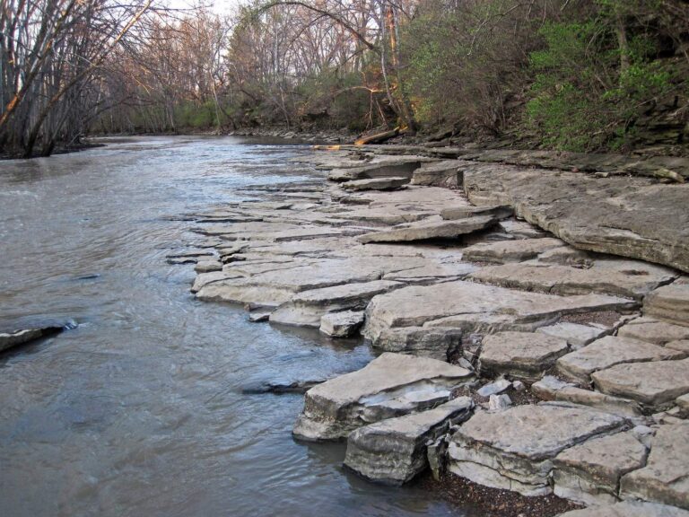
Photo: James St. John, CC BY 2.0
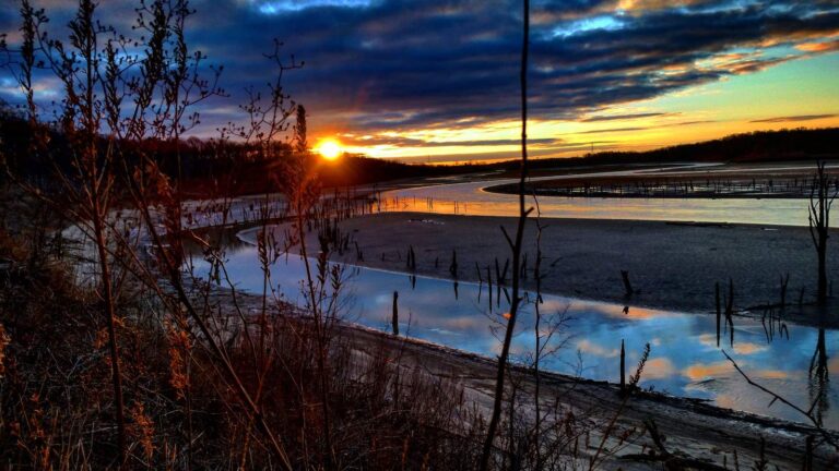
Photo: LouisvilleUSACE, CC BY 2.0

Photo: LouisvilleUSACE, CC BY 2.0
Steuben County fishing questions
Does Steuben County offer a public boat ramp?
The DNR lists 23 boat ramps; Ball Lake boat ramp is the first.
Which Steuben County lake has the most mapped area?
Lake James, at 1,884 acres (NHD outline area).
What species does the DNR name on lakes around Steuben County?
Bluegill leads the count of lake pages within 50 miles, then largemouth bass, redear sunfish and channel catfish; the DNR names them on lake and access records.
Where does a Steuben County angler buy minnows?
Start at Angler Enterprises Inc; the county list has 12.
In which town are the Steuben County offices located?
The seat is Angola.
What does a non-Hoosier pay to fish in Steuben County?
Indiana residents buy the annual license for $23; out-of-state anglers spend $60.
Which Indiana counties are close to Steuben County?
Look at DeKalb County, LaGrange County and Noble County next.
Does the DNR number a district for Steuben County lakes?
The DNR lake layer gives the county's own lakes the number for DNR fisheries district 2.
Is there shore access in Steuben County?
The DNR layer lists 2 piers and shore sites, such as Failing Lake (Trine Recreation Area).
How many events list Steuben County water?
7 events on file; the next is Potato Creek Bass Club at Lake James (10 Apr 2027) on Lake James, April 10, 2027.
Do any Steuben County lakes break from the statewide limits?
The guide lists 4 special regulation waters in this county, starting with Hamilton Lake; the table above shows each.
Are Steuben County lakes stocked?
The DNR dashboard carries 137 rows; the newest lists 2,131 Rainbow Trout, 10.5 in average (February 2026) in Gage, Lake.
Which record weights name Steuben County as the county?
Brook Trout, 3 lb. 15.5 oz., 1973, from Lake Gage.
Fish Steuben County for a whole weekend
River pages carry USGS gauges that update themselves.