Cache River Fishing
An Illinois river through Johnson County.
 Pick for bluegillPiscifun Carbon X ultralight spinning reel28% OFFSale $57.99
Photo of Big Muddy River: Aaron Lucas, CC BY-SA 4.0
First Illinois notes on the Cache River
The Cache River is an Illinois river crossing Johnson County. It is under a mile to Cairo.
IDNR plots 1 boat ramp here. Stage comes from 1 USGS gauge.
IDNR IFishIllinois waterbody page, ifishillinois.org, read November 4, 2026. Census 2023 places.
What IDNR says about the Cache River
- Location (IDNR)The Cache River is located at the southern tip of Illinois. The upper reach flows through the hills of the Ozark plateau; the lower Cache flows through flatter coastal plain where drainage is slow and wetlands become more abundant.
- Description (IDNR)The Cache River State Natural Area is situated in southernmost Illinois within a floodplain carved long ago by glacial floodwater of the Ohio River. When the Ohio River adopted its present course, it left the Cache River to meander across rich and vast wetlands. Among the outstanding natural features found within the area today are massive cypress trees whose flared bases, called buttresses, exceed 40 feet …
- More from IDNRThe Cache River shares a common border with the Illinois Ozarks; the large, contiguous forests that occur along the boundary are split into the two parts. Significant natural features that represent forest, wetland, and aquatic habitats are found at Horseshoe Lake, an old oxbow of the Mississippi River. Near-virgin woods of beech, sugar maple, swamp chestnut oak, and American elm grow on the island in the …
IDNR IFishIllinois waterbody page, ifishillinois.org, read November 4, 2026.
What the Cache River is running right now
| USGS gauge | Latest reading | Time (ET) |
|---|---|---|
| Cache River At Forman, Il | 1 cfs, 8.25 ft gage height | Nov 12 12:00 am |
US Geological Survey provisional data, retrieved Nov 12, 2026 12:34 am ET. Provisional readings can be revised.
The numbers belong to Cache River at Forman, IL.
USGS instantaneous values, provisional; site list read November 4, 2026.
Launching onto the Cache River
- Cache River Boat Ramp at Golden Lilylaunch, Alexander County
Launches one bay over from Cache River
- East Side Dr Boat Ramp on Horseshoe Lake (Alexander) (east)Horseshoe Lake (Alexander), 4 miles
- East Side Dr Boat Ramp on Horseshoe Lake (Alexander) (south)Horseshoe Lake (Alexander), 4 miles
- Horseshoe Lake (Alexander County) Dam Boat RampHorseshoe Lake (Alexander), 4 miles
- East Side Dr Boat Ramp on Horseshoe Lake (Alexander) (north)Horseshoe Lake (Alexander), 5 miles
- Horseshoe Lake (Alexander County) Refuge Road Boat RampHorseshoe Lake (Alexander), 5 miles
Much Illinois stream frontage is private; fish the Cache River from public ramps, parks and state sites, or with the owner's permission.
IDNR IFishIllinois map, boat ramp and launch layer of October 2025 (KML; name, waterbody and notes as printed), read November 5, 2026.
Illinois limits that apply on the Cache River
| Species group | Daily limit | Statewide rule as printed |
|---|---|---|
| Alligator Gar | 1 per 24 hours | Harvest limit is 1 Alligator Gar per 24 hours. |
| Blue, Channel, and Flathead Catfish | no limit | There are no daily harvest or size limits, except as specified under Site Specific Regulations. |
| Bluegill, Redear Sunfish, Other Sunfish | no limit | There are no harvest or size limits, except as specified under Site Specific Regulations. |
| Crappie (White, Black or Hybrid Crappie) | no limit | There are no daily harvest or size limits, except as specified under Site Specific Regulations. |
| Lake Sturgeon | no possession | Protected; No possession. |
| Largemouth Bass, Smallmouth Bass, Spotted Bass | 6 (combined) | Daily harvest limit is 6 Bass, either singly or in the aggregate, except as specified under Site Specific Regulations. In rivers and streams and their tributaries statewide, except for the Mississippi, Ohio (including Golconda Marina), and Wabash Rivers, the d |
| Muskellunge, Northern Pike, and their Hybrid | muskellunge 1, northern pike 3 | All Muskellunge and Muskellunge hybrids (Tiger Muskie) taken must be 36" in total length or longer, except as specified under Site Specific Regulations. No more than 1 Muskellunge or Muskellunge hybrid (Tiger Muskie) may be taken per day, except as specified u |
| Paddlefish | 2 | Daily harvest limit is 2 Paddlefish. Please refer to Site Specific Regulations for the Mississippi River between Illinois and Iowa and the Mississippi River between Illinois and Missouri. |
| Striped Bass (Ocean Rockfish), White Bass, Yellow Bass, and their Hybrids | no limit under 17 inches; 3 at 17 inches or longer | There are no daily harvest limits or minimum size limits for Striped Bass (Ocean Rockfish), White Bass, Yellow Bass, and their hybrids, which are less than 17" in total length, except as specified under Site Specific Regulations. For these fish 17" in total le |
| Trout and Salmon | 5 (combined) | Daily harvest limit is 5 trout or salmon, either singly or in the aggregate. |
| Walleye, Sauger, or their Hybrid | 6 (combined) | All Walleye, Sauger, or their hybrid (Saugeye) taken must be 14" in total length or longer, except in the Mississippi River, Wabash River, or except as specified under Site Specific Regulations. Daily harvest limit is 6 Walleye, Sauger, or their hybrid, either |
The Cache River follows the statewide table plus any site entry.
Digest rules along the Cache River
- Fishing is prohibited at Cache River State Natural Area designated waterfowl hunting areas from 7 days prior to the start of the regular duck season through the end of duck and Canada goose season. No fishing in Section 8 Woods …
- Site-Specific Fishing R
- egulations (Cache River State Natural Area):
- Recreational Use Restriction: Waterfowl Refuge or Hunting Area (see above)
- All Fish: 2 pole and line fishing only and each pole must not have more than 2 hooks or lures attached while fishing; bow fishing is allowed; no seines
Site-specific regulations on the IFishIllinois page, as printed, ifishillinois.org, read November 4, 2026.
Anglers 16 and older carry an Illinois fishing license ($15 a year for residents, $31.50 for nonresidents in 2026).
IDNR 2026 Illinois Fishing Information digest (IDNR), read November 4, 2026.
 For the bluegill herePiscifun Carbon XT ultralight spinning reel25% OFFSale $59.99
Five rivers close to the Cache River
Next over: Big Muddy River, around 36 miles away.
| Water | Distance | USGS gauges | Mapped ramps | First IDNR-rated fish |
|---|---|---|---|---|
| Cache River | 1 | 1 | ||
| Big Muddy River | 36 miles northwest | 3 | 4 | |
| Crab Orchard Creek | 48 miles north | 1 | 0 | |
| Middle Fork Saline River | 60 miles northeast | 1 | 0 | |
| South Fork Saline River | 60 miles northeast | 1 | 0 | |
| Saline River | 70 miles northeast | 2 | 0 |
USGS gauges, IDNR boat ramp layer and IDNR outlook lines; read November 4, 2026.
A few miles of blacktop from Cache River
Other water a county or two from Cache River
- Horseshoe Lake (Alexander)5 miles
- Dongola City Reservoir18 miles
- Lyerla Lake (UCFWA)20 miles
- Anna City Lake25 miles
Where to buy crawlers and minnows near Cache River
- Egyptian Hills Marina Incmarina, Creal Springs
Towns with motels by Cache River
- Cairo8 miles
- Jonesboro24 miles
- Anna25 miles
- Vienna29 miles
One more river beside the Cache River
- Big Muddy River36 miles
- Crab Orchard Creek48 miles
- Middle Fork Saline River60 miles
- South Fork Saline River60 miles
- Saline River70 miles
The counties Cache River runs through
- Johnson County
Piscifun tackle to load up before the Cache River


Piscifun and Amazon links are affiliate links; the site earns a commission on qualifying purchases.
Timber, cornfield and water around Cache River through a lens
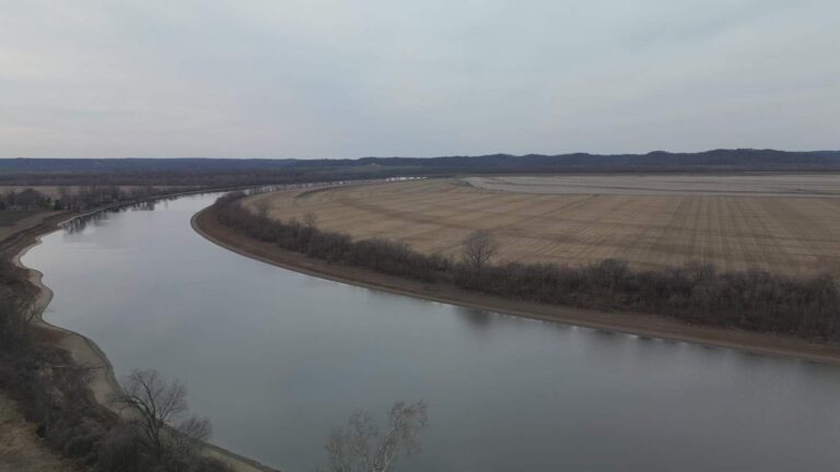
Photo: U.S. Department of Agriculture, CC0 1.0
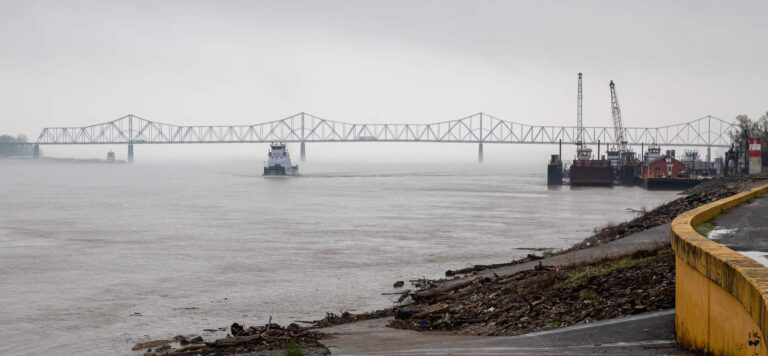
Photo: David Brossard, CC BY-SA 2.0

Photo: USFWS Midwest Region, Public domain
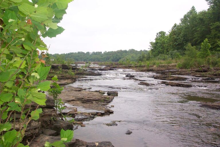
Photo: Curtis Abert, CC BY 2.0
The Cache River, sorted out question by question
How do I pin the Cache River on an Illinois road map?
The Cache River is located at the southern tip of Illinois. The upper reach flows through the hills of the Ozark plateau; the lower Cache flows through flatter coastal plain where drainage is slow and It touches Johnson County.
Can I see the stage of the Cache River before driving?
The flow band streams Cache River at Forman, IL.
Where does IDNR map a put-in on the Cache River?
1 boat ramp, including Cache River Boat Ramp at Golden Lily.
What does the 2026 digest let me keep from the Cache River?
Statewide digest row for Largemouth Bass, Smallmouth Bass, Spotted Bass: Daily harvest limit is 6 Bass, either singly or in the aggregate, except as specified under Site Specific Regulations. The same row adds a separate rule for rivers and streams, quoted in the limits band. The limits band adds a digest entry for it.
Can an out-of-state angler fish the Cache River?
Anglers 16 and older carry an Illinois fishing license ($15 a year for residents, $31.50 for nonresidents in 2026).
How does IDNR rate the Cache River?
No fish are named for it in IDNR sources.
Where do anglers on the Cache River buy tackle?
Egyptian Hills Marina Inc in the same county is first on our list.
Which banks of the Cache River are open?
Fish from public sites or with permission; farmland lines many banks.
Plan a float on the Cache River
Check the gauge, then pick a put-in.