Illinois Lake Levels and River Gauges
Dated Corps readings for Carlyle, Rend and Shelbyville, live USGS lake gauges, and NOAA river and pool readings.
 Angler pickPiscifun Viper X spinning reel50% OFFSale $39.99
Photo of Big Muddy River: Aaron Lucas, CC BY-SA 4.0
USACE St. Louis District readings for 3 Illinois lakes
One dated reading from each lake’s St. Louis District forecast page, report issued Wednesday, 04 November 2026 08:37. These are not live figures; elevations are in feet as printed, and the page prints no datum. Inflow and outflow are day-second-feet as printed.
| Lake | Pool | Inflow, DSF | Outflow, DSF | Reading |
|---|---|---|---|---|
| Carlyle Lake | 444.82 ft | 170 | 70 | Wed 04-Nov 06:00 2026 |
| Rend Lake | 403.58 ft | 140 | 30 | Wed 04-Nov 06:00 2026 |
| Lake Shelbyville | 599.28 ft | 130 | 70 | Wed 04-Nov 06:00 2026 |
USACE St. Louis District forecast page, report issued Wednesday, 04 November 2026 08:37 (one dated reading, not live; feet as printed, datum not printed; DSF = day-second-feet).
Live USGS readings on Illinois lakes and Lake Michigan
| Lake | Level | Reading | Source |
|---|---|---|---|
| Lake Michigan at Chicago Lock at Chicago | 0.24 ft | Nov 5, 2026 | USGS 04087440 (gage height) |
| Lake Tranquility | 4.06 ft | Nov 5, 2026 | USGS 05547000 (gage height) |
| Fox Chain O' Lakes | 4.01 ft | Nov 5, 2026 | USGS 05547500 (gage height) |
| Fox Chain O' Lakes | 3.97 ft | Nov 5, 2026 | USGS 05548000 (gage height) |
| Nippersink Lake (LCFPD) | n/a |
NOAA station 9087044 (Calumet Harbor) read 578.556 ft above IGLD 1985 at 2026-11-04 14:30 local (LST/LDT).
USGS provisional data, refreshed hourly by the site; NOAA Calumet Harbor as a dated reading.
NOAA readings on the Mississippi, Illinois and Ohio rivers
| Gauge | Stage or pool | Flow | Flood category | Read (UTC) |
|---|---|---|---|---|
| Illinois River at Dresden Lock (tailwater) | 483.4 ft | – | no flooding | 2026-11-05 18:00:00 UTC |
| Illinois River at Morris | 5.11 ft | 4.91 kcfs | no flooding | 2026-11-05 18:45:00 UTC |
| Illinois River at Ottawa | 458.73 ft | – | no flooding | 2026-11-05 18:30:00 UTC |
| Illinois River at Marseilles Lock (tailwater) | 459.23 ft | 2.6 kcfs | no flooding | 2026-11-05 18:30:00 UTC |
| Illinois River at Marseilles | 11.2 ft | 3.9 kcfs | no flooding | 2026-11-05 18:45:00 UTC |
| Illinois River at Starved Rock Lock (tailwater) | 441.3 ft | 4.25 kcfs | no flooding | 2026-11-05 18:00:00 UTC |
| Illinois River near La Salle | 11.36 ft | 5.16 kcfs | no flooding | 2026-11-05 18:45:00 UTC |
| Illinois River at Seneca | 20.47 ft | – | no flooding | 2026-11-05 18:45:00 UTC |
| Illinois River near Henry | 14.75 ft | 4.71 kcfs | no flooding | 2026-11-05 18:45:00 UTC |
| Illinois River at Chillicothe | 440.38 ft | – | not defined | 2026-11-05 18:00:00 UTC |
| Illinois River at Peoria | 11.85 ft | 5.23 kcfs | no flooding | 2026-11-05 18:45:00 UTC |
| Illinois River at Peoria Lock and Dam | 431.86 ft | 5.24 kcfs | no flooding | 2026-11-05 16:00:00 UTC |
| Illinois River at Kingston Mines | 3.52 ft | 6.47 kcfs | not defined | 2026-11-05 18:45:00 UTC |
| Illinois River at Copperas Creek | 3.25 ft | 6.91 kcfs | not defined | 2026-11-05 18:45:00 UTC |
| Illinois River near Havana | 5.96 ft | 6.18 kcfs | no flooding | 2026-11-05 18:45:00 UTC |
| Illinois River at Beardstown | 9.55 ft | 6.41 kcfs | no flooding | 2026-11-05 18:45:00 UTC |
| Illinois River at LaGrange Lock and Dam | 7.66 ft | 9.02 kcfs | no flooding | 2026-11-05 18:00:00 UTC |
| Illinois River at Meredosia | 2.85 ft | 10.8 kcfs | no flooding | 2026-11-05 18:30:00 UTC |
| Illinois River at Valley City | 2.34 ft | 7.18 kcfs | no flooding | 2026-11-05 19:00:00 UTC |
| Illinois River at Hardin | 19.32 ft | 8.18 kcfs | no flooding | 2026-11-05 18:30:00 UTC |
| Mississippi River at Dubuque (LD11) | 5.93 ft | 41.4 kcfs | no flooding | 2026-11-05 18:30:00 UTC |
| Mississippi River at Dubuque (Railroad Bridge) | 8.48 ft | 42.6 kcfs | no flooding | 2026-11-05 18:30:00 UTC |
| Mississippi River at Bellevue | 6.02 ft | 41.7 kcfs | no flooding | 2026-11-05 18:30:00 UTC |
| Mississippi River at Fulton | 5.86 ft | 44.5 kcfs | no flooding | 2026-11-05 18:30:00 UTC |
| Mississippi River at Camanche | 9.93 ft | 55.8 kcfs | no flooding | 2026-11-05 18:30:00 UTC |
| Mississippi River at LeClaire | 5.16 ft | 44.4 kcfs | no flooding | 2026-11-05 18:30:00 UTC |
| Mississippi River at Rock Island | 5.98 ft | 49.7 kcfs | no flooding | 2026-11-05 18:30:00 UTC |
| Mississippi River above Fairport | 10.41 ft | – | no flooding | 2026-11-05 18:30:00 UTC |
| Mississippi River at Illinois City | 4.55 ft | 47.3 kcfs | no flooding | 2026-11-05 18:30:00 UTC |
| Mississippi River at Muscatine | 6.8 ft | 53 kcfs | no flooding | 2026-11-05 18:15:00 UTC |
| Mississippi River at New Boston | 6.7 ft | 62.7 kcfs | no flooding | 2026-11-05 18:40:00 UTC |
| Mississippi River at Keithsburg | 7.95 ft | 70 kcfs | no flooding | 2026-11-05 18:30:00 UTC |
| Mississippi River at Gladstone | 4.19 ft | 81.7 kcfs | no flooding | 2026-11-05 18:30:00 UTC |
| Mississippi River at Burlington | 10.11 ft | 81 kcfs | no flooding | 2026-11-05 18:00:00 UTC |
| Mississippi River at Fort Madison | 526.19 ft | 106 kcfs | no flooding | 2026-11-05 18:30:00 UTC |
| Mississippi River at Keokuk | 6.31 ft | 87.3 kcfs | no flooding | 2026-11-05 18:40:00 UTC |
| Mississippi River at Gregory Landing | 8.46 ft | 100 kcfs | no flooding | 2026-11-05 18:30:00 UTC |
| Mississippi River at Canton Lock and Dam 20 | 7.54 ft | 96.8 kcfs | no flooding | 2026-11-05 18:30:00 UTC |
| Mississippi River at LaGrange | 8.35 ft | 4.58 kcfs | no flooding | 2026-11-05 18:00:00 UTC |
| Mississippi River at Quincy | 11.89 ft | 66.2 kcfs | no flooding | 2026-11-05 18:15:00 UTC |
| Mississippi River at Quincy Lock and Dam 21 | 7.21 ft | 87.5 kcfs | no flooding | 2026-11-05 18:30:00 UTC |
| Mississippi River at Hannibal | 11.32 ft | 91.4 kcfs | no flooding | 2026-11-05 18:15:00 UTC |
| Mississippi River at Saverton Lock and Dam 22 | 7.89 ft | 91.3 kcfs | no flooding | 2026-11-05 18:30:00 UTC |
| Mississippi River at Louisiana | 12.29 ft | 143 kcfs | no flooding | 2026-11-05 18:30:00 UTC |
| Mississippi River at Clarksville Lock and Dam 24 | 17.61 ft | 86.6 kcfs | no flooding | 2026-11-05 18:30:00 UTC |
| Mississippi River at Mozier Landing | 35.98 ft | – | not defined | 2026-11-05 18:30:00 UTC |
| Mississippi River at Winfield Lock and Dam 25 | 16.79 ft | 78.4 kcfs | no flooding | 2026-11-05 18:00:00 UTC |
| Mississippi River at Grafton | 15.35 ft | 118 kcfs | no flooding | 2026-11-05 18:30:00 UTC |
| Mississippi River at Alton | 18.59 ft | – | no flooding | 2026-11-05 18:30:00 UTC |
| Mississippi River at Mel Price (Alton) Lock and Dam | 6.28 ft | 103 kcfs | no flooding | 2026-11-05 18:30:00 UTC |
| Mississippi River at St. Louis | 5.3 ft | 143 kcfs | no flooding | 2026-11-05 18:30:00 UTC |
| Mississippi River at Herculaneum | 2.66 ft | – | no flooding | 2026-11-05 18:00:00 UTC |
| Mississippi River at Chester | 8.12 ft | 140 kcfs | no flooding | 2026-11-05 18:30:00 UTC |
| Mississippi River above Red Rock Landing | 11.6 ft | – | no flooding | 2026-11-05 19:00:00 UTC |
| Mississippi River above Grand Tower | 12.85 ft | – | no flooding | 2026-11-05 18:30:00 UTC |
| Mississippi River above Moccasin Springs | 11.61 ft | – | no flooding | 2026-11-05 18:30:00 UTC |
| Mississippi River at Cape Girardeau | 12.76 ft | 131 kcfs | no flooding | 2026-11-05 18:30:00 UTC |
| Mississippi River at Thebes | 11.55 ft | 139 kcfs | no flooding | 2026-11-05 19:00:00 UTC |
| Mississippi River above Commerce | 7.26 ft | – | no flooding | 2026-11-05 18:30:00 UTC |
| Mississippi River above Price Landing | 2.16 ft | 114 kcfs | no flooding | 2026-11-05 19:00:00 UTC |
| Mississippi River above Birds Point | 9.55 ft | – | no flooding | 2026-11-05 18:30:00 UTC |
| Mississippi River above Wickliffe | 11.59 ft | – | not defined | 2026-11-05 18:00:00 UTC |
| Ohio River at Evansville | 14.72 ft | 63.6 kcfs | no flooding | 2026-11-05 18:00:00 UTC |
| Ohio River at Henderson | 13.05 ft | 65.7 kcfs | no flooding | 2026-11-05 18:45:00 UTC |
| Ohio River at J.T. Myers Lock and Dam | 14.07 ft | 74.4 kcfs | no flooding | 2026-11-05 18:00:00 UTC |
| Ohio River at Shawneetown | 15.32 ft | 68.2 kcfs | no flooding | 2026-11-05 18:30:00 UTC |
| Ohio River at Golconda | 29.9 ft | – | no flooding | 2026-11-05 18:00:00 UTC |
| Ohio River at Olmsted Lock and Dam Headwater | 22.75 ft | – | no flooding | 2026-11-05 18:00:00 UTC |
| Ohio River at Olmsted Lock and Dam Tailwater | 15.17 ft | – | not defined | 2026-11-05 18:00:00 UTC |
| Ohio River at Smithland Lock and Dam | 12.79 ft | 71.6 kcfs | no flooding | 2026-11-05 19:00:00 UTC |
| Ohio River at Paducah | 15.95 ft | 89.1 kcfs | no flooding | 2026-11-05 18:00:00 UTC |
| Ohio River at Cairo | 12.64 ft | 210 kcfs | no flooding | 2026-11-05 18:00:00 UTC |
NOAA National Water Prediction Service gauge readings (water.noaa.gov), read November 5, 2026; dated readings, not live (kcfs = thousand cubic feet per second).
More Illinois rivers with NOAA forecast gauges
NOAA National Water Prediction Service gauge readings (water.noaa.gov), read November 5, 2026; dated readings, not live (kcfs = thousand cubic feet per second).
Illinois rivers and pools carrying a USGS station
- Apple River1 gauge
- Big Muddy River3 gauges
- Bonpas Creek1 gauge
- Cache River1 gauge
- Calumet River1 gauge
- Chicago River8 gauges
- Crab Orchard Creek1 gauge
- Des Plaines River12 gauges
- DuPage River1 gauge
- East Branch Du Page River2 gauges
- East Fork Kaskaskia River1 gauge
- Edwards River1 gauge
- Embarras River4 gauges
- Fox River12 gauges
- Green River (Henry County)1 gauge
- Illinois River10 gauges
- Illinois River, Alton Pool3 gauges
- Illinois River, LaGrange Pool2 gauges
- Illinois River, Marseilles Pool3 gauges
- Illinois River, Peoria Pool1 gauge
- Illinois River, Starved Rock Pool1 gauge
- Iroquois River2 gauges
- Kankakee River4 gauges
- Kaskaskia River11 gauges
- Kishwaukee River5 gauges
- La Moine River2 gauges
- Little Calumet River1 gauge
- Little Wabash River5 gauges
- Mackinaw River3 gauges
- Mazon River1 gauge
- Middle Fork Saline River1 gauge
- Middle Fork Vermilion River1 gauge
- Mississippi River4 gauges
- Mississippi River, Open River1 gauge
- Mississippi River, Pool 131 gauge
- Mississippi River, Pool 262 gauges
- North Branch Chicago River2 gauges
- North Fork Embarras River1 gauge
- North Fork Vermilion River (Vermilion County)1 gauge
- Ohio River7 gauges
- Ohio River, Olmsted Pool2 gauges
- Ohio River, Open River2 gauges
- Ohio River, Smithland Pool3 gauges
- Pecatonica River2 gauges
- Rock River9 gauges
- Rock River, Dixon Pool1 gauge
- Rock River, Fordham Pool4 gauges
- Rock River, Milan Pool1 gauge
- Rock River, Oregon Pool1 gauge
- Rock River, Sterling Pool2 gauges
- Saline River2 gauges
- Sangamon River9 gauges
- Sinsinawa River1 gauge
- Skillet Fork1 gauge
- Skokie River2 gauges
- South Branch Kishwaukee River (McHenry County)2 gauges
- South Branch Kishwaukee River (Winnebago County)2 gauges
- South Fork Saline River1 gauge
- South Fork Sangamon River2 gauges
- Spoon River3 gauges
- Vermilion River (Illinois River basin)2 gauges
- Vermilion River (Wabash River basin)3 gauges
- Wabash River8 gauges
- West Branch Du Page River3 gauges
- West Okaw River1 gauge
USGS instantaneous values, 283 Illinois stream gauges read November 4, 2026.
Prairie water pictured beside Illinois Lake Levels and River Gauges

Photo: Alaina McDavid, CC BY-SA 2.0
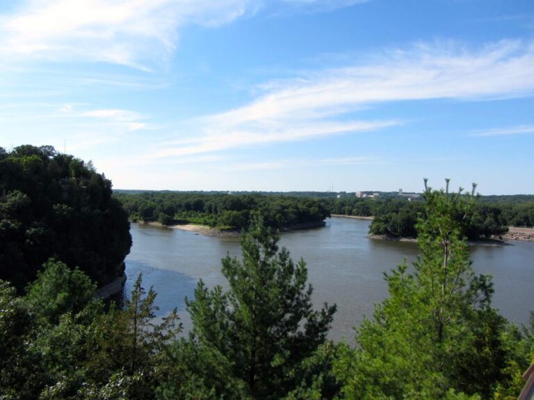
Photo: Richie Diesterheft, CC BY-SA 2.0

Photo: edward stojakovic, CC BY 2.0
Photo: Gary Todd, CC0 1.0
Illinois lake level and river gauge questions
Which Illinois lakes show a Corps reading here?
3: Carlyle Lake, Rend Lake and Lake Shelbyville, from the USACE St. Louis District forecast pages.
Are the Corps readings live?
No; each is one dated reading from a report issued Wednesday, 04 November 2026 08:37. Follow the source link for the newest page.
What does DSF mean?
Day-second-feet, the unit the St. Louis District pages print for inflow and outflow.
Which vertical datum sits behind the St. Louis District feet?
The forecast pages do not print one, so none is added here.
How many USGS lake stations stream live on this Illinois page?
5 reporting USGS lake gauges, including Lake Michigan at the Chicago Lock.
Are the NOAA river readings live?
No; each prints with the UTC time NOAA read it, from the National Water Prediction Service.
Where are river flows?
On each river and pool page with a USGS gauge; 65 pages have one.
How many NOAA gauges cover Illinois rivers here?
277, 72 of them on the Mississippi, Illinois and Ohio.