Fishing in Twin Falls County, Idaho
County seat: Twin Falls. Population 90,046.
- 13lake pages
- 5launch sites
- 5river pages
 Pick for salmonPiscifun Viper X spinning reel50% OFFSale $39.99
Photo of Salmon Falls Creek Reservoir: BLMIdaho, CC BY 2.0
What Twin Falls County holds before you hitch the trailer
Twin Falls County counted 90,046 residents in 2020 and runs its business from Twin Falls. Most of the county's listed waters (100%) fall in the IDFG Magic Valley Region, though region lines follow drainages rather than county borders.
Milner Lake heads 13 paged lakes in the county, which add up to 10,921 acres. Planner pages for Salmon Falls Creek and North Fork Salmon Falls Creek include steelhead or salmon. Count 5 launch sites across the county: 3 BLM and 2 IDFG. Shore fishing has 2 walk-in access sites mapped by IDFG.
Census 2020 population and county seat; IDFG Idaho Fishing Planner (list of Idaho waters), read November 7, 2026. IDFG Fishing and Boating Access Sites layer (ArcGIS service), read November 7, 2026.
 For the salmon herePiscifun AlumiX spinning reel46% OFFSale $64.99
Pins for the fishing water of Twin Falls County
IDFG Fishing and Boating Access Sites, BLM and Forest Service launch points, Fishing Planner lake points (outlet) and stream midpoints. Checked November 2026.
The Twin Falls County lake list, sorted by size
| Lake | Acres | Launches | Kind | Game fish IDFG names |
|---|---|---|---|---|
| Milner Lake | 4,350 | 0 | lake | bullhead, smallmouth bass, channel catfish |
| Salmon Falls Creek Reservoir | 2,753 | 0 | reservoir | bluegill and sunfish, walleye, yellow perch |
| Cedar Creek Reservoir | 870 | 1 | reservoir | rainbow trout, bridgelip sucker, redside shiner |
| Upper Salmon Falls Reservoir | 869 | 0 | reservoir | yellow trout, rainbow trout |
| Murtaugh Lake | 829 | 1 | lake | bluegill and sunfish, largemouth bass, yellow perch |
| Lower Salmon Falls Reservoir | 723 | 0 | reservoir | bluegill and sunfish, largemouth bass, rainbow trout |
| Bliss Reservoir | 147 | 0 | reservoir | bullhead |
| Shoshone Falls Reservoir | 126 | 0 | reservoir | |
| Deep Creek Reservoir (Twin Falls County) | 93 | 0 | reservoir | |
| Twin Falls Reservoir | 87 | 0 | reservoir | |
| Williams Reservoir | 44 | 0 | reservoir | |
| Dierkes Lake | 24 | 0 | lake | bluegill and sunfish, largemouth bass, rainbow trout |
| Bluegill Lake | 8 | 0 | lake |
Surface acres as listed in the IDFG Idaho Fishing Planner, read November 7, 2026. Game fish are the Planner’s recommended species; IDFG prints no lake depths there.
The Twin Falls County game fish tally
Each bar tallies lakes within 50 miles of Twin Falls naming the fish, with rainbow trout first.
IDFG Fishing Planner recommended game fish and stocking rows, counted per lake page within 50 miles; not a creel survey.
Backcountry and pothole lakes the Planner lists in Twin Falls County
The Planner names 17 more lakes in Twin Falls County, the biggest listed first.
| Water | Acres | Kind | Nearest town |
|---|---|---|---|
| Cedar Mesa Reservoir | 23 | reservoir | Buhl |
| Sumner Gravel Pond | 23 | lake | Wendell |
| Lower Deep Creek Reservoir | 17 | reservoir | Filer |
| Horse Basin Pond | 4 | lake | Kimberly |
| Worley Reservoir | 3 | reservoir | Buhl |
| Bluegill Lake | 3 | lake | Buhl |
| Filer Pond | 2 | lake | Filer |
| Filer Pond West | 1 | lake | Filer |
| Dry Cottonwood Reservoir | 1 | reservoir | Kimberly |
| Rockys Pond | 1 | lake | Hansen |
| Berger Reservoir | 0 | reservoir | Filer |
| Centennial Park Pond | 0 | lake | Twin Falls |
| Dry Fork Reservoir | 0 | reservoir | Kimberly |
| Filer Kids Pond | 0 | lake | Filer |
| Upper Burnt Creek Reservoir | 0 | reservoir | Kimberly |
| Milner Lake | NHD-mapped lake | Burley | |
| Twin Lakes | lake | Buhl |
IDFG Idaho Fishing Planner (list of Idaho waters), read November 7, 2026.
Running water throughout Twin Falls County
- Salmon Falls CreekIDFG recommended water, steelhead or salmon listed, 1 launch, 1 USGS gauge, 121 mi Planner length
- Goose CreekIDFG recommended water, 1 USGS gauge, 118.6 mi Planner length
- Rock CreekIDFG recommended water, 1 USGS gauge, 43.4 mi Planner length
- Snake River1 launch, 14 USGS gauges
- North Fork Salmon Falls Creeksteelhead or salmon listed, 24.2 mi Planner length
Further IDFG-listed streams in Twin Falls County (123)
- High Line Canal60.7 mi
- Shoshone Creek46.9 mi
- Devil Creek44.9 mi
- Deadman Creek39.8 mi
- Low Line Canal38.7 mi
- Cedar Creek35.4 mi
- Deep Creek34.7 mi
- North Side Main Canal33.6 mi
- Twin Falls Main Canal26.1 mi
- House Creek22.2 mi
- Deep Creek19.3 mi
- Main Canal17.3 mi
- McMullen Creek15.9 mi
- Lost Creek15.7 mi
- Big Creek14.6 mi
- Perrine Coulee14.4 mi
- Dry Creek14.1 mi
- Cedar Draw13.7 mi
- North Cottonwood Creek12.6 mi
- Wilson Creek12.2 mi
- Mud Creek12 mi
- Milligan Creek11.9 mi
- Cottonwood Creek11.8 mi
- Fifth Fork Rock Creek11.8 mi
- Yahoo Creek11.7 mi
- Dry Cottonwood Creek10.6 mi
- Mule Creek10.5 mi
- Unnamed Stream10.5 mi
- Bottom Creek10.3 mi
- Desert Creek10 mi
- Antelope Canyon9.7 mi
- Big Cottonwood Creek9.6 mi
- Tuana Gulch9.5 mi
- Twin Springs Creek9.5 mi
- Unnamed Stream9.3 mi
- Cottonwood Creek9.2 mi
- West Basin Draw9 mi
- Horse Creek8.7 mi
- Hot Creek8.7 mi
- Dry Gulch8.5 mi
- Black Canyon8.4 mi
- Monument Canyon8.2 mi
- Little House Creek7.4 mi
- Green Creek7.3 mi
- Bear Creek7.1 mi
- China Creek6.8 mi
- Cottonwood Creek6.8 mi
- Fourth Fork Rock Creek6.8 mi
- Soldier Creek6.8 mi
- Horse Creek6.7 mi
- Langford Flat Creek6.4 mi
- Worley Ditch6.2 mi
- Little Creek6 mi
- Shack Creek5.8 mi
- Rice Creek5.6 mi
- Fall Creek5.4 mi
- John Boyd Draw5.4 mi
- Indian Jim Canyon5.3 mi
- Indian Mike Creek5.3 mi
- Goat Springs Creek4.9 mi
- Worley Draw4.8 mi
- Browns Creek4.6 mi
- Unnamed Stream4.6 mi
- McCongle Canyon4.4 mi
- Niles Gulch4.4 mi
- Middle Fork Devil Creek4.3 mi
- Rocky Canyon4.2 mi
- South Fork Deep Creek4.1 mi
- South Fork Shoshone Creek4.1 mi
- Taylor Creek4.1 mi
- Beaver Meadows4 mi
- Middle Fork Shoshone Creek4 mi
- North Willow Springs Creek4 mi
- Pole Camp Creek4 mi
- Deer Canyon3.9 mi
- Player Creek3.7 mi
- Cedar Draw3.6 mi
- A Lateral3.5 mi
- Hannahs Fork3.5 mi
- Rocky Canyon3.5 mi
USGS gauges posting from Twin Falls County
| USGS gauge | Latest reading | Time (ET) |
|---|---|---|
| Snake River Nr Buhl Id | 1,500 cfs, 0.86 ft gage height | Nov 12 7:30 pm |
| Snake River Nr Twin Falls Id | 394 cfs, 1.61 ft gage height | Nov 12 7:30 pm |
| Salmon Falls Creek Nr Hagerman Id | 110 cfs, 5.02 ft gage height | Nov 12 7:45 pm |
| Rock Creek Ab Hwy 30/93 Xing At Twin Falls Id | 36 cfs, 5.76 ft gage height | Nov 12 7:45 pm |
US Geological Survey provisional data, retrieved Nov 12, 2026 8:32 pm ET. Provisional readings can be revised.
IDFG Idaho Fishing Planner (list of Idaho waters), read November 7, 2026. Stream lengths as printed in the Planner; USGS gauges live.
Anadromous water across Twin Falls County
- Salmon Falls CreekIDFG Magic Valley Region
- North Fork Salmon Falls CreekIDFG Magic Valley Region
This page leaves out steelhead and salmon dates because the Commission proclamations were not reachable on the IDFG site in November 2026. Idaho steelhead and salmon rules
IDFG Idaho Fishing Planner (list of Idaho waters), read November 7, 2026.
Planted fish across Twin Falls County
Planner pages for Twin Falls County water print 1,416 stocking rows, 10,270,747 fish across 11 waters.
- Snake RiverRainbow Trout – Triploid, 500 fish, Catchable (12-14 inches), October 27, 2026
- Snake RiverRainbow Trout – Triploid, 21,576 fish, Catchable (6+ inches), October 22, 2026
- Snake RiverRainbow Trout – Triploid, 5,846 fish, Catchable (12-14 inches), October 21, 2026
- Salmon Falls Creek ReservoirSteelhead, 42,998 fish, Fingerling (3-6 inches), September 30, 2026
- Salmon Falls Creek ReservoirSteelhead, 38,721 fish, Fingerling (3-6 inches), September 29, 2026
- Salmon Falls CreekRainbow Trout – Triploid, 306 fish, Catchable (6+ inches), September 24, 2026
- Salmon Falls Creek ReservoirRainbow Trout – Triploid, 9,643 fish, Catchable (12-14 inches), September 23, 2026
- Lower Salmon Falls ReservoirWhite Sturgeon, 55 fish, Adults, September 21, 2026
- Salmon Falls Creek ReservoirSteelhead, 74,250 fish, Fingerling (3-6 inches), September 18, 2026
- Salmon Falls Creek ReservoirRainbow Trout – Triploid, 3,948 fish, Catchable (12-14 inches), September 15, 2026
- Dierkes LakeRainbow Trout – Triploid, 4,560 fish, Catchable (12-14 inches), September 8, 2026
- Milner LakeChannel Catfish, 9,509 fish, Catchable (6+ inches), August 12, 2026
Stocking rows as printed on the IDFG Fishing Planner water pages (date, species, number and size as listed), read November 7, 2026. Newest releases first.
IDFG, BLM and Forest Service sites in Twin Falls County
- Cedar Creek Reservoir boat rampCedar Creek Reservoir, BLM, boat ramp, ramp
- Cedar Draw boat ramplaunch site, IDFG, boating access, ramp, restroom, camping
- Murtaugh Lake boat rampMurtaugh Lake, IDFG, boating access, ramp, dock, restroom, camping
- Salmon Falls Creek Boat LaunchSalmon Falls Creek, BLM, boat launch
- Upper Salmon Falls Creek Boat Launchlaunch site, BLM, boat launch
Twin Falls County fishing access without a ramp (2)
- Bordewick fishing access on Niagara Springs Settling Pond 4fishing access
- Filer Ponds fishing accessfishing access, restroom
IDFG Fishing and Boating Access Sites layer (ArcGIS service), read November 7, 2026. BLM and Forest Service points as published; lanes and ramp counts are not fields in any layer.
Region bag limits that cover most Twin Falls County water
For most Twin Falls County lakes and creeks the IDFG Magic Valley Region limits apply; a few waters sit in a neighbouring region. By Idaho Code 36-416, residents owe $28.75 and nonresidents $106.25 for the annual fishing license, with vendor fees on top at the counter.
| Group | Rule as printed |
|---|---|
| Bass | Bass limit is 6, both species combined; None under 12 inches |
| Brook Trout | Brook Trout limit is 25; Harvest allowed during any open season unless otherwise noted under Special Rules – if gear or bait restrictions are listed, they apply when fishing for Brook Trout |
| Bull Trout | Bull Trout – catch-and-release |
| Kokanee | Kokanee limit is 6 |
| Sturgeon | Sturgeon – catch-and-release; Sturgeon must not be removed from the water and must be released upon landing; Barbless hooks, sliding swivel device to secure a weight, and a lighter test line to secure weight to sliding swivel device are required. See fishing regulations for details |
| Tiger Muskie | Tiger Muskie limit is 2, none under 40 inches |
| Trout | Trout limit is 6, all species combined; In rivers and streams, only 2 of the 6 trout may be Cutthroat Trout; Bull Trout and Brook Trout are listed separately |
| Walleye | Walleye limit is 6 |
| Whitefish | Whitefish limit is 25; Harvest allowed during any open season unless otherwise noted under Special Rules – if gear or bait restrictions are listed, they apply when fishing for whitefish |
| Protected Nongame Fish | May not be harvested or possessed (also known as Green Sucker) |
| All Other Fish Species | No bag, length or possession limit |
Planner rule blocks inside Twin Falls County (7)
- Goose CreekAll Waters Open All Year
- Lower Salmon Falls ReservoirJanuary 1 through June 30 – bass – catch-and-release
- North Fork Salmon Falls CreekAll Waters Open All Year
- Rock CreekAll Waters Open All Year
- Salmon Falls CreekAll Waters Open All Year
- Snake RiverAll Waters Open All Year
- Upper Salmon Falls ReservoirNo motors
Region bag limits from Idaho Fishing Seasons and Rules, 2025-2027 for the Magic Valley Region, as printed on IDFG Fishing Planner water pages (the brochure PDF on idfg.idaho.gov was unreachable during site maintenance), read November 7, 2026. Fishing license fees as set in Idaho Code 36-416 (statute; IDFG sale prices add vendor and processing fees), read November 7, 2026.
Bait, flies and hired help in Twin Falls County
Gem State tackle counters in Twin Falls County
- C n T enterprisebait and tackle shop, Kimberly
- Dick's Sporting Goods, 1939 Fillmore Stbait and tackle shop, Twin Falls
- Dry Creek Outfittersbait and tackle shop, Murtaugh
- Idaho Trout Fittersbait and tackle shop, Twin Falls
- Patriot Defensebait and tackle shop, Buhl
- Sierra, 851 Pole Line Rdbait and tackle shop, Twin Falls
- Sportsman's Warehouse Twin Fallssporting goods store, Twin Falls
Yellow Pages and chain store listings, guide listings (city of business); retrieved November 7, 2026.
Close around Twin Falls County
Twin Falls County communities by size
- Twin Fallspop. 51,807
- Kimberlypop. 4,626
- Buhlpop. 4,558
- Filerpop. 2,738
- Hansenpop. 1,086
Idaho county pages around Twin Falls County
- Jerome County31 miles northeast
- Gooding County44 miles north
- Lincoln County51 miles northeast
- Cassia County53 miles east
Piscifun gear a Gem State angler might carry to Twin Falls County


Piscifun and Amazon links are affiliate links; the site earns a commission on qualifying purchases.
Benchland and bank around Twin Falls County, seen through a lens
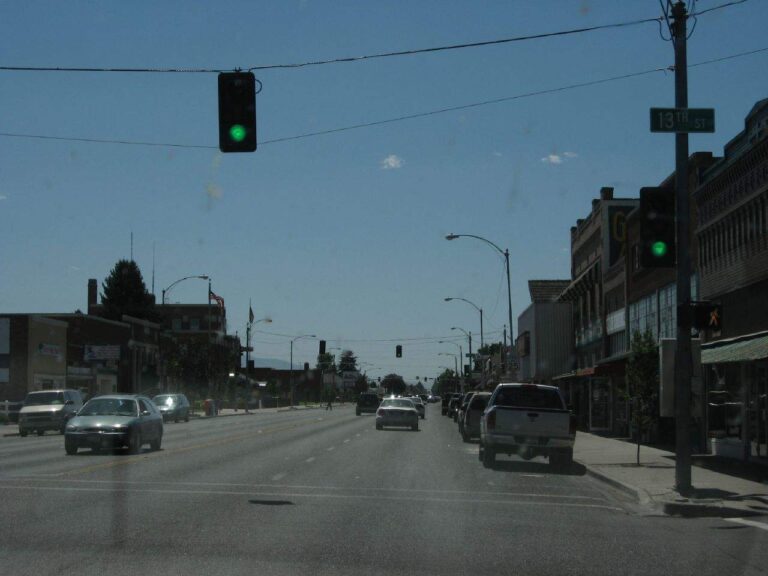
Photo: Ken Lund, CC BY-SA 2.0
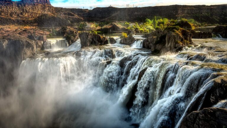
Photo: G. Yancy, CC BY 2.0
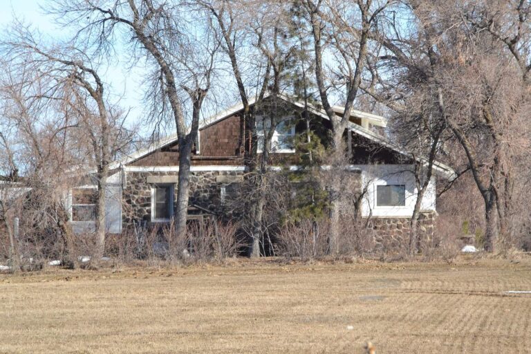
Photo: 25or6to4, CC BY-SA 4.0

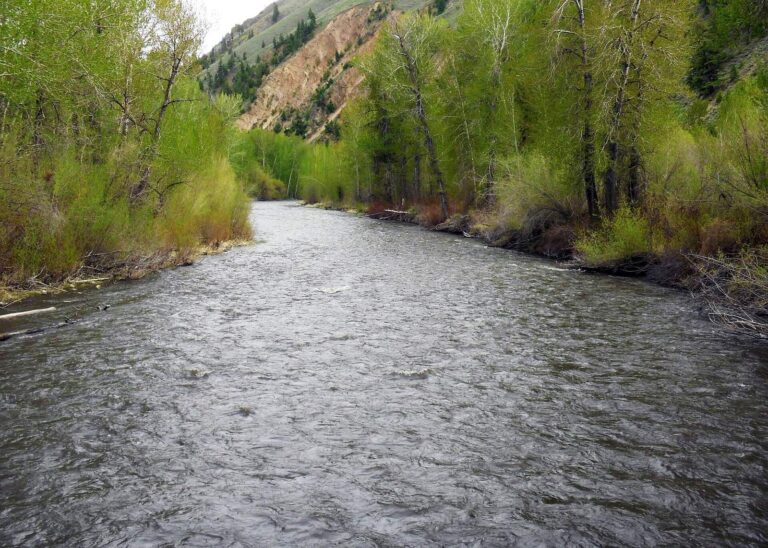
Photo: U.S. Geological Survey, CC0 1.0

Water across Twin Falls County, in questions
Can I put a drift boat in somewhere in Twin Falls County?
Count 5 launch sites, run as 3 BLM and 2 IDFG.
Which Twin Falls County reservoir tops the IDFG acreage list?
Milner Lake, at 4,350 acres in the IDFG Fishing Planner.
What ends up on the stringer around Twin Falls County?
Rainbow trout lead the count of lake pages within 50 miles, followed by bluegill and sunfish, largemouth bass and yellow trout.
Which Idaho stores sell Twin Falls County anglers their bait and flies?
Try C n T enterprise; the list holds 7.
Are any outfitters based in Twin Falls County?
No guide listing names this county.
Which Idaho town runs the business of Twin Falls County?
Twin Falls hosts the county offices.
What does Idaho Code 36-416 set for a visiting angler fishing Twin Falls County?
By Idaho Code 36-416, residents owe $28.75 and nonresidents $106.25 for the annual fishing license, with vendor fees on top at the counter.
Which Idaho county guide should Twin Falls County anglers try after this one?
Closest by centre point: Jerome County, Gooding County and Lincoln County.
Which IDFG region holds most Twin Falls County water?
The IDFG Magic Valley Region holds 100% of the listed water here.
Which IDFG special rules apply to Twin Falls County water?
The Planner prints special rules for 7 county waters with a page here, starting with Goose Creek; the list above shows the first ones.
Is there stocked water in Twin Falls County?
1,416 IDFG releases listed on Planner pages, 10,270,747 fish; the newest went into Snake River on Oct. 27, 2026.
Which Twin Falls County rivers list steelhead?
The Planner lists steelhead or salmon on Salmon Falls Creek and North Fork Salmon Falls Creek. Steelhead and salmon need a Commission season to be open, and those proclamations sat behind IDFG maintenance when this page was written.
Plan an Idaho weekend of fishing in Twin Falls County
Lake pages list launches, stocking and IDFG game fish.