Fishing in Cassia County, Idaho
County seat: Burley. Population 24,655.
- 5lake pages
- 4launch sites
- 6river pages
 Pick for sunfishPiscifun Carbon X ultralight spinning reel28% OFFSale $57.99
Photo of Lake Walcott: USFWS – Pacific Region, Public domain
Where the fishing in Cassia County starts
At the 2020 Census Cassia County held 24,655 residents, with county offices in Burley. By the Planner's count, 100% of the county's listed lakes and streams belong to the IDFG Magic Valley Region. 1 high mountain lake in the county are filed as high mountain lakes.
Largest among 5 lake pages is Lake Walcott; the set spans 13,708 acres. The access layers map 4 launch sites in the county (2 BLM and 2 IDFG). Bank anglers get 2 walk-in access sites on the IDFG layer.
Census 2020 population and county seat; IDFG Idaho Fishing Planner (list of Idaho waters), read November 7, 2026. IDFG Fishing and Boating Access Sites layer (ArcGIS service), read November 7, 2026.
Every IDFG launch and lake page in Cassia County, pinned
IDFG Fishing and Boating Access Sites, BLM and Forest Service launch points, Fishing Planner lake points (outlet) and stream midpoints. Checked November 2026.
Which Cassia County lakes have a full guide
| Lake | Acres | Launches | Kind | Game fish IDFG names |
|---|---|---|---|---|
| Lake Walcott | 8,248 | 1 | lake | bluegill and sunfish, largemouth bass, yellow perch |
| Milner Lake | 4,350 | 0 | lake | bullhead, smallmouth bass, channel catfish |
| Lower Goose Creek Reservoir | 1,007 | 0 | reservoir | walleye, yellow perch, rainbow trout |
| Sublett Reservoir | 80 | 1 | reservoir | brown trout, cutthroat trout, rainbow trout |
| Lake Cleveland | 24 | 0 | high mountain lake | cutthroat trout, rainbow trout, northern leatherside chub |
Surface acres as listed in the IDFG Idaho Fishing Planner, read November 7, 2026. Game fish are the Planner’s recommended species; IDFG prints no lake depths there.
 For the sunfish herePiscifun Carbon XT ultralight spinning reel25% OFFSale $59.99
What IDFG recommends on water close to Cassia County
Bars count lake pages within 50 miles of Burley where IDFG recommends or stocks each fish; rainbow trout tops it.
IDFG Fishing Planner recommended game fish and stocking rows, counted per lake page within 50 miles; not a creel survey.
Unpaged lakes across Cassia County
6 further lakes of Cassia County, many of them alpine, stay on this list until more is published.
| Water | Acres | Kind | Nearest town |
|---|---|---|---|
| Sixmile Reservoir | 2 | reservoir | Heyburn |
| Eightmile Lake | 2 | lake | Heyburn |
| Castle Rocks State Park Fishing Pond | 1 | lake | Burley |
| Keith Reservoir | 1 | reservoir | Hansen |
| Freedom Park Pond | 1 | lake | Heyburn |
| Lincoln Reservoir | 0 | reservoir | Hansen |
Trail-reached alpine lakes account for 1. Idaho high mountain lakes
IDFG Idaho Fishing Planner (list of Idaho waters), read November 7, 2026.
River guides crossing Cassia County
- Goose CreekIDFG recommended water, 1 USGS gauge, 118.6 mi Planner length
- Rock CreekIDFG recommended water, 1 USGS gauge, 43.4 mi Planner length
- Cassia CreekIDFG recommended water, 1 USGS gauge, 29.1 mi Planner length
- Trapper CreekIDFG recommended water, 19.6 mi Planner length
- Snake River1 launch, 14 USGS gauges
- Raft River1 USGS gauge, 108.5 mi Planner length
Planner streams of Cassia County without a guide (273)
- Clear Creek30.8 mi
- Marsh Creek30.5 mi
- Meadow Creek26.9 mi
- Twin Falls Main Canal26.1 mi
- Big Cottonwood Creek22.1 mi
- Trout Creek19.6 mi
- Birch Creek18.3 mi
- George Creek18.2 mi
- Warm Creek18.1 mi
- Junction Creek15.3 mi
- Calder Creek14.7 mi
- Almo Creek14.6 mi
- Johnson Creek14.3 mi
- Dry Creek14.1 mi
- North Heglar Canyon12.1 mi
- Mill Creek12 mi
- Houtz Canyon11.9 mi
- Pole Creek11.9 mi
- Barnes Creek11.8 mi
- Onemile Creek11.8 mi
- Little Cottonwood Creek11.7 mi
- Sublett Creek11.5 mi
- West Dry Canyon11.4 mi
- Grape Creek11.1 mi
- Eightmile Canyon10.7 mi
- Holt Creek10.7 mi
- Birch Creek10.6 mi
- Howell Creek10.6 mi
- Shirley Creek10.5 mi
- Kelsaw Canyon10.2 mi
- Summit Creek10.2 mi
- Rice Creek10.1 mi
- Heglar Canyon9.9 mi
- Cottonwood Creek9.8 mi
- Sandrock Canyon9.7 mi
- Third Fork Rock Creek9.7 mi
- Big Cottonwood Creek9.6 mi
- Fisher Canyon9.6 mi
- Big Cedar Canyon9.5 mi
- Jay Creek8.8 mi
- East Fork Dry Creek8.6 mi
- Piney Creek8.6 mi
- Cold Creek8.5 mi
- Fall Creek8.5 mi
- Clyde Creek8.4 mi
- Black Pine Canyon8.3 mi
- South Heglar Canyon8.3 mi
- Cottonwood Creek7.9 mi
- Dry Gulch7.9 mi
- Echo Hollow7.9 mi
- Summit Creek7.9 mi
- Deer Hollow7.8 mi
- Cold Spring Canyon7.7 mi
- Edwards Creek7.6 mi
- Unnamed Stream7.6 mi
- Willow Creek7.6 mi
- Dairy Canyon7.5 mi
- Cave Gulch7.4 mi
- Circle Creek7.4 mi
- N E Creek7.4 mi
- Land Creek7.3 mi
- Lone Cedar Canyon7.3 mi
- Rice Canyon7.3 mi
- Sawmill Creek7.3 mi
- Emigrant Canyon7.2 mi
- Land Creek7.2 mi
- Cold Spring Creek7 mi
- Birch Creek6.9 mi
- Monument Canyon6.9 mi
- Fourth Fork Rock Creek6.8 mi
- Jones Canyon6.7 mi
- West Fork Dry Creek6.6 mi
- Lanes Gulch6.5 mi
- Unnamed Stream6.3 mi
- Unnamed Stream6.3 mi
- Walker Hollow6.3 mi
- Blue Hill Creek6.2 mi
- Harrington Fork Rock Creek6.2 mi
- Round Mountain Creek6.2 mi
- Strevell Canyon6.2 mi
Gauge stations of Cassia County
| USGS gauge | Latest reading | Time (ET) |
|---|---|---|
| Goose Creek Ab Trapper Creek Nr Oakley Id | 17 cfs, 1.76 ft gage height | Nov 13 7:30 pm |
| Cassia Creek Below Blacksmith Ck, Id | 9 cfs, 1.81 ft gage height | Nov 13 7:45 pm |
| Raft River Ab Onemile Creek Nr Malta Id | 2 cfs, 3.82 ft gage height | Nov 13 7:15 pm |
US Geological Survey provisional data, retrieved Nov 13, 2026 8:32 pm ET. Provisional readings can be revised.
IDFG Idaho Fishing Planner (list of Idaho waters), read November 7, 2026. Stream lengths as printed in the Planner; USGS gauges live.
The Cassia County stocking log
Hatchery trucks made 1,396 listed stops in Cassia County, leaving 9,112,758 fish in 11 waters.
- Snake RiverRainbow Trout – Triploid, 500 fish, Catchable (12-14 inches), October 27, 2026
- Snake RiverRainbow Trout – Triploid, 21,576 fish, Catchable (6+ inches), October 22, 2026
- Snake RiverRainbow Trout – Triploid, 5,846 fish, Catchable (12-14 inches), October 21, 2026
- Lake WalcottRainbow Trout – Triploid, 24,220 fish, Catchable (12-14 inches), October 20, 2026
- Sublett ReservoirCutthroat Trout – Yellowstone, 16,702 fish, Fingerling (3-6 inches), October 15, 2026
- Sublett ReservoirRainbow Trout – Triploid, 3,000 fish, Catchable (6+ inches), September 8, 2026
- Lake WalcottRainbow Trout – Triploid, 30,376 fish, Catchable (6+ inches), September 3, 2026
- Milner LakeChannel Catfish, 9,509 fish, Catchable (6+ inches), August 12, 2026
- Lake ClevelandCutthroat Trout – Yellowstone, 4,008 fish, Fry (0-3 inches), July 9, 2026
- Lake ClevelandRainbow Trout – Triploid, 1,212 fish, Catchable (6+ inches), July 9, 2026
- Lake ClevelandRainbow Trout – Triploid, 3,650 fish, Catchable (6+ inches), July 8, 2026
- Lake ClevelandRainbow Trout – Triploid, 3,646 fish, Catchable (6+ inches), June 30, 2026
Stocking rows as printed on the IDFG Fishing Planner water pages (date, species, number and size as listed), read November 7, 2026. Newest releases first.
Mapped water access across Cassia County
- Gifford Springs boat ramp on Lake WalcottLake Walcott, IDFG, fishing access, ramp, restroom, camping
- Sublett Reservoir launchSublett Reservoir, IDFG, boating access, restroom, camping
- Milner Bicentennial Boat LaunchMilner Lake, BLM, point of interest
- Trout Point Camping Area launchlaunch site, BLM, boat launch
Walk-in IDFG access in Cassia County (2)
- Big Cottonwood WMA fishing accessfishing access
- Peterson Island fishing accessfishing access
IDFG Fishing and Boating Access Sites layer (ArcGIS service), read November 7, 2026. BLM and Forest Service points as published; lanes and ramp counts are not fields in any layer.
IDFG region table for Cassia County
Rows below come from the IDFG Magic Valley Region, which covers the bulk of the county's Planner waters; water-specific rules override them. The statute behind Idaho licenses, Code 36-416, puts the annual fishing fee at $28.75 resident and $106.25 nonresident; sale prices run a little higher.
| Group | Rule as printed |
|---|---|
| Bass | Bass limit is 6, both species combined; None under 12 inches |
| Brook Trout | Brook Trout limit is 25; Harvest allowed during any open season unless otherwise noted under Special Rules – if gear or bait restrictions are listed, they apply when fishing for Brook Trout |
| Bull Trout | Bull Trout – catch-and-release |
| Kokanee | Kokanee limit is 6 |
| Sturgeon | Sturgeon – catch-and-release; Sturgeon must not be removed from the water and must be released upon landing; Barbless hooks, sliding swivel device to secure a weight, and a lighter test line to secure weight to sliding swivel device are required. See fishing regulations for details |
| Tiger Muskie | Tiger Muskie limit is 2, none under 40 inches |
| Trout | Trout limit is 6, all species combined; In rivers and streams, only 2 of the 6 trout may be Cutthroat Trout; Bull Trout and Brook Trout are listed separately |
| Walleye | Walleye limit is 6 |
| Whitefish | Whitefish limit is 25; Harvest allowed during any open season unless otherwise noted under Special Rules – if gear or bait restrictions are listed, they apply when fishing for whitefish |
| Protected Nongame Fish | May not be harvested or possessed (also known as Green Sucker) |
| All Other Fish Species | No bag, length or possession limit |
Special rules on Cassia County lakes and streams (8)
- Cassia CreekAll Waters Open All Year
- Goose CreekAll Waters Open All Year
- Lake WalcottBass limit is 2, any size
- Raft RiverAll Waters Open All Year
- Rock CreekAll Waters Open All Year
- Snake RiverAll Waters Open All Year
- Sublett ReservoirDecember 1 through Friday before Memorial Day weekend – closed to fishing
- Trapper CreekAll Waters Open All Year
Region bag limits from Idaho Fishing Seasons and Rules, 2025-2027 for the Magic Valley Region, as printed on IDFG Fishing Planner water pages (the brochure PDF on idfg.idaho.gov was unreachable during site maintenance), read November 7, 2026. Fishing license fees as set in Idaho Code 36-416 (statute; IDFG sale prices add vendor and processing fees), read November 7, 2026.
Cassia County fly shops and guide services
Idaho fly shops and bait counters of Cassia County
- Snake River Sportsbait and tackle shop, Burley
- CAL Ranch Burleysporting goods store, Burley
- Sports Marinamarina, Burley
Yellow Pages and chain store listings, guide listings (city of business); retrieved November 7, 2026.
Idaho backroads fanning out from Cassia County
Town guides inside Cassia County
- Burleypop. 11,704
County pages next to Cassia County
- Minidoka County40 miles north
- Jerome County43 miles northwest
- Power County49 miles northeast
- Twin Falls County53 miles west
Piscifun reels and line packed for Cassia County


Piscifun and Amazon links are affiliate links; the site earns a commission on qualifying purchases.
Benchland and bank around Cassia County, seen through a lens
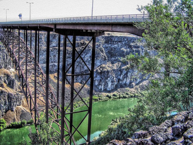
Photo: Bill Badzo, CC BY-SA 2.0
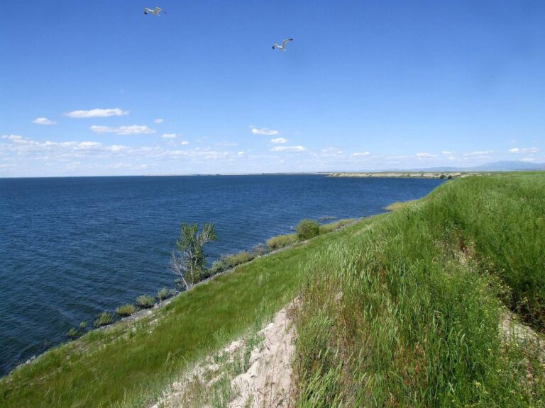
Photo: JF Hobbs, CC BY 3.0

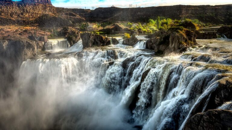
Photo: G. Yancy, CC BY 2.0
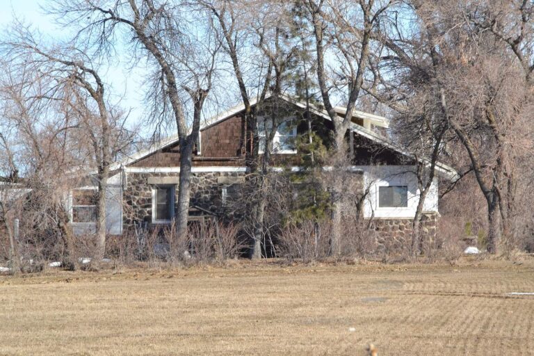
Photo: 25or6to4, CC BY-SA 4.0

Fishing within Cassia County: the usual questions
Where can a trailer reach the water in Cassia County?
There are 4 launch sites, split as 2 BLM and 2 IDFG.
Which Planner lake hands Cassia County anglers the most surface?
Lake Walcott, at 8,248 acres in the IDFG Fishing Planner.
Which IDFG game fish should a Cassia County visitor pack for?
Rainbow trout lead the count of lake pages within 50 miles, followed by bluegill and sunfish, largemouth bass and yellow perch.
Which Cassia County stores stock hooks, sinkers and Idaho flies?
3 listings, such as Snake River Sports.
How many Idaho outfitters list Cassia County as home base?
No Idaho outfitter lists this county; the guides page has the statewide set.
Which Idaho town serves as seat of Cassia County?
It is Burley.
What is the license fee to fish Cassia County?
The statute behind Idaho licenses, Code 36-416, puts the annual fishing fee at $28.75 resident and $106.25 nonresident; sale prices run a little higher.
Which Idaho county pages sit next to Cassia County?
Try Minidoka County, Jerome County and Power County.
Which region table applies in Cassia County?
The IDFG Magic Valley Region takes 100% of them; the rest follow neighbouring regions.
Does the 2025-2027 brochure print rules for Cassia County water?
The Planner prints special rules for 8 county waters with a page here, starting with Cassia Creek; the list above shows the first ones.
Where is the stocked water in Cassia County?
1,396 IDFG releases listed on Planner pages, 9,112,758 fish; the newest went into Snake River on Oct. 27, 2026.
Spend a Gem State morning on Cassia County water
River pages list game fish and USGS flow.