Fishing in Latah County, Idaho
County seat: Moscow. Population 39,517.
- 2lake pages
- 2launch sites
- 5river pages
 Pick for steelheadPiscifun Viper X spinning reel50% OFFSale $39.99
Photo of Dworshak Reservoir: Dsdugan, CC BY-SA 3.0
Latah County through an Idaho angler's windshield
The 2020 Census tallied 39,517 people in Latah County, whose seat is Moscow. The IDFG Clearwater Region takes in 100% of the waters the Planner lists for the county; the remainder follows other region tables.
2 lakes and reservoirs here have a full page, together 83 Planner acres, led by Spring Valley Reservoir. IDFG names steelhead or salmon on Potlatch River and East Fork Potlatch River. Boaters get 2 launch sites from the agency layers, split as 2 IDFG.
Census 2020 population and county seat; IDFG Idaho Fishing Planner (list of Idaho waters), read November 7, 2026. IDFG Fishing and Boating Access Sites layer (ArcGIS service), read November 7, 2026.
 For the steelhead herePiscifun AlumiX spinning reel46% OFFSale $64.99
Latah County lakes, rivers and put-ins on a map
IDFG Fishing and Boating Access Sites, BLM and Forest Service launch points, Fishing Planner lake points (outlet) and stream midpoints. Checked November 2026.
Lake guides covering Latah County
| Lake | Acres | Launches | Kind | Game fish IDFG names |
|---|---|---|---|---|
| Spring Valley Reservoir | 49 | 1 | reservoir | bluegill and sunfish, bullhead, largemouth bass |
| Moose Creek Reservoir | 34 | 1 | reservoir | bluegill and sunfish, bullhead, largemouth bass |
Measured from Moscow, the next lake guides sit outside Latah County.
| Lake | From Moscow | Acres | Launches | Kind | Game fish IDFG names |
|---|---|---|---|---|---|
| Levee Pond | 21 miles south | 12 | 0 | lake | |
| Mann Lake | 26 miles south | 136 | 1 | lake | bluegill and sunfish, bullhead, largemouth bass |
| Dworshak Reservoir | 36 miles east | 16,484 | 0 | reservoir | kokanee, cutthroat trout, smallmouth bass |
| Lake Waha | 37 miles south | 94 | 1 | lake | kokanee, yellow perch, smallmouth bass |
| Winchester Lake | 39 miles southeast | 103 | 0 | lake | bluegill and sunfish, bullhead, largemouth bass |
| Elk Creek Reservoir | 39 miles east | 87 | 1 | reservoir | bluegill and sunfish, bullhead, largemouth bass |
Surface acres as listed in the IDFG Idaho Fishing Planner, read November 7, 2026. Game fish are the Planner’s recommended species; IDFG prints no lake depths there.
Game fish IDFG names most around Latah County
Across lake guides inside 50 miles of Moscow, bullhead is named more than any other game fish.
IDFG Fishing Planner recommended game fish and stocking rows, counted per lake page within 50 miles; not a creel survey.
Other Latah County water listed by IDFG
A further 9 lakes in Latah County are listed but thin on facts.
| Water | Acres | Kind | Nearest town |
|---|---|---|---|
| Atwater Lake | 16 | lake | Genesee |
| Robinson Lake (Latah County) | 7 | lake | Moscow |
| Blue Lagoons | 6 | lake | Orofino |
| Camp Grizzly Pond | 4 | lake | Moscow |
| Village of Troy Reservoir | 1 | reservoir | Moscow |
| Hordemann Pond | 1 | lake | Moscow |
| Palouse River Pond | 0 | lake | St. Maries |
| Kendrick Pool | 0 | lake | Genesee |
| Juliaetta Pond | lake | Genesee |
IDFG Idaho Fishing Planner (list of Idaho waters), read November 7, 2026.
Creeks and forks of Latah County
- Palouse RiverIDFG recommended water, 1 USGS gauge, 166.4 mi Planner length
- Potlatch RiverIDFG recommended water, steelhead or salmon listed, 1 USGS gauge, 56.9 mi Planner length
- East Fork Potlatch RiverIDFG recommended water, steelhead or salmon listed, 21.8 mi Planner length
- South Fork Palouse River46 mi Planner length
- Paradise Creek1 USGS gauge, 19.5 mi Planner length
More creeks and forks of Latah County (149)
- Big Bear Creek24.5 mi
- Fourmile Creek19.8 mi
- Little Potlatch Creek18.7 mi
- Cow Creek17.9 mi
- Middle Potlatch Creek15.8 mi
- Silver Creek15.7 mi
- Missouri Flat Creek14.9 mi
- Pine Creek14.7 mi
- Long Meadow Creek13.3 mi
- Meadow Creek12.6 mi
- Corral Creek12 mi
- Cedar Creek11.2 mi
- West Fork Saint Maries River10.7 mi
- Hatter Creek10.6 mi
- Flannigan Creek10.1 mi
- Cedar Creek10 mi
- Catholic Creek9.9 mi
- Thorn Creek9.9 mi
- Little Bear Creek9.8 mi
- West Fork Little Bear Creek9.5 mi
- Big Creek9.3 mi
- East Fork Emerald Creek9 mi
- Gold Creek9 mi
- Spring Valley Creek8.8 mi
- East Fork Big Bear Creek8.7 mi
- West Fork Emerald Creek8.6 mi
- Crane Creek (Benewah County)8.5 mi
- Bethel Canyon8.4 mi
- Hog Meadow Creek8.2 mi
- Big Meadow Creek8.1 mi
- Big Sand Creek8 mi
- Flat Creek7.9 mi
- Deep Creek7.7 mi
- Middle Fork Big Bear Creek7.7 mi
- Strychnine Creek7.7 mi
- West Fork Potlatch River7.7 mi
- Howard Gulch7.4 mi
- East Fork Meadow Creek7.3 mi
- Boulder Creek7.2 mi
- West Fork Big Bear Creek7.2 mi
- Three Bear Creek7.1 mi
- Duffield Creek7 mi
- Little Thorn Creek7 mi
- North Fork Palouse River6.7 mi
- Dry Creek6.6 mi
- Moose Creek6.6 mi
- Ruby Creek6.5 mi
- East Fork Charlie Creek6.1 mi
- East Fork Deep Creek6.1 mi
- Dicks Creek5.9 mi
- Little Sand Creek5.6 mi
- Middle Fork Deep Creek5.5 mi
- Feather Creek5.4 mi
- Rock Creek5.3 mi
- Brush Creek5.1 mi
- Randall Flat Creek5.1 mi
- Gnat Creek5 mi
- Leopold Creek5 mi
- Maple Creek4.9 mi
- Felton Creek4.8 mi
- Nora Creek4.8 mi
- Mannering Creek4.7 mi
- East Fork Corral Creek4.6 mi
- Long Creek4.6 mi
- Jerome Creek4.5 mi
- Cougar Creek4.4 mi
- Schwartz Creek4.4 mi
- East Fork Flat Creek4.3 mi
- Lemman Creek4.3 mi
- Crumarine Creek4.2 mi
- Little Bear Creek4.2 mi
- West Fork Rock Creek4 mi
- White Pine Creek4 mi
- Camas Creek (Latah County)3.9 mi
- East Fork Rock Creek3.9 mi
- Purdue Creek3.9 mi
- Round Meadow Creek3.9 mi
- Wepah Creek3.9 mi
- Gnat Creek3.8 mi
- West Fork Deep Creek3.8 mi
Current discharge from Latah County gauges
| USGS gauge | Latest reading | Time (ET) |
|---|---|---|
| Palouse River Nr Potlatch, Id | 15 cfs, 5.34 ft gage height | Nov 12 7:45 pm |
| Paradise Creek At Hwy8 Near Moscow, Id | 2 cfs, 46.30 ft gage height | Nov 12 7:45 pm |
US Geological Survey provisional data, retrieved Nov 12, 2026 8:32 pm ET. Provisional readings can be revised.
IDFG Idaho Fishing Planner (list of Idaho waters), read November 7, 2026. Stream lengths as printed in the Planner; USGS gauges live.
Latah County rivers that list steelhead or salmon
- Potlatch RiverIDFG Clearwater Region
- East Fork Potlatch RiverIDFG Clearwater Region
Steelhead and salmon need a Commission season to be open, and those proclamations sat behind IDFG maintenance when this page was written. Idaho steelhead and salmon rules
IDFG Idaho Fishing Planner (list of Idaho waters), read November 7, 2026.
What IDFG hatcheries put into Latah County
Across 5 waters, 270 IDFG releases put 2,056,024 fish into Latah County water.
- Spring Valley ReservoirRainbow Trout, 6,003 fish, Catchable (6+ inches), October 6, 2026
- Moose Creek ReservoirRainbow Trout, 3,001 fish, Catchable (6+ inches), October 6, 2026
- Spring Valley ReservoirRainbow Trout – Triploid, 4,050 fish, Catchable (12-14 inches), June 4, 2026
- Moose Creek ReservoirRainbow Trout – Triploid, 2,997 fish, Catchable (12-14 inches), June 4, 2026
- Spring Valley ReservoirRainbow Trout, 3,573 fish, Catchable (12-14 inches), May 5, 2026
- Moose Creek ReservoirRainbow Trout, 2,961 fish, Catchable (12-14 inches), May 5, 2026
- Spring Valley ReservoirRainbow Trout – Triploid, 5,997 fish, Catchable (12-14 inches), March 31, 2026
- Spring Valley ReservoirRainbow Trout, 3,500 fish, Catchable (6+ inches), October 8, 2025
- Moose Creek ReservoirRainbow Trout, 3,500 fish, Catchable (6+ inches), October 8, 2025
- Spring Valley ReservoirRainbow Trout – Triploid, 5,738 fish, Catchable (12-14 inches), October 6, 2025
- Moose Creek ReservoirRainbow Trout – Triploid, 2,947 fish, Catchable (12-14 inches), October 6, 2025
- Spring Valley ReservoirRainbow Trout – Triploid, 7,040 fish, Catchable (12-14 inches), July 15, 2025
Stocking rows as printed on the IDFG Fishing Planner water pages (date, species, number and size as listed), read November 7, 2026. Newest releases first.
Access inventory for Latah County
- Moose Creek Reservoir boat rampMoose Creek Reservoir, IDFG, fishing access, dock, restroom, camping
- Spring Valley Reservoir boat rampSpring Valley Reservoir, IDFG, fishing access, ramp, dock, restroom, camping
IDFG Fishing and Boating Access Sites layer (ArcGIS service), read November 7, 2026. BLM and Forest Service points as published; lanes and ramp counts are not fields in any layer.
Daily limits for Latah County water
Use the IDFG Clearwater Region block as the starting point in Latah County, then look for a printed rule on the water itself. Budget the statutory $28.75 resident or $106.25 nonresident annual fishing fee from Idaho Code 36-416, plus whatever the vendor tacks on.
| Group | Rule as printed |
|---|---|
| Bass | In rivers and streams, no bag, length or possession limits; In lakes and reservoirs, limit is 6, both species combined |
| Brook Trout | Brook Trout limit is 25; Harvest allowed during any open season unless otherwise noted under Special Rules – if gear or bait restrictions are listed, they apply when fishing for Brook Trout |
| Bull Trout | Bull Trout – catch-and-release |
| Kokanee | Kokanee limit is 25 |
| Salmon | Spring and summer Chinook Salmon seasons and limits are set by the Idaho Fish and Game Commission and issued in separate brochures; Seasons and limits for fall Chinook Salmon and Coho Salmon can be found here; Sockeye Salmon fishing is prohibited. Defined as ocean-run Oncorhynchus nerka longer than 14 inches in the Snake River drainage below Hells Canyon Dam, the Salmon River drainage (excluding above Mosquito Flat D |
| Steelhead | Defined as Rainbow Trout longer than 20 inches in the Snake River drainage below Hells Canyon Dam, the Salmon River drainage (excluding lakes and reservoirs), and the Clearwater River drainage (excluding that portion above Dworshak Dam, and lakes); Fishing for steelhead is prohibited unless a steelhead season is specifically opened for that water. See fishing regulations for details |
| Sturgeon | Sturgeon – catch-and-release; Sturgeon must not be removed from the water and must be released upon landing; Barbless hooks, sliding swivel device to secure a weight, and a lighter test line to secure weight to sliding swivel device are required. See fishing regulations for details |
| Tiger Muskie | Tiger Muskie limit is 2, none under 40 inches |
| Trout | In rivers and streams, trout limit is 2, all species combined; In lakes, reservoirs, ditches and canals, trout limit is 6, all species combined; Bull Trout and Brook Trout are listed separately |
| Walleye | No bag, length, or possession limits. Harvest is encouraged (Stocked illegally in this Region. May be harmful to existing fisheries.) |
| Whitefish | Whitefish limit is 25; Harvest allowed during any open season unless otherwise noted under Special Rules – if gear or bait restrictions are listed, they apply when fishing for whitefish |
| Protected Nongame Fish | May not be harvested or possessed |
| All Other Fish Species | No bag, length, or possession limits |
Where Latah County water departs from the region table (6)
- East Fork Potlatch RiverAll Waters Open All Year
- Moose Creek ReservoirElectric motors only
- Palouse RiverAll Waters Open All Year
- Potlatch RiverAll Waters Open All Year
- South Fork Palouse RiverAll Waters Open All Year
- Spring Valley ReservoirElectric motors only
Region bag limits from Idaho Fishing Seasons and Rules, 2025-2027 for the Clearwater Region, as printed on IDFG Fishing Planner water pages (the brochure PDF on idfg.idaho.gov was unreachable during site maintenance), read November 7, 2026. Fishing license fees as set in Idaho Code 36-416 (statute; IDFG sale prices add vendor and processing fees), read November 7, 2026.
Recent Idaho records near Latah County
Nothing in Latah County made the 2026 record announcements, but these nearby waters did.
| Species | Record | Kind | Water | Date |
|---|---|---|---|---|
| Rainbow Trout | 20.03 pounds | certified weight | Dworshak Reservoir | Jan. 13, 2026 |
Idaho state record fish, read November 8, 2026. A partial list: records IDFG announced in 2026.
Shops and outfitters listing Latah County
Shop listings for Latah County
- Sure Shot Sporting Goods Cobait and tackle shop, Moscow
- White Pine Outfittersbait and tackle shop, Moscow
Yellow Pages and chain store listings, guide listings (city of business); retrieved November 7, 2026.
Beyond the edge of Latah County
Overnight bases in Latah County
- Moscowpop. 25,435
- Geneseepop. 1,030
Counties bordering Latah County
- Benewah County28 miles north
- Nez Perce County34 miles south
- Lewis County43 miles south
- Clearwater County52 miles east
A Piscifun spinning kit for the run up to Latah County


Piscifun and Amazon links are affiliate links; the site earns a commission on qualifying purchases.
Gem State fish to know on sight at Latah County
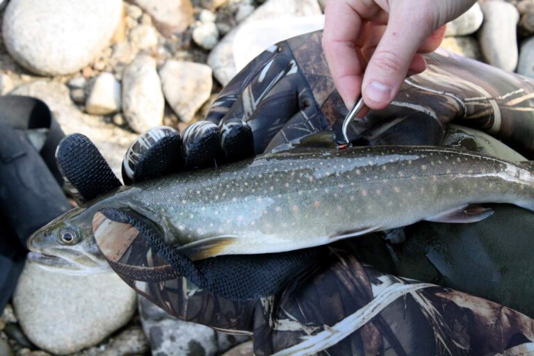
Photo: Bureau of Reclamation, CC BY-SA 2.0

Photo: Ryndon, CC BY 2.0

Photo: Oregon Department of Fish & Wildlife, CC BY-SA 2.0

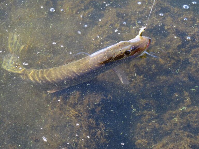
Photo: Argyleist, CC BY 2.0
What Idaho anglers ask about Latah County
Do IDFG, BLM or the Forest Service run the launches in Latah County?
2 launch sites; 2 IDFG.
Which Latah County reservoir shows the most acres?
Spring Valley Reservoir, at 49 acres in the IDFG Fishing Planner.
What tops the game fish tally for Latah County?
Bullhead lead the count of lake pages within 50 miles, followed by largemouth bass, bluegill and sunfish and rainbow trout.
Where does a Gem State angler restock in Latah County?
Sure Shot Sporting Goods Co is one of 2 shops listed here.
Is there an Idaho fishing guide with a Latah County address?
No outfitter gives a city in the county.
Which Idaho town keeps the Latah County courthouse?
Moscow, home of the courthouse.
Which Idaho license covers a Latah County trip?
Budget the statutory $28.75 resident or $106.25 nonresident annual fishing fee from Idaho Code 36-416, plus whatever the vendor tacks on.
Which Idaho counties meet the Latah County boundary?
The list above starts with Benewah County, Nez Perce County and Lewis County.
Under which IDFG region is most Latah County fishing?
Most listed waters (100%) fall in the IDFG Clearwater Region; region lines follow drainages.
Which Latah County lakes or creeks carry their own IDFG rule block?
The Planner prints special rules for 6 county waters with a page here, starting with East Fork Potlatch River; the list above shows the first ones.
When was Latah County water last stocked?
270 IDFG releases listed on Planner pages, 2,056,024 fish; the newest went into Spring Valley Reservoir on Oct. 6, 2026.
Are there steelhead or salmon in Latah County?
The Planner lists steelhead or salmon on Potlatch River and East Fork Potlatch River. The Commission opens steelhead and salmon by separate proclamation; check IDFG before fishing them, as those pages were offline when this was built.
Fish the reservoirs and trout creeks of Latah County
Each launch opens with a directions link.