Fishing in Nome Census Area, Alaska
Administrative center: Nome. Census 2020 residents: 10,046.
- 1other sites
- 7ramps
- 88river pages
 Pick for salmonPiscifun Viper X spinning reel50% OFFSale $39.99
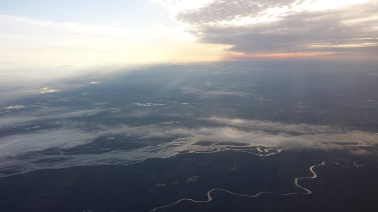
Photo of Tanana River: Ron Reiring, CC BY 2.0
Planning a first Alaska trip in Nome Census Area
The 2020 count for Nome Census Area came to 10,046 people, with Nome as the administrative center. The unit is a Census Bureau creation, with no borough assembly behind it. On the Gazetteer, the census area spans 22,970 square miles of land and 5,321 square miles of water. Flowing water in Nome Census Area starts with Anvik River, Eldorado Creek and Etta Creek.
Boat anglers get 7 ramps; bank and harbor anglers get 1 other fishing site. The 2026 booklets print their own heading for 4 waters of its waters.
Population from the 2020 Census (TIGERweb), places and boroughs from the Census 2023 Gazetteer, read November 14, 2026. Launch or access details as published in the ADF&G goFishAK layer (ADF&G titles it a draft), read November 14, 2026.
Last Frontier fishing points laid out across Nome Census Area
Launch or access details as published in the ADF&G goFishAK layer (ADF&G titles it a draft), read November 14, 2026. Lake pins are the ADF&G reference point for each lake.
Alaska stream pages for Nome Census Area
- Anvik River1 USGS gauge
- Eldorado Creek1 USGS gauge
- Etta Creek1 USGS gauge
- Niukluk River1 USGS gauge, goFishAK entry
- Snake River1 USGS gauge
- Unalakleet River1 USGS gauge, goFishAK entry
- *North Fork Rathlatulik RiverAWC stream record
- Agiapuk RiverAWC stream record
- American RiverAWC stream record
- Anikovik RiverAWC stream record
- Arctic Riverregulation heading
- Bear RiverAWC stream record
- Bluestone RiverAWC stream record
- Bonanza RiverAWC stream record
- California RiverAWC stream record
- Casadepaga RiverAWC stream record
- Chiroskey RiverAWC stream record
- Cobblestone RiverAWC stream record
- Cripple RiverAWC stream record
- Don RiverAWC stream record
- East Fork Andreafsky RiverAWC stream record
- East Fork Koyuk RiverAWC stream record
- East Fork Solomon RiverAWC stream record
- Eldorado RiverAWC stream record
- Etchepuk RiverAWC stream record
- Feather RiverAWC stream record
- Fish RiverAWC stream record
- Flambeau RiverAWC stream record
- Fox RiverAWC stream record
- Golsovia RiverAWC stream record
Alaska creek and river gauges across Nome Census Area
| USGS gauge | Latest reading | Time (ET) |
|---|---|---|
| Unalakleet R Ab Chiroskey R Nr Unalakleet Ak | 90.69 ft gage height | Nov 16 12:15 pm |
| Etta C Nr Council Ak | 2 cfs | Oct 1 3:45 am Not updated since Oct 1, 2008. |
US Geological Survey provisional data, retrieved Nov 16, 2026 12:33 pm ET. Provisional readings can be revised.
Stream record from the ADF&G Anadromous Waters Catalog (2026 layer), read November 14, 2026. A catalog entry is a use record, not a fishing-quality claim. Streamflow and level from USGS National Water Information System; many Alaska gauges report only in the open-water season.
Alaska put-ins listed for Nome Census Area
- Kuzitrin River gravel boat launchlaunch ramp; Nome Census Area
- Niukluk River gravel boat launchlaunch ramp; Nome Census Area
- Nome River gravel boat launchlaunch ramp; Nome Census Area
- Pilgram River gravel boat launchlaunch ramp; Nome Census Area
- Snake River Boat Harbor Launch Ramplaunch ramp; Nome Census Area
- Solomon River gravel boat launchlaunch ramp; Nome Census Area
- Unalakleet River Boat Launchlaunch ramp; Nome Census Area
ADF&G access sites in Nome Census Area
- Port of Nome small boat harborharbor, launch ramp, fuel, repair services, storage, restrooms; Nome Census Area
Launch or access details as published in the ADF&G goFishAK layer (ADF&G titles it a draft), read November 14, 2026.
Mapped but undocumented ADF&G-layer lakes in Nome Census Area
- Salmon Lakeabout 1,888 acres of mapped outline
- Glacial Lakeabout 949 acres of mapped outline
- Imuruk Basinabout 57,104 acres of mapped outline
- Devil Mountain Lakesabout 5,248 acres of mapped outline
- White Fish Lakeabout 1,871 acres of mapped outline
- Kuzitrin Lakeabout 1,210 acres of mapped outline
- Lava Lakeabout 874 acres of mapped outline
- Lake Omiaktalikabout 657 acres of mapped outline
- Fox Lakeabout 526 acres of mapped outline
- Clear Lakesabout 417 acres of mapped outline
- Taylor Lagoonabout 280 acres of mapped outline
- McCarthy Marshabout 226 acres of mapped outline
- Agnes Lakeabout 203 acres of mapped outline
- Marys Lakeabout 189 acres of mapped outline
- Clear Lakesabout 157 acres of mapped outline
- Coral Lakeabout 117 acres of mapped outline
- Clear Lakesabout 87 acres of mapped outline
- Clear Lakesabout 77 acres of mapped outline
- Puyuk Lakeabout 46 acres of mapped outline
- Crater Lakeabout 45 acres of mapped outline
- Zagoskin Lakeabout 36 acres of mapped outline
- Grassy Lakeabout 27 acres of mapped outline
- Twin Lakesabout 22 acres of mapped outline
- Telephone Sloughabout 16 acres of mapped outline
- Ryan Lakeabout 14 acres of mapped outline
- No Itch Lakeno outline figure
- Red Cliff Lakeno outline figure
- Shishmaref Road Planning – Lake Ano outline figure
- Shishmaref Road Planning – Lake Bno outline figure
- Shishmaref Road Planning – Lake Cno outline figure
- Shishmaref Road Planning – Lake Dno outline figure
- Shishmaref Road Planning – Lake Eno outline figure
- Shishmaref Road Planning – Lake Fno outline figure
- Shishmaref Road Planning – Lake Gno outline figure
- Shishmaref Road Planning – Lake Hno outline figure
- Shishmaref Road Planning – Lake Ino outline figure
- Shishmaref Road Planning – Lake Jno outline figure
- Shishmaref Road Planning – Lake Kno outline figure
- Shishmaref Road Planning – Lake Lno outline figure
Mapped outline area computed from the USGS National Hydrography Dataset waterbody polygon, read November 14, 2026: outline area is not a surface-acre figure from ADF&G. Names come from ADF&G lake lists and the USGS names layer; no page and no fish list for these lakes.
 For the salmon herePiscifun AlumiX spinning reel46% OFFSale $64.99
Waters in Nome Census Area with a heading in the 2026 summary
Rules and fees are the 2026 edition: ADF&G prints "Effective until the 2027 summary is issued" on every 2026 booklet, and no 2027 booklet exists. Emergency orders supersede the booklet.
- Arctic RiverARCTIC, Kenai River: Russian 1 per day, 1 in possession, must be less than 16Lake inches long. RM 66 Lake RM 68 Kena RM 78 RM 74 River RM 82 RM 80.7 Between markers located at the outlet of Kenai Lake downstream to river mile 80.7, a person may not sport fish from a vessel during motor use or BURBOT
- Nome RiverNOME RIVER, Northwestern drainages: Open year-round to sport fishing for species other than Arctic grayling.
- Penny RiverPENNY RIVER, Northwestern drainages: Closed to chum salmon fishing. All chum salmon caught must be released immediately.
- Solomon RiverSOLOMON RIVER, Northwestern drainages: Open year-round to sport fishing for species other than Arctic grayling.
Rules as printed in the 2026 ADF&G Sport Fishing Regulations Summary (booklet). Effective until the 2027 summary is issued; emergency orders supersede the booklet (ADF&G emergency orders). Read November 14, 2026.
Alaska bait counters around Nome Census Area
Bait and fly shops worth a detour before Nome Census Area, Alaska
- Nome Outfitters Gun & Tacklebait and tackle shop, Nome
- Nome Small Boat Harbormarina, Nome
Yellow Pages, chamber and DOT&PF harbor listings (city of business), read November 14, 2026. Guides are listed as businesses; no licence or registration status is implied.
Along the same valley as Nome Census Area, Alaska
Alaska cities and towns of Nome Census Area
- Nome2020 count 3,699
Adjoining Nome Census Area
- Kusilvak Census Area175 miles south
- Northwest Arctic Borough193 miles northeast
- Bethel Census Area295 miles southeast
- Yukon-Koyukuk Census Area369 miles east
Piscifun tackle chosen for a day at Nome Census Area


Piscifun and Amazon links are affiliate links; the site earns a commission on qualifying purchases.
Clearing up Alaska myths about fishing Nome Census Area
Which Alaska ramps serve Nome Census Area?
7 ramps show up in the access data for Nome Census Area.
Which lake in Nome Census Area has the most acreage?
No lake in Nome Census Area has a page; the named-waters list above shows what the ADF&G and USGS layers hold.
What species does ADF&G map around Nome Census Area?
Each lake page prints the fish ADF&G lists for it.
Which Alaska stores in Nome Census Area sell fishing gear?
Nome Outfitters Gun & Tackle heads a list of 2.
Which Alaska town holds the Nome Census Area offices?
That is Nome.
What do I buy before an Alaska day on Nome Census Area water?
A resident annual sport fishing license is $20 and a nonresident annual license $100
Which neighbours should I check near Nome Census Area?
The closest pages are Kusilvak Census Area, Northwest Arctic Borough and Bethel Census Area.
What is the king salmon limit in Nome Census Area?
Limits depend on the booklet area, the species heading and any heading printed for the water; the four booklet pages on this site give the headings, and king salmon rows lean on emergency orders. Rules and fees are the 2026 edition: ADF&G prints "Effective until the 2027 summary is issued" on every 2026 booklet, and no 2027 booklet exists. Emergency orders supersede the booklet.
Which lakes in Nome Census Area have special limits?
4 waters with a page here carry their own heading, beginning with Arctic River.
Plan a Last Frontier fishing day in Nome Census Area
Access pages repeat ADF&G text with directions.