Fishing in Kusilvak Census Area, Alaska
Administrative center: Hooper Bay. Census 2020 residents: 8,368.
- 0other sites
- 0ramps
- 34river pages
 Pick for salmonPiscifun Viper X spinning reel50% OFFSale $39.99
Photo of Naknek River: Alaska Region U.S. Fish & Wildlife Service, Public domain
Kusilvak Census Area: the Alaska short version
Residents of Kusilvak Census Area numbered 8,368 in 2020, and Hooper Bay is where its administrative center sits. No borough government exists here; the Bureau draws the census area for counting. Gazetteer totals: 17,077 square miles of land and 2,582 square miles of water. For a stream day, start with Yukon River, *Ecuilnguaraq River and Andreafsky River.
A resident annual sport fishing license is $20 and a nonresident annual license $100
Population from the 2020 Census (TIGERweb), places and boroughs from the Census 2023 Gazetteer, read November 14, 2026. Launch or access details as published in the ADF&G goFishAK layer (ADF&G titles it a draft), read November 14, 2026.
Plotting every ADF&G-mapped lake and access point in Kusilvak Census Area
Launch or access details as published in the ADF&G goFishAK layer (ADF&G titles it a draft), read November 14, 2026. Lake pins are the ADF&G reference point for each lake.
Reservoirs and ponds in Kusilvak Census Area, Alaska
With only a few paged Alaska lakes in Kusilvak Census Area, here are the closest from Hooper Bay.
| Lake | From Hooper Bay | Size | Access sites | ADF&G lists |
|---|---|---|---|---|
| Canyon Lake | 221 miles southeast | about 335 acres of mapped outline | 0 | none on the list |
| Arolik Lake | 221 miles southeast | about 536 acres of mapped outline | 0 | none on the list |
| Klak Lake | 228 miles southeast | about 187 acres of mapped outline | 0 | none on the list |
| Kanuktik Lake | 233 miles southeast | about 1,752 acres of mapped outline | 0 | none on the list |
| Kagati Lake | 233 miles southeast | about 1,247 acres of mapped outline | 0 | none on the list |
| Goodnews Lake | 235 miles southeast | about 862 acres of mapped outline | 0 | none on the list |
Acres as the ADF&G lake layer lists them, read November 14, 2026. Lakes with no ADF&G acreage print their USGS mapped outline instead. Record from the ADF&G Sport Fish Lakes Database (SF_Lakes), read November 14, 2026.
Streams crossing Kusilvak Census Area
- Yukon River1 USGS gauge
- *Ecuilnguaraq RiverAWC stream record
- Andreafsky RiverAWC stream record
- Anerkochik RiverAWC stream record
- Aphrewn RiverAWC stream record
- Archuelinguk RiverAWC stream record
- Atchuelinguk RiverAWC stream record
- Azun RiverAWC stream record
- Black RiverAWC stream record
- Bonasila RiverAWC stream record
- Chuilnak RiverAWC stream record
- East Fork Andreafsky RiverAWC stream record
- Ekasluktuli RiverAWC stream record
- Hawk RiverAWC stream record
- Kashunuk RiverAWC stream record
- Keoklevik RiverAWC stream record
- Kogok RiverAWC stream record
- Kokechik RiverAWC stream record
- Kun RiverAWC stream record
- Kuttak RiverAWC stream record
- Kuyukutuk RiverAWC stream record
- Manokinak RiverAWC stream record
- Nageethluk RiverAWC stream record
- Ninglikfak RiverAWC stream record
- Nunakogok RiverAWC stream record
- Nungatak RiverAWC stream record
- Opagyarak RiverAWC stream record
- Pastoliak (*Pastuliaraq) RiverAWC stream record
- Pastolik (*Pastuliq) RiverAWC stream record
- Pikmiktalik RiverAWC stream record
USGS gauge readings logged inside Kusilvak Census Area
| USGS gauge | Latest reading | Time (ET) |
|---|---|---|
| Yukon R At Pilot Station Ak | 273,000 cfs, 17.52 ft gage height | Nov 5 12:45 pm Not updated since Nov 5, 2026. |
US Geological Survey provisional data, retrieved Nov 16, 2026 12:33 pm ET. Provisional readings can be revised.
Stream record from the ADF&G Anadromous Waters Catalog (2026 layer), read November 14, 2026. A catalog entry is a use record, not a fishing-quality claim. Streamflow and level from USGS National Water Information System; many Alaska gauges report only in the open-water season.
USGS-named basins in Kusilvak Census Area without a write-up
- Kgun Lakeabout 20,837 acres of mapped outline
- Nunavakanuk Lakeabout 18,005 acres of mapped outline
- Nuigalak Lakeabout 13,628 acres of mapped outline
- Nanvaranak Lakeabout 13,270 acres of mapped outline
- Nashak Lakeabout 5,375 acres of mapped outline
- Kagankaguti Lakeabout 4,596 acres of mapped outline
- Partway Lakeabout 4,144 acres of mapped outline
- Kingaglia Lakeabout 4,077 acres of mapped outline
- Kawialik Lakeabout 3,039 acres of mapped outline
- Nuskealik Lakeabout 2,448 acres of mapped outline
- Nanvaranak Choaabout 1,533 acres of mapped outline
- Kingokakthluk Lakeabout 1,221 acres of mapped outline
- Engineer Lakeabout 1,184 acres of mapped outline
- Allman Lakeabout 353 acres of mapped outline
- Tungak Lakeabout 287 acres of mapped outline
- Onolavik Lakeabout 283 acres of mapped outline
- Nunvotchuk Lakeabout 193 acres of mapped outline
- Kako Lakeabout 91 acres of mapped outline
- Russian Mission Lakeabout 84 acres of mapped outline
- Ocolaksuk Lakeabout 77 acres of mapped outline
Mapped outline area computed from the USGS National Hydrography Dataset waterbody polygon, read November 14, 2026: outline area is not a surface-acre figure from ADF&G. Names come from ADF&G lake lists and the USGS names layer; no page and no fish list for these lakes.
Alaska fly shops and tackle stores of Kusilvak Census Area
Gear stores within reach of Kusilvak Census Area, Alaska
- Bethel Small Boat Harbormarina, Bethel, 154 miles
- Nome Outfitters Gun & Tacklebait and tackle shop, Nome, 208 miles
- Nome Small Boat Harbormarina, Nome, 208 miles
Yellow Pages, chamber and DOT&PF harbor listings (city of business), read November 14, 2026. Guides are listed as businesses; no licence or registration status is implied.
Alaska places mapped beside Kusilvak Census Area
Alaska towns in Kusilvak Census Area with their own pages
- Hooper Bay2020 count 1,375
Alaska boroughs and census areas sharing a line with Kusilvak Census Area
- Bethel Census Area137 miles southeast
- Nome Census Area175 miles north
- Dillingham Census Area251 miles southeast
- Bristol Bay Borough323 miles southeast
A Piscifun bundle sized for last-frontier fishing at Kusilvak Census Area


Piscifun and Amazon links are affiliate links; the site earns a commission on qualifying purchases.
Spruce banks and gravel bars near Kusilvak Census Area in pictures
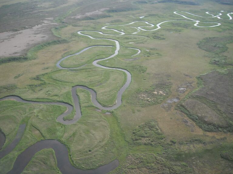
Photo: Alaska Region U.S. Fish & Wildlife Service, Public domain
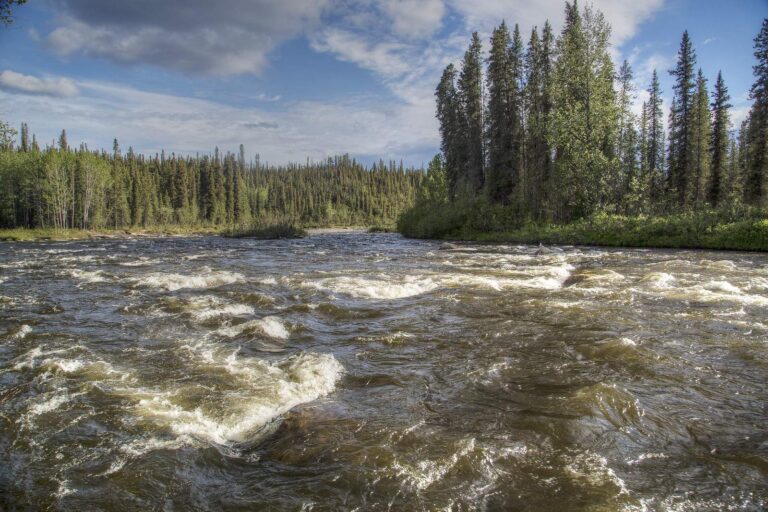
Photo: Bureau of Land Management, CC BY 2.0
What Alaskans ask about the water in Kusilvak Census Area
Are there public Alaska ramps in Kusilvak Census Area?
No goFishAK ramp sits in Kusilvak Census Area itself.
Which lake leads Kusilvak Census Area on size?
No lake inside Kusilvak Census Area has a page here; Canyon Lake, 221 miles from Hooper Bay, is the closest one.
Which species keep appearing in ADF&G lists around Kusilvak Census Area?
Each lake page prints the fish ADF&G lists for it.
Which Alaska shops in Kusilvak Census Area carry tackle?
The listings hold none for Kusilvak Census Area; stores far off appear above.
Which place is the administrative center of Kusilvak Census Area?
The administrative center is Hooper Bay.
Do I need an Alaska license to fish in Kusilvak Census Area?
A resident annual sport fishing license is $20 and a nonresident annual license $100
Which Alaska area pages sit near Kusilvak Census Area?
Look at Bethel Census Area, Nome Census Area and Dillingham Census Area.
Is there an Alaska daily limit in Kusilvak Census Area?
Limits depend on the booklet area, the species heading and any heading printed for the water; the four booklet pages on this site give the headings, and king salmon rows lean on emergency orders. Rules and fees are the 2026 edition: ADF&G prints "Effective until the 2027 summary is issued" on every 2026 booklet, and no 2027 booklet exists. Emergency orders supersede the booklet.
 For the salmon herePiscifun AlumiX spinning reel46% OFFSale $64.99
Work the Alaska lakes and streams of Kusilvak Census Area
Each Alaska access page ends with a directions link.