Fishing in Bethel Census Area, Alaska
Administrative center: Bethel. Census 2020 residents: 18,666.
- 8lake pages
- 1ramp
- 111river pages
 Pick for northern pikePiscifun Viper X spinning reel50% OFFSale $39.99
Photo of Naknek River: Alaska Region U.S. Fish & Wildlife Service, Public domain
An overview of the Alaska water in Bethel Census Area
Bethel is the administrative center of Bethel Census Area, a census area where the 2020 Census tallied 18,666. Census areas are statistical units and run no government of their own. The Census measures 40,639 square miles of land and 4,917 square miles of water inside the line. Bethel Census Area carries 8 lakes with write-ups; Whitefish Lake (Hoholitna) is biggest. Running water with its own page here includes Kuskokwim River, Kuskokwim River and Browns Slough.
Inside the line of Bethel Census Area sit 1 ramp and 1 other fishing site that are not ramps. The 2026 summary lists headings for 1 water in Bethel Census Area.
Population from the 2020 Census (TIGERweb), places and boroughs from the Census 2023 Gazetteer, read November 14, 2026. Launch or access details as published in the ADF&G goFishAK layer (ADF&G titles it a draft), read November 14, 2026.
Pins for the launches, trails and lakes of Bethel Census Area
Launch or access details as published in the ADF&G goFishAK layer (ADF&G titles it a draft), read November 14, 2026. Lake pins are the ADF&G reference point for each lake.
Alaska still water inside Bethel Census Area
| Lake | Size | Access sites | ADF&G lists |
|---|---|---|---|
| Whitefish Lake (Hoholitna) | about 8,424 acres of mapped outline | 0 | none on the list |
| Tundra Lake | about 5,509 acres of mapped outline | 0 | none on the list |
| Kanuktik Lake | about 1,752 acres of mapped outline | 0 | none on the list |
| Kagati Lake | about 1,247 acres of mapped outline | 0 | none on the list |
| Goodnews Lake | about 862 acres of mapped outline | 0 | none on the list |
| Arolik Lake | about 536 acres of mapped outline | 0 | none on the list |
| Canyon Lake | about 335 acres of mapped outline | 0 | none on the list |
| Klak Lake | about 187 acres of mapped outline | 0 | none on the list |
Acres as the ADF&G lake layer lists them, read November 14, 2026. Lakes with no ADF&G acreage print their USGS mapped outline instead. Record from the ADF&G Sport Fish Lakes Database (SF_Lakes), read November 14, 2026.
The Alaska presence tally for Bethel Census Area
Bars count lake pages within 250 miles of Bethel where an ADF&G layer lists the fish; Arctic char leads.
ADF&G species lists, counted per lake page within 250 miles; presence in a layer, not a catch survey. Record from the ADF&G Sport Fish Lakes Database (SF_Lakes), read November 14, 2026.
 For the northern pike herePiscifun AlumiX spinning reel46% OFFSale $64.99
Moving Alaska water in Bethel Census Area
- Kuskokwim River2 USGS gauges
- Kuskokwim River2 USGS gauges
- Browns Slough1 USGS gauge
- Crooked Creek1 USGS gauge
- Kuskokwim River1 USGS gauge
- Yukon River1 USGS gauge
- Ahding RiverAWC stream record
- Ahlik RiverAWC stream record
- Akulikutak RiverAWC stream record
- Alakuchak RiverAWC stream record
- Aniak RivergoFishAK entry
- Big RiverAWC stream record
- Binajoaksmiut RiverAWC stream record
- Buckstock RiverAWC stream record
- Chakwakamiut RiverAWC stream record
- Cheeneetnuk RiverAWC stream record
- Chuilnuk RiverAWC stream record
- Chukowan RiverAWC stream record
- Dahloongamiut RiverAWC stream record
- Dooksook RiverAWC stream record
- Duchikmiut RiverAWC stream record
- East Fork Arolik RiverAWC stream record
- East Fork George RiverAWC stream record
- Eek RiverAWC stream record
- Eenayarak RiverAWC stream record
- Fog RiverAWC stream record
- Gagaryah RiverAWC stream record
- George RiverAWC stream record
- Goodnews RivergoFishAK entry
- Gweek RiverAWC stream record
Water-level stations inside Bethel Census Area
| USGS gauge | Latest reading | Time (ET) |
|---|---|---|
| Kuskokwim R At Crooked Creek Ak | 4.05 ft gage height | Nov 16 11:45 am |
| Crooked C Ab Airport Rd Nr Crooked Creek Ak | 10.78 ft gage height | Nov 16 11:45 am |
US Geological Survey provisional data, retrieved Nov 16, 2026 12:33 pm ET. Provisional readings can be revised.
Stream record from the ADF&G Anadromous Waters Catalog (2026 layer), read November 14, 2026. A catalog entry is a use record, not a fishing-quality claim. Streamflow and level from USGS National Water Information System; many Alaska gauges report only in the open-water season.
Alaska launch ramps across Bethel Census Area
- Boat Launchlaunch ramp; Bethel Census Area
Docks and piers in Bethel Census Area, Alaska
- Bethel small boat harborharbor, launch ramp, dock; Bethel Census Area
Launch or access details as published in the ADF&G goFishAK layer (ADF&G titles it a draft), read November 14, 2026.
Small Alaska ponds of Bethel Census Area with only a name and outline
- Dall Lakeabout 111,681 acres of mapped outline
- Aropuk Lakeabout 41,125 acres of mapped outline
- Nunavakpak Lakeabout 33,767 acres of mapped outline
- Kaghasuk Lakeabout 29,362 acres of mapped outline
- Kagalurpak Lakeabout 27,608 acres of mapped outline
- Kayigyalik Lakeabout 21,924 acres of mapped outline
- Takslesluk Lakeabout 20,688 acres of mapped outline
- Kegum Kagati Lakeabout 20,491 acres of mapped outline
- Nunavakanukakslak Lakeabout 20,232 acres of mapped outline
- Whitefish Lakeabout 18,360 acres of mapped outline
- Arhymot Lakeabout 14,702 acres of mapped outline
- Eek Lakeabout 12,692 acres of mapped outline
- Puk Palik Lakeabout 12,545 acres of mapped outline
- Kayigyalik Lakeabout 12,371 acres of mapped outline
- Kagaluk Lakeabout 10,640 acres of mapped outline
- Bow Lakeabout 9,756 acres of mapped outline
- Kukaklik Lakeabout 6,839 acres of mapped outline
- Kulik Lakeabout 6,430 acres of mapped outline
- Kolekfikpuk Lakeabout 5,687 acres of mapped outline
- Chilok Lakeabout 4,191 acres of mapped outline
- Kinarak Lakeabout 3,655 acres of mapped outline
- Nanvakfak Lakeabout 3,057 acres of mapped outline
- Lou Lakeabout 2,103 acres of mapped outline
- Big Lakeabout 1,858 acres of mapped outline
- Nagugun Lakeabout 1,310 acres of mapped outline
- Tishimna Lakeabout 1,251 acres of mapped outline
- Trout Lakeabout 1,040 acres of mapped outline
- Pegati Lakeabout 1,015 acres of mapped outline
- Ithagsutlek Lakeabout 944 acres of mapped outline
- North Lime Lakeabout 749 acres of mapped outline
- South Lime Lakeabout 661 acres of mapped outline
- Pingo Lakeabout 607 acres of mapped outline
- Eek Lakeabout 456 acres of mapped outline
- Tsingigkalik Lakeabout 416 acres of mapped outline
- Kagan Lakeabout 402 acres of mapped outline
- Lukluksukwik Lakeabout 392 acres of mapped outline
- Kolmakof Lakeabout 371 acres of mapped outline
- Kutokbuna Lakeabout 354 acres of mapped outline
- East Lime Lakeabout 342 acres of mapped outline
- Karon Lakeabout 316 acres of mapped outline
Mapped outline area computed from the USGS National Hydrography Dataset waterbody polygon, read November 14, 2026: outline area is not a surface-acre figure from ADF&G. Names come from ADF&G lake lists and the USGS names layer; no page and no fish list for these lakes.
Booklet headings the summary lists for Bethel Census Area waters
Rules and fees are the 2026 edition: ADF&G prints "Effective until the 2027 summary is issued" on every 2026 booklet, and no 2027 booklet exists. Emergency orders supersede the booklet.
- Canyon LakeCANYON CREEK, Susitna River drainage: Only one unbaited, single-hook, artificial lure or fly is allowed year-round.
Rules as printed in the 2026 ADF&G Sport Fishing Regulations Summary (booklet). Effective until the 2027 summary is issued; emergency orders supersede the booklet (ADF&G emergency orders). Read November 14, 2026.
Gear stores in Bethel Census Area
Alaska: shops the Bethel Census Area regulars swear by
- Bethel Small Boat Harbormarina, Bethel
Yellow Pages, chamber and DOT&PF harbor listings (city of business), read November 14, 2026. Guides are listed as businesses; no licence or registration status is implied.
In Alaska close to Bethel Census Area
Alaska places in Bethel Census Area with town pages
- Bethel2020 count 6,325
Alaska neighbors of Bethel Census Area
- Dillingham Census Area116 miles southeast
- Kusilvak Census Area137 miles northwest
- Bristol Bay Borough187 miles southeast
- Lake and Peninsula Borough235 miles southeast
Piscifun reels and line to pack for an Alaska trip to Bethel Census Area


Piscifun and Amazon links are affiliate links; the site earns a commission on qualifying purchases.
Glacier-fed shorelines and silver-run riffles around Bethel Census Area, photographed
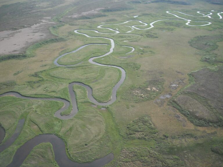
Photo: Alaska Region U.S. Fish & Wildlife Service, Public domain
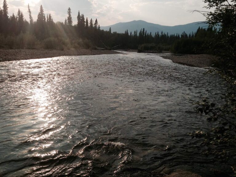
Photo: Brian, CC BY 2.0
Fishing inside Bethel Census Area, Alaska: the common asks
Where can I put a skiff in the water in Bethel Census Area?
1 ramp, each in the access list above.
Which Alaska lake is the biggest in Bethel Census Area?
Whitefish Lake (Hoholitna) leads with about 8,424 acres of mapped outline.
What fish turn up on lake pages near Bethel Census Area?
The layers name Arctic char on the most lake pages within 250 miles, then Dolly Varden, northern pike and rainbow trout; they show presence, not a catch.
Where do anglers in Bethel Census Area pick up flies and jigs?
1 listings, Bethel Small Boat Harbor among them.
What Alaska community serves Bethel Census Area as its administrative center?
It is Bethel.
What does an Alaska fishing license cost for Bethel Census Area?
A resident annual sport fishing license is $20 and a nonresident annual license $100
What Alaska units are closest to Bethel Census Area?
Nearest first: Dillingham Census Area, Kusilvak Census Area and Bristol Bay Borough.
What Alaska limits cover Bethel Census Area water?
Limits depend on the booklet area, the species heading and any heading printed for the water; the four booklet pages on this site give the headings, and king salmon rows lean on emergency orders. Rules and fees are the 2026 edition: ADF&G prints "Effective until the 2027 summary is issued" on every 2026 booklet, and no 2027 booklet exists. Emergency orders supersede the booklet.
Does the regulation summary list headings for Bethel Census Area water?
1 water with a page here carry their own heading, beginning with Canyon Lake.
A glacial-river morning in Bethel Census Area
River pages list access sites and USGS flow.