Fishing in Dillingham Census Area, Alaska
Administrative center: Dillingham. Census 2020 residents: 4,857.
- 4lake pages
- 6ramps
- 55river pages
 Pick for troutPiscifun Carbon X ultralight spinning reel28% OFFSale $57.99
Photo of Naknek River: Alaska Region U.S. Fish & Wildlife Service, Public domain
Fishing Dillingham Census Area in brief
Census 2020 put 4,857 people in Dillingham Census Area; Dillingham serves as its administrative center. A census area is a Census Bureau statistical unit, not a local government. Its Gazetteer footprint is 18,334 square miles of land and 2,295 square miles of water. By acreage or outline, Tikchik Lake tops the 4 lakes with pages. Stream pages for Dillingham Census Area: Koktuli River, Mulchatna River and Nushagak River.
ADF&G and DOT&PF together place 6 ramps and 1 other fishing site in Dillingham Census Area. 3 waters in Dillingham Census Area carry a heading of their own in the 2026 summary.
Population from the 2020 Census (TIGERweb), places and boroughs from the Census 2023 Gazetteer, read November 14, 2026. Launch or access details as published in the ADF&G goFishAK layer (ADF&G titles it a draft), read November 14, 2026.
Marking lakes, harbors and walk-in sites in Dillingham Census Area
Launch or access details as published in the ADF&G goFishAK layer (ADF&G titles it a draft), read November 14, 2026. Lake pins are the ADF&G reference point for each lake.
Choosing among the Alaska lakes of Dillingham Census Area
| Lake | Size | Access sites | ADF&G lists |
|---|---|---|---|
| Tikchik Lake | about 14,942 acres of mapped outline | 0 | none on the list |
| Kisaralik Lake | about 3,351 acres of mapped outline | 0 | none on the list |
| Kukaktlim Lake | about 678 acres of mapped outline | 0 | none on the list |
| Lake Aleknagik | no size printed | 0 | rainbow trout, sockeye salmon, silver salmon |
Acres as the ADF&G lake layer lists them, read November 14, 2026. Lakes with no ADF&G acreage print their USGS mapped outline instead. Record from the ADF&G Sport Fish Lakes Database (SF_Lakes), read November 14, 2026.
 For the trout herePiscifun Carbon XT ultralight spinning reel25% OFFSale $59.99
Which fish the layers list across Dillingham Census Area waters
The count covers ADF&G lists on lakes within 80 miles of Dillingham, with Arctic char in front.
ADF&G species lists, counted per lake page within 80 miles; presence in a layer, not a catch survey. Record from the ADF&G Sport Fish Lakes Database (SF_Lakes), read November 14, 2026.
Alaska rivers and creeks running through Dillingham Census Area
- Koktuli River1 USGS gauge
- Mulchatna River1 USGS gauge
- Nushagak River1 USGS gauge, goFishAK entry
- Nuyakuk Riverregulation heading, 1 USGS gauge
- Stuyahok River1 USGS gauge
- Agulowak RiverAWC stream record
- Agulukpak RiverAWC stream record
- Allen RiverAWC stream record
- Aniak RivergoFishAK entry
- Chichitnok RiverAWC stream record
- Chukowan RiverAWC stream record
- East Fork Mosquito RiverAWC stream record
- Gemuk RiverAWC stream record
- Grant RiverAWC stream record
- Igushik RiverAWC stream record
- Iowithla RiverAWC stream record
- Izavieknik RiverAWC stream record
- Kanik RiverAWC stream record
- Kashaiak RiverAWC stream record
- Kemuk RiverAWC stream record
- King Salmon RiverAWC stream record
- Kipchuk RiverAWC stream record
- Kisaralik RiverAWC stream record
- Kogrukluk RiverAWC stream record
- Kokwok Riverregulation heading
- Kukaktlik RiverAWC stream record
- Kulukak RiverAWC stream record
- Kurtluk RiverAWC stream record
- Kwethluk RivergoFishAK entry
- Little King Salmon RiverAWC stream record
How the rivers of Dillingham Census Area are running, by gauge
| USGS gauge | Latest reading | Time (ET) |
|---|---|---|
| Nuyakuk R Nr Dillingham Ak | 5,810 cfs, 5.17 ft gage height | Nov 16 11:45 am |
| Allen R Nr Aleknagik Ak | 858 cfs, 11.08 ft gage height | Oct 19 3:45 am Not updated since Oct 19, 2014. |
| Napotoli C 4 Mi Ab Nushagak R Nr Dillingham Ak | 1,150 cfs, 6.41 ft gage height | Apr 29 5:00 pm Not updated since Apr 29, 2021. |
US Geological Survey provisional data, retrieved Nov 16, 2026 12:33 pm ET. Provisional readings can be revised.
Stream record from the ADF&G Anadromous Waters Catalog (2026 layer), read November 14, 2026. A catalog entry is a use record, not a fishing-quality claim. Streamflow and level from USGS National Water Information System; many Alaska gauges report only in the open-water season.
Alaska boat launches inside Dillingham Census Area
- Aleknagik Accesslaunch ramp; Dillingham Census Area
- Boat Launch 16×120launch ramp; Dillingham Census Area
- Boat Launch 30×90launch ramp; Dillingham Census Area
- Bradford Point Beach Accesslaunch ramp; Dillingham Census Area
- Snake Lake Accesslaunch ramp; Dillingham Census Area
- Wood River Accesslaunch ramp; Dillingham Census Area
Bank spots within Dillingham Census Area
- Dillingham Harborharbor; Dillingham Census Area
Launch or access details as published in the ADF&G goFishAK layer (ADF&G titles it a draft), read November 14, 2026.
The short list of minor lakes inside Dillingham Census Area
- Aniak Lakeabout 973 acres of mapped outline
- Lake Nerkaabout 50,175 acres of mapped outline
- Nuyakuk Lakeabout 45,106 acres of mapped outline
- Chikuminuk Lakeabout 24,631 acres of mapped outline
- Lake Beverleyabout 22,538 acres of mapped outline
- Lake Aleknagikabout 20,850 acres of mapped outline
- Lake Chauekuktuliabout 20,027 acres of mapped outline
- Lake Nunavaugalukabout 19,647 acres of mapped outline
- Lake Kulikabout 11,703 acres of mapped outline
- Upnuk Lakeabout 11,504 acres of mapped outline
- Ualik Lakeabout 9,689 acres of mapped outline
- Togiak Lakeabout 9,649 acres of mapped outline
- Amanka Lakeabout 8,182 acres of mapped outline
- Nishlik Lakeabout 3,264 acres of mapped outline
- Little Togiak Lakeabout 2,015 acres of mapped outline
- Grant Lakeabout 1,908 acres of mapped outline
- Upper Togiak Lakeabout 1,679 acres of mapped outline
- High Lakeabout 1,547 acres of mapped outline
- Pungokepuk Lakeabout 1,480 acres of mapped outline
- Kikertalik Lakeabout 1,405 acres of mapped outline
- Heart Lakeabout 1,322 acres of mapped outline
- Supply Lakeabout 1,083 acres of mapped outline
- Gechiak Lakeabout 1,054 acres of mapped outline
- Slate Lakeabout 779 acres of mapped outline
- Cascade Lakeabout 768 acres of mapped outline
- Gold Lakeabout 744 acres of mapped outline
- Okstukuk Lakeabout 639 acres of mapped outline
- Nenevok Lakeabout 611 acres of mapped outline
- Mikchalk Lakeabout 437 acres of mapped outline
- Lynx Lakeabout 410 acres of mapped outline
- West Togiak Lakeabout 410 acres of mapped outline
- Ongivinuk Lakeabout 303 acres of mapped outline
- Elva Lakeabout 288 acres of mapped outline
- Nunavachak Lakeabout 238 acres of mapped outline
- North Fork Lakesabout 165 acres of mapped outline
- Stovall Lakeabout 100 acres of mapped outline
- Oiluluk Lakeabout 97 acres of mapped outline
- Tshachaling-Atachtoli Lakeabout 62 acres of mapped outline
- Ka-ki-ak-tu-dli-okabout 17 acres of mapped outline
- Gemuk Lakeno outline figure
Mapped outline area computed from the USGS National Hydrography Dataset waterbody polygon, read November 14, 2026: outline area is not a surface-acre figure from ADF&G. Names come from ADF&G lake lists and the USGS names layer; no page and no fish list for these lakes.
Special-rule headings printed for Dillingham Census Area lakes and streams
Rules and fees are the 2026 edition: ADF&G prints "Effective until the 2027 summary is issued" on every 2026 booklet, and no 2027 booklet exists. Emergency orders supersede the booklet.
- Kokwok RiverKOKWOK RIVER – including waters of the, Bristol Bay salt and fresh waters: Nushagak River within ¼ mile of its confluence with the Kokwok River:
- Nuyakuk RiverNUYAKUK RIVER – from the outlet of Tikchik Lake, Bristol Bay salt and fresh waters: to an island located about 2 miles downstream from Nuyakuk Falls:
- Swan RiverSWAN LAKE, Ketchikan Area: Bait is allowed year-round.
Rules as printed in the 2026 ADF&G Sport Fishing Regulations Summary (booklet). Effective until the 2027 summary is issued; emergency orders supersede the booklet (ADF&G emergency orders). Read November 14, 2026.
Buying flies inside Dillingham Census Area
Restocking leaders and line for Dillingham Census Area, Alaska
- Dillingham Boat Harbormarina, Dillingham
Alaska outfitters who run trips to Dillingham Census Area
- Bristol Bay Fishing Adventuresfishing guide, Dillingham, (907) 842-3238
Yellow Pages, chamber and DOT&PF harbor listings (city of business), read November 14, 2026. Guides are listed as businesses; no licence or registration status is implied.
Grouped near Dillingham Census Area on the Alaska map
Alaska lodging towns across Dillingham Census Area
- Dillingham2020 count 2,249
Alaska boroughs and census areas next to Dillingham Census Area
- Bristol Bay Borough72 miles southeast
- Bethel Census Area116 miles northwest
- Lake and Peninsula Borough119 miles southeast
- Kodiak Island Borough201 miles southeast
Piscifun kit to stow in the dry bag for time at Dillingham Census Area


Piscifun and Amazon links are affiliate links; the site earns a commission on qualifying purchases.
Spruce banks and gravel bars near Dillingham Census Area in pictures
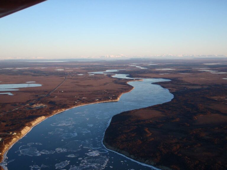
Photo: Alaska Region U.S. Fish & Wildlife Service, Public domain
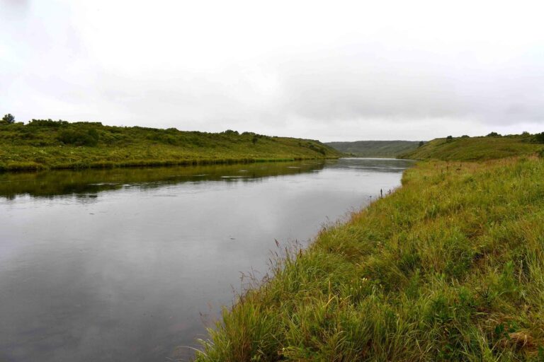
Photo: NRCS Alaska, Public domain
Alaska: the questions Dillingham Census Area anglers trade over coffee
How many boat ramps does Dillingham Census Area have in the ADF&G data?
The access layers list 6 ramps.
Which Alaska water in Dillingham Census Area has the biggest size figure?
That is Tikchik Lake, listed at about 14,942 acres of mapped outline.
Which fish lead the ADF&G lists near Dillingham Census Area?
The layers name Arctic char on the most lake pages within 80 miles, then Dolly Varden, northern pike and rainbow trout; they show presence, not a catch.
Is there an Alaska harbor or bait counter in Dillingham Census Area?
There are 1; Dillingham Boat Harbor comes first.
From which community does Dillingham Census Area run its affairs?
Dillingham.
Which licenses should anglers in Dillingham Census Area carry?
A resident annual sport fishing license is $20 and a nonresident annual license $100
Which boroughs and census areas lie closest to Dillingham Census Area?
Bristol Bay Borough, Bethel Census Area and Lake and Peninsula Borough sit nearest.
How many fish may I keep on Dillingham Census Area water?
Limits depend on the booklet area, the species heading and any heading printed for the water; the four booklet pages on this site give the headings, and king salmon rows lean on emergency orders. Rules and fees are the 2026 edition: ADF&G prints "Effective until the 2027 summary is issued" on every 2026 booklet, and no 2027 booklet exists. Emergency orders supersede the booklet.
Where do the Alaska limits change in Dillingham Census Area?
3 waters with a page here carry their own heading, beginning with Kokwok River.
Hitch the skiff for water in Dillingham Census Area
Check a water's heading before keeping fish.