Mobile Bay Fishing
A bay of the Alabama coast in Baldwin and Mobile counties.
 Pick for redfishPiscifun Alloy S inshore spinning reelCheck price at Piscifun
Photo: alyssa BLACK, CC BY-SA 2.0
Mobile Bay summed up for a first saltwater trip
USGS names Mobile Bay as a bay of Baldwin and Mobile counties. Anything within 16 miles is listed with it. Fairhope is the closest Census place, some 9 miles off.
Trailers go in at 21 public ramps near it. ADCNR lists 6 piers and bank sites too. ADCNR records 96 public access sites for parking and walking in. ADCNR placed 20 inshore reefs within 12 miles. It is covered by 7 water level stations.
USGS GNIS domestic names (feature class and primary point), read November 1, 2026; ADCNR coastal layers; Census 2023 places.
Launch sites ADCNR lists near Mobile Bay
- Arlington Park on Spanish Riverramps: 1 (kayak ramp only), kayak only, docks: 1, ~15 parking spots, restrooms, located at the east end of Broad Street across from …
- Bay Watch Boat Ramp on Weeks Bayramps: 2, docks: 1, 36 spots for vehicles with …, restrooms, 11470 US Highway 98
- Billygoat Hole Ramp on Pass Druryramps: 4, docks: 5, ~45 parking spots, restrooms, Bienville Boulevard next to the Mobile Bay Ferry landing
- C&S Bait and Tackle boat ramp on Deer Riverramps: 1 (double ramp), business launch, docks: 2, ~60 parking spots, restrooms, 7554 Deer River Road
- D'Olive Bay Rampramps: 2, docks: , 20 parking spots, 1 Yacht Club Dr., Daphne, AL 36526
- Deer River Bait & Tackle boat rampramps: 1, business launch, docks: 2, ~40 parking spots, restrooms, 7560 Deer River Road
- Delta Port Marina on Heron Bayramps: 1, business launch, docks: 2, ~40 unmarked parking spots, 2 van …, restrooms, 5080 Green Drive, Coden, AL off State Hwy 188.
- Dog River Park on Spanish Riverramps: 4, docks: 5, ~30 parking spots, 2459 North Dog River Drive (Locally known also as …
- Fowl River Marina on Deer Riverramps: 2, business launch, docks: 3, ~40 parking spots, restrooms, State Highway 193 on the north side of the Fowl River Bridge
- Ft. Morgan Boat Ramp on Pass Druryramps: 2 (double ramps), docks: 1 finger pier, 2 side piers, ~10 parking spots, restrooms, From HWY 59 in Gulf Shores, turn west onto HWY 180. …
- Jemison's Bait & Tackle boat ramp on Heron Bayramps: 2, business launch, docks: 2, ~30 parking spots, restrooms, 16871 Dauphin Island Parkway just north of Heron Bay. …
- Landnier Landing on Pass Druryramps: 1, 35 parking spots, restrooms
- Little Billygoat Hole Ramp on Pass Druryramps: 2, docks: 3, ~30 parking spots, Bienville Boulevard across from Ft. Gaines and next …
- McNally Park on Deer Riverramps: 1, docks: 2, ~15 parking spots, 4380 Park Road
- Memories Fish Camp boat ramp on Deer Riverramps: 1, business launch, docks: 0, ~15 parking spots, 4901 Fowl River Road
- Mullet Point Boat Ramp on Weeks Bayramps: 1, docks: 1, ~25 parking spots, restrooms, 13203 County Road 1
- Pier Street Ramp on Mobile Bayramps: 2, docks: 3, ~8 parking spots, restrooms, 1 Pier Ave (1/4 mile south of Fairhope Pier)
- Schwartz Boat Launch on Deer Riverramps: 1, docks: 2, ~25 parking spots, 3810 Schwartz Lane on Rabbit Creek (a tributary to …
- The Pines Boat Launch on Bon Secour Bayramps: 1, docks: 1, ~4 (street parking only), From HWY 59 in Gulf Shores, turn west on HWY 180. …
- The River Shack Boat Launch on Deer Riverramps: 2, business launch, docks: 3, ~15 parking spots, restrooms, 6152 Marina Drive South (under the Dog River Bridge …
- View Point Launch on Weeks Bayramps: 2, docks: 1, Unknown/No marked spaces, restrooms, 10471 County Road 1
Private launches serving Mobile Bay
- C&S Bait and Tackle boat ramp on Deer Riverramps: 1 (double ramp), business launch, docks: 2, ~60 parking spots, restrooms, 7554 Deer River Road
- Deer River Bait & Tackle boat rampramps: 1, business launch, docks: 2, ~40 parking spots, restrooms, 7560 Deer River Road
- Delta Port Marina on Heron Bayramps: 1, business launch, docks: 2, ~40 unmarked parking spots, 2 van …, restrooms, 5080 Green Drive, Coden, AL off State Hwy 188.
- Fowl River Marina on Deer Riverramps: 2, business launch, docks: 3, ~40 parking spots, restrooms, State Highway 193 on the north side of the Fowl River Bridge
- Jemison's Bait & Tackle boat ramp on Heron Bayramps: 2, business launch, docks: 2, ~30 parking spots, restrooms, 16871 Dauphin Island Parkway just north of Heron Bay. …
- Memories Fish Camp boat ramp on Deer Riverramps: 1, business launch, docks: 0, ~15 parking spots, 4901 Fowl River Road
- The River Shack Boat Launch on Deer Riverramps: 2, business launch, docks: 3, ~15 parking spots, restrooms, 6152 Marina Drive South (under the Dog River Bridge …
Public access points around Mobile Bay
- Aloe Bay Landing1100 Desoto Avenue, Dauphin Island, MS Sound
- Anderson StreetPonce de Leon Court at Anderson Street, Gulf Shores, Gulf Frontal
- Arlington Park1705 South Broad Street, Mobile, Western Shore
- Audubon Bird Sanctuary213 Bienville Boulevard, Dauphin Island, MS Sound
- Battles Road AccessWest end of Battles Road off of Scenic Highway 98, Fairhope, Eastern Shore
- Bayfront Park (Daphne)6200 Bayfront Park Drive, Daphne, Eastern Shore
- Bayfront Park (Mobile County)15961 Dauphin Island Parkway, Coden, Western Shore
- Bayou Heron ParkCorner of Cadillac Ave and Penalver Street, Dauphin Island, MS Sound
- Beach Boulevard Access 1Beach Boulevard between Our Road and Cortez Street, Gulf Shores, Gulf Frontal
- Beach Boulevard Access 2Beach Boulevard east of Cortez Street, Gulf Shores, Gulf Frontal
- Beach Boulevard Access 3Beach Boulevard east of Cortez Street, Gulf Shores, Gulf Frontal
- Beacon LanePonce de Leon Court at Beacon Lane, Gulf Shores, Gulf Frontal
- Belrose Park100 Belrose Avenue, Daphne, Eastern Shore
- Bernard Court EastPonce de Leon Court at Bernard Court East, Gulf Shores, Gulf Frontal
- Bernard Court WestSouth end of Bernard Court West, Fort Morgan, Gulf Frontal
- Billy Goat Hole Ramps Alonzo Landing114 Bienville Boulevard, Dauphin Island, MS Sound
- Bohemian ParkCR 48 at Langford Road, Fairhope, Weeks Bay
- Bon Secour National Wildlife Refuge BeachFort Morgan Road (AL-180), 19.8 miles west of Gulf …, Fort Morgan, Gulf Frontal
- Bonita Court NorthNorth end of Bonita Court, Fort Morgan, Bon Secour Bay
- Boone Lane Fish River AccessEast end of Boone Lane off CR 33, Fairhope, Weeks Bay
- Boykin Court NorthNorth end of Boykin Court, Fort Morgan, Gulf Frontal
- Boykin Court SouthSouth end of Boykin Court South, Fort Morgan, Gulf Frontal
- Brodbeck and Zundel General Merchandise StoreScenic Highway 98 and Zundel Road, Fairhope, Eastern Shore
- Buchanan Court EastSouth end of Buchanan Court East, Fort Morgan, Gulf Frontal
Other ramps a short tow from Mobile Bay
- Bayou La Batre Boat LaunchBayou La Batre, 16 miles west
- Chocalotta Ramp on Chacaloochee BayChacaloochee Bay, 16 miles north
- Scott's Landing on Blakeley RiverBlakeley River, 16 miles north
- Tenesaw Public Boat Ramp on Polecat BayPolecat Bay, 16 miles north
- Ted Middleton Jr. Landing on Polecat BayPolecat Bay, 17 miles north
ADCNR coastal boating access pages and public access site layer (ADCNR GIS), read November 1, 2026; ADCNR WFF public boat ramp list (list), read November 1, 2026.
Shore fishing at Mobile Bay
- Pier Street Boat Ramp on Mobile Bayfishing pier, salt water, 1 Pier Avenue, Fairhope
- Dauphin Island Public Beach and Fishing Pier (Dauphin Island Main Beach) on Pass Druryfishing pier, salt water, 1509 Bienville Boulevard, Dauphin Island
- Fort Morgan Fishing Pier and Boat Ramp on Pass Druryfishing pier, salt water, Fort Morgan Road (AL-180), 20.4 miles west …, Fort Morgan
- Magnolia Springs Public Pierfishing pier, salt water, Corner of Bay Street and Cedar Avenue, Magnolia Springs
- The Pines Fishing Pier and Boat Launch on Bon Secour Bayfishing pier, salt water, Fort Morgan Road (AL-180), 12.6 miles west …, Gulf Shores
- Weeks Bay Boat Ramp and Pierfishing pier, salt water, US-98 just west of Fish River Bridge, Fairhope
Piers and bank spots that sit near Mobile Bay
- Little Lagoon Pierfishing pier, salt water, 21 miles
- Gulf State Park Pier on Oyster Bayfishing pier, salt water, 24 miles
ADCNR coastal boating access pages and public access site layer (ADCNR GIS), read November 1, 2026.
Artificial reefs by Mobile Bay
The ADCNR list puts 20 inshore reefs near Mobile Bay.
| Reef | Placed | Material | Listed depth | Distance |
|---|---|---|---|---|
| Point Clear Reef | 2016 | 3" x 6" limestone aggregate | 11 ft listed depth | 3 miles northeast |
| Denton Reef | 1997 | 900 prestressed concrete roof slabs encircling oyster cultch material; 4300 tons of … | 10 ft listed depth | 4 miles southwest |
| P. Grey Cane, Jr. Reef | 1999 | Concrete pipe and rubble placed circular config with oyster half-shells and #57 … | 7 ft listed depth | 5 miles east |
| Zundel Landing | 1995 | 300 yds concrete block placed in and around old pier pilings and 3" X 6" limestone … | 4 ft listed depth | 5 miles northeast |
| Battles Wharf Reef | 1999 | Concrete pipe and rubble placed inside old pier pilings and 3" X 6" limestone aggregate | 5 ft listed depth | 6 miles northeast |
| Bender – Austal Reef | 1999 | Concrete pipe and rubble encircling oyster cultch material and 3"x6" limestone aggregate | 7 ft listed depth | 6 miles north |
| Dog River Reef | 2023 | 7000 tons of 3"x6" limestone aggregate (2023) | 8 miles north | |
| Dog River Reef | 7000 tons of 3"x6" limestone aggregate was installed during 2023 | 8 miles north | ||
| Upper Wreck Reef | 2006 | Abandon barge and shrimpboat w/concrete rubble placed around perimeter and 3" X 6" … | 5 ft listed depth | 8 miles southeast |
| Bon Secour Reef | 2023 | 3367 tons of 3"x6" limestone aggregate (2023) | 9 miles southeast | |
| Bon Secour Reef | 3367 tons of 3"x6" limestone aggregate was installed during 2023 | 9 miles southeast | ||
| Wellhead Reef | 2023 | 3367 tons of 3"x6" limestone aggregate (2023) | 10 miles south | |
| Wellhead Reef | 3367 tons of 3"x6" limestone aggregate was installed during 2023 | 10 miles south | ||
| ExxonMobil: Alex Maisel Memorial Reef | 2003 | 3" X 6" limestone aggregate placed around gas production platforms | 13 ft listed depth | 10 miles south |
ADCNR Marine Resources Division public reef master list 2025 (KMZ; reef layer), read November 1, 2026. Coordinates are for information only, not for navigation.
How much water covers Mobile Bay today
NOAA CO-OPS water level, preliminary reading at retrieval (November 1, 2026); station page for live data.
- Point Clear, Mobile Baytide predictions, 5 miles
- East Fowl River, Hwy 193 Bridgetide predictions, 6 miles
- Fly Creek, Mobile Baytide predictions, 9 miles
- Dog River Bridgetide predictions, 10 miles
On Mobile Bay, wind and river flow move the water as much as the moon does; check the station before running shallow.
NOAA CO-OPS water level and tide prediction stations; read November 1, 2026.
Port towns by Mobile Bay
- FairhopeBaldwin County, 8 miles
- Point ClearBaldwin County, 6 miles
- Alabama PortMobile County, 8 miles
USGS GNIS domestic names (feature class and primary point), read November 1, 2026.
Daily limits on Mobile Bay
| Species | Daily limit and size | Waters |
|---|---|---|
| Sheepshead | 8 per person; 12" min. FL | state waters |
| Spotted Seatrout | 6 per person – one fish is allowed to be over; 15" min. TL – 22" max TL | state waters |
| Red Drum (Redfish) | 3 per person; 16" min. – 26" max TL | state waters |
| Cobia (Ling) | 1 per person, not to exceed 2 per vessel; 36" min. FL | state waters |
| Spanish Mackerel | 15 per person; no size limit | state waters |
| Florida Pompano | 3 per person; 12" min. TL | state waters |
| Striped Bass | 2 per person; 16" min TL | state waters |
| Flounder | 5 per person (Closed Season for the month of November); 14" min TL | state waters |
| Tripletail (Blackfish) | 3 per person; 18" min TL | state waters |
| Mullet | Oct. 24-Dec. 31, 25 mullet per person from the shoreline or 25 per boat. No mullet by cast net or snagging in Theodore Industrial Canal, Dog River, Fowl River, and their tributaries.; no siz | state waters |
The MRD inshore rows cover the usual catches on Mobile Bay.
The license line is set by highways and landmarks, quoted on the saltwater page; check it for spots up the rivers.
Saltwater anglers 16 and older carry an Alabama saltwater license ($30.90 resident, $66.80 nonresident for 2026-27), plus the $10 Gulf Reef Fish Endorsement to keep reef fish such as red snapper.
Limits as printed by the ADCNR Marine Resources Division recreational size, creel and possession limits for state waters (MRD limits page), read November 1, 2026.
 For the redfish herePiscifun NautiX saltwater spinning reel14% OFFSale $94.99
Mobile Bay set against nearby salt water
Of the five closest coastal pages, Bon Secour Bay has the most ramps and access sites (30).
| Water | Distance | Type | Ramps | Piers and banks | Access sites | Inshore reefs |
|---|---|---|---|---|---|---|
| Mobile Bay | bay | 21 | 6 | 96 | 20 | |
| Deer River | 7 miles northwest | tidal river | 7 | 0 | 2 | 11 |
| Heron Bay | 11 miles southwest | bay | 2 | 0 | 1 | 20 |
| Weeks Bay | 11 miles east | bay | 3 | 1 | 8 | 13 |
| Magnolia River | 12 miles east | tidal river | 0 | 1 | 5 | 13 |
| Bon Secour Bay | 12 miles southeast | bay | 4 | 2 | 26 | 19 |
ADCNR ramp, access and reef layers, USGS GNIS; read November 1, 2026.
More Alabama water an hour or so from Mobile Bay
More Alabama lakes near Mobile Bay
- Shelby Lakes24 miles
- Big Creek Lake29 miles
- Dead Lake31 miles
- Citronelle Lake47 miles
Rivers behind Mobile Bay
- Fowl River8 miles
- Dog River13 miles
- Tensaw River19 miles
- Fish River19 miles
Buying bait for Mobile Bay
- Fowl River Marinabait and tackle shop, Theodore, 6 miles
- Fisherman's Discountbait and tackle shop, Fairhope, 8 miles
- Beachcomber Marina & Dry Dockmarina, Mobile, 9 miles
- Fairhope Docksmarina, Fairhope, 10 miles
- Mobile Bay Marinamarina, Mobile, 10 miles
- Grand Mariner Marinamarina, Mobile, 10 miles
Charter and guide names for Mobile Bay
- AAA Charterscharter, Foley, (251) 948-2525
- Action Charter Service Inccharter, Orange Beach, (888) 558-3889
- Alabama Coastal Charterscharter, Gulf Shores, (251) 943-6017
- Alabama Deep Sea Fishingcharter, Lillian, (251) 981-3733
- Alabama Fun Fishing LLCcharter, Orange Beach, (251) 550-5002
- Alabama Inshore Charterscharter, Fairhope, (251) 421-6797
- Allen Stella Marina Charterscharter, Foley, (251) 981-4510
- Annan Brian Capt Gulf Rebelcharter, Orange Beach, (251) 981-3119
Alabama towns with rooms near Mobile Bay
- Fairhope9 miles
- Theodore13 miles
- Daphne15 miles
- Bayou La Batre15 miles
Alabama county pages covering Mobile Bay
- Baldwin Countyseat: Bay Minette
- Mobile Countyseat: Mobile
Piscifun reels a Yellowhammer State angler might load for Mobile Bay


Piscifun and Amazon links are affiliate links; the site earns a commission on qualifying purchases.
A picture guide to fish at Mobile Bay
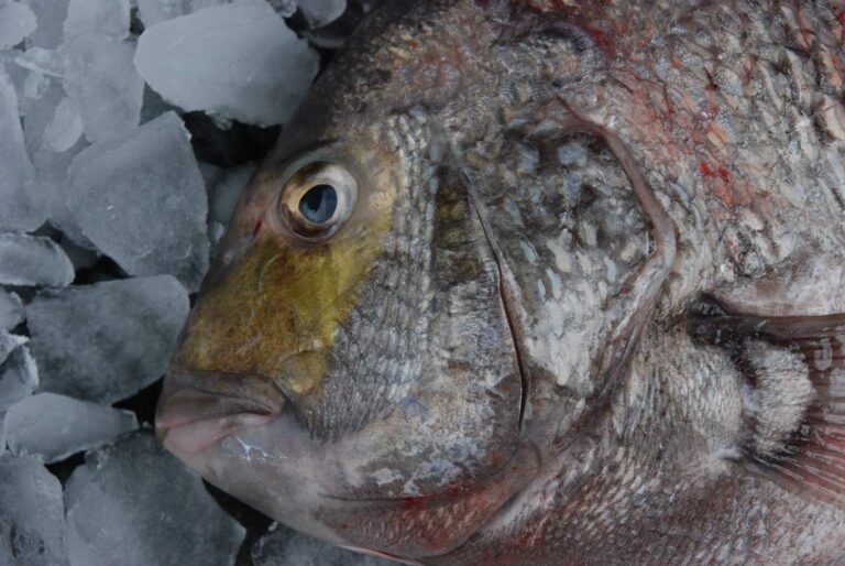
Photo: Louisiana Sea Grant College Program Louisiana State University, CC BY 2.0

Photo: Smithsonian Environmental Research Center, CC BY 2.0

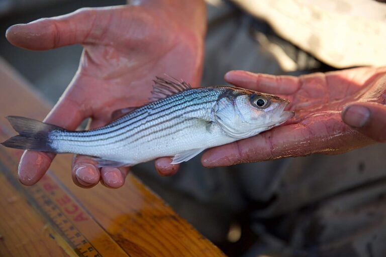
Photo: USFWS Pacific Southwest Region, Public domain

Photo: Totti, CC BY-SA 4.0

Mobile Bay, the common questions settled
Which stretch of shoreline should I search for Mobile Bay?
Its home is Baldwin and Mobile counties, about 9 miles from Fairhope.
Does ADCNR treat Mobile Bay as salt or fresh for the license?
Saltwater anglers 16 and older carry an Alabama saltwater license ($30.90 resident, $66.80 nonresident for 2026-27), plus the $10 Gulf Reef Fish Endorsement to keep reef fish such as red snapper. Check the line on the saltwater page for upper water.
Where does a trailered bay boat get wet for Mobile Bay?
ADCNR lists 21 public ramps; Arlington Park on Spanish River is one.
Has the digest written special rules for Mobile Bay?
Red Drum (Redfish): 3 per person; 16" min. – 26" max TL.
Which NOAA station serves Mobile Bay?
NOAA East Fowl River Bridge covers it.
Which pier on Mobile Bay would ADCNR point me to?
6 piers and bank sites on the ADCNR lists; Pier Street Boat Ramp on Mobile Bay is one.
Who keeps live shrimp near Mobile Bay?
Head to Fowl River Marina, about 6 miles away,.
What reef count sits around Mobile Bay?
Point Clear Reef is nearest of 20 inshore reefs.
Gas the bay boat and aim for Mobile Bay
Read the MRD limits before filling the cooler.