D'Olive Bay Fishing
A bay of the Alabama coast in Baldwin County.
 Pick for redfishPiscifun Alloy S inshore spinning reelCheck price at Piscifun
Photo of Tensaw River: Andrea Wright, CC BY 2.0
Getting oriented on D'Olive Bay
D’Olive Bay, a bay, lies in Baldwin County on the USGS names map. Daphne, around 2 miles away, is the closest town.
It has 1 public ramp from the ADCNR coastal and WFF lists. ADCNR marks 7 public access sites close by. Within 12 miles lie 8 inshore reefs from the ADCNR list. Water level data come from 5 water level stations.
USGS GNIS domestic names (feature class and primary point), read November 1, 2026; ADCNR coastal layers; Census 2023 places.
Trailering a bay boat to D'Olive Bay
- D'Olive Bay Rampramps: 2, docks: , 20 parking spots, 1 Yacht Club Dr., Daphne, AL 36526
Getting to the water at D'Olive Bay
- Bayfront Park (Daphne)6200 Bayfront Park Drive, Daphne, Eastern Shore
- Belrose Park100 Belrose Avenue, Daphne, Eastern Shore
- Dryer AvenueWest end of Dryer Avenue, Daphne, Eastern Shore
- Gator Alley D'Olive BoardwalkNorth Main Street just south of I-10, Daphne, Eastern Shore
- May Day Park (Starke's Landing)West end of College Avenue, Daphne, Eastern Shore
- McMillian BluffLovette Lane at McMillian Avenue, Daphne, Eastern Shore
- Village Point Park Preserve27717 Main Street, Daphne, Eastern Shore
Backup ramps for a busy day at D'Olive Bay
- Scott's Landing on Blakeley RiverBlakeley River, 2 miles north
- Chocalotta Ramp on Chacaloochee BayChacaloochee Bay, 5 miles northwest
- Tenesaw Public Boat Ramp on Polecat BayPolecat Bay, 5 miles northwest
- Ted Middleton Jr. Landing on Polecat BayPolecat Bay, 6 miles northwest
- Arlington Park on Spanish RiverSpanish River, 8 miles west
- Pier Street Ramp on Mobile BayMobile Bay, 9 miles south
ADCNR coastal boating access pages and public access site layer (ADCNR GIS), read November 1, 2026; ADCNR WFF public boat ramp list (list), read November 1, 2026.
Public piers by D'Olive Bay
Bank fishing within reach of D'Olive Bay
- Pier Street Boat Ramp on Mobile Bayfishing pier, salt water, 9 miles
- Weeks Bay Boat Ramp and Pierfishing pier, salt water, 17 miles
- Magnolia Springs Public Pierfishing pier, salt water, 19 miles
ADCNR coastal boating access pages and public access site layer (ADCNR GIS), read November 1, 2026.
Limestone and rubble reefs near D'Olive Bay
Within a 12-mile run of D'Olive Bay sit 8 inshore reefs from the ADCNR list.
| Reef | Placed | Material | Listed depth | Distance |
|---|---|---|---|---|
| Dell Williamson Reef | 1991 | Concrete block and oyster cultch material placed inside old pier pilings and 3"x6" … | 6 ft listed depth | 3 miles south |
| Buddy Beiser Reef | 1999 | Concrete pipe and rubble placed around abandon barge and 3" X 6" limestone aggregate | 9 ft listed depth | 4 miles southwest |
| Choctaw Pass Reef | 1999 | Concrete pipe and rubble and 3" X 6" limestone aggregate | 4 ft listed depth | 6 miles west |
| Battles Wharf Reef | 1999 | Concrete pipe and rubble placed inside old pier pilings and 3" X 6" limestone aggregate | 5 ft listed depth | 11 miles south |
| Dog River Reef | 2023 | 7000 tons of 3"x6" limestone aggregate (2023) | 11 miles southwest | |
| Dog River Reef | 7000 tons of 3"x6" limestone aggregate was installed during 2023 | 11 miles southwest | ||
| Bender – Austal Reef | 1999 | Concrete pipe and rubble encircling oyster cultch material and 3"x6" limestone aggregate | 7 ft listed depth | 11 miles southwest |
| Zundel Landing | 1995 | 300 yds concrete block placed in and around old pier pilings and 3" X 6" limestone … | 4 ft listed depth | 12 miles south |
ADCNR Marine Resources Division public reef master list 2025 (KMZ; reef layer), read November 1, 2026. Coordinates are for information only, not for navigation.
Tide tables and gauges for D'Olive Bay
NOAA CO-OPS water level, preliminary reading at retrieval (November 1, 2026); station page for live data.
- Meaher State Park, Mobile Baytide predictions, 2 miles
- Fly Creek, Mobile Baytide predictions, 7 miles
- MOBILE, Mobile River (State Dock)tide predictions, 8 miles
- Coast Guard Sector Mobiletide predictions, 8 miles
Gulf tides here are small, and a strong north wind can push water off D'Olive Bay faster than the tide table suggests.
NOAA CO-OPS water level and tide prediction stations; read November 1, 2026.
The passes that feed D'Olive Bay
- Choctaw Pass7 miles west
- Pass Picada3 miles northwest
- Pinto Pass7 miles west
- Sardine Pass2 miles northwest
- Duck Skiff Pass2 miles northwest
USGS GNIS domestic names (feature class and primary point), read November 1, 2026.
Where charter boats leave for D'Olive Bay
- FairhopeBaldwin County, 9 miles
- DaphneBaldwin County, 3 miles
- MobileMobile County, 8 miles
- Point ClearBaldwin County, 12 miles
- Spanish FortBaldwin County, 2 miles
USGS GNIS domestic names (feature class and primary point), read November 1, 2026.
Keeping redfish and trout from D'Olive Bay
| Species | Daily limit and size | Waters |
|---|---|---|
| Sheepshead | 8 per person; 12" min. FL | state waters |
| Spotted Seatrout | 6 per person – one fish is allowed to be over; 15" min. TL – 22" max TL | state waters |
| Red Drum (Redfish) | 3 per person; 16" min. – 26" max TL | state waters |
| Cobia (Ling) | 1 per person, not to exceed 2 per vessel; 36" min. FL | state waters |
| Spanish Mackerel | 15 per person; no size limit | state waters |
| Florida Pompano | 3 per person; 12" min. TL | state waters |
| Striped Bass | 2 per person; 16" min TL | state waters |
| Flounder | 5 per person (Closed Season for the month of November); 14" min TL | state waters |
| Tripletail (Blackfish) | 3 per person; 18" min TL | state waters |
| Mullet | Oct. 24-Dec. 31, 25 mullet per person from the shoreline or 25 per boat. No mullet by cast net or snagging in Theodore Industrial Canal, Dog River, Fowl River, and their tributaries.; no siz | state waters |
For D'Olive Bay, the inshore saltwater rows apply; the full MRD list is on the saltwater page.
Whether a spot needs the saltwater or the freshwater license depends on the line ADCNR describes; the saltwater page quotes it.
Saltwater anglers 16 and older carry an Alabama saltwater license ($30.90 resident, $66.80 nonresident for 2026-27), plus the $10 Gulf Reef Fish Endorsement to keep reef fish such as red snapper.
Limits as printed by the ADCNR Marine Resources Division recreational size, creel and possession limits for state waters (MRD limits page), read November 1, 2026.
 For the redfish herePiscifun NautiX saltwater spinning reel14% OFFSale $94.99
D'Olive Bay and the closest bays and bayous
Of the waters listed, Blakeley River has the most entry points: 3.
| Water | Distance | Type | Ramps | Piers and banks | Access sites | Inshore reefs |
|---|---|---|---|---|---|---|
| D'Olive Bay | bay | 1 | 0 | 7 | 8 | |
| Blakeley River | under a mile west | tidal river | 1 | 0 | 2 | 7 |
| Apalachee River | 3 miles northwest | tidal river | 0 | 0 | 0 | 7 |
| Bay Minette Basin | 5 miles north | bay | 0 | 0 | 1 | 3 |
| Chacaloochee Bay | 5 miles northwest | bay | 1 | 0 | 1 | 5 |
| Spanish River | 6 miles west | tidal river | 2 | 0 | 1 | 6 |
ADCNR ramp, access and reef layers, USGS GNIS; read November 1, 2026.
The Alabama country behind D'Olive Bay
Alabama still water near D'Olive Bay
- Dead Lake17 miles
- Big Creek Lake26 miles
- Shelby Lakes31 miles
- Citronelle Lake38 miles
Streams near D'Olive Bay
- Tensaw River6 miles
- Fish River8 miles
- Dog River12 miles
- Mobile River12 miles
Gear stores a short hop from D'Olive Bay
- Sunrise Marina, 28791 Us Highway 98marina, Daphne, under a mile
- Dick's Sporting Goods Daphnesporting goods store, Daphne, under a mile
- Bass Pro Shops Spanish Fortsporting goods store, Spanish Fort, 1 mile
- Encore Outdoorsbait and tackle shop, Daphne, 3 miles
- Bama-Baitsbait and tackle shop, Daphne, 3 miles
- Autrey's Bait Shopbait and tackle shop, Daphne, 5 miles
Guide services that list D'Olive Bay
- AAA Charterscharter, Foley, (251) 948-2525
- Action Charter Service Inccharter, Orange Beach, (888) 558-3889
- Alabama Coastal Charterscharter, Gulf Shores, (251) 943-6017
- Alabama Deep Sea Fishingcharter, Lillian, (251) 981-3733
- Alabama Fun Fishing LLCcharter, Orange Beach, (251) 550-5002
- Alabama Inshore Charterscharter, Fairhope, (251) 421-6797
- Allen Stella Marina Charterscharter, Foley, (251) 981-4510
- Annan Brian Capt Gulf Rebelcharter, Orange Beach, (251) 981-3119
Overnight towns for D'Olive Bay anglers
- Daphne3 miles
- Spanish Fort6 miles
- Fairhope9 miles
- Loxley11 miles
County-by-county pages for D'Olive Bay
- Baldwin Countyseat: Bay Minette
Piscifun spinning and casting gear rigged for D'Olive Bay


Piscifun and Amazon links are affiliate links; the site earns a commission on qualifying purchases.
The country around D'Olive Bay through a lens

Photo: Rex Hammock, CC BY-SA 2.0

Photo: Rian Castillo, CC BY 2.0

Photo: Free Public Domain Illustrations by rawpixel, CC BY 2.0
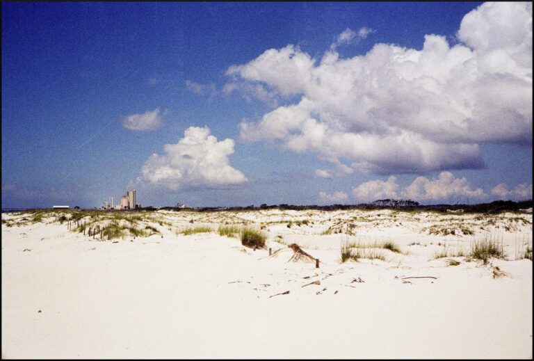
Photo: blgrssby, CC BY-SA 2.0
Questions Alabama anglers ask about D'Olive Bay
Which Alabama coastal county holds D'Olive Bay?
Steer toward Baldwin County, about 2 miles from Daphne.
What are the 2026-27 Alabama fees for fishing D'Olive Bay?
Saltwater anglers 16 and older carry an Alabama saltwater license ($30.90 resident, $66.80 nonresident for 2026-27), plus the $10 Gulf Reef Fish Endorsement to keep reef fish such as red snapper. ADCNR describes the line in words on the saltwater page.
Where do bay boats launch for D'Olive Bay?
The one listing is D'Olive Bay Ramp.
Which MRD creel rows cover D'Olive Bay?
Red Drum (Redfish): 3 per person; 16" min. – 26" max TL.
Which NOAA reading speaks for D'Olive Bay?
Check Mobile State Docks; the reading is above.
Is D'Olive Bay worth a trip without any boat at all?
Nothing sits on it; the nearest listed is Pier Street Boat Ramp on Mobile Bay, about 9 miles away.
Which Alabama tackle counter sits nearest D'Olive Bay?
Sunrise Marina, under a mile away, tops our shop list.
Where is placed structure near D'Olive Bay?
The reef band lists 8 inshore reefs; Dell Williamson Reef is closest.
Which cuts are near D'Olive Bay?
Close by: Choctaw Pass, Pass Picada, Pinto Pass, Sardine Pass and Duck Skiff Pass.
Put D'Olive Bay on the saltwater list
Every Alabama saltwater fee and limit is one click away.