Fishing in Juab County, Utah
County seat: Nephi. Census 2020 residents: 11,786.
- 2lake pages
- 2launches
- 8river pages
 Pick for sunfishPiscifun Carbon X ultralight spinning reel28% OFFSale $57.99
Photo of Tooele: Terry Ott, CC BY 2.0
An overview of the water in Juab County
With Nephi as its seat, Juab County recorded 11,786 residents in the 2020 Census. Inside the county boundary the Gazetteer counts 3,392 square miles of land and 14 square miles of water. Of the 2 Utah lakes and reservoirs in the county with pages, Mona Reservoir spreads widest.
Boaters have 2 launches in the county; shore anglers have 6 shore or pier points. For a river day, look at Basin Creek (Deep Creek Mountains), Granite Creek (Deep Creek Mountains) and Indian Farms Creek (Deep Creek Mountains). Community fisheries in the county include Burraston Ponds. Across 4 waters, DWR recorded 84,360 fish stocked here in 2026 (22 rows).
U.S. Census Bureau, 2020 Census counts (TIGERweb) and the 2023 Gazetteer, read November 11, 2026. UGRC Boat Ramps layer (ArcGIS service) and the DWR Fish Utah access list, read November 11, 2026.
Where the Utah launch points fall in Juab County
UGRC Boat Ramps layer (ArcGIS service) and the DWR Fish Utah access list, read November 11, 2026. Lake pins are the DWR map point for each water.
Still water inside Juab County
| Lake | Size | Launches | Status | DWR lists |
|---|---|---|---|---|
| Mona Reservoir | 1,250 acres | 1 | reservoir | common carp, sucker |
| Burraston Ponds | 30 acres | 0 | community fishery | common carp, green sunfish, rainbow trout, tiger trout |
Just over the Juab County line sit more lakes; miles run from Nephi.
| Lake | From Nephi | Size | Launches | Status | DWR lists |
|---|---|---|---|---|---|
| Theodore Ahlin Park Pond (Pole Canyon Pond) | 17 miles north | 3 | 0 | community fishery | rainbow trout, tiger trout |
| Box Lake (Payson Lakes) | 19 miles northeast | 3 acres | 0 | natural lake | rainbow trout |
| Big East Reservoir (Payson Lakes) | 19 miles northeast | Approximately 22 acres when full | 0 | reservoir | brook trout, rainbow trout |
| Maple Lake | 19 miles northeast | 5 acres | 0 | natural lake | rainbow trout, muskie Tiger |
| McClellan Lake (Payson Lakes) | 19 miles northeast | 3.5 acres | 0 | natural lake | rainbow trout |
| Spring Lake | 21 miles north | 6 acres | 0 | community fishery | bluegill, channel catfish, largemouth bass, rainbow trout, tiger trout |
Size as the DWR Fish Utah page for this water prints it (DWR), read November 11, 2026. Waters with no DWR acreage print their mapped outline instead. Utah DWR Fish Utah planner (dwrapps.utah.gov), read November 11, 2026.
 For the sunfish herePiscifun Carbon XT ultralight spinning reel25% OFFSale $59.99
Which fish Fish Utah keeps naming near Juab County
Summing Fish Utah lists for lakes within 40 miles of Nephi, rainbow trout comes out on top.
DWR Fish Utah species lists (likely or possible), counted per lake page within 40 miles; DWR’s ratings, not a catch survey. Utah DWR Fish Utah planner (dwrapps.utah.gov), read November 11, 2026.
Utah lakes of Juab County with only a name and an outline
Past the paged lakes, Juab County holds 16 named waters on UGRC and DWR maps.
| Water | Size | Listed by |
|---|---|---|
| The Meadows | about 602 acres of mapped outline | UGRC lakes layer |
| Harrison Pool | about 431 acres of mapped outline | UGRC lakes layer |
| Egret Pool | about 419 acres of mapped outline | UGRC lakes layer |
| Gadwall Pool | about 380 acres of mapped outline | UGRC lakes layer |
| Curlew Pool | about 372 acres of mapped outline | UGRC lakes layer |
| Chicken Creek Reservoir | about 308 acres of mapped outline | UGRC lakes layer |
| Avocet Pool | about 232 acres of mapped outline | UGRC lakes layer |
| Mallard Pool | about 215 acres of mapped outline | UGRC lakes layer |
| Pintail Pool | about 198 acres of mapped outline | UGRC lakes layer |
| Ibis Pool | about 172 acres of mapped outline | UGRC lakes layer |
| Shoveler Pool | about 165 acres of mapped outline | UGRC lakes layer |
| Hole-in-the-Wall Reservoir | about 33 acres of mapped outline | UGRC lakes layer |
| East Topaz 2 Reservoir | about 32 acres of mapped outline | UGRC lakes layer |
| Picture Rock Reservoir | about 31 acres of mapped outline | UGRC lakes layer |
| Mud Lake Reservoir | about 20 acres of mapped outline | UGRC lakes layer |
| Burriston Ponds | about 18 acres of mapped outline | UGRC lakes layer |
Outline area from the UGRC Utah Lakes NHD layer (ArcGIS service; mapped polygon area, not a DWR surface-acre figure), read November 11, 2026. Listed waters are not claimed to hold fish. Utah DWR Fish Utah planner (dwrapps.utah.gov), read November 11, 2026.
Utah stream pages for Juab County
- Basin Creek (Deep Creek Mountains)DWR stream reach
- Granite Creek (Deep Creek Mountains)DWR stream reach
- Indian Farms Creek (Deep Creek Mountains)DWR stream reach
- North Fork of Birch Creek (Deep Creek Mountains)DWR stream reach
- Red Cedar Creek (Deep Creek Mountains)DWR stream reach
- Salt Creek1 USGS gauge
- Tom's Creek (Deep Creek Mountains)DWR stream reach
- Trout Creek (Deep Creek Mountains)1 USGS gauge
USGS stream gauges in Juab County, Utah
| USGS gauge | Latest reading | Time (ET) |
|---|---|---|
| Salt Crk Bl Nephi Powerplant Div Nr Nephi, Ut | 7 cfs, 2.44 ft gage height | Nov 14 5:45 pm |
| Salt Creek At Nephi, Ut | 9 cfs, 1.53 ft gage height | Nov 14 5:30 pm |
| Currant Creek Near Mona, Ut | 1 cfs, 3.96 ft gage height | Nov 14 5:30 pm |
| Trout Creek Near Callao, Ut | 2 cfs, 2.79 ft gage height | Nov 14 6:00 pm |
| Sevier River Near Juab, Ut | 0 cfs, 3.72 ft gage height | Nov 14 6:00 pm |
US Geological Survey provisional data, retrieved Nov 14, 2026 6:32 pm ET. Provisional readings can be revised.
Utah DWR Fish Utah planner (dwrapps.utah.gov), read November 11, 2026. USGS Water Data for the Nation, live through the site, retrieved on page view.
Put-ins listed for Juab County
- Mona Reservoir Boat RampMona Reservoir, boat ramp, for any vessel class, administered by a private operator in the UGRC layer
- Yuba State Park Boat Ramp at Yuba Reservoir & State ParkYuba Reservoir & State Park, boat ramp, for any vessel class, administered by a private operator in the UGRC layer
Shore fishing sites in Juab County
- Boat Launch Ramp Shore Access at Mona ReservoirMona Reservoir, shore access
- Burraston Ponds Parking Lot Shore AccessBurraston Ponds, shore access
- Burraston Ponds Parking Lot Shore AccessBurraston Ponds, shore access
- Burraston Ponds Parking Lot Shore AccessBurraston Ponds, shore access
- Burraston Ponds Parking Lot Shore AccessBurraston Ponds, shore access
- Public Restroom Shore Access at Mona ReservoirMona Reservoir, shore access
UGRC Boat Ramps layer (ArcGIS service) and the DWR Fish Utah access list, read November 11, 2026. Neither layer publishes fees or opening hours.
DWR stocking trucks bound for Juab County in 2026
These are the latest county rows from DWR, names left in DWR's shorthand.
| Date | Water as DWR prints it | County | Fish | Species |
|---|---|---|---|---|
| August 13, 2026 | BURRASTON PONDS | Juab | 499 | Rainbow |
| July 6, 2026 | BURRASTON PONDS | Juab | 506 | Rainbow |
| June 16, 2026 | SALT CR | Juab | 999 | Rainbow |
| June 15, 2026 | BURRASTON PONDS | Juab | 1,001 | Rainbow |
| June 10, 2026 | YUBA RES (SEVIER BRG | Juab | 7,356 | Walleye |
| June 9, 2026 | YUBA RES (SEVIER BRG | Juab | 26,375 | Walleye |
| June 8, 2026 | YUBA RES (SEVIER BRG | Juab | 17,483 | Walleye |
| June 8, 2026 | YUBA RES (SEVIER BRG | Juab | 16,625 | Walleye |
| June 2, 2026 | BURRASTON PONDS | Juab | 1,280 | Rainbow |
| June 2, 2026 | BURRASTON PONDS | Juab | 96 | Rainbow |
DWR fish stocking table for 2026, year to date (DWR stocking report; water names are DWR abbreviations), read November 11, 2026.
What anglers in Juab County may keep under Utah rules
The limits here are from the 2027 Utah Fishing Guidebook, which takes effect January 1, 2027; the 2026 Utah Fishing Guidebook stays in force through December 31, 2026 and differs only where a row says so. Statewide limits govern Juab County except where a water carries its own rule. Licenses in Utah run 365 days from the purchase date: $40 for a resident adult, $120 for a nonresident adult.
| Species group | 2027 daily limit | 2026 daily limit | Guidebook note |
|---|---|---|---|
| Baitfish (common carp, fathead minnow, redside shiner, Utah sucker, Utah chub, white sucker) | No limit | same | (NEW) Formerly called "nongame species"; baitfish species are listed on page 20. |
| Black crappie and white crappie (a combined total) | 50 | same | – |
| Bluegill and green sunfish (a combined total) | 50 | same | – |
| Bonneville cisco | 30 | same | – |
| Bullhead | 24 | same | – |
| Burbot | No limit | same | REMINDER: Do not release any burbot you catch. All burbot caught must be immediately killed. |
| Channel catfish | 8 | same | – |
| Community fisheries | 2 | 2 | The limit includes fish of most species. All tiger muskellunge must be released. NEW: There are restrictions for largemouth bass at some waters. See page 39. |
| Crayfish | No limit | same | REMINDER: You may use bait to catch crayfish on waters where bait use is prohibited for fish, as long as none of the lines have hooks attached. |
| Kokanee salmon | See trout limit | same | Kokanee salmon are part of the total trout limit. Anglers may not possess kokanee salmon at any waterbody statewide from Sept. 10 through Nov. 30. |
| Largemouth and smallmouth bass (a combined total) | 6 | same | – |
| Northern pike | 20, only 1 over 36 inches | same | – |
Special-regulation waters of Juab County
- Basin Creek (Deep Creek Mountains)General Regulations: Anglers may possess a daily limit of 4 fish, anglers can catch fish using flies, bait and lures and there are no size restrictions on the fish… (Fish Utah page)
- Burraston PondsFishing from a boat with a motor of any kind is prohibited. (2027 guidebook, p. 37)
- Granite Creek (Deep Creek Mountains)General Regulations: Anglers may possess a daily limit of 4 fish, anglers can catch fish using flies, bait and lures and there are no size restrictions on the fish… (Fish Utah page)
- Indian Farms Creek (Deep Creek Mountains)General Regulations: Anglers may possess a daily limit of 4 fish, anglers can catch fish using flies, bait and lures and there are no size restrictions on the fish… (Fish Utah page)
- Mona ReservoirLimits for all species are double the statewide limits listed on page 9. (2027 guidebook, p. 46)
- North Fork of Birch Creek (Deep Creek Mountains)General Regulations: Anglers may possess a daily limit of 4 fish, anglers can catch fish using flies, bait and lures and there are no size restrictions on the fish… (Fish Utah page)
- Red Cedar Creek (Deep Creek Mountains)General Regulations: Anglers may possess a daily limit of 4 fish, anglers can catch fish using flies, bait and lures and there are no size restrictions on the fish… (Fish Utah page)
- Tom's Creek (Deep Creek Mountains)General Regulations: Anglers may possess a daily limit of 4 fish, anglers can catch fish using flies, bait and lures and there are no size restrictions on the fish… (Fish Utah page)
- Trout Creek (Deep Creek Mountains)General Regulations: Anglers may possess a daily limit of 4 fish, anglers can catch fish using flies, bait and lures and there are no size restrictions on the fish… (Fish Utah page)
Utah special-regulation waters
2027 Utah Fishing Guidebook (effective January 1, 2027; DWR PDF), read November 11, 2026. License prices as printed in the 2027 Utah Fishing Guidebook, p. 8 (the 2026 guidebook prints the same prices; checked against the DWR fees page), read November 11, 2026.
Where Juab County shows up on the DWR record list
No DWR record names water in Juab County, so record waters within 80 miles are shown.
| Species | Weight or length as listed | Water | Year | Category |
|---|---|---|---|---|
| White bass | 19" | Salem Pond | 2005 | catch and release (length) |
| White bass | 4 lbs. 1 oz. | Utah Lake | 1970 | catch and keep |
| Channel catfish | 32 lbs. 8 oz. | Utah Lake | 1978 | catch and keep |
| Walleye | 33" | Utah Lake | 2022 | catch and release (length) |
Utah state record fish as DWR lists them (records page), read November 11, 2026.
Where Juab County anglers shop
Stores for flies and jigs in Juab County
- Wholesale Fishing Supply Incbait and tackle shop, Mona
Yellow Pages, Utah State Parks and NPS listings (city of business), read November 11, 2026.
In Utah close to Juab County
Utah cities and towns of Juab County
- Nephi2020 count 6,443
- Mona2020 count 1,750
Bordering Juab County
- Tooele County55 miles north
- Millard County55 miles south
- Utah County66 miles northeast
- Sanpete County69 miles east
Piscifun reels and line to pack for Juab County


Piscifun and Amazon links are affiliate links; the site earns a commission on qualifying purchases.
Identification photos for fish at Juab County

Photo: NOAA Great Lakes Environmental Research Laboratory, CC BY-SA 2.0

Photo: USFWS Mountain-Prairie, CC BY 2.0


Photo: USFWS Mountain-Prairie, CC BY 2.0
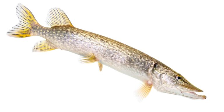
Photo: USFWS Mountain-Prairie, Public domain
Reservoirs, creeks and launches of Juab County, explained
Which Utah launches serve Juab County?
2 launches show up in the launch data for the county.
Where is the widest reservoir in Juab County?
Mona Reservoir leads with 1,250 acres.
What fish turn up on Fish Utah pages near Juab County?
Fish Utah rates rainbow trout likely or possible on the most lakes within 40 miles, then tiger trout, brook trout and wiper.
Which Juab County stores sell Utah fishing gear?
Wholesale Fishing Supply Inc heads a list of 1.
Where does the Utah county of Juab County keep its courthouse?
Nephi has it.
What does a Utah fishing license cost for Juab County?
Utah prices its adult 365-day fishing license at $40 for residents and $120 for visitors, unchanged between the two guidebooks.
Which Utah counties should I check near Juab County?
The closest county pages are Tooele County, Millard County and Utah County.
How many trout may an angler in Juab County take home?
Statewide, the trout, kokanee and grayling row sets a daily limit 4 under the 2027 guidebook; the 2026 guidebook prints the same number. Waters with their own entry can differ.
Does the guidebook list exceptions for Juab County water?
9 waters with a page here carry their own rules, beginning with Basin Creek (Deep Creek Mountains).
Did hatchery trucks visit Juab County this year?
The 2026 DWR table lists 84,360 fish in 22 rows across 4 waters in the county.
Plan a Beehive State day in Juab County
Lake pages carry launches, DWR species lists and dated guidebook rules.