Fishing near Morristown, Tennessee
City, Hamblen County. 2020 Census: 30,431 residents.
- 5 milesCherokee Lake
- 8ramps within 40 mi
- 6rivers within 60 mi
 Pick for troutPiscifun Carbon X ultralight spinning reel28% OFFSale $57.99
Photo of Cherokee Lake: carlfbagge, CC BY 2.0
Tennessee lakes and streams handy to Morristown
In Hamblen County, the city of Morristown held 30,431 people at the 2020 Census. It doubles as the seat of Hamblen County. Cherokee Lake lies 5 miles northwest, the shortest run to named water. The biggest water in range is Norris Lake at 34,200 acres. Cherokee Lake and Douglas Lake near town are on the TVA reservoir list.
The first TWRA launch out of town is Hwy 25E #1 Boat Ramp on Cherokee Lake, 4 miles off. The nearest river or tailwater page is Holston River, 9 miles away. The nearest TWRA site without a ramp is TVA Brights Pike Fishing Access on Cherokee Lake, 4 miles off.
U.S. Census Bureau, 2020 Census counts (TIGERweb) and the 2023 Gazetteer, read November 18, 2026. Miles are straight-line from the Census place point; the drive is usually longer.
Tennessee ponds and big TVA water near Morristown
| Water | From Morristown | Size | TWRA sites | Type | Fish on the TWRA list |
|---|---|---|---|---|---|
| Cherokee Lake | 5 miles to the northwest | 30,300 acres | 51 | reservoir, TVA-listed | no TWRA list |
| Douglas Lake | 15 miles to the south | 30,600 acres | 23 | reservoir, TVA-listed | no TWRA list |
| Norris Lake | 32 miles to the west | 34,200 acres | 67 | reservoir, TVA-listed | no TWRA list |
Surface acres as published for this water (source), read November 18, 2026. Waters without published acreage show their NHD outline. Waters without a page link to their county row. TWRA record for this water (TWRA), read November 18, 2026.
Tennessee streams to wade near Morristown
- Holston River9 miles, tailwater, 12 TWRA access sites
- French Broad River16 miles, named in the guide, 13 TWRA access sites, 1 USGS gauge
- Pigeon River24 miles, named in the guide, 5 TWRA access sites, 1 USGS gauge
- Powell River27 miles, named in the guide, 3 TWRA access sites, 1 USGS gauge
- Nolichucky River27 miles, named in the guide, 11 TWRA access sites, 3 USGS gauges
- Clinch River36 miles, tailwater, 16 TWRA access sites, 2 USGS gauges
Tennessee stream readings close to Morristown
USGS has no current reading for these gauges.
TWRA and agency records for this river (source), read November 18, 2026. USGS Water Data for the Nation, live through the site, retrieved on page view.
Tennessee water near Morristown on a single map
TWRA public access record (TWRA), read November 18, 2026. Census place point.
Boat launches a short tow from Morristown
- Hwy 25E #1 Boat Ramp on Cherokee Lake4 miles, Cherokee Lake, boat ramp; free to launch
- Hamblen Boat Dock on Cherokee Lake5 miles, Cherokee Lake, marina; restrooms, camping, bait; free to launch
- Lakeside Marina on Cherokee Lake5 miles, Cherokee Lake, marina; restrooms; fee charged
- Cherokee – Boat Launch Road5 miles, Cherokee Lake, boat ramp; camping, bait; free to launch
- Kidwells Ridge Boat Ramp on Cherokee Lake5 miles, Cherokee Lake, boat ramp; camping; free to launch
- Twin Churches Boat Ramp on Cherokee Lake6 miles, Cherokee Lake, boat ramp; free to launch
- Panther Creek State Park on Cherokee Lake7 miles, Cherokee Lake, boat ramp; restrooms, camping, bait; free to launch
- Oak Grove Access Area on Cherokee Lake7 miles, Cherokee Lake, boat ramp; camping; free to launch
TWRA fishing sites close to Morristown
- TVA Brights Pike Fishing Access on Cherokee Lake4 miles, Cherokee Lake, fishing site; camping
- TVA Holt’s Church Fishing Access on Cherokee Lake5 miles, Cherokee Lake, fishing site; camping; free to launch
- Cedar Creek Access on Cherokee Lake6 miles, Cherokee Lake, fishing site; free to launch
- Cedar Creek Access on Cherokee Lake6 miles, Cherokee Lake, fishing site; free to launch
- Cedar Creek Acces Area on Cherokee Lake6 miles, Cherokee Lake, fishing site; bait; free to launch
- Circle Park on Cherokee Lake7 miles, Cherokee Lake, fishing site; free to launch
TWRA public access record (TWRA), read November 18, 2026.
Stocking rows for water handy to Morristown
- Little River
Tennessee trout stocking by date
TWRA trout stocking information (TWRA source), as of Nov. 18, 2026, read November 18, 2026. Dates are TWRA’s; counts appear only where TWRA printed one.
 For the trout herePiscifun Carbon XT ultralight spinning reel25% OFFSale $59.99
What the 2026-27 guide says for lakes near Morristown
The rules here are from the 2026-27 Tennessee Fishing Guide as TWRA posts it online, last updated September 15, 2026; TWRA had published no 2027-28 guide when this site checked. Most lakes near Morristown use statewide limits; a named-water line replaces them for the fish it lists. Anglers 13 and older need a Tennessee fishing license; TWRA lists the resident combo hunt/fish license at $33 and the nonresident annual fishing all species license at $98.
Tennessee license and regulations
- Cherokee LakeRestrictions extend from Cherokee Dam upstream to John Sevier Dam. (Cherokee)
- Douglas LakeRestrictions extend from Douglas Dam upstream to the ENKA Dam on the Nolichucky River, Highway 321 bridge in Newport on Pigeon River, and Highway 321 bridge on French Broad River. Restrictions on Walleye and Sauger or Sauger/Walleye hybrids also include Pigeon and French Broad Rivers upstream of Douglas Dam to NC state line. (Douglas)
- Norris LakeExtends from the dam upstream to the Hwy. 25E bridge on the Clinch River arm and upstream to Gap Creek on the Powell River arm. (Norris)
2026-27 Tennessee Fishing Guide (TWRA), read November 18, 2026. License prices from TWRA (license page), read November 18, 2026.
Tennessee record fish caught near Morristown
| Species | Weight as listed | Water | Year | Class |
|---|---|---|---|---|
| Paddlefish | 149 lbs. | Cherokee Lake | 2023 | Class A |
| Goldfish | 3 lb. 5 oz | Douglas Lake | 2016 | Class A |
| Smallmouth Redhorse | 1 lb. 10 oz. | French Broad River | 2013 | Class A |
| River Redhorse | 11 lbs. 10 oz. | Pigeon River | 2009 | Class A |
| Warmouth | 1 lb. 12 oz. | Nolichucky River | 1984 | Class A |
Tennessee state record fish from TWRA (TWRA page), read November 18, 2026. Angler names are not printed. Record waters within 100 miles.
Weigh-ins on lakes close to Morristown
| Date | Event | Water | Organizer |
|---|---|---|---|
| March 11, 2027 | Bass Pro Tour Stage 3 | Norris Lake | Major League Fishing |
| April 24, 2027 | Phoenix Bass Fishing League Team/Solo | Cherokee Lake | Major League Fishing |
| May 26, 2027 | Bassmaster Open | Douglas Lake | B.A.S.S. |
| Oct. 1, 2027 | Big Bass Tour: Douglas Lake | Douglas Lake | Big Bass Tour (Bass Pro Shops/Cabela's Big Bass Tour) |
| Oct. 31, 2026 | Bill Dance Giant Bass Open (held) | Douglas Lake | Jefferson County Tourism listing |
| Oct. 10, 2025 | BFL Regional (held) | Douglas Lake | MLF Phoenix Bass Fishing League |
| July 10, 2025 | Bassmaster College National Championship (held) | Cherokee Lake | B.A.S.S. College |
| May 18, 2025 | BFL Volunteer Division event (held) | Cherokee Lake | MLF Phoenix Bass Fishing League |
| May 29, 2024 | 41st BFL All-American (held) | Cherokee Lake | MLF Phoenix Bass Fishing League |
| May 11, 2024 | BFL Volunteer Division event (held) | Douglas Lake | MLF Phoenix Bass Fishing League |
Event as listed by the organizer (source), read November 18, 2026.
Tennessee tackle stores around Morristown
Where the regulars at Morristown buy their bait
- Dick's Sporting Goods (Morristown)bait and tackle shop, Morristown, 3 miles
- Academy Sports + Outdoors (Morristown)bait and tackle shop, Morristown, 3 miles
- Hookers & Huntersbait and tackle shop, Morristown, 4 miles
- Superior Bait & Tacklebait and tackle shop, Bean Station, 5 miles
- Lakeside Marina Salesmarina, Bean Station, 5 miles
- Cedar Hill Boat Dockmarina, Talbott, 7 miles
- Fall Creek Marinamarina, Russellville, 7 miles
- German Creek Resort & Marinamarina, Bean Station, 7 miles
Shop and marina listings from directories and operator pages; miles only where a listing has an address point, read November 18, 2026. Guides are listed as businesses.
A Tennessee back road or two from Morristown
More Tennessee towns ringing Morristown
- White Pine7 miles, 2020 count 2,471
- Bean Station9 miles, 2020 count 2,967
- Jefferson City12 miles, 2020 count 8,419
- Rutledge14 miles, 2020 count 1,321
- Dandridge14 miles, 2020 count 3,344
Tennessee lakes in the same corner as Morristown
- Cherokee Lake5 miles
- Douglas Lake15 miles
- Norris Lake32 miles
- Hamblen Countycounty page
Piscifun reels and line packed for a run up to Morristown


Piscifun and Amazon links are affiliate links; the site earns a commission on qualifying purchases.
Morning fog on the water near Morristown, valley style

Photo: Warren LeMay, CC BY-SA 2.0
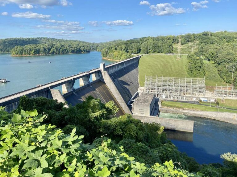
Photo: Warren LeMay, CC BY-SA 2.0
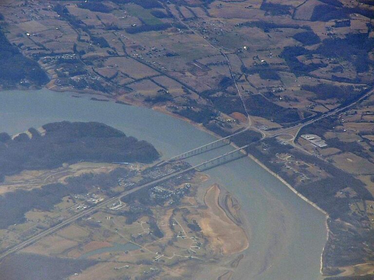
Photo: Peter Reed, CC BY-SA 2.0

Photo: WorldIslandInfo.com, CC BY 2.0
Practical matters for a fishing stay around Morristown
Which TWRA-listed lake is nearest Morristown?
Cherokee Lake, about 5 miles northwest of the town point.
Is there a free TWRA ramp near Morristown?
Hwy 25E #1 Boat Ramp on Cherokee Lake, 4 miles by straight line, on Cherokee Lake.
Which TWRA fishing sites are close to Morristown?
TVA Brights Pike Fishing Access on Cherokee Lake, 4 miles away (fishing site; camping).
Does Morristown have a place to buy minnows and crickets?
Dick's Sporting Goods (Morristown), one of 8 listings nearby.
Which Tennessee county is Morristown part of?
Hamblen County. The town is also the county seat.
Do I need a fishing license near Morristown, Tennessee?
Anglers 13 and older need a Tennessee fishing license; TWRA lists the resident combo hunt/fish license at $33 and the nonresident annual fishing all species license at $98.
Which towns sit close to Morristown?
White Pine (7 miles), Bean Station (9 miles) and Jefferson City (12 miles).
Which TWRA limits apply close to Morristown?
The statewide lines in the 2026-27 Tennessee Fishing Guide apply unless TWRA lists the water by name, and a named-water line wins for the fish it covers; each lake, river and tailwater page here prints its own lines. The rules here are from the 2026-27 Tennessee Fishing Guide as TWRA posts it online, last updated September 15, 2026; TWRA had published no 2027-28 guide when this site checked.
Which Tennessee creek or river runs near Morristown?
The closest river or tailwater page is Holston River, 9 miles from town.
Is there trout stocking near Morristown?
TWRA lists Little River on an undated day, status not printed; numbers appear only where TWRA printed them.
Which trail events launch on lakes near Morristown?
Bass Pro Tour Stage 3 on Norris Lake, March 11, 2027.
What TVA water is near Morristown?
Cherokee Lake, Douglas Lake and Norris Lake near town are on the TVA reservoir list; TVA posts its own lake levels.
A foggy-cove morning from Morristown
River pages add access sites and nearby USGS gauges.