Fishing near Brownsville, Tennessee
City, Haywood County. 2020 Census: 9,788 residents.
- 21 milesWhiteville Lake
- 8ramps within 40 mi
- 2rivers within 60 mi
 Pick for troutPiscifun Carbon X ultralight spinning reel28% OFFSale $57.99
Photo of Reelfoot Lake: Ken Ratcliff, CC BY 2.0
What Brownsville, Tennessee offers anyone toting a rod
The 2020 Census put 9,788 people in Brownsville, a city of Haywood County. Haywood County keeps its courthouse here. Head south for 21 miles and you reach Whiteville Lake, the closest water on record. Largest nearby: Gibson County Lake, 560 acres.
Boats go in at Highway 76 Boat Ramp on Hatchie River, roughly 5 miles away. Moving water: Mississippi River, a 37 miles drive.
U.S. Census Bureau, 2020 Census counts (TIGERweb) and the 2023 Gazetteer, read November 18, 2026. Miles are straight-line from the Census place point; the drive is usually longer.
Closest reservoirs to Brownsville
| Water | From Brownsville | Size | TWRA sites | Type | Fish on the TWRA list |
|---|---|---|---|---|---|
| Whiteville Lake | 21 miles to the south | 158 acres | 1 | lake | no TWRA list |
| Davy Crockett Lake | 22 miles to the northeast | 87 acres | 1 | lake | no TWRA list |
| Lake Graham | 30 miles to the east | 500 acres | 1 | lake | no TWRA list |
| Gibson County Lake | 35 miles to the northeast | 560 acres | 2 | lake | no TWRA list |
| Glenn Springs Lake | 36 miles to the west | 310 acres | 1 | lake | no TWRA list |
| Herb Parsons Lake | 37 miles to the southwest | 177 acres | 1 | lake | no TWRA list |
Surface acres as published for this water (source), read November 18, 2026. Waters without published acreage show their NHD outline. Waters without a page link to their county row. TWRA record for this water (TWRA), read November 18, 2026.
Reaching a Tennessee stream from Brownsville
- Mississippi River37 miles, named in the guide, 6 TWRA access sites, 1 USGS gauge
- Wolf River39 miles, named in the guide, 5 TWRA access sites, 4 USGS gauges
Gauge posts a drive from Brownsville
USGS has no current reading for these gauges.
TWRA and agency records for this river (source), read November 18, 2026. USGS Water Data for the Nation, live through the site, retrieved on page view.
Tennessee fishing spots around Brownsville, pinned
TWRA public access record (TWRA), read November 18, 2026. Census place point.
The nearest TWRA ramps for Brownsville trailers
- Highway 76 Boat Ramp on Hatchie River5 miles, Hatchie River, boat ramp; free to launch
- Hatchie River Boat Ramp7 miles, Hatchie River, boat ramp; free to launch
- Highway 54 Boat Ramp on South Fork Forked Deer River9 miles, South Fork Forked Deer River, boat ramp; free to launch
- Big Eddy Road Ramp on Hatchie River11 miles, Hatchie River, boat ramp; free to launch
- Hop In Boat Ramp on Hatchie River13 miles, Hatchie River, boat ramp; free to launch
- Highway 54 Boat Ramp on Hatchie River13 miles, Hatchie River, boat ramp; free to launch
- Highway 51 Boat Ramp on Hatchie River15 miles, Hatchie River, boat ramp; free to launch
- Whiteville Lake Boat Ramp21 miles, Whiteville Lake, boat ramp; courtesy dock, fishing pier, restrooms; free to launch
TWRA public access record (TWRA), read November 18, 2026.
Does TWRA stock water close to Brownsville
- Lake Graham
- Wolf River
Tennessee trout stocking by date
TWRA trout stocking information (TWRA source), as of Nov. 18, 2026, read November 18, 2026. Dates are TWRA’s; counts appear only where TWRA printed one.
 For the trout herePiscifun Carbon XT ultralight spinning reel25% OFFSale $59.99
Statewide and named-water limits near Brownsville
The rules here are from the 2026-27 Tennessee Fishing Guide as TWRA posts it online, last updated September 15, 2026; TWRA had published no 2027-28 guide when this site checked. Water reached from Brownsville follows the statewide lines unless TWRA lists it by name. Anglers 13 and older need a Tennessee fishing license; TWRA lists the resident combo hunt/fish license at $33 and the nonresident annual fishing all species license at $98.
Tennessee license and regulations
2026-27 Tennessee Fishing Guide (TWRA), read November 18, 2026. License prices from TWRA (license page), read November 18, 2026.
State-record water in range of Brownsville
| Species | Weight as listed | Water | Year | Class |
|---|---|---|---|---|
| Brown Bullhead | 3 lbs. 15 oz. | Whiteville Lake | 2014 | Class A |
| Brown Bullhead | 3 lbs., 4 oz. (c) | Whiteville Lake | 2014 | Class B |
| White Bass | 5 lbs. 10 oz. | Mississippi River | 2003 | Class A |
| Black Carp | 114 lbs., 3 oz. (k) | Mississippi River | 2023 | Class B |
| Flathead Catfish | 92 lbs. (k) | Mississippi River | 2000 | Class B |
Tennessee state record fish from TWRA (TWRA page), read November 18, 2026. Angler names are not printed. Record waters within 100 miles.
Contest days around Brownsville
| Date | Event | Water | Organizer |
|---|---|---|---|
| June 27, 2026 | Reelfoot Lake Ultimate Crappie Challenge (held) | Reelfoot Lake | Reelfoot Lake Ultimate Crappie Challenge |
Event as listed by the organizer (source), read November 18, 2026.
Tennessee bait counters close to Brownsville
Bait shops worth the detour on the way to Brownsville
- Walmartsporting goods store, Covington, 23 miles
- Dick's Sporting Goods (Jackson)bait and tackle shop, Jackson, 23 miles
- Marina Medical Transpotationmarina, Jackson, 25 miles
- Fort Pillow Grocery & Bait Shopbait and tackle shop, Henning, 26 miles
- Pioneer Outdoor Sportsbait and tackle shop, Bolivar, 27 miles
- Primary Tackle Cobait and tackle shop, Arlington, 30 miles
- The Original Billy Phillips Luresbait and tackle shop, Jackson, 31 miles
- Hooked-Up Bait Cobait and tackle shop, Jackson, 33 miles
Shop and marina listings from directories and operator pages; miles only where a listing has an address point, read November 18, 2026. Guides are listed as businesses.
In the same drainage as Brownsville
Nearby bases besides Brownsville
- Bells13 miles, 2020 count 2,463
- Alamo16 miles, 2020 count 2,336
- Ripley19 miles, 2020 count 7,800
- Whiteville20 miles, 2020 count 2,606
- Mason20 miles, 2020 count 1,337
Other Tennessee reservoirs close to Brownsville
- Whiteville Lake21 miles
- Davy Crockett Lake22 miles
- Lake Graham30 miles
- Gibson County Lake35 miles
- Haywood Countycounty page
Piscifun tackle picked for a hazy ridge-country morning at Brownsville


Piscifun and Amazon links are affiliate links; the site earns a commission on qualifying purchases.
Reservoir coves and ridge-line water around Brownsville, photographed

Photo: Ken Ratcliff, CC BY 2.0
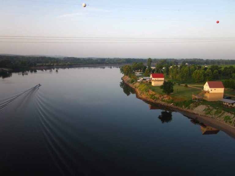
Photo: Allen Gathman, CC BY-SA 2.0
Photo: Egan Snow, CC BY-SA 2.0

Photo: U.S. Army Corps of Engineers Nashville District, CC BY-SA 2.0
Questions from anglers booked into Brownsville, Tennessee
Which lake is the quickest run from Brownsville, Tennessee?
Whiteville Lake, about 21 miles south of the town point.
Where can I launch a boat near Brownsville, Tennessee?
Highway 76 Boat Ramp on Hatchie River, 5 miles by straight line, on Hatchie River.
Is there a fishing pier or bank access near Brownsville?
TWRA maps no bank site within 40 miles; the Whiteville Lake entry lists its ramps and shoreline.
Which stores around Brownsville stock hooks and line?
Walmart, one of 8 listings nearby.
Inside which Tennessee county line is Brownsville?
Haywood County. The town is also the county seat.
What do visitors to Brownsville need to fish?
Anglers 13 and older need a Tennessee fishing license; TWRA lists the resident combo hunt/fish license at $33 and the nonresident annual fishing all species license at $98.
Which Tennessee towns are a few exits from Brownsville?
Bells (13 miles), Alamo (16 miles) and Ripley (19 miles).
What are the creel limits near Brownsville, Tennessee?
The statewide lines in the 2026-27 Tennessee Fishing Guide apply unless TWRA lists the water by name, and a named-water line wins for the fish it covers; each lake, river and tailwater page here prints its own lines. The rules here are from the 2026-27 Tennessee Fishing Guide as TWRA posts it online, last updated September 15, 2026; TWRA had published no 2027-28 guide when this site checked.
Which Tennessee river runs closest to Brownsville?
The closest river or tailwater page is Mississippi River, 37 miles from town.
What does the TWRA trout list show near Brownsville?
TWRA lists Lake Graham on an undated day, status not printed; numbers appear only where TWRA printed them.
Plan a reservoir day out of Brownsville
Ramp lines link to driving directions.