Cherokee Heights Boat Ramp on Kentucky Lake
Boat ramp access to Kentucky Lake, 8 miles from Parsons in Decatur County.
- Parsonsnearest town
- Kentucky Lakewater
 Pick for largemouth bassPiscifun Chaos Pro CNC baitcasting reel25% OFFSale $97.99
Photo of Buffalo River: Noel Pennington, CC BY 2.0
Cherokee Heights Boat Ramp on Kentucky Lake at a quick Volunteer State look
TWRA lists Cherokee Heights Boat Ramp on Kentucky Lake, a boat ramp, 8 miles from Parsons in Decatur County. It opens onto Kentucky Lake. Expect one lane concrete ramp when you back down at Cherokee Heights Boat Ramp on Kentucky Lake. Its launch rating covers boats of any length. Hours on file: open 24 hours, open year-round. Money matters at the ramp: no launch fee. Facilities marked yes: restrooms, lighted parking and canoe and kayak landing.
The parking bands read 5-10 trailer spaces; fewer than 25 car spaces. The winter-pool field reads usable at winter pool. Supplies on file: bait nearby, ice nearby and gas nearby. TWRA records it as owned by TWRA (MOU) and managed by TWRA.
TWRA public access record (TWRA), read November 18, 2026.
What the TWRA access record lists for Cherokee Heights Boat Ramp on Kentucky Lake
| Field | As recorded |
|---|---|
| Access type | Boat Launch |
| Launch lanes | one lane |
| Ramp surface | concrete |
| Boats it takes | boats of any length |
| Hours | open 24 hours |
| Season | open year-round |
| Launch fee | no launch fee |
| Trailer parking | 5-10 spaces |
| Car parking | fewer than 25 spaces |
| On the record | restrooms, lighted parking, canoe and kayak landing |
| Winter pool | usable at winter pool |
| Services | bait nearby, ice nearby, gas nearby |
| Owner | TWRA (MOU) |
| Managed by | TWRA |
| TWRA region on the record | Region 1 |
| Also called | Cherokee Heights |
| Directions as TWRA prints them | From Parsons, take 641 / 69N to Cherokee Heights Rd |
| Water | Kentucky Lake |
| County | Decatur County |
| Nearest town | Parsons, 8 miles |
TWRA public access record (TWRA), read November 18, 2026. TWRA records yes/no flags and size bands only; no launch price or ramp grade is published.
What lies beyond the ramp at Cherokee Heights Boat Ramp on Kentucky Lake
TVA controls the water level at Kentucky Lake. The guide prints a border-water agreement for Kentucky Lake: Kentucky Lake: Reciprocal waters extend from Governor Ned McWherter Bridge (U.S. 79/TN 76) in Tennessee north to Eggner's Ferry Bridge (U.S. 68/KY 80) in Kentucky. This includes all tributaries and embayments, except for the Blood River embayment in Kentucky. Anglers must obey the regulations of the state in which they are licensed unless they are fishing from the bank. Bank anglers, regardless of which state's license they hold, must abide by the regulations of the state in which they are fishing.
Kentucky Lake holds largemouth bass, smallmouth bass, spotted bass, crappie, bluegill and white bass, per TWRA.
Outline area from the USGS National Hydrography Dataset waterbody layer (NHD service; mapped polygon area, not an agency surface-acre figure), read November 18, 2026. Species as TWRA lists them for this water (TWRA), read November 18, 2026. A listed species is present by the agency’s account, not a catch report.
 For the largemouth bass herePiscifun AlinoX 300 low profile baitcaster34% OFFSale $104.99
Tennessee size rules near Cherokee Heights Boat Ramp on Kentucky Lake
The rules here are from the 2026-27 Tennessee Fishing Guide as TWRA posts it online, last updated September 15, 2026; TWRA had published no 2027-28 guide when this site checked.
The guide gives Kentucky Lake these rules of its own:
| Water as printed | Rule line | Guide page |
|---|---|---|
| Kentucky Lake | Includes the following dewatering areas—West Sandy, Big Sandy, Gin Creek, Camden Bottoms, Duck River Bottoms, Busseltown, Perryville, and Gumdale. The dewatering areas are closed to fishing five (5) days prior to and during the late waterfowl season. | – |
| Kentucky Lake | Black Bass: Five (5) per day in combination. | – |
| Kentucky Lake | Largemouth/Smallmouth Bass: 15 inch minimum length limit. | – |
| Kentucky Lake | Spotted Bass: No length limit. | – |
| Kentucky Lake | Crappie (all species): 20 per day in combination, 10 inch minimum length limit—this includes all dewatering areas. | – |
| Kentucky Lake | Catfish (all species): No creel limit for fish 34 inches and less in length; only one (1) fish over 34 inches in length may be harvested per day. | – |
| Kentucky Lake | Striped Bass or Hybrid Striped Bass: Two (2) per day in combination, 15 inch minimum length limit. | – |
| Kentucky Lake | White Bass: 15 per day, no length limit. | – |
| Kentucky Lake | Yellow Bass: No creel or length limit. | – |
| Kentucky Lake | Walleye: Five (5) per day, 16 inch minimum length limit. | – |
Anglers 13 and older need a Tennessee fishing license; TWRA lists the resident combo hunt/fish license at $33 and the nonresident annual fishing all species license at $98.
2026-27 Tennessee Fishing Guide (TWRA), read November 18, 2026. License prices from TWRA (license page), read November 18, 2026.
Dated water numbers for Cherokee Heights Boat Ramp on Kentucky Lake
TVA posts observed and predicted elevations for Kentucky Lake on its lake levels page; this site links to it rather than copying a reading.
TVA lake levels for this reservoir (tva.com), dated as TVA served them, read November 18, 2026. TVA is not affiliated with this site.
Other launches on the same water as Cherokee Heights Boat Ramp on Kentucky Lake
- Woodland Shores Boat Ramp on Kentucky LakeKentucky Lake, boat ramp; free to launch, under a mile northeast
- Brodies Landing on Kentucky LakeKentucky Lake, boat ramp; free to launch, 1 mile south
- Perryville Marina on Kentucky LakeKentucky Lake, marina; courtesy dock, restrooms, bait; free to launch, 7 miles south
- Beech River – Perryville Boat Ramp on Kentucky LakeKentucky Lake, boat ramp; free to launch, 8 miles south
- Morgan's Creek Access Area on Kentucky LakeKentucky Lake, boat ramp; free to launch, 8 miles northeast
- Beech Bend Park on Kentucky LakeKentucky Lake, boat ramp; courtesy dock, fishing pier, restrooms; fee charged, 8 miles south
- Nix Landing Access Area on Kentucky LakeKentucky Lake, boat ramp; free to launch, 9 miles northeast
- Lost Creek Dock on Kentucky LakeKentucky Lake, marina; courtesy dock, restrooms, camping; fee charged, 9 miles south
Within reach of Cherokee Heights Boat Ramp on Kentucky Lake, Tennessee
Boat ramps near Cherokee Heights Boat Ramp on Kentucky Lake
- Cuba Landing Marina on Kentucky Lakemarina; courtesy dock, restrooms, bait; fee charged, 12 miles
- Dogwood Lake Boat Rampboat ramp; free to launch, 12 miles
- Wildlife Cove Village and Marina on Kentucky Lakemarina; restrooms, camping, bait; free to launch, 12 miles
- Mermaid Marina on Kentucky Lakemarina; courtesy dock, restrooms, bait; free to launch, 12 miles
- Red Bud Lake Boat Rampboat ramp; courtesy dock, fishing pier; free to launch, 13 miles
Bank and pier access near Cherokee Heights Boat Ramp on Kentucky Lake
- HWY 412 at Buffalo River Fishing Accessfishing site; bait; free to launch, 14 miles
- Birdsong fishing pier on Kentucky Lakefishing site; fishing pier; free to launch, 16 miles
- Duck River Unit Wildlife Refuge Pump Station Rd Fishing Access on Kentucky Lakefishing site; free to launch, 17 miles
Lakes to try near Cherokee Heights Boat Ramp on Kentucky Lake
- Laurel Hill Lake38 miles
- Pickwick Lake50 miles
Tennessee current a drive from Cherokee Heights Boat Ramp on Kentucky Lake
- Buffalo River20 miles
Tackle stops within reach of Cherokee Heights Boat Ramp on Kentucky Lake
- Cherokee Marinamarina, Sugar Tree, 1 mile
- Triple Creek Entbait and tackle shop, Linden, 4 miles
- Crooked Creek Marinamarina, Lobelville, 6 miles
- Perryville Marinamarina, Parsons, 7 miles
Tennessee towns a county road away from Cherokee Heights Boat Ramp on Kentucky Lake
- Parsons8 miles
- New Johnsonville20 miles
- Lexington20 miles
- Decatur Countycounty page
Piscifun tackle picked for a hazy ridge-country morning at Cherokee Heights Boat Ramp on Kentucky Lake


Piscifun and Amazon links are affiliate links; the site earns a commission on qualifying purchases.
Reservoir coves and ridge-line water around Cherokee Heights Boat Ramp on Kentucky Lake, photographed

Photo: U.S. Army Corps of Engineers Nashville District, CC BY-SA 2.0

Photo: Land Between the Lakes KY\/TN, Public domain
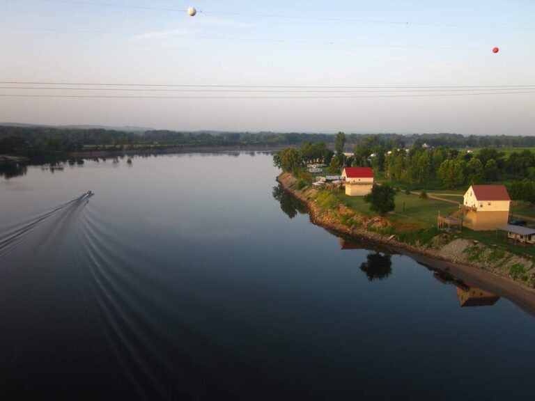
Photo: Allen Gathman, CC BY-SA 2.0
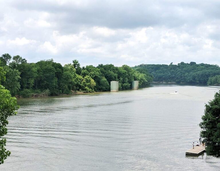
Photo: Sheila Berrios-Nazario, CC BY 2.0
Cherokee Heights Boat Ramp on Kentucky Lake, taken one Tennessee question at a time
How do I find Cherokee Heights Boat Ramp on Kentucky Lake?
TWRA places Cherokee Heights Boat Ramp on Kentucky Lake 8 miles from Parsons in Decatur County. Directions on file: From Parsons, take 641 / 69N to Cherokee Heights Rd.
Does TWRA show a launch fee at Cherokee Heights Boat Ramp on Kentucky Lake?
The TWRA entry for Cherokee Heights Boat Ramp on Kentucky Lake lists no launch fee.
How many launch lanes does TWRA list at Cherokee Heights Boat Ramp on Kentucky Lake?
For Cherokee Heights Boat Ramp on Kentucky Lake, TWRA lists one lane; concrete surface; boats of any length.
Is Cherokee Heights Boat Ramp on Kentucky Lake open all year?
Plan on open 24 hours, open year-round at Cherokee Heights Boat Ramp on Kentucky Lake.
What does TWRA list for the water at Cherokee Heights Boat Ramp on Kentucky Lake?
The agency list for Kentucky Lake names largemouth bass, smallmouth bass, spotted bass, crappie and bluegill.
What is the closest backup to Cherokee Heights Boat Ramp on Kentucky Lake?
Your backup is Woodland Shores Boat Ramp on Kentucky Lake, under a mile from Cherokee Heights Boat Ramp on Kentucky Lake.
Which TWRA license do I carry at Cherokee Heights Boat Ramp on Kentucky Lake?
Anglers 13 and older need a Tennessee fishing license; TWRA lists the resident combo hunt/fish license at $33 and the nonresident annual fishing all species license at $98.
Which Tennessee bait counter is handiest to Cherokee Heights Boat Ramp on Kentucky Lake?
The nearest listed counter is Cherokee Marina, 1 mile away. The record adds bait nearby, ice nearby and gas nearby.
Do different limits apply at Cherokee Heights Boat Ramp on Kentucky Lake?
There are 10 rule lines for Kentucky Lake, quoted above with the guide page.
Make Cherokee Heights Boat Ramp on Kentucky Lake your next put-in
Carry your TWRA license; wildlife officers check launches.