Fishing in Georgetown County, South Carolina
County seat: Georgetown. Population 63,404 (2020). SCDNR Region 4.
- 2bank and pier sites
- 26landings
- 11river pages
 Pick for black crappiePiscifun Carbon X ultralight spinning reel28% OFFSale $57.99
Photo of Lake Moultrie: Evanoco, CC BY-SA 4.0
What Georgetown County offers from landing to tide line
Georgetown County had a 2020 population of 63,404 and runs its government out of Georgetown. Its public access points sit chiefly in SCDNR Region 4.
Boaters get 26 landings and paddle launches, and shore anglers get 2 piers and bank sites, on SCDNR maps of the county. For current, start with Great Pee Dee River, Intracoastal Waterway and Waccamaw River. The Atlantic side of the county gives 4 coastal water pages, 13 artificial reef areas and 2 saltwater piers.
U.S. Census Bureau, 2020 Census counts (TIGERweb) and the 2023 Gazetteer, read November 9, 2026. SCDNR South Carolina Public Water Access layer (ArcGIS service, the data behind the SCDNR fishing access map), read November 9, 2026.
Where the water points land across Georgetown County
SCDNR Public Water Access layer and lake points, checked November 9, 2026.
SCDNR-profiled lakes inside Georgetown County
Georgetown County has little paged lake water, so here are the nearest lakes from Georgetown.
| Lake | From Georgetown | Size | Landings | Kind | SCDNR species list |
|---|---|---|---|---|---|
| Wee Tee Lake | 29 miles west | not printed | 1 | named at an SCDNR access | Largemouth Bass, Black Crappie, Redear Sunfish |
| Bonneau Ferry WMA Lake | 38 miles southwest | 100 acres | 0 | mapped lake | none on SCDNR lists |
| Lake Moultrie | 45 miles west | 60,400 acres | 9 | major reservoir | Largemouth Bass, Bluegill, Redear Sunfish |
Surface acres and depth as SCDNR prints them on its page for this lake, read November 9, 2026. Sizes SCDNR does not print show as mapped outline area. Species as SCDNR lists them at its access points.
 For the black crappie herePiscifun Carbon XT ultralight spinning reel25% OFFSale $59.99
The species tally for lakes near Georgetown County
Tallying lake pages up to 100 miles from Georgetown by SCDNR species entries puts Largemouth Bass first.
SCDNR Public Water Access species lists, counted per lake page within 100 miles; an occurrence list, not a catch survey.
Flowing and tidal streams of Georgetown County
- Great Pee Dee Rivertidal, 16 SCDNR accesses, 9 USGS gauges
- Intracoastal Waterwaytidal, 14 SCDNR accesses
- Waccamaw Rivertidal, 14 SCDNR accesses, 6 USGS gauges
- Black Rivertidal, 10 SCDNR accesses, 5 USGS gauges
- North Santee Rivertidal, 3 SCDNR accesses
- Black Mingo Creek2 SCDNR accesses
- Main Creektidal, 2 SCDNR accesses
- Sampit Rivertidal, 2 SCDNR accesses, 1 USGS gauge
- Pawleys Creektidal, 1 SCDNR access
- Peters Creektidal, 1 SCDNR access
- Wadmacon Creektidal, 1 SCDNR access
Smaller Georgetown County waterways on the list (1)
- Murrells Inlettidal, 1 SCDNR access
Georgetown County river gauges right now
| USGS gauge | Latest reading | Time (ET) |
|---|---|---|
| Waccamaw R Nr Hagley Land. Nr Pawleys Island, Sc | 60,600 cfs, 14.59 ft gage height | Sep 26 12:45 am Not updated since Sep 26, 2000. |
| Black River Near Andrews, Sc | 401 cfs, 18.23 ft gage height | Apr 1 11:00 am Not updated since Apr 1, 2026. |
| Turkey Creek Near Maryville, Sc | 0 cfs, 1.21 ft gage height | Nov 13 7:00 pm |
| Waccamaw River Near Pawleys Island, Sc | 3.77 ft gage height | Nov 13 7:15 pm |
| Black River At Sc51 Near Rhems, Sc | 10.95 ft gage height | Nov 13 7:20 pm |
| Black River Near Dunbar, Sc | 14.95 ft gage height | Nov 13 7:15 pm |
US Geological Survey provisional data, retrieved Nov 13, 2026 7:33 pm ET. Provisional readings can be revised.
SCDNR South Carolina Public Water Access layer (ArcGIS service, the data behind the SCDNR fishing access map), read November 9, 2026. USGS Water Data for the Nation, live through the site, retrieved on page view.
Tide-washed water belonging to Georgetown County
Where Georgetown County meets the tide
- Midway Inletinlet
- Murrells Inletinlet
- Pawleys Inletinlet
- Winyah Baybay
SCDNR reefs nearest Georgetown County
- Will Goldfinch ReefPA-03
- Saltwater Anglers ReefPA-09
- Ten Mile ReefPA-10
- Pawley's Island ReefPA-11
- CCA-North Inlet ReefPA-12
- Wayne Upchurch ReefPA-13
- Georgetown ReefPA-14
- Georgetown Nearshore ReefPA-15
- C.J. Davidson Jr. ReefPA-16
- Vermilion ReefPA-17
- Greenville ReefPA-18
- Cape Romain ReefPA-19
- Hector ReefPA-20
Fishing piers along the Georgetown County shore
- South Jetty at Murrells Inlet PierMurrells Inlet
- Winyah Bay Fishing and Observation Pier on Great Pee Dee RiverGreat Pee Dee River
A year of freshwater fishing costs $10 for a South Carolina resident and $35 for anyone from out of state. Residents fishing salt water buy a $15 annual saltwater license.
Saltwater limits South Carolina piers
USGS Geographic Names Information System point for this water, read November 9, 2026. SCDNR Marine Artificial Reef map layers and the SCDNR reef sheet for each permit area (SCDNR reef program), read November 9, 2026. SCDNR South Carolina Public Water Access layer (ArcGIS service, the data behind the SCDNR fishing access map), read November 9, 2026. License prices as printed on the SCDNR license pricing pages (dnr.sc.gov), read November 9, 2026.
Georgetown County boat landings and paddle launches
- Browns Ferry Boat Ramp on Black RiverBlack River, boat ramp, 2 lanes, concrete or paved, courtesy dock
- Carroll Ashmore Campbell Marine Complex Boat Ramp on Sampit RiverSampit River, boat ramp, 6 lanes, concrete or paved, courtesy dock
- East Bay Street Boat Ramp on Sampit RiverSampit River, boat ramp, 3 lanes, concrete or paved, courtesy dock
- Hagley Boat Ramp on Waccamaw RiverWaccamaw River, boat ramp, 2 lanes, concrete or paved, courtesy dock
- Harris Landing on North Santee RiverNorth Santee River, boat ramp, 1 lane, concrete or paved
- Mingo Boat Ramp on Black Mingo CreekBlack Mingo Creek, boat ramp, 1 lane, dirt
- Murrells Inlet Boat RampMurrells Inlet, boat ramp, 3 lanes, concrete or paved, courtesy dock
- Old Pumping Station Boat Ramp on Black RiverBlack River, boat ramp, 1 lane, concrete or paved, courtesy dock
- Pea House Boat Ramp on Black RiverBlack River, boat ramp, 2 lanes, concrete or paved, courtesy dock
- Peters Creek Boat Ramp on Black RiverBlack River, boat ramp, 1 lane, dirt
- Peters Creek LandingPeters Creek, paddle launch
- Petersfield Boat Ramp on Great Pee Dee RiverGreat Pee Dee River, boat ramp, 1 lane, gravel, courtesy dock
- Pine Tree Boat Ramp on Black RiverBlack River, boat ramp, 2 lanes, concrete or paved, courtesy dock
- Pole Yard Boat Ramp on North Santee RiverNorth Santee River, boat ramp, 2 lanes, concrete or paved, courtesy dock
- Pringles Ferry Boat Ramp on Black RiverBlack River, boat ramp, 1 lane, concrete or paved
- Pritchard Street Boat Ramp on Pawleys CreekPawleys Creek, boat ramp, 1 lane, concrete or paved
- Rocky Point Boat Ramp on Black RiverBlack River, boat ramp, 1 lane, concrete or paved
- Samworth WMA Boat Ramp on Great Pee Dee RiverGreat Pee Dee River, boat ramp, 1 lane, concrete or paved
- Sandhole Boat Ramp on Wadmacon CreekWadmacon Creek, boat ramp, 1 lane, concrete or paved
- Sandy Island Boat Ramp on Waccamaw RiverWaccamaw River, boat ramp, 1 lane, gravel, courtesy dock
- Shell Road Boat Ramp on Main CreekMain Creek, boat ramp, 1 lane, concrete or paved
- South Island Ferry Boat Ramp on Intracoastal WaterwayIntracoastal Waterway, boat ramp, 2 lanes, concrete or paved, courtesy dock
- Tom Crocker Boat Ramp on Main CreekMain Creek, boat ramp, 1 lane, concrete or paved
- Wacca Wache Boat Ramp on Waccamaw RiverWaccamaw River, boat ramp, 3 lanes, concrete or paved, courtesy dock
- Collins Landing on North Santee RiverNorth Santee River, paddle launch
- Cowhead Landing on Black Mingo CreekBlack Mingo Creek, paddle launch
Piers and bank access of Georgetown County
- South Jetty at Murrells Inlet PierMurrells Inlet, pier
- Winyah Bay Fishing and Observation Pier on Great Pee Dee RiverGreat Pee Dee River, pier
SCDNR South Carolina Public Water Access layer (ArcGIS service, the data behind the SCDNR fishing access map), read November 9, 2026. The SCDNR layer carries no fee or hours field.
Size and daily limits for Georgetown County water
Wherever no guide row names a Georgetown County water, these statewide freshwater limits govern it. A total of 40 game fish may be kept in any one day (freshwater), not exceeding the species limits (guide p. 28). A year of freshwater fishing costs $10 for a South Carolina resident and $35 for anyone from out of state.
| Species | Size limit | Daily limit |
|---|---|---|
| American Eel | 9 inches min | 25 |
| Blue Catfish | See limits in Freshwater Nongame Fishing Regulations section. | See limits in Freshwater Nongame Fishing Regulations section. |
| Bream | Any length | 30 |
| Redbreast Sunfish | Any length | 15 |
| Crappie | 8 inches min | 20 |
| Walleye & Sauger | Any length | No more than 8 combined total of walleye or sauger |
| Chain Pickerel | Any length | 30 |
| Redfin Pickerel | Any length | 30 |
| Yellow Perch | Any length | 30 |
| Smallmouth Bass | 12 inches min | No more than 5 combined total of smallmouth, largemouth, redeye bass or their hybrids |
| Redeye (Bartrams) Bass | Any length | No more than 5 combined total of smallmouth, largemouth, redeye bass or their hybrids |
| Largemouth Bass | Any length | No more than 5 combined total of smallmouth, largemouth, redeye bass or their hybrids |
| Spotted Bass | Any length | 15 |
| White Bass | Any length | 10 |
| Striped or Hybrid Bass or a combination | Any length | 10 |
Spots in Georgetown County with their own limits
- Black Mingo CreekStriped or Hybrid Bass or a combination: Oct. 1 – June 15: 26 inches min, 3
- Black RiverStriped or Hybrid Bass or a combination: Oct. 1 – June 15: 26 inches min, 3
- Great Pee Dee RiverStriped or Hybrid Bass or a combination: Oct. 1 – June 15: 26 inches min, 3
- Sampit RiverStriped or Hybrid Bass or a combination: Oct. 1 – June 15: 26 inches min, 3
- Waccamaw RiverStriped or Hybrid Bass or a combination: Oct. 1 – June 15: 26 inches min, 3
2026-2027 South Carolina Hunting & Fishing Guide, valid August 14, 2026 to August 14, 2027 (online guide), read November 9, 2026. License prices as printed on the SCDNR license pricing pages (dnr.sc.gov), read November 9, 2026.
Where Georgetown County turns up on the record list
| Species | Weight as listed | List | Water | Year |
|---|---|---|---|---|
| Flathead Catfish | 113-7 | freshwater | Great Pee Dee River | 2026 |
South Carolina state record fish as listed by SCDNR (record list), read November 9, 2026.
Bass trails and weigh-ins on Georgetown County water
Clubs and trails post 7 events on Georgetown County water; 3 remain on the schedule.
| Date | Event | Water | Organizer |
|---|---|---|---|
| Nov. 28, 2026 | CATT Waccamaw River Fall Qualifier 3 | Waccamaw River | Carolina Anglers Team Trail (CATT) |
| Dec. 19, 2026 | CATT Waccamaw River Fall Final | Waccamaw River | Carolina Anglers Team Trail (CATT) |
| July 31, 2027 | Phantom Outdoors Open on the Waccamaw River | Waccamaw River | Carolina Anglers Team Trail (CATT) |
| Oct. 3, 2026 | CATT Waccamaw River, SC Oct 3, 2026 | Waccamaw River | Carolina Anglers Team Trail (CATT) |
| Sept. 12, 2026 | CATT Waccamaw River, SC Sept 12, 2026 | Waccamaw River | Carolina Anglers Team Trail (CATT) |
| Aug. 8, 2026 | CATT Waccamaw River, SC Summer Final Aug 8, 2026 | Waccamaw River | Carolina Anglers Team Trail (CATT) |
| not printed | Phantom Outdoors Open, Waccamaw River | Waccamaw River | Carolina Anglers Team Trail (CATT) |
Organizer schedule and results pages, checked November 2026.
Stocking up for a Georgetown County trip
Marinas and tackle shops of Georgetown County
- BBR Outdoorsbait and tackle shop, Georgetown
- Baisch Boys Bait & Tacklebait and tackle shop, Murrells Inlet
- Big Dave's Bait & Tanklebait and tackle shop, Murrells Inlet
- Crazy Sister Bait & Tacklebait and tackle shop, Murrells Inlet
- Harrison Fisheries Companybait and tackle shop, Murrells Inlet
- Inlet Tacklebait and tackle shop, Murrells Inlet
- JW Firearms LLCbait and tackle shop, Andrews
- Pawleys Island Outdoorsbait and tackle shop, Pawleys Island
- Perry's Bait & Tacklebait and tackle shop, Murrells Inlet
- South Island Bait Shopbait and tackle shop, Georgetown
- The Ice House LLCbait and tackle shop, Georgetown
- Winston's Bait & Tacklebait and tackle shop, Murrells Inlet
- Winyah Bait & Tacklebait and tackle shop, Georgetown
- Belle Isle Marinamarina, Georgetown
- Georgetown Dry Stack Marinamarina, Georgetown
- Georgetown Landing Marinamarina, Georgetown
- Harborwalk Marinamarina, Georgetown
- Heritage Plantationmarina, Pawleys Island
- Heritage Plantation Marinamarina, Pawleys Island
- Marlin Quay Marina, 1508 S Waccamaw Drmarina, Murrells Inlet
- Morningstar Marinasmarina, Pawleys Island
- The Boat Shed Marina and Tackle Shopmarina, Georgetown
- Wacca Wache Marinamarina, Murrells Inlet
- Wacca Wache Marina-Lanemarina, Murrells Inlet
Paid trips out of Georgetown County
- A Fishfull Thinking Guide Servicecharter, Murrells Inlet, (843) 902-0356
- All Bout Fishincharter, Murrells Inlet
- Barrier Island Guide Servicecharter, Pawleys Island, (843) 446-7337
- Brag and release fishing charterscharter, Murrells Inlet, (843) 236-9287
- Captain Shannon's Sport Fishingcharter, Murrells Inlet, (843) 450-1430
- Carolina Guide Servicecharter, Pawleys Island, (843) 814-7900
- Catch 1 Fishing Charterscharter, Murrells Inlet, (843) 450-1430
- Crazy Girl Fishing Charterscharter, Murrells Inlet, (843) 798-9100
- Crazy Sister Marinacharter, Murrells Inlet, (843) 651-3676
- Delta Guide Servicecharter, Georgetown, (843) 546-3645
- Fish On Charterscharter, Georgetown, (843) 527-7980
- Georgetown Coastal Adventurescharter, Georgetown, (843) 546-3543
- Gul 'r' Boy Charter Servicecharter, Georgetown, (843) 520-6339
- Jolly Rogers Fishing Adventurescharter, Murrells Inlet, (843) 357-3727
- Living Water Guide Servicecharter, Pawleys Island, (843) 997-4655
- North Island Fishing Charterscharter, Pawleys Island, (843) 325-1547
- Point Runner Voyager's View Marinacharter, Murrells Inlet, (843) 651-4384
- Reel Deep Charterscharter, Murrells Inlet, (843) 458-0089
- Rooster Tail Charterscharter, Murrells Inlet, (833) 476-6783
- Santee Coastal Excursionscharter, Pawleys Island, (864) 982-0780
Yellow Pages listings (city of business), read November 9, 2026.
Next stops beyond Georgetown County
Georgetown County communities with pages
- Murrells Inletpop. 9,740
- Georgetownpop. 8,403
- Litchfield Beachpop. 8,370
- Andrewspop. 2,575
Counties ringing Georgetown County
- Williamsburg County28 miles northwest
- Horry County39 miles northeast
- Berkeley County41 miles west
- Marion County46 miles north
Piscifun gear a Palmetto State angler could pack for Georgetown County


Piscifun and Amazon links are affiliate links; the site earns a commission on qualifying purchases.
Tidal flats and reservoir coves by Georgetown County, through the lens

Photo: NOAA Photo Library, CC BY 2.0
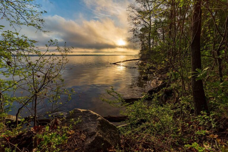
Photo: Andrew Parlette, CC BY 2.0
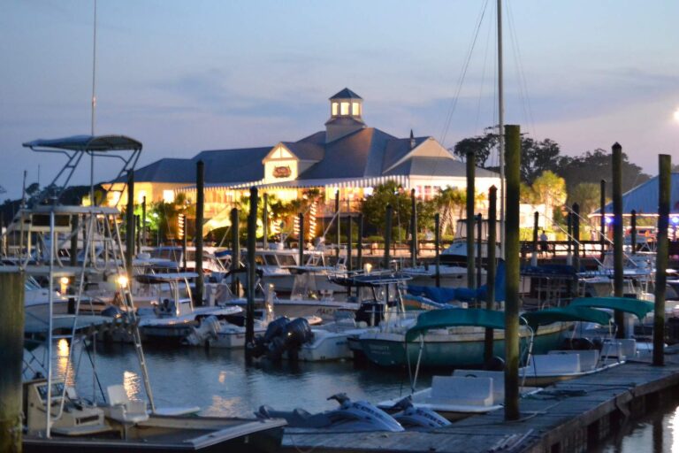
Photo: Sabine Fontana, CC BY 2.0
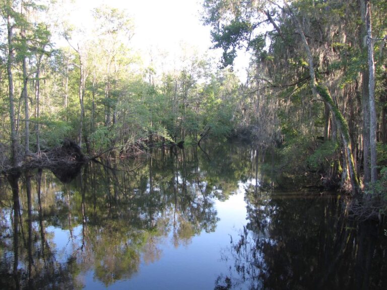
Photo: Gerry Dincher, CC BY-SA 2.0
Lakes, creeks and landings of Georgetown County, in questions
How many SCDNR ramps serve Georgetown County?
Count 26 landings and launches in the SCDNR access layer.
Which still water in Georgetown County is widest?
No lake page lies inside the county; Wee Tee Lake, 29 miles from Georgetown, is the nearest.
What fish show up on access lists near Georgetown County?
SCDNR access lists name Largemouth Bass on the most lake pages within 100 miles, then Redear Sunfish, Black Crappie and Bluegill.
Where are the Georgetown County tackle counters on Yellow Pages?
Start with BBR Outdoors, one of 24.
Where is the Georgetown County courthouse?
Georgetown holds it.
Which SCDNR license do I buy for Georgetown County lakes?
A year of freshwater fishing costs $10 for a South Carolina resident and $35 for anyone from out of state. Residents fishing salt water buy a $15 annual saltwater license.
Which counties neighbour Georgetown County?
Begin with Williamsburg County, Horry County and Berkeley County.
How many crappie can a Georgetown County angler keep each day?
Statewide: Crappie: 20 daily, size 8 inches min. A guide row naming a lake can change it.
Is Georgetown County in SCDNR Region 1, 2, 3 or 4?
SCDNR Region 4, going by the majority of its SCDNR access records.
Are there lake-specific limits in Georgetown County?
5 waters with a page here have a guide row of their own, beginning with Black Mingo Creek.
Do SC clubs and trails fish Georgetown County?
7 organizer entries on file; next is CATT Waccamaw River Fall Qualifier 3 on Waccamaw River, Nov. 28, 2026.
Which records were caught in Georgetown County water?
Flathead Catfish, 113-7 as listed, from Great Pee Dee River (2026).
Which saltwater spots belong to Georgetown County?
Yes: 4 coastal water pages, 13 artificial reef areas and 2 saltwater piers.
Plan a fishing weekend across Georgetown County
Lake pages show landings, SCDNR species lists and any guide row.