Fishing in Berkeley County, South Carolina
County seat: Moncks Corner. Population 229,861 (2020). SCDNR Region 4.
- 3lake pages
- 27landings
- 12river pages
 Pick for bluegillPiscifun Carbon X ultralight spinning reel28% OFFSale $57.99
Photo of Lake Marion: Mrs. Gemstone, CC BY-SA 2.0
Berkeley County fishing on SCDNR records
A county of 229,861 people in 2020, Berkeley County is governed from Moncks Corner. The county's SCDNR landings are mostly tagged SCDNR Region 4. The county holds 3 lakes with pages; Lake Marion is the biggest.
SCDNR lists 27 landings and paddle launches and 27 piers and bank sites across the county. Moving water with its own page includes Cooper River, Santee River and Rediversion Canal. Toward the ocean, the county has 2 saltwater piers.
U.S. Census Bureau, 2020 Census counts (TIGERweb) and the 2023 Gazetteer, read November 9, 2026. SCDNR South Carolina Public Water Access layer (ArcGIS service, the data behind the SCDNR fishing access map), read November 9, 2026.
Landings, piers and lakes of Berkeley County on the map
SCDNR Public Water Access layer and lake points, checked November 9, 2026.
Lake water on record in Berkeley County
| Lake | Size | Landings | Kind | SCDNR species list |
|---|---|---|---|---|
| Lake Marion | 90,000 acres | 17 | major reservoir | Largemouth Bass, Bluegill, Redear Sunfish |
| Lake Moultrie | 60,400 acres | 9 | major reservoir | Largemouth Bass, Bluegill, Redear Sunfish |
| Bonneau Ferry WMA Lake | 100 acres | 0 | mapped lake | none on SCDNR lists |
Paged still water outside Berkeley County, closest to Moncks Corner first.
| Lake | From Moncks Corner | Size | Landings | Kind | SCDNR species list |
|---|---|---|---|---|---|
| Wee Tee Lake | 18 miles northeast | not printed | 1 | named at an SCDNR access | Largemouth Bass, Black Crappie, Redear Sunfish |
Surface acres and depth as SCDNR prints them on its page for this lake, read November 9, 2026. Sizes SCDNR does not print show as mapped outline area. Species as SCDNR lists them at its access points.
 For the bluegill herePiscifun Carbon XT ultralight spinning reel25% OFFSale $59.99
Which fish crowd the lists near Berkeley County
Each bar counts the lake pages within 100 miles of Moncks Corner whose SCDNR access lists include the fish; Largemouth Bass shows up most.
SCDNR Public Water Access species lists, counted per lake page within 100 miles; an occurrence list, not a catch survey.
Still water in Berkeley County listed but not profiled
Another 11 named waters in Berkeley County are listed here without a full write-up.
| Water | Size | Kind |
|---|---|---|
| Alligator Lake | not printed | named at an SCDNR access |
| Blue Bird Pond | not printed | named at an SCDNR access |
| Co-Op Pond | not printed | named at an SCDNR access |
| Goose Creek | not printed | named at an SCDNR access |
| Guillard Lake | not printed | named at an SCDNR access |
| Hogpen | not printed | WMA impoundment |
| Jackie Pond | not printed | named at an SCDNR access |
| New Hope Pond | not printed | named at an SCDNR access |
| New Lake | not printed | named at an SCDNR access |
| Quarterman Reserve | not printed | named at an SCDNR access |
| Windom Corner Pond | not printed | named at an SCDNR access |
Outline area from the SCDNR Lakes and Reservoirs map layer (a GIS polygon area, not an SCDNR surface-acre figure), read November 9, 2026. SCDNR South Carolina Public Water Access layer (ArcGIS service, the data behind the SCDNR fishing access map), read November 9, 2026.
Streams SCDNR lists in Berkeley County
- Cooper Rivertidal, 7 SCDNR accesses, 3 USGS gauges
- Santee Rivertidal, 7 SCDNR accesses, 4 USGS gauges
- Rediversion Canal5 SCDNR accesses
- Wambaw Creektidal, 3 SCDNR accesses
- Back Rivertidal, 2 SCDNR accesses, 1 USGS gauge
- Wadboo Creek2 SCDNR accesses
- Beresford Creektidal, 1 SCDNR access
- Biggin Creek1 SCDNR access
- Dunham Creektidal, 1 SCDNR access
- Echaw Creektidal, 1 SCDNR access
- Quenby Creektidal, 1 SCDNR access
- Tail Race Canal1 SCDNR access
Live stream readings across Berkeley County
| USGS gauge | Latest reading | Time (ET) |
|---|---|---|
| Back River At Dupont Intake Nr Kittredge, Sc | 2,520 cfs, 15.79 ft gage height | Nov 12 8:00 pm |
| Santee River Nr Jamestown, Sc | 1,200 cfs, 1.98 ft gage height | Nov 12 7:30 pm |
| Lake Moultrie Tailrace Canal At Moncks Corner, Sc | 20,200 cfs, 8.10 ft gage height | Nov 12 7:45 pm |
| Santee River Near Russellville, Sc | 842 cfs, 9.59 ft gage height | Nov 12 8:00 pm |
| Santee River Near Pineville, Sc | 701 cfs, 2.34 ft gage height | Nov 12 7:15 pm |
| Rediv Canal At Santee River Nr St Stephen, Sc | 13 cfs, 7.11 ft gage height | Nov 12 7:30 pm |
US Geological Survey provisional data, retrieved Nov 12, 2026 8:32 pm ET. Provisional readings can be revised.
SCDNR South Carolina Public Water Access layer (ArcGIS service, the data behind the SCDNR fishing access map), read November 9, 2026. USGS Water Data for the Nation, live through the site, retrieved on page view.
Salt water touching Berkeley County
Berkeley County ocean and sound piers
- Beresford Creek PierBeresford Creek
- Bushy Park Landing Pier on Back RiverBack River
Freshwater licenses run $10 for residents and $35 for visitors on the SCDNR fee page. The resident saltwater license is $15 a year.
Saltwater limits South Carolina piers
USGS Geographic Names Information System point for this water, read November 9, 2026. SCDNR Marine Artificial Reef map layers and the SCDNR reef sheet for each permit area (SCDNR reef program), read November 9, 2026. SCDNR South Carolina Public Water Access layer (ArcGIS service, the data behind the SCDNR fishing access map), read November 9, 2026. License prices as printed on the SCDNR license pricing pages (dnr.sc.gov), read November 9, 2026.
Ramp list for Berkeley County from the SCDNR layer
- Amos Lee Gourdine Boat Ramp on Lake MoultrieLake Moultrie, boat ramp, 2 lanes, concrete or paved, courtesy dock
- Arrowhead Landing on Santee RiverSantee River, boat ramp, 2 lanes, concrete or paved
- Augustus M Flood Boat Ramp on Lake MoultrieLake Moultrie, boat ramp, 1 lane, concrete or paved
- Bushy Park – Fresh Water on Back RiverBack River, boat ramp, 2 lanes, concrete or paved, courtesy dock
- Bushy Park – Salt Water on Cooper RiverCooper River, boat ramp, 1 lane, concrete or paved, courtesy dock
- Dunham Creek Boat RampDunham Creek, boat ramp, 4 lanes, concrete or paved, courtesy dock
- E Jarvis Morris Boat Ramp on Lake MoultrieLake Moultrie, boat ramp, 1 lane, concrete or paved
- Fred L Day Boat Ramp on Lake MoultrieLake Moultrie, boat ramp, 1 lane, concrete or paved, fishing pier
- Hatchery Boat Ramp on Lake MoultrieLake Moultrie, boat ramp, 2 lanes, concrete or paved, courtesy dock
- Henderson G Guerry Boat Ramp on Lake MoultrieLake Moultrie, boat ramp, 2 lanes, dirt
- Hines Drive Access on Lake MoultrieLake Moultrie, boat ramp, 1 lane, concrete or paved
- Huger Park on Cooper RiverCooper River, boat ramp, 1 lane, concrete or paved
- John R Bettis Boat Ramp on Goose CreekGoose Creek, boat ramp, 2 lanes, concrete or paved, courtesy dock
- Lenuds Boat Ramp on Santee RiverSantee River, boat ramp, 2 lanes, concrete or paved
- McConnels Boat Ramp on Santee RiverSantee River, boat ramp, 1 lane, concrete or paved
- Pitch Landing on Echaw CreekEchaw Creek, paddle launch, gravel
- Ralph Hamer Sr Boat Ramp on Quenby CreekQuenby Creek, boat ramp, 2 lanes, concrete or paved, courtesy dock
- Rembert C Dennis Boat Ramp on Wadboo CreekWadboo Creek, boat ramp, 2 lanes, concrete or paved, courtesy dock
- Richardsons Boat Ramp on Lake MoultrieLake Moultrie, boat ramp, 2 lanes, concrete or paved, courtesy dock
- Spiers Boat Ramp on Lake MarionLake Marion, boat ramp, 2 lanes, concrete or paved, courtesy dock, fishing pier
- Thornley Forest II Boat Ramp on Lake MoultrieLake Moultrie, boat ramp, 2 lanes, concrete or paved, courtesy dock
- William Dennis Boat Ramp on Tail Race CanalTail Race Canal, boat ramp, 2 lanes, concrete or paved, courtesy dock
- Wilsons Boat Ramp on Santee RiverSantee River, boat ramp, 2 lanes, gravel
- Henry Brown Bridge Paddle Launch on Wadboo CreekWadboo Creek, paddle launch
- Laurel Hill Landing on Santee RiverSantee River, paddle launch
- Old Santee Canal Park Dock on Biggin CreekBiggin Creek, paddle launch
- Wambaw/Elmwood LandingWambaw Creek, paddle launch
Berkeley County bank sites on the SCDNR layer
- Amos Lee Gourdine Bank Access on Lake MoultrieLake Moultrie, bank, other (see comments)
- Bluebird Pond BankBlue Bird Pond, bank
- Bonneau Ferry State Lakes – Alligator Lake Bank FishingAlligator Lake, bank
- Bonneau Ferry State Lakes – New Lake Bank FishingNew Lake, bank
- Bonneau Ferry State Lakes – Quarterman Reserve Bank FishingQuarterman Reserve, bank
- Canal WMA Public Dove Field (Hwy 35) Bank on Rediversion CanalRediversion Canal, bank
- Canal WMA Public Dove Field (Hwy 45 – North of Canal) Bank on Rediversion CanalRediversion Canal, bank
- Canal WMA Public Dove Field (Hwy 45 – South of Canal) Bank on Rediversion CanalRediversion Canal, bank
- Coop Pond BankCo-Op Pond, bank
- Guillard Lake BankGuillard Lake, bank
- Jackie Pond BankJackie Pond, bank
- New Hope Pond BankNew Hope Pond, bank
- Rediversion Bank on Rediversion CanalRediversion Canal, bank
- Rediversion Bank, upstream on Rediversion CanalRediversion Canal, bank
- Spiers Landing Park Bank on Lake MarionLake Marion, bank
- Spiers Landing Park Pier on Lake MarionLake Marion, pier, wood
- Wadboo Bridge Pier on Cooper RiverCooper River, pier, wood
- Windom Corner Pond BankWindom Corner Pond, bank
- Beresford Creek PierBeresford Creek, pier
- Bonneau Ferry State Lakes – Hogpen Bank FishingHogpen, bank
- Bushy Park Landing Pier on Back RiverBack River, pier
- Cane Swamp BankPond, bank
- Co-Op Pond BankCo-Op Pond, bank
- Fred L. Day Fishing Pier on Lake MoultrieLake Moultrie, pier, wood
- Gator Pond BankPond, bank
- John R. Bettis Pier on Goose CreekGoose Creek, pier
- Richardsons Landing Pier on Lake MoultrieLake Moultrie, pier
SCDNR South Carolina Public Water Access layer (ArcGIS service, the data behind the SCDNR fishing access map), read November 9, 2026. The SCDNR layer carries no fee or hours field.
Dated reservoir readings across Berkeley County
Lake Marion
| USGS gauge | Latest reading | Time (ET) |
|---|---|---|
| Lake Marion Near Elloree, Sc | 74.23 ft lake elevation | Nov 12 7:15 pm |
| Lake Marion Near Pineville, Sc | 74.36 ft lake elevation | Nov 12 7:45 pm |
US Geological Survey provisional data, retrieved Nov 12, 2026 8:32 pm ET. Provisional readings can be revised.
Lake Moultrie
| USGS gauge | Latest reading | Time (ET) |
|---|---|---|
| Lk Moultrie At Rediversion Nr Russellville, Sc | 74.61 ft lake elevation | Nov 12 8:00 pm |
| Lake Moultrie Near Pinopolis, Sc | 74.22 ft lake elevation | Nov 12 7:45 pm |
US Geological Survey provisional data, retrieved Nov 12, 2026 8:32 pm ET. Provisional readings can be revised.
What a Berkeley County creel may hold
Most Berkeley County fresh water follows the statewide limits below. A total of 40 game fish may be kept in any one day (freshwater), not exceeding the species limits (guide p. 28). Freshwater licenses run $10 for residents and $35 for visitors on the SCDNR fee page.
| Species | Size limit | Daily limit |
|---|---|---|
| American Eel | 9 inches min | 25 |
| Blue Catfish | See limits in Freshwater Nongame Fishing Regulations section. | See limits in Freshwater Nongame Fishing Regulations section. |
| Bream | Any length | 30 |
| Redbreast Sunfish | Any length | 15 |
| Crappie | 8 inches min | 20 |
| Walleye & Sauger | Any length | No more than 8 combined total of walleye or sauger |
| Chain Pickerel | Any length | 30 |
| Redfin Pickerel | Any length | 30 |
| Yellow Perch | Any length | 30 |
| Smallmouth Bass | 12 inches min | No more than 5 combined total of smallmouth, largemouth, redeye bass or their hybrids |
| Redeye (Bartrams) Bass | Any length | No more than 5 combined total of smallmouth, largemouth, redeye bass or their hybrids |
| Largemouth Bass | Any length | No more than 5 combined total of smallmouth, largemouth, redeye bass or their hybrids |
| Spotted Bass | Any length | 15 |
| White Bass | Any length | 10 |
| Striped or Hybrid Bass or a combination | Any length | 10 |
Special-limit lakes and rivers of Berkeley County
- Cooper RiverStriped or Hybrid Bass or a combination: Oct. 1 – June 15: 26 inches min, 3
- Lake MarionLargemouth Bass: 14 inches min, No more than 5 combined total of smallmouth, largemouth, redeye bass or their hybrids
- Lake MoultrieLargemouth Bass: 14 inches min, No more than 5 combined total of smallmouth, largemouth, redeye bass or their hybrids
- Santee RiverStriped or Hybrid Bass or a combination: Oct. 1 – June 15 striped bass between 23 and 25 inches may be harvested except that one fish may be greater than 26 inches, 3
2026-2027 South Carolina Hunting & Fishing Guide, valid August 14, 2026 to August 14, 2027 (online guide), read November 9, 2026. License prices as printed on the SCDNR license pricing pages (dnr.sc.gov), read November 9, 2026.
Heavyweights on the books around Berkeley County
| Species | Weight as listed | List | Water | Year |
|---|---|---|---|---|
| Largemouth Bass | 16-2 | freshwater | Lake Marion | 1949 |
| Black Crappie | 5-0 | freshwater | Lake Moultrie | 1957 |
| Blue Catfish | 113.8 | freshwater | Lake Moultrie | 2017 |
| Channel Catfish | 58-0 | freshwater | Lake Moultrie | 1964 |
| American Shad | 7-0 | freshwater | Santee River | 1985 |
| Longnose Gar | 28-8 | freshwater | Lake Moultrie | 2015 |
South Carolina state record fish as listed by SCDNR (record list), read November 9, 2026.
The weigh-in calendar of Berkeley County
Trails list Berkeley County water in 31 entries, 15 of them upcoming.
| Date | Event | Water | Organizer |
|---|---|---|---|
| Nov. 14, 2026 | CATT Santee Cooper Fall Qualifier 5 | Santee Cooper Lakes | Carolina Anglers Team Trail (CATT) |
| Nov. 21, 2026 | CATT Cooper River Fall Qualifier #6 | Cooper River | Carolina Anglers Team Trail (CATT) |
| Dec. 12, 2026 | CATT Cooper River Fall Final | Cooper River | Carolina Anglers Team Trail (CATT) |
| Dec. 12, 2026 | CATT Santee Cooper Fall Final | Santee Cooper Lakes | Carolina Anglers Team Trail (CATT) |
| Feb. 6, 2027 | CATT Santee Cooper Spring Qualifier #1 (no forward-facing sonar) | Santee Cooper Lakes | Carolina Anglers Team Trail (CATT) |
| Feb. 13, 2027 | CATT Santee Cooper Spring Qualifier #2 (GOLD) | Santee Cooper Lakes | Carolina Anglers Team Trail (CATT) |
| Feb. 20, 2027 | Fishers of Men SC Low Country Classic, Santee Cooper Lakes | Santee Cooper Lakes | Fishers of Men National Tournament Trail |
| Feb. 27, 2027 | CATT Santee Cooper Spring Qualifier #3 (GOLD, no forward-facing sonar) | Santee Cooper Lakes | Carolina Anglers Team Trail (CATT) |
| Oct. 31, 2026 | Glynn Weber & Woody Floyd Win Santee Cooper, SC Oct 31, 2026 20.29 lbs! | Santee Cooper Lakes | Carolina Anglers Team Trail (CATT) |
| Oct. 24, 2026 | Michael & Justin Craven Win the Cooper River, SC Oct 24, 2026 14.54 lbs! | Cooper River | Carolina Anglers Team Trail (CATT) |
| Oct. 17, 2026 | James Gibbons & Jonathan Sutton Win Santee Cooper, SC Oct 17, 2026 27.36 lbs! | Santee Cooper Lakes | Carolina Anglers Team Trail (CATT) |
| Oct. 3, 2026 | Bennett Lawshe Wins Santee Cooper, SC Oct 3, 2026 With 5 bass weighing 28.98 lbs! | Santee Cooper Lakes | Carolina Anglers Team Trail (CATT) |
Organizer schedule and results pages, checked November 2026.
Berkeley County Yellow Pages tackle and guide listings
Where to buy shrimp and minnows in Berkeley County
- Corner Gasbait and tackle shop, Moncks Corner
- Dick's Sporting Goods, 355 Azalea Square Blvdbait and tackle shop, Summerville
- Henry's Bait & Tacklebait and tackle shop, Summerville
- M&P Crickets Farmsbait and tackle shop, Goose Creek
- Ned's Wholesale Baitbait and tackle shop, Cross
- Daniel Island Marinamarina, Charleston
- Hidden Cove Marinamarina, Moncks Corner
Booking a guide in Berkeley County
- Fish Call Charterscharter, Charleston, (843) 509-7337
- Lowcountry Lazy Charterscharter, Summerville, (843) 560-3809
- Overdose Fishing Charterscharter, Moncks Corner, (843) 509-2306
- Reel Fish Finder Charterscharter, Moncks Corner, (843) 697-2081
- Captain James Lavanwayfishing guide, Moncks Corner, (843) 697-2081
- Capts Always Availablefishing guide, Moncks Corner, (843) 761-7663
- Ken's Guide Servicefishing guide, Bonneau, (843) 825-6565
- Quality Time Outdoorsfishing guide, Goose Creek, (843) 425-7259
Yellow Pages listings (city of business), read November 9, 2026.
Branching out from Berkeley County
Where to base a trip in Berkeley County
- Goose Creekpop. 45,946
- Hanahanpop. 20,325
- Ladsonpop. 15,550
- Moncks Cornerpop. 13,297
- Sangareepop. 7,781
- St. Stephenpop. 1,571
Counties a short hop from Berkeley County
- Dorchester County27 miles west
- Charleston County28 miles south
- Williamsburg County32 miles northeast
- Clarendon County35 miles northwest
Piscifun reels and leaders boxed up for Berkeley County


Piscifun and Amazon links are affiliate links; the site earns a commission on qualifying purchases.
Tidal flats and reservoir coves by Berkeley County, through the lens
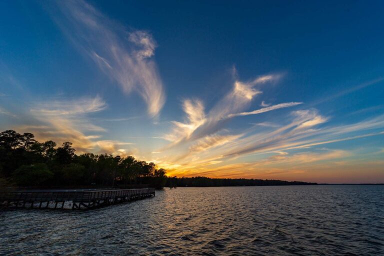
Photo: Andrew Parlette, CC BY 2.0
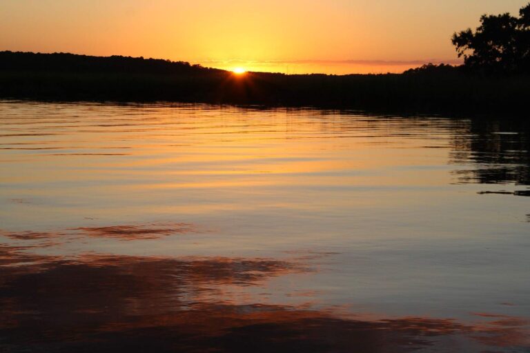
Photo: Wendy Pitts Reeves, CC BY 2.0
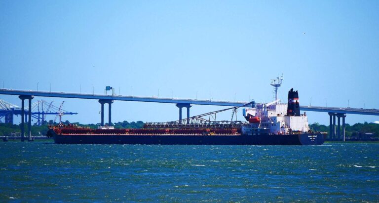
Photo: Brian Stansberry, CC BY 4.0

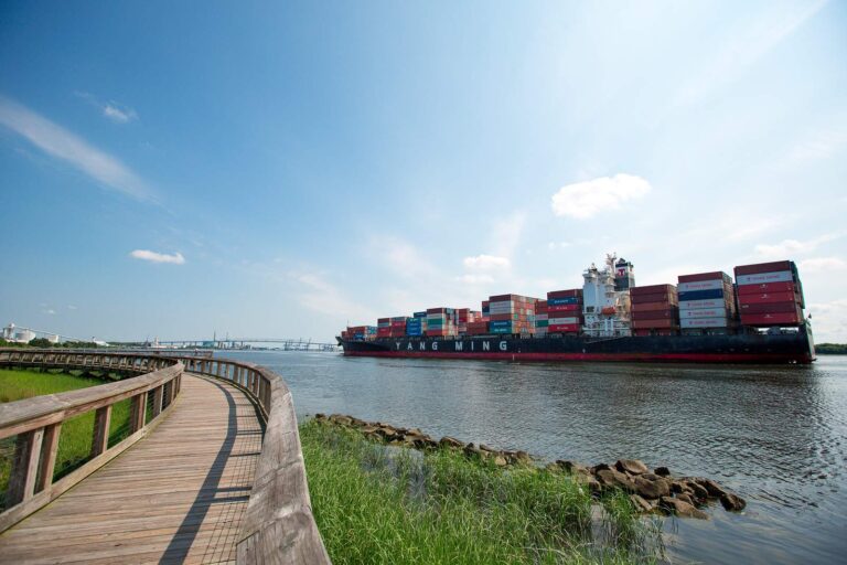
Photo: North Charleston, CC BY-SA 2.0
Fishing around Berkeley County: the questions that come up
Where can a boat be launched in Berkeley County?
There are 27 landings and launches on SCDNR maps of the county.
Which lake in Berkeley County is biggest?
Lake Marion comes first with 90,000 acres.
What can be caught near Berkeley County according to SCDNR lists?
SCDNR access lists name Largemouth Bass on the most lake pages within 100 miles, then Redear Sunfish, Black Crappie and Bluegill.
Does Berkeley County have a bait and tackle listing?
7 listings, including Corner Gas.
Which SC town hosts the Berkeley County seat?
Moncks Corner.
What does a fishing license cost for Berkeley County water?
Freshwater licenses run $10 for residents and $35 for visitors on the SCDNR fee page. The resident saltwater license is $15 a year.
What counties lie beside Berkeley County?
By distance: Dorchester County, Charleston County and Williamsburg County.
Is there a crappie size limit across Berkeley County?
Statewide: Crappie: 20 daily, size 8 inches min. A guide row naming a lake can change it.
Which SCDNR region covers Berkeley County?
SCDNR Region 4, going by the majority of its SCDNR access records.
Does the guide print rules for Berkeley County waters?
4 waters with a page here have a guide row of their own, beginning with Cooper River.
Which tournaments come to Berkeley County lakes?
31 organizer entries on file; next is CATT Santee Cooper Fall Qualifier 5 on Santee Cooper Lakes, Nov. 14, 2026.
Which SCDNR records came from Berkeley County?
Largemouth Bass, 16-2 as listed, from Lake Marion (1949).
Does Berkeley County have saltwater fishing?
Yes: 2 saltwater piers.
Spend a Palmetto morning on Berkeley County water
River pages list SCDNR accesses and USGS flow.