Fishing in Horry County, South Carolina
County seat: Conway. Population 351,029 (2020). SCDNR Region 4.
- 8bank and pier sites
- 29landings
- 6river pages
 Pick for black crappiePiscifun Carbon X ultralight spinning reel28% OFFSale $57.99
Photo of Little Pee Dee River: Gerry Dincher, CC BY-SA 2.0
Horry County fishing on SCDNR records
A county of 351,029 people in 2020, Horry County is governed from Conway. The county's SCDNR landings are mostly tagged SCDNR Region 4.
SCDNR lists 29 landings and paddle launches and 8 piers and bank sites across the county. Moving water with its own page includes Little Pee Dee River, Great Pee Dee River and Intracoastal Waterway. Toward the ocean, the county has 4 coastal water pages, 6 artificial reef areas and 8 saltwater piers.
U.S. Census Bureau, 2020 Census counts (TIGERweb) and the 2023 Gazetteer, read November 9, 2026. SCDNR South Carolina Public Water Access layer (ArcGIS service, the data behind the SCDNR fishing access map), read November 9, 2026.
Landings, piers and lakes of Horry County on the map
SCDNR Public Water Access layer and lake points, checked November 9, 2026.
Lake water on record in Horry County
Paged still water outside Horry County, closest to Conway first.
| Lake | From Conway | Size | Landings | Kind | SCDNR species list |
|---|---|---|---|---|---|
| Dargan's Pond | 50 miles northwest | 50 acres | 0 | SCDNR state lake | none on SCDNR lists |
| Wee Tee Lake | 52 miles southwest | not printed | 1 | named at an SCDNR access | Largemouth Bass, Black Crappie, Redear Sunfish |
Surface acres and depth as SCDNR prints them on its page for this lake, read November 9, 2026. Sizes SCDNR does not print show as mapped outline area. Species as SCDNR lists them at its access points.
 For the black crappie herePiscifun Carbon XT ultralight spinning reel25% OFFSale $59.99
Which fish crowd the lists near Horry County
Each bar counts the lake pages within 100 miles of Conway whose SCDNR access lists include the fish; Largemouth Bass shows up most.
SCDNR Public Water Access species lists, counted per lake page within 100 miles; an occurrence list, not a catch survey.
Still water in Horry County listed but not profiled
Another 1 named waters in Horry County are listed here without a full write-up.
| Water | Size | Kind |
|---|---|---|
| Gunters Lake | not printed | named at an SCDNR access |
Outline area from the SCDNR Lakes and Reservoirs map layer (a GIS polygon area, not an SCDNR surface-acre figure), read November 9, 2026. SCDNR South Carolina Public Water Access layer (ArcGIS service, the data behind the SCDNR fishing access map), read November 9, 2026.
Streams SCDNR lists in Horry County
- Little Pee Dee River23 SCDNR accesses, 3 USGS gauges
- Great Pee Dee Rivertidal, 16 SCDNR accesses, 9 USGS gauges
- Intracoastal Waterwaytidal, 14 SCDNR accesses
- Waccamaw Rivertidal, 14 SCDNR accesses, 6 USGS gauges
- Lumber River2 SCDNR accesses, 1 USGS gauge
- Bull Creektidal, 1 SCDNR access
Other Horry County streams named by SCDNR (1)
- Williams Creek1 SCDNR access
Live stream readings across Horry County
| USGS gauge | Latest reading | Time (ET) |
|---|---|---|
| Pee Dee River At Hwy 701 Nr Bucksport, Sc | 6,230 cfs, 10.30 ft gage height | Nov 12 5:15 pm |
| Aiw At Highway 9 At Nixons Crossroads, Sc | 2,900 cfs, 12.25 ft gage height | Oct 1 12:45 am Not updated since Oct 1, 2000. |
| Buck Creek Near Longs, Sc | 243 cfs, 5.29 ft gage height | Sep 30 12:45 am Not updated since Sep 30, 2010. |
| Little Pee Dee R. At Galivants Ferry, Sc | 246 cfs, 2.56 ft gage height | Nov 12 6:00 pm |
| Lumber River At Nichols, Sc | 144 cfs, 11.01 ft gage height | Nov 12 6:00 pm |
| Crabtree Swamp At Conway, Sc | 7 cfs, 11.03 ft gage height | Nov 12 6:00 pm |
US Geological Survey provisional data, retrieved Nov 12, 2026 6:33 pm ET. Provisional readings can be revised.
SCDNR South Carolina Public Water Access layer (ArcGIS service, the data behind the SCDNR fishing access map), read November 9, 2026. USGS Water Data for the Nation, live through the site, retrieved on page view.
Salt water touching Horry County
Bays and inlets off Horry County
- Cherry Grove Inletinlet
- Dunn Soundsound
- Hog Inletinlet
- Long Baybay
Offshore structure near Horry County
- Jim Caudle ReefPA-01
- Barracuda AlleyPA-02
- Ron McManus Memorial ReefPA-04
- BP-25 ReefPA-06
- Pop Nash ReefPA-07
- Bill Perry Jr. ReefPA-08
Horry County ocean and sound piers
- 2nd Avenue Pier on Atlantic OceanAtlantic Ocean
- Apache Campground Pier on Atlantic OceanAtlantic Ocean
- Cherry Grove (Intracoastal Waterway) Pier on Intracoastal WaterwayIntracoastal Waterway
- Hwy 544 Pier on Intracoastal WaterwayIntracoastal Waterway
- Kingfisher Pier on Long BayLong Bay
- Myrtle Beach State Park Pier on Atlantic OceanAtlantic Ocean
- Springmaid Pier on Atlantic OceanAtlantic Ocean
- Surfside Pier on Long BayLong Bay
Freshwater licenses run $10 for residents and $35 for visitors on the SCDNR fee page. The resident saltwater license is $15 a year.
Saltwater limits South Carolina piers
USGS Geographic Names Information System point for this water, read November 9, 2026. SCDNR Marine Artificial Reef map layers and the SCDNR reef sheet for each permit area (SCDNR reef program), read November 9, 2026. SCDNR South Carolina Public Water Access layer (ArcGIS service, the data behind the SCDNR fishing access map), read November 9, 2026. License prices as printed on the SCDNR license pricing pages (dnr.sc.gov), read November 9, 2026.
Ramp list for Horry County from the SCDNR layer
- Big Savannah Lake Landing on Waccamaw RiverWaccamaw River, boat ramp, 1 lane, dirt
- Bucksport Boat Ramp on Waccamaw RiverWaccamaw River, boat ramp, 2 lanes, concrete or paved, courtesy dock
- Bucksville Boat Ramp on Waccamaw RiverWaccamaw River, boat ramp, 2 lanes, concrete or paved, courtesy dock
- Causey Boat Ramp on Lumber RiverLumber River, boat ramp, 1 lane, concrete or paved
- Cherry Grove Boat Ramp on Williams CreekWilliams Creek, boat ramp, 2 lanes, concrete or paved, courtesy dock, fishing pier
- Chris Anderson Boat Ramp on Waccamaw RiverWaccamaw River, boat ramp, 2 lanes, concrete or paved, courtesy dock
- Conway Marina on Waccamaw RiverWaccamaw River, boat ramp, 2 lanes, concrete or paved, courtesy dock
- Danny Knight Boat Ramp on Waccamaw RiverWaccamaw River, boat ramp, 2 lanes, concrete or paved
- Enterprise Boat Ramp on Intracoastal WaterwayIntracoastal Waterway, boat ramp, 2 lanes, concrete or paved, courtesy dock
- Gunters Lake Boat RampGunters Lake, boat ramp, 1 lane, concrete or paved
- Highway 22 and 17 Interchange Boat Ramp on Intracoastal WaterwayIntracoastal Waterway, boat ramp, 2 lanes, concrete or paved, courtesy dock
- Highway 544 Boat Ramp on Intracoastal WaterwayIntracoastal Waterway, boat ramp, 2 lanes, concrete or paved, courtesy dock
- Huggins Boat Ramp on Little Pee Dee RiverLittle Pee Dee River, boat ramp, 1 lane, concrete or paved
- Hughes Boat Ramp on Little Pee Dee RiverLittle Pee Dee River, boat ramp, 2 lanes, concrete or paved
- Johnny Causey Boating Facility Boat Ramp on Intracoastal WaterwayIntracoastal Waterway, boat ramp, 2 lanes, concrete or paved, courtesy dock
- Lees Boat Ramp on Waccamaw RiverWaccamaw River, boat ramp, 1 lane, concrete or paved
- North Myrtle Beach Boat Ramp on Intracoastal WaterwayIntracoastal Waterway, boat ramp, 2 lanes, concrete or paved
- Peach Tree Boat Ramp on Waccamaw RiverWaccamaw River, boat ramp, 1 lane, concrete or paved
- Pitch Boat Ramp on Waccamaw RiverWaccamaw River, boat ramp, 2 lanes, concrete or paved, courtesy dock
- Pitts Boat Ramp on Little Pee Dee RiverLittle Pee Dee River, boat ramp, 2 lanes, concrete or paved
- Port Harrelson Boat Ramp on Bull CreekBull Creek, boat ramp, 2 lanes, concrete or paved, courtesy dock
- Punch Bowl Boat Ramp on Little Pee Dee RiverLittle Pee Dee River, boat ramp, 2 lanes, concrete or paved, courtesy dock
- Reaves Ferry Boat Ramp on Waccamaw RiverWaccamaw River, boat ramp, 1 lane, concrete or paved
- Ricefield Cove Boat Ramp on Lumber RiverLumber River, boat ramp, 1 lane, concrete or paved
- Rosewood Boat Ramp on Intracoastal WaterwayIntracoastal Waterway, boat ramp, 1 lane, concrete or paved, courtesy dock
- Sandy Bluff Boat Ramp on Little Pee Dee RiverLittle Pee Dee River, boat ramp, 2 lanes, concrete or paved, courtesy dock
- Savannah Bluff Boat Ramp on Waccamaw RiverWaccamaw River, boat ramp, 2 lanes, concrete or paved, courtesy dock
- T Craig Campbell Boat Ramp on Intracoastal WaterwayIntracoastal Waterway, boat ramp, 2 lanes, concrete or paved, courtesy dock
- Yauhannah Boat Ramp on Great Pee Dee RiverGreat Pee Dee River, boat ramp, 2 lanes, concrete or paved, courtesy dock
Horry County bank sites on the SCDNR layer
- 2nd Avenue Pier on Atlantic OceanAtlantic Ocean, pier
- Apache Campground Pier on Atlantic OceanAtlantic Ocean, pier
- Cherry Grove (Intracoastal Waterway) Pier on Intracoastal WaterwayIntracoastal Waterway, pier
- Hwy 544 Pier on Intracoastal WaterwayIntracoastal Waterway, pier
- Kingfisher Pier on Long BayLong Bay, pier
- Myrtle Beach State Park Pier on Atlantic OceanAtlantic Ocean, pier
- Springmaid Pier on Atlantic OceanAtlantic Ocean, pier
- Surfside Pier on Long BayLong Bay, pier
SCDNR South Carolina Public Water Access layer (ArcGIS service, the data behind the SCDNR fishing access map), read November 9, 2026. The SCDNR layer carries no fee or hours field.
What a Horry County creel may hold
Most Horry County fresh water follows the statewide limits below. A total of 40 game fish may be kept in any one day (freshwater), not exceeding the species limits (guide p. 28). Freshwater licenses run $10 for residents and $35 for visitors on the SCDNR fee page.
| Species | Size limit | Daily limit |
|---|---|---|
| American Eel | 9 inches min | 25 |
| Blue Catfish | See limits in Freshwater Nongame Fishing Regulations section. | See limits in Freshwater Nongame Fishing Regulations section. |
| Bream | Any length | 30 |
| Redbreast Sunfish | Any length | 15 |
| Crappie | 8 inches min | 20 |
| Walleye & Sauger | Any length | No more than 8 combined total of walleye or sauger |
| Chain Pickerel | Any length | 30 |
| Redfin Pickerel | Any length | 30 |
| Yellow Perch | Any length | 30 |
| Smallmouth Bass | 12 inches min | No more than 5 combined total of smallmouth, largemouth, redeye bass or their hybrids |
| Redeye (Bartrams) Bass | Any length | No more than 5 combined total of smallmouth, largemouth, redeye bass or their hybrids |
| Largemouth Bass | Any length | No more than 5 combined total of smallmouth, largemouth, redeye bass or their hybrids |
| Spotted Bass | Any length | 15 |
| White Bass | Any length | 10 |
| Striped or Hybrid Bass or a combination | Any length | 10 |
Special-limit lakes and rivers of Horry County
- Great Pee Dee RiverStriped or Hybrid Bass or a combination: Oct. 1 – June 15: 26 inches min, 3
- Little Pee Dee RiverStriped or Hybrid Bass or a combination: Oct. 1 – June 15: 26 inches min, 3
- Lumber RiverStriped or Hybrid Bass or a combination: Oct. 1 – June 15: 26 inches min, 3
- Waccamaw RiverStriped or Hybrid Bass or a combination: Oct. 1 – June 15: 26 inches min, 3
2026-2027 South Carolina Hunting & Fishing Guide, valid August 14, 2026 to August 14, 2027 (online guide), read November 9, 2026. License prices as printed on the SCDNR license pricing pages (dnr.sc.gov), read November 9, 2026.
Heavyweights on the books around Horry County
| Species | Weight as listed | List | Water | Year |
|---|---|---|---|---|
| Redbreast Sunfish | 2-0 | freshwater | Lumber River | 1975 |
| Flathead Catfish | 113-7 | freshwater | Great Pee Dee River | 2026 |
South Carolina state record fish as listed by SCDNR (record list), read November 9, 2026.
The weigh-in calendar of Horry County
Trails list Horry County water in 7 entries, 3 of them upcoming.
| Date | Event | Water | Organizer |
|---|---|---|---|
| Nov. 28, 2026 | CATT Waccamaw River Fall Qualifier 3 | Waccamaw River | Carolina Anglers Team Trail (CATT) |
| Dec. 19, 2026 | CATT Waccamaw River Fall Final | Waccamaw River | Carolina Anglers Team Trail (CATT) |
| July 31, 2027 | Phantom Outdoors Open on the Waccamaw River | Waccamaw River | Carolina Anglers Team Trail (CATT) |
| Oct. 3, 2026 | CATT Waccamaw River, SC Oct 3, 2026 | Waccamaw River | Carolina Anglers Team Trail (CATT) |
| Sept. 12, 2026 | CATT Waccamaw River, SC Sept 12, 2026 | Waccamaw River | Carolina Anglers Team Trail (CATT) |
| Aug. 8, 2026 | CATT Waccamaw River, SC Summer Final Aug 8, 2026 | Waccamaw River | Carolina Anglers Team Trail (CATT) |
| not printed | Phantom Outdoors Open, Waccamaw River | Waccamaw River | Carolina Anglers Team Trail (CATT) |
Organizer schedule and results pages, checked November 2026.
Horry County Yellow Pages tackle and guide listings
Where to buy shrimp and minnows in Horry County
- A Reel Fixbait and tackle shop, Loris
- Bass Pro Shops, 10177 N Kings Hwybait and tackle shop, Myrtle Beach
- Cabana Martbait and tackle shop, North Myrtle Beach
- Capt Crumbs Fishing Reel Repairs & Outpostbait and tackle shop, Myrtle Beach
- Dick's Sporting Goods, 1536 Highway 17 Nbait and tackle shop, North Myrtle Beach
- Dick's Sporting Goods, 2000 Coastal Grand Cirbait and tackle shop, Myrtle Beach
- Dick's Sporting Goods, 300 Coastal Grand Cirbait and tackle shop, Myrtle Beach
- Fish On Outfittersbait and tackle shop, North Myrtle Beach
- Gander Mountainbait and tackle shop, Myrtle Beach
- Johnny's Bait & Tacklebait and tackle shop, Little River
- Pure Lurebait and tackle shop, North Myrtle Beach
- Springmaid Pierbait and tackle shop, Myrtle Beach
- Stalvey Bait & Tacklebait and tackle shop, Conway
- Anchor Marinamarina, North Myrtle Beach
- BUCKSPORT PLANTATION MARINA & RV RESORTmarina, Conway
- Barefoot Landing Marinamarina, North Myrtle Beach
- Barefoot Marina – Harbor Mastermarina, North Myrtle Beach
- Bw's Marinamarina, Little River
- Coquina Yacht Clubmarina, Little River
- Crickett Cove Marinamarina, Little River
- Grande Dunes Marinamarina, Myrtle Beach
- Grande Harbour Marinamarina, Little River
- Hague Marinamarina, Myrtle Beach
- Harbor Oaks Marina Club Housemarina, Myrtle Beach
- Harbourgate Marina Groupmarina, North Myrtle Beach
- Lightkeepers Marinamarina, Little River
- Marlin Quay Marina, 800 Legion Stmarina, Conway
- Myrtle Beach Yacht Clubmarina, Little River
- North Myrtle Beach Marinamarina, Little River
- Osprey Marina & Grillmarina, Myrtle Beach
Booking a guide in Horry County
- A-Aces Up Fishing Charterscharter, Murrells Inlet, (843) 997-3270
- Apache Family Campground & Piercharter, Myrtle Beach, (843) 497-6486
- BRAG AND RELEASE FISHING CHARTERS AND TOURScharter, Myrtle Beach, (843) 236-9287
- Bentstik Fishing Charterscharter, Little River, (843) 446-1055
- Best Deals Fishing Charterscharter, Conway, (843) 254-7235
- Blackfish Charter Boatcharter, Little River, (843) 249-1379
- Capt Cush Calmwater Fishing Charterscharter, North Myrtle Beach, (843) 997-5850
- Captain Juel's Chartercharter, Little River, (843) 446-1913
- Captain Smiley Fishing Charterscharter, Little River, (843) 361-7445
- Coastal Eco-Charters, Inc.charter, North Myrtle Beach, (843) 685-2737
- Fish Hook Charterscharter, North Myrtle Beach, (843) 283-7692
- Follow Me Charterscharter, Little River, (843) 340-5486
- Little River Fishing Fleetcharter, North Myrtle Beach, (843) 249-1100
- Little River Sportfishingcharter, Little River, (910) 840-5359
- Long Ricky & Toni Captaincharter, Little River, (843) 249-1889
- Longway Charter Fishingcharter, Little River, (843) 249-7813
- Low Country Fishing Charterscharter, Myrtle Beach, (843) 222-7433
- Lowcountry Experience Inccharter, Myrtle Beach, (843) 236-1804
- Lucky Strike Charterscharter, Little River, (843) 249-2049
- North Myrtle Beach Fishing Charterscharter, North Myrtle Beach, (843) 907-0064
Yellow Pages listings (city of business), read November 9, 2026.
Branching out from Horry County
Where to base a trip in Horry County
- Myrtle Beachpop. 35,682
- Conwaypop. 24,849
- Carolina Forestpop. 23,342
- Socasteepop. 22,213
- North Myrtle Beachpop. 18,790
- Red Hillpop. 15,906
- Little Riverpop. 11,711
- Garden Citypop. 10,235
- Forestbrookpop. 6,656
- Surfside Beachpop. 4,155
- Lorispop. 2,449
Counties a short hop from Horry County
- Marion County25 miles northwest
- Georgetown County39 miles southwest
- Dillon County40 miles northwest
- Florence County43 miles west
Piscifun reels and leaders boxed up for Horry County


Piscifun and Amazon links are affiliate links; the site earns a commission on qualifying purchases.
Tidal flats and reservoir coves by Horry County, through the lens
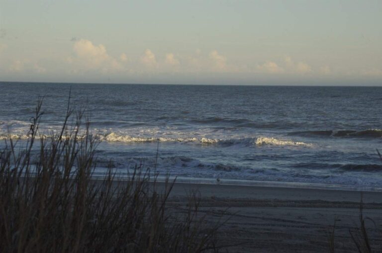
Photo: Alan Sterling, CC BY 2.0
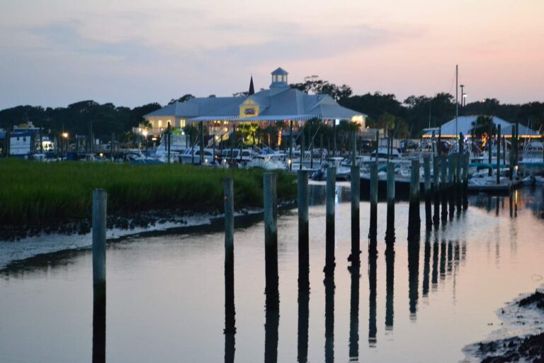
Photo: Sabine Fontana, CC BY 2.0
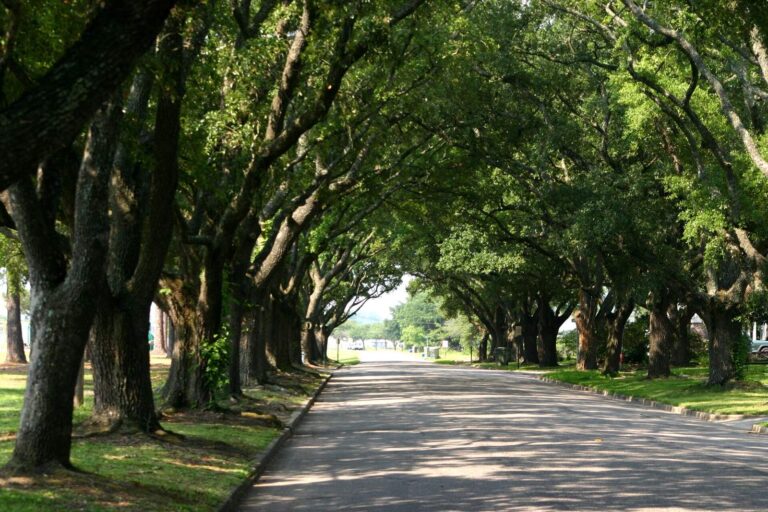
Photo: Pollinator at English Wikipedia, CC BY-SA 3.0


Photo: Gerry Dincher, CC BY-SA 2.0
Fishing around Horry County: the questions that come up
Where can a boat be launched in Horry County?
There are 29 landings and launches on SCDNR maps of the county.
Which lake in Horry County is biggest?
No lake page lies inside the county; Dargan's Pond, 50 miles from Conway, is the nearest.
What can be caught near Horry County according to SCDNR lists?
SCDNR access lists name Largemouth Bass on the most lake pages within 100 miles, then Redear Sunfish, Black Crappie and Bluegill.
Does Horry County have a bait and tackle listing?
31 listings, including A Reel Fix.
Which SC town hosts the Horry County seat?
Conway.
What does a fishing license cost for Horry County water?
Freshwater licenses run $10 for residents and $35 for visitors on the SCDNR fee page. The resident saltwater license is $15 a year.
What counties lie beside Horry County?
By distance: Marion County, Georgetown County and Dillon County.
Is there a crappie size limit across Horry County?
Statewide: Crappie: 20 daily, size 8 inches min. A guide row naming a lake can change it.
Which SCDNR region covers Horry County?
SCDNR Region 4, going by the majority of its SCDNR access records.
Does the guide print rules for Horry County waters?
4 waters with a page here have a guide row of their own, beginning with Great Pee Dee River.
Which tournaments come to Horry County lakes?
7 organizer entries on file; next is CATT Waccamaw River Fall Qualifier 3 on Waccamaw River, Nov. 28, 2026.
Which SCDNR records came from Horry County?
Redbreast Sunfish, 2-0 as listed, from Lumber River (1975).
Does Horry County have saltwater fishing?
Yes: 4 coastal water pages, 6 artificial reef areas and 8 saltwater piers.
Spend a Palmetto morning on Horry County water
River pages list SCDNR accesses and USGS flow.