Tallahatchie River Fishing
A river in Leflore, Quitman and Tallahatchie counties, Mississippi.
 Pick for largemouthPiscifun Chaos Pro CNC baitcasting reel25% OFFSale $97.99
Photo: Richard apple, CC BY-SA 3.0
Mississippi: before a first trip to the Tallahatchie River
Tallahatchie River, a river of Leflore, Quitman and Tallahatchie counties, appears in the state data through 2 ramps, 1 USGS gauge and 4 Corps locations. The Corps reporting list includes Tallahatchie River @ Lambert, MS and Tallahatchie River @ Locopolis. Staying in Sumner leaves you about 8 miles from the mapped point.
Ramp rows total 2 launches here. 1 gauge supply its flow figures.
MDWFP and MDMR access-point records and USGS or USACE gauge listings for Tallahatchie River (source), read November 19, 2026. No flowline length is published, so none is printed.
U.S. Census Bureau, 2020 Census counts (TIGERweb) and the 2023 Gazetteer, read November 19, 2026.
Mississippi: uSGS gauge readings for the Tallahatchie River
USGS has no current reading for these gauges.
USACE readings for Tallahatchie River @ Lambert, MS, Nov. 19, 2:00 a.m. EST.
USACE CWMS reporting API for Tallahatchie River @ Lambert, MS (water.usace.army.mil), readings as served with their time stamps, read November 19, 2026. Not live; elevations carry the datum the Corps lists.
Read each figure as one spot at one moment, with its time stamp.
USGS Water Data for the Nation, live through the site, retrieved on page view.
Putting a boat in at Tallahatchie River, Mississippi
The data hold no hours or charges for Tallahatchie River, and being listed does not mean a ramp is open.
MDWFP Fishing Dashboard boat ramps layer (ArcGIS service), read November 19, 2026. Lanes, hours and fees are not published; the fee type is a label only.
Rows to check before bagging fish at Tallahatchie River
For Tallahatchie River, the general creel table follows. The lake page can add its own line, copied below when it does. A lake with a special rule lists it on its MDWFP lake page; the rows printed here are the ones read on Nov. 19, 2026, and the agency page has the last word.
| Fish as printed | Daily limit as printed | Minimum size as printed | Special |
|---|---|---|---|
| Black bass (combined largemouth, spotted, smallmouth) | 10 | ||
| Sauger | 10 | ||
| Walleye | 3 | Harvest and possession of walleye prohibited in Lake Lamar Bruce, Elvis Presley Lake, Lake Monroe, Choctaw Lake (Choctaw County) (public-water-body page) and in the Old Tombigbee River and its tributaries north of Hwy 278 (Monroe, Itawamba, Prentiss counties) (Rule 1.4 A.3). Water-specific creel in waters table. | |
| Striped bass and striped bass hybrids | 6 | 15 in minimum | |
| Crappie (combined black and white) | 30 | Lake-specific crappie rules apply (e.g. 12 in / 10 per day on Sardis, Grenada, Enid, Arkabutla). | |
| Bream (combined bluegill, redear and other sunfish) | 100 | ||
| Alligator gar | 2 | Alligator gar harvest prohibited on Bee Lake (Holmes County). | |
| Paddlefish | 2 | must be less than 30 in (measured eye to fork of tail) | Paddlefish over 30 in must be released; no harvest in the Tenn-Tom Waterway, Tombigbee River and tributaries, or Pickwick Lake. |
| Catfish (blue, channel, flathead) | 10 only at MDWFP State Fishing Lakes and State Park Lakes; no creel limit on other waters | On border waters with Alabama and Tennessee: 1 catfish over 34 in per person per day. | |
| Any game or sport fish species not listed | no daily creel limit | Rule 1.4 A.1.b. | |
| All sturgeon (Alabama, Atlantic, pallid, shovelnose) | 0 (harvest and possession prohibited in all Mississippi waters) | Rule 1.4 A.7. |
Read on Nov. 19, 2026: MDWFP Rule 1.4 and the public water body pages are the only sources here, and any 2027 rule, fee or season is left out until MDWFP prints it.
MDWFP lists the resident all-game hunting and freshwater fishing license at $25 and the nonresident freshwater license at $68, with agent and process fees on top.
MDWFP statewide creel limits (Rule 1.4, updated April 2026) and public water body regulations (mdwfp.com), read November 19, 2026. Web pages summarize 40 Miss. Admin. Code Part 3; the rule text controls.
License prices from the MDWFP price page (mdwfp.com), read November 19, 2026. Agent and process fees are not included.
 For the largemouth herePiscifun AlinoX 300 low profile baitcaster34% OFFSale $104.99
Grouped near Tallahatchie River on the map
Other streams near the Tallahatchie River, Mississippi
- Cassidy Bayou8 miles west
- Yalobusha River28 miles southeast
- Big Sunflower River35 miles southwest
- Coldwater River (Tunica County)37 miles north
- Bogue Phalia53 miles southwest
Mississippi: restocking line and hooks near Tallahatchie River
- Mullen's Farm Supplybait and tackle shop, Charleston, 10 miles
- Oakland One Stopbait and tackle shop, Oakland, 18 miles
- Lakeside Storebait and tackle shop, Pope, 23 miles
- S and S Bait (Chuck's Stop)bait and tackle shop, Pope, 23 miles
- Wal Mart (Clarksdale)bait and tackle shop, Clarksdale, 25 miles
- Wal Mart (Grenada)bait and tackle shop, Grenada, 26 miles
Mississippi: where to sleep when fishing Tallahatchie River
- Sumner8 miles
- Charleston10 miles
- Tutwiler12 miles
Mississippi: which county holds Tallahatchie River
- Leflore Countyseat: Greenwood
- Quitman Countyseat: Marks
- Tallahatchie Countyseat: Charleston and Sumner
Piscifun hooks, extra line and pliers for an afternoon at Tallahatchie River


Piscifun and Amazon links are affiliate links; the site earns a commission on qualifying purchases.
Cypress banks and red clay shores around Tallahatchie River, photographed
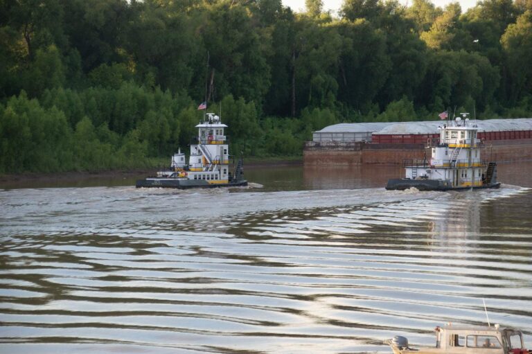
Photo: Michael Gaylard, CC BY 2.0
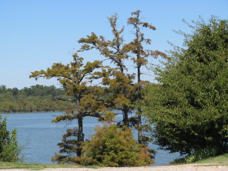
Photo: NatalieMaynor, CC BY 2.0

Photo: Kevin, CC BY 2.0
Tallahatchie River: the questions Magnolia State anglers raise first
Which gauges report for the Tallahatchie River?
In practice: USGS gauges on file: Tallahatchie River At Money, Ms. Each reports its own spot, not the whole river.
Which county lists the Tallahatchie River?
Plainly: Tallahatchie River runs through Leflore, Quitman and Tallahatchie counties.
Has MDWFP mapped a ramp on the Tallahatchie River?
Quick check: Anglers get 2 launches to choose from, starting with Paducah Wells Fishing Area on Tallahatchie River. No lanes, hours or fee amounts are printed.
Which statewide rows apply along the Tallahatchie River?
In practice: Rule 1.4 statewide limits apply as printed here, and no water-specific rule was found for this water. Some limits differ between rivers and lakes, so read the table and the current rule text.
Must I hold a Mississippi fishing license at the Tallahatchie River?
Plainly: MDWFP lists the resident all-game hunting and freshwater fishing license at $25 and the nonresident freshwater license at $68, with agent and process fees on top.
Which shop on our list is a short drive from the Tallahatchie River?
Quick check: Mullen's Farm Supply, about 10 miles away, is first on the list.
What community lies next to the Tallahatchie River?
In practice: Census data put Sumner nearest, roughly 8 miles off in a straight line.
Which waters lie a short way from the Tallahatchie River?
Plainly: Waters nearby with a page of their own: Cassidy Bayou, Yalobusha River and Big Sunflower River.
What pin do I set for the Tallahatchie River?
Quick check: The Directions button opens a map pinned at the coordinates on file for the Tallahatchie River. Access is never guaranteed, so call the owner or county first.
What do gauge readings for the Tallahatchie River tell me?
In practice: Gauges are on file, and the flow block prints each reading beside the time it was taken.
Put a Saturday on the calendar for the Tallahatchie River
Staying legal takes only what that page lists.