Antietam Creek Fishing
A stream in Washington County, Maryland.
 Pick for troutPiscifun Carbon X ultralight spinning reel19% OFFSale $56.99
Photo: Nicholas, CC BY 2.0
The Antietam Creek, by the agency records
Antietam Creek is a stream in Washington County; the records that place it include 2 USGS gauges and 10 stocking events. For fuel and a meal, St. James lies about 2 miles from it.
DNR pins no launch to this stream. Flow figures here rest on 2 USGS stations.
Maryland DNR access-site and trout-stocking records, special management layers and USGS or NOAA station listings for Antietam Creek (source), read November 20, 2026. No flowline length is published, so none is printed.
U.S. Census Bureau, 2020 Census counts (TIGERweb) and the 2023 Gazetteer, read November 20, 2026.
 For the trout herePiscifun Carbon XT ultralight spinning reel39% OFFSale $54.99
Flow readings for the Antietam Creek
USGS has no current reading for these gauges.
Treat each figure as one spot at one moment, with its time stamp.
USGS Water Data for the Nation, live through the site, retrieved on page view.
Facilities and permits noted for Antietam Creek
| Type as printed | County | Location or comment as printed |
|---|---|---|
| Put & Take | Washington |
Maryland DNR access-site and trout-stocking records, special management layers and USGS or NOAA station listings for Antietam Creek (source), read November 20, 2026. No flowline length is published, so none is printed.
Dated trout deliveries logged for Antietam Creek
10 stocking events are filed under Antietam Creek, spanning March 6, 2026 through Oct. 15, 2026, according to the feed read Nov. 20, 2026.
| Date | Fish | Number printed | Size printed | Status words |
|---|---|---|---|---|
| Oct. 15, 2026 | Rainbow trout/Golden rainbow trout | 500 | stocked, as listed by DNR | |
| May 6, 2026 | Rainbow trout/Golden rainbow trout | 400 | stocked, as listed by DNR | |
| May 1, 2026 | Rainbow trout/Golden rainbow trout | 400 | stocked, as listed by DNR | |
| April 22, 2026 | Rainbow trout/Golden rainbow trout | 400 | stocked, as listed by DNR | |
| April 15, 2026 | Rainbow trout/Golden rainbow trout | 400 | stocked, as listed by DNR | |
| April 10, 2026 | Rainbow trout/Golden rainbow trout | 400 | stocked, as listed by DNR | |
| April 1, 2026 | Rainbow trout/Golden rainbow trout | 400 | stocked, as listed by DNR | |
| March 23, 2026 | Rainbow trout/Golden rainbow trout | 400 | stocked, as listed by DNR | |
| March 12, 2026 | Rainbow trout/Golden rainbow trout/Brown trout | 400 | stocked, as listed by DNR | |
| March 6, 2026 | Rainbow trout/Golden rainbow trout/Brown trout | 400 | stocked, as listed by DNR |
The feed covers one season and ends at the last date above. DNR states that fall stocking is complete and that trout stocking can resume as early as February.
Stocking events from the Maryland DNR trout stocking feed behind its Trout Stocking page (DNR trout stocking), read November 20, 2026. DNR lists only the current season; the closure code is not interpreted.
Maryland: boat access around Antietam Creek
No ramp is pinned to Antietam Creek in the department access layers, so expect bank fishing or a carry-in.
Pier and bank access around Antietam Creek
- Antietam Creek – Mollies Hole Fishing Areashore fishing access
- Antietam Battlefield Park – Route 34 Bridge on Antietam Creekshore fishing access
- Antietam Creek – Millers Church Road Fishing Areashore fishing access
- Antietam Creek – Kiwanis Parkshore fishing access
- Antietam Creek – Funkstown Fishing Areashore fishing access
- Antietam Creek – Garis Shop Road Fishing Areashore fishing access
- Antietam Creek – Devils Backbone Parkshore fishing access
Hours and charges are left off, because the department file is not a status report.
DNR Maryland Water Access Sites layer (ArcGIS service), read November 20, 2026. Lanes, hours and fees are as the layer publishes them and are not a statement of condition.
Size and daily limits that reach Antietam Creek
The statewide freshwater table is the base for a day at Antietam Creek, with water-specific lines added underneath. Check the guide entry for any water you plan to fish: special rules are listed there, and the rows on this page copy only what was read.
| Fish as printed | Daily and possession as printed | Minimum size as printed | Special |
|---|---|---|---|
| American Eel | Daily—25; Possession—25 | 9 inches | |
| Baitfish (Including Madtoms) | Daily—35 in aggregate; Possession—35 in aggregate | None | |
| Bass (Largemouth and Smallmouth) | Daily—5 in aggregate; Possession—10 in aggregate | 12 inches or as provided for by special regulations. | Catch and Release is permitted at all times. Cannot be used as bait. |
| Carp | Daily—15; Possession—30 | None | |
| Chain Pickerel | Daily—5; Possession—10 | 14 inches | Cannot be used as bait. |
| Channel Catfish | Daily—5; Possession—10 | None | |
| Crappie | Daily—15; Possession—30 | None | |
| Herring (Alewife and Blueback) | Catch and Release is permitted at all times. | ||
| Muskellunge and Tiger Muskie | Daily—1; Possession—2 | 36 inches | Cannot be used as bait. |
| Northern pike | Daily—2; Possession—4 | 30 inches | Cannot be used as bait. |
| Saugeye | Daily—5; Possession—10 | 15 inches | |
| Shad (American/White and Hickory) | Catch and Release is permitted at all times. |
Source for the rules: the DNR-linked Maryland Guide pages (last updated Jan. to Oct. 2026), read Nov. 20, 2026; the guide abridges COMAR, so the Code controls.
DNR charges $32 for the resident nontidal license and $55 for the nonresident nontidal license, not counting any service fee.
Rules as summarized in the Maryland Guide to Fishing and Crabbing (DNR-linked eRegulations summary pages) and the DNR Fishing Regulations page (eregulations.com), read November 20, 2026. These are abridged summaries; the Code of Maryland Regulations (COMAR) text controls.
License fees from the 2026 table in the Maryland Guide to Fishing and Crabbing (eregulations.com), read November 20, 2026. Agent and service fees may apply.
What the MDE list says about Antietam Creek
The MDE advisory chart has 4 species on the list for Antietam Creek, naming Brown Trout, Large and Smallmouth Bass, Rock Bass and White Sucker (PCBs and PFOS); meal limits are on the chart.
Maryland Department of the Environment fish consumption advisories (mde.maryland.gov), chart PDF created May 18, 2026, page read November 20, 2026. Meal limits are on the MDE chart.
Sharing a watershed with Antietam Creek
Other runs near the Antietam Creek
- Beaver Creek3 miles east
- Conococheague Creek6 miles west
- Little Antietam Creek7 miles south
- Middle Creek10 miles east
- Fishing Creek13 miles east
Where to pick up bloodworms and minnows near Antietam Creek
- Beaver Creek Fly Shopfly shop, Hagerstown, 3 miles
- Precision Fly & Tacklefly shop, Hagerstown, 3 miles
- Academy Sports + Outdoorsbait and tackle shop, Hagerstown, 4 miles
- Dick's Sporting Goods, 17318 Valley Mall Rdbait and tackle shop, Hagerstown, 4 miles
- Dick's Sporting Goods, 17780 Garland Groh Blvdbait and tackle shop, Hagerstown, 5 miles
- Razors Edgebait and tackle shop, Hagerstown, 6 miles
Captains and guides who work the water at Antietam Creek
- David Kashuba (Dave the Fishpimp)fishing guide, Hagerstown, (443) 542-7609
Overnight stops within reach of Antietam Creek
- St. James2 miles
- Robinwood4 miles
- Hagerstown4 miles
County pages that mention Antietam Creek
- Washington Countyseat: Hagerstown
Piscifun rods and split-ring pliers for the drive across to Antietam Creek


Piscifun and Amazon links are affiliate links; the site earns a commission on qualifying purchases.
Ripples and reflections near Antietam Creek, pictured
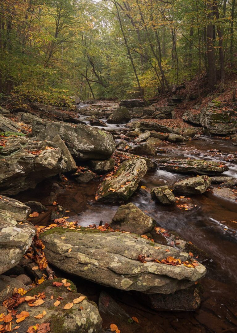
Photo: John Brighenti, CC BY 2.0


Photo: Environmental Protection Agency. 12/2/1970, Public domain

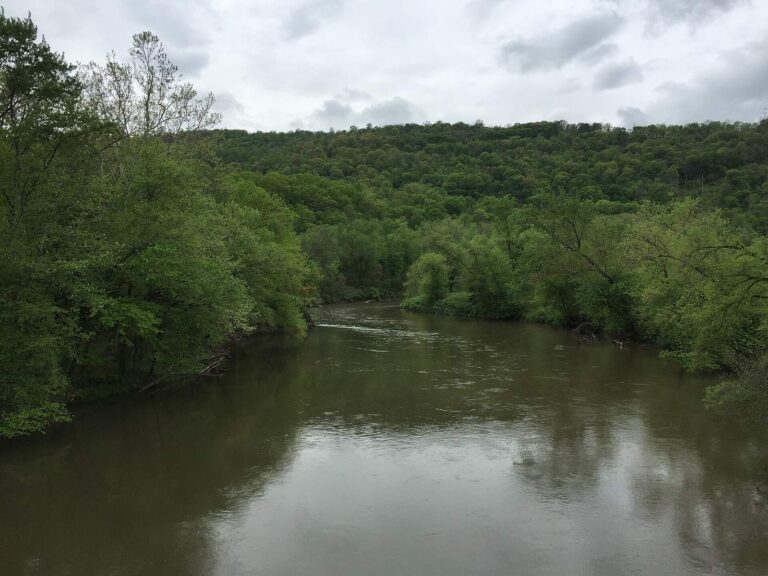
Photo: Famartin, CC BY-SA 4.0


Photo: Famartin, CC BY-SA 4.0

What to ask yourself before tying on a rig at Antietam Creek
Which USGS stations speak for Antietam Creek?
Plainly: USGS gauges on file: Antietam Creek Near Sharpsburg, Md and Antietam Creek Near Waynesboro, Pa. Each reports its own spot, not the whole stream.
Where is Antietam Creek pinned on the Maryland map?
Quick check: Antietam Creek runs through Washington County.
Has DNR mapped a launch on Antietam Creek?
In practice: No ramp is mapped on it, so plan on wading or bank fishing.
What is the Maryland keeper rule for Antietam Creek?
Plainly: The nontidal freshwater table applies as printed here; DNR also lists special management labels (Put and Take – no closure and Put & Take) tied to this water. Read the table and the current Code before keeping a fish.
Does a day at Antietam Creek need a license?
Quick check: DNR charges $32 for the resident nontidal license and $55 for the nonresident nontidal license, not counting any service fee.
Which shop stocks gear for a day at Antietam Creek?
In practice: Beaver Creek Fly Shop, about 3 miles away, is first on the list.
How far is the closest Census town from Antietam Creek?
Plainly: The nearest listed town is St. James, about 2 miles away as the crow flies.
Which other Maryland waters are near Antietam Creek?
Quick check: Close by, these have full pages: Beaver Creek, Conococheague Creek and Little Antietam Creek.
How do I get driving directions to Antietam Creek?
In practice: Hit Directions to open a map with Antietam Creek placed at its filed coordinates. Verify the road and the gate with whoever manages the land.
Does DNR stock trout in Antietam Creek?
Plainly: The feed lists 10 events for this water, the latest on Oct. 15, 2026. DNR posts only the season in progress and states that fall stocking is complete.
Where is current flow posted for Antietam Creek?
Quick check: Gauges are on file, and the flow block prints each reading beside the time it was taken.
Should I read a fish advisory before eating from Antietam Creek?
Short answer: The MDE advisory chart has 4 species on the list for Antietam Creek, naming Brown Trout, Large and Smallmouth Bass, Rock Bass and White Sucker (PCBs and PFOS); meal limits are on the chart.
Rig up for Antietam Creek
Staying legal takes what that page lists.