Fishing in Washington County, Maryland
County seat: Hagerstown. Census 2020 residents: 154,705.
- 24named waters
- 14ramps
- 9river pages
 Pick for troutPiscifun Carbon X ultralight spinning reel19% OFFSale $56.99
Photo of Cumberland: Famartin, CC BY-SA 4.0
Waters of Washington County, summarized
In Maryland, Washington County had 154,705 residents in 2020, and its courthouse stands in Hagerstown. Washington County spans 458 square miles of land and 9.6 square miles of water on the Gazetteer file. Blair Valley Lake leads the 24 waters mapped for Washington County by size. Flowing-water pages open with Potomac River (Washington County), Antietam Creek and Conococheague Creek.
Access in the county adds up to 14 boat ramps plus 45 piers and fishing points bank or pier sites. For Washington County, the 2026 trout table prints 43 stocking entries, the most recent Oct. 15, 2026. DNR prints rule rows by name for 4 waters of the county's page waters. The state line cuts across 1 water in this county.
U.S. Census Bureau, 2020 Census counts (TIGERweb) and the 2023 Gazetteer, read November 20, 2026. DNR Maryland Water Access Sites layer (ArcGIS service), read November 20, 2026. Lanes, hours and fees are as the layer publishes them and are not a statement of condition.
 For the trout herePiscifun Carbon XT ultralight spinning reel39% OFFSale $54.99
DNR trout stocking dated for Washington County
- Antietam CreekOct. 15, 2026, Rainbow/Golden, 500 fish
- Greenbrier LakeOct. 9, 2026, Rainbow/Golden, 1,500 fish
- Blairs Valley LakeOct. 8, 2026, Rainbow/Golden, 1,500 fish
- Beaver CreekMay 8, 2026, Rainbow/Golden, 500 fish
- Antietam CreekMay 6, 2026, Rainbow/Golden, 400 fish
- Antietam CreekMay 1, 2026, Rainbow/Golden, 400 fish
- Licking CreekApril 27, 2026, Rainbow/Golden, 500 fish
- Licking CreekApril 27, 2026, Rainbow/Golden, 500 fish
DNR publishes only the current season; these rows run to the last delivery of 2026. Maryland stocking page
Stocking events from the Maryland DNR trout stocking feed behind its Trout Stocking page (DNR trout stocking), read November 20, 2026. DNR lists only the current season; the closure code is not interpreted.
Pin by pin: Washington County water on the map in Maryland
DNR Maryland Water Access Sites layer (ArcGIS service), read November 20, 2026. Lanes, hours and fees are as the layer publishes them and are not a statement of condition. Water pins sit at the point DNR or the USGS gives for each water.
Maryland: lakes inside Washington County
| Lake | Size | Access points | Kind | Operator or DNR label |
|---|---|---|---|---|
| Greenbrier Lake | about 28 acres on the DNR layer | 2 | lake | Maryland Department of Natural Resources |
| Indian Springs Pond | about 26 acres on the DNR layer | 1 | pond | Maryland Department of Natural Resources |
| Brownsville Pond | no size printed | 1 | pond | not printed |
| Pangborn Pond | no size printed | 1 | pond | City of Hagerstown |
| Sharpsburg Community Pond | no size printed | 1 | pond | Town of Sharpsburg |
Acres as stated in the DNR hotspot page text for this water (DNR hotspot page), read November 20, 2026. The DNR Maryland Lakes polygon gives a different figure, so each is labeled with its source. Waters with no DNR acreage show the layer or mapped outline figure instead, never merged. Maryland DNR record for this water (Maryland DNR source), read November 20, 2026.
Creeks and runs of Washington County
- Potomac River (Washington County)54 access points, 4 USGS gauges
- Antietam Creek7 access points, 2 USGS gauges, stocking history
- Conococheague Creek2 access points, 1 USGS gauge
- Beaver Creek1 access point, stocking history
- Israel CreekDNR rule rows, 1 access point, stocking history
- Licking Creek1 access point, 1 USGS gauge, stocking history
- Little Antietam Creek1 access point, stocking history
- Little Tonoloway Creek1 access point, stocking history
- Sideling Hill Creek1 access point, 1 USGS gauge, stocking history
Stage and flow gauges across Washington County for Maryland anglers
| USGS gauge | Latest reading | Time (ET) |
|---|---|---|
| Sideling Hill Creek Near Bellegrove, Md | 3 cfs, 0.34 ft gage height | Nov 21 6:00 pm |
| Potomac River At Hancock, Md | 777 cfs, 3.05 ft gage height | Nov 21 6:15 pm |
| Tonoloway Creek Near Hancock, Md | 6 cfs, 1.59 ft gage height | Nov 21 5:45 pm |
US Geological Survey provisional data, retrieved Nov 21, 2026 7:07 pm ET. Provisional readings can be revised.
Maryland DNR access-site and trout-stocking records, special management layers and USGS or NOAA station listings for this water (source), read November 20, 2026. No flowline length is published, so none is printed. USGS Water Data for the Nation, live through the site, retrieved on page view.
Ramps mapped in Washington County
- Big Slackwater Fishing Area on Potomac River (Washington County)boat ramp, concrete surface; Washington County
- C&O Canal – Hancock Fishing Area on Potomac River (Washington County)boat ramp; Washington County
- Dargan Bend Fishing Area on Potomac River (Washington County)boat ramp, concrete surface; Washington County
- Fort Frederick State Park / Big Pool boat rampboat ramp, gravel surface; Washington County
- Four Locks Fishing Area on Potomac River (Washington County)boat ramp, concrete surface; Washington County
- Greenbrier State Park on Greenbrier Lakeboat ramp, concrete surface; Washington County
- Indian Springs WMA / Blairs Valley Lake Fishing Area on Blair Valley Lakeboat ramp, concrete surface; Washington County
- Little Tonoloway / Hancock Fishing Area on Potomac River (Washington County)boat ramp, concrete surface; Washington County
- Lock 38 Fishing Area on Potomac River (Washington County)boat ramp, concrete surface; Washington County
- McCoys Ferry Fishing Area on Potomac River (Washington County)boat ramp, concrete surface; Washington County
- Snyders Landing on Potomac River (Washington County)boat ramp, concrete surface; Washington County
- Taylors Landing – East on Potomac River (Washington County)boat ramp, concrete surface; Washington County
- Taylors Landing – West on Potomac River (Washington County)boat ramp, concrete surface; Washington County
- Williamsport Fishing Area on Potomac River (Washington County)boat ramp, concrete surface; Washington County
Public docks in Washington County
- Antietam Battlefield Park – Route 34 Bridge on Antietam Creekshore fishing access; Washington County
- Antietam Creek – Devils Backbone Parkshore fishing access; Washington County
- Antietam Creek – Funkstown Fishing Areashore fishing access; Washington County
- Antietam Creek – Garis Shop Road Fishing Areashore fishing access; Washington County
- Antietam Creek – Kiwanis Parkshore fishing access; Washington County
- Antietam Creek – Millers Church Road Fishing Areashore fishing access; Washington County
- Antietam Creek – Mollies Hole Fishing Areashore fishing access; Washington County
- Beaver Creek – Jackson Fisheries Management Areashore fishing access; Washington County
- Big Pool Fishing Area on Big Pool and Beaver Pondshore fishing access; Washington County
- Big Slackwater Fishing Area on Potomac River (Washington County)shore fishing access; Washington County
- Brownsville Community Pond Fishing Area on Brownsville Pondshore fishing access; Washington County
- C&O Canal – Four Locks Fishing Area on Potomac River (Washington County)shore fishing access; Washington County
- C&O Canal – Gift Road Fishing Area on Potomac River (Washington County)shore fishing access; Washington County
- C&O Canal – Hancock Fishing Area on Potomac River (Washington County)shore fishing access; Washington County
- C&O Canal – Lock #56 Fishing Areashore fishing access; Washington County
- C&O Canal – Snyders Landing on Potomac River (Washington County)shore fishing access; Washington County
- Conococheague Creek – Route 40 Fishing Areashore fishing access; Washington County
- Cushwa Basin Fishing Areashore fishing access; Washington County
- Greenbrier State Park on Greenbrier Lakefishing pier; Washington County
- Indian Springs Community Pond Fishing Area on Indian Springs Pondshore fishing access; Washington County
- Indian Springs Wildlife Management Area on Blair Valley Lakeshore fishing access; Washington County
- Israel Creek Parking Fishing Areashore fishing access; Washington County
- Kemps Mill Park on Conococheague Creekshore fishing access; Washington County
- Kirkwood Park on Little Tonoloway Creekshore fishing access; Washington County
DNR Maryland Water Access Sites layer (ArcGIS service), read November 20, 2026. Lanes, hours and fees are as the layer publishes them and are not a statement of condition.
Water in Washington County that rides on this page in Maryland
Still water: lakes, ponds and impoundments in Washington County
| Water | Kind | Size | DNR label | Access | Map pin |
|---|---|---|---|---|---|
| Blair Valley Lake | lake | 2,182 acres | Maryland Department of Natural Resources | 2 | 39.6977, -77.9422 |
| Lake Royer | lake | about 23 acres on the DNR layer | not printed | 0 | 39.7108, -77.4954 |
| Big Pool | pond | no size printed | not printed | 1 | 39.6164, -78.0135 |
| Big Pool and Beaver Pond | pond | no size printed | Maryland Department of Natural Resources | 1 | 39.6074, -78.0069 |
| Boonsboro Pond | pond | no size printed | Town of Boonsboro | 1 | 39.5052, -77.6584 |
| Cushwa Basin | pond | no size printed | National Park Service | 1 | 39.6008, -77.8263 |
| Ft. Ritchie Pond | pond | no size printed | not printed | 0 | 39.7070, -77.4985 |
| Little Pool | pond | no size printed | not printed | 0 | 39.6852, -78.1109 |
Maryland DNR record for this water (Maryland DNR source), read November 20, 2026. Outline area from the USGS National Hydrography Dataset polygon (NHD service; mapped area, not a surveyed surface-acre figure), read November 20, 2026.
Creeks, branches and rivers in Washington County
| Water | Kind | Size | DNR label | Access | Map pin |
|---|---|---|---|---|---|
| Marsh Run | creek | no size printed | not printed | 0 | 39.5146, -77.7772 |
| Tonoloway Creek | creek | no size printed | not printed | 0 | 39.7064, -78.1527 |
Maryland DNR record for this water (Maryland DNR source), read November 20, 2026. Outline area from the USGS National Hydrography Dataset polygon (NHD service; mapped area, not a surveyed surface-acre figure), read November 20, 2026.
Special limits on Washington County lakes and rivers in Maryland
The numbers on this page are the 2026 limits printed in the Maryland Guide as read on Nov. 20, 2026; a water with its own rule says so, and no 2027 figure is given.
Rules as summarized in the Maryland Guide to Fishing and Crabbing (DNR-linked eRegulations summary pages) and the DNR Fishing Regulations page (eregulations.com), read November 20, 2026. These are abridged summaries; the Code of Maryland Regulations (COMAR) text controls.
State-record entries near Washington County
| Species | Weight as printed | Water | Date | Division |
|---|---|---|---|---|
| Chesapeake Channa (northern Snakehead) | 21.8 lbs. | Susquehanna River | 6/07/2025 | Invasive |
| Longnose Gar | 20.5 lbs. | Marshyhope Creek | 2/08/2025 | Chesapeake Bay Division |
State records from the DNR record pages (dnr.maryland.gov) as printed in the Maryland Guide (eregulations.com), read November 20, 2026. Angler names are not printed.
Organized events fished in Washington County for Maryland anglers
| Date | Event | Water | Organizer |
|---|---|---|---|
| March 20, 2027 | Bass Angler Coalition open bass tournament, Potomac River | Potomac River | Bass Angler Coalition |
| April 10, 2027 | Bass Angler Coalition open bass tournament, Potomac River | Potomac River | Bass Angler Coalition |
| April 25, 2027 | Bass Angler Coalition open bass tournament, Potomac River | Potomac River | Bass Angler Coalition |
| May 8, 2027 | Phoenix Bass Fishing League Team/Solo Series, Potomac River (2027) | Potomac River | Major League Fishing (Phoenix Bass Fishing League) |
| May 15, 2027 | Bass Angler Coalition open bass tournament, Potomac River | Potomac River | Bass Angler Coalition |
| May 16, 2027 | Bass Angler Coalition open bass tournament, Potomac River | Potomac River | Bass Angler Coalition |
| June 12, 2027 | Bass Angler Coalition open bass tournament, Potomac River | Potomac River | Bass Angler Coalition |
| June 19, 2027 | Phoenix Bass Fishing League Team/Solo Series, Potomac River (2027) | Potomac River | Major League Fishing (Phoenix Bass Fishing League) |
| Nov. 1, 2026 | Kickin Bass club bass tournament, Potomac River | Potomac River | Kickin Bass |
| Oct. 25, 2026 | Antietam Bassmasters open bass tournament, Potomac River | Potomac River | Antietam Bassmasters |
Event as listed by the organizer (source), read November 20, 2026.
Maryland: where to buy bait in Washington County
Tackle counters within a short detour of Washington County
- Academy Sports + Outdoorsbait and tackle shop, Hagerstown
- Beaver Creek Fly Shopfly shop, Hagerstown
- Dick's Sporting Goods, 17780 Garland Groh Blvdbait and tackle shop, Hagerstown
- Dick's Sporting Goods, 17318 Valley Mall Rdbait and tackle shop, Hagerstown
- Precision Fly & Tacklefly shop, Hagerstown
- Razors Edgebait and tackle shop, Hagerstown
- Molly's Holefishing pier, Washington County
Booking a trip on Washington County
- David Kashuba (Dave the Fishpimp)fishing guide, Hagerstown, (443) 542-7609
Business directory and operator listings (city of business), read November 20, 2026. Guides appear as businesses; no license or permit status is implied.
Grouped close to Washington County
Maryland: places to stay around Washington County
- Hagerstown2020 count 43,527
- Halfway2020 count 11,896
- Robinwood2020 count 7,397
- Fountainhead-Orchard Hills2020 count 6,189
- St. James2020 count 4,757
- Boonsboro2020 count 3,799
- Maugansville2020 count 3,669
- Smithsburg2020 count 2,977
- Paramount-Long Meadow2020 count 2,658
- Williamsport2020 count 2,083
- Hancock2020 count 1,557
- Keedysville2020 count 1,213
What lies beside Washington County
- Frederick County24 miles out, heading east
- Carroll County43 miles out, heading east
- Montgomery County46 miles out, heading southeast
- Allegany County47 miles out, heading west
Map grouping for Washington County
The western Maryland group is a editorial grouping of whole counties, and Washington County is inside it.
This week around Washington County
Maryland fishing this week
Maryland stocking history
Maryland fish advisories
Piscifun tackle picked for a marsh-edge morning at Washington County


Piscifun and Amazon links are affiliate links; the site earns a commission on qualifying purchases.
Tidal creeks and ramps by Washington County through a lens
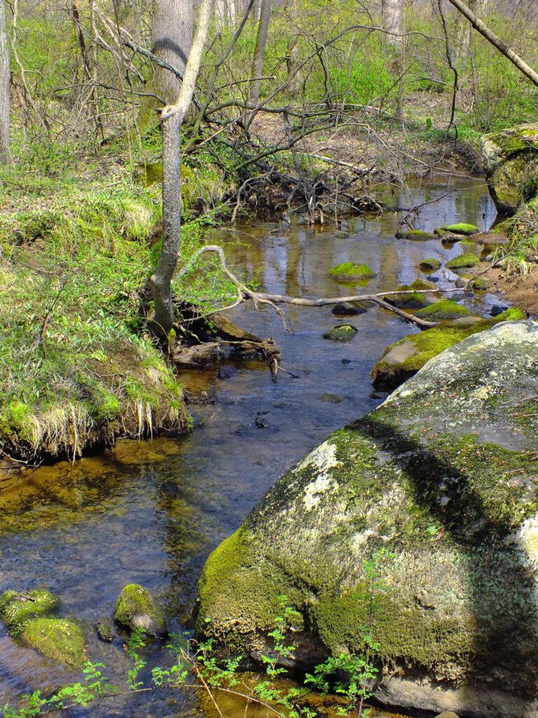
Photo: Nicholas, CC BY 2.0

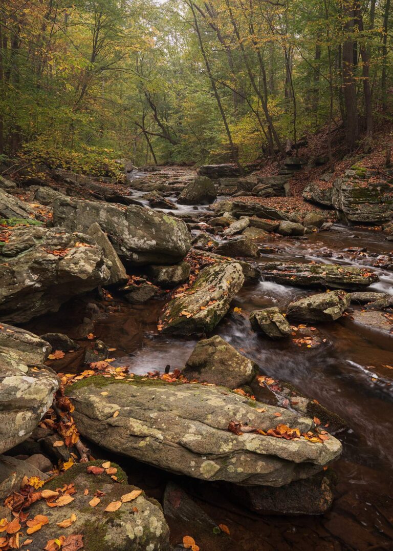
Photo: John Brighenti, CC BY 2.0


Photo: John Brighenti, CC BY 2.0


Photo: Environmental Protection Agency. 12/2/1970, Public domain

Before you fish Washington County, the points that come up most
Which landings does Washington County use in Maryland?
Launch data for the county names 14 ramps.
Maryland: Which water has the most acreage in Washington County?
Blair Valley Lake (2,182 acres).
Does DNR list a species for waters in Washington County?
The county stocking rows name rainbow trout/golden rainbow trout and rainbow trout/golden rainbow trout/brown trout; a stocking row shows what a hatchery delivered, not a catch.
Which counters in Washington County stock rods and reels in Maryland?
Academy Sports + Outdoors opens the list of 7.
Where are the offices of Washington County found in Maryland?
Its seat: Hagerstown.
Maryland: Which license goes in my wallet for Washington County?
Anglers 16 and older need a license; DNR prints $32 for a resident nontidal sport fishing license and $55 for a nonresident nontidal license, with service fees extra where they apply.
After Washington County, which county should I open next in Maryland?
County pages nearest by distance: Frederick County, Carroll County and Montgomery County.
Maryland: What is the daily limit in Washington County?
Limits come from the DNR statewide tables unless the water has a row of its own, and a water-specific row replaces the statewide limit for the fish it names; each lake and river page on this site prints its rows. The numbers on this page are the 2026 limits printed in the Maryland Guide as read on Nov. 20, 2026; a water with its own rule says so, and no 2027 figure is given.
What of the waters in Washington County sit in the tables above in Maryland?
Yes. All 24 waters named in DNR and USGS records for the county sit on this page, linked or pinned.
Which Washington County lakes carry water-specific limits in Maryland?
Rule tables name 4 waters that have pages on this site, starting with Greenbrier Lake.
Which waters in Washington County have stocking history?
The 2026 trout stocking table lists 43 deliveries for the county, the latest dated Oct. 15, 2026; DNR publishes only the current season, and fall stocking is complete.
Which tournament organizers use Washington County waters in Maryland?
28 entries on file; the next comes Bass Angler Coalition open bass tournament, Potomac River on Potomac River, March 20, 2027.
Plan a Maryland fishing day in Washington County
In Maryland, access rows repeat DNR details with directions.