Fishing near Georgetown, Kentucky
City, Scott County. Census 2020 residents: 37,086.
- 2 milesScott County Park
- 8ramps within 15 mi
- 4rivers within 20 mi
 Pick for catfishPiscifun LumiCat II catfish rod48% OFFSale $114.99
Photo: Warren LeMay, CC BY-SA 2.0
Casting a line near Georgetown
Census figures for 2020 put 37,086 people in the Scott County city of Georgetown. It doubles as the Scott County seat of government. About 2 miles southwest of town sits Scott County Park, the nearest lake covered here. Among nearby lakes, Corinth Lake is the biggest at 84 acres.
The shortest tow runs 3 miles to Richard O. Winder Ramp on North Fork Elkhorn Creek. The closest stream page is the Elkhorn Creek, 15 miles away. Shore casters drive about 2 miles to Scott County Park Lake Fishing Pier. Scott County Park, roughly 2 miles off, gets FINs catfish or trout. Herrington Lake Tailwater puts dam releases within 32 miles.
U.S. Census Bureau, 2020 Census counts (TIGERweb) and the 2023 Gazetteer, read November 10, 2026. Straight-line miles from the Census place point.
 For the catfish herePiscifun Chaos XS round baitcaster36% OFFSale $57.99
Corps and state lakes driving distance from Georgetown
| Lake | From Georgetown | Size | KDFWR ramps | Kind | Fish in the KDFWR table |
|---|---|---|---|---|---|
| Scott County Park | 2 miles southwest | 2.4 acres | 0 | FINs lake | largemouth bass, rainbow trout, bluegill |
| Lusby Lake | 3 miles southwest | 2.3 acres | 0 | FINs lake | largemouth bass, rainbow trout, bluegill |
| Kentucky Horse Park | 8 miles south | about 5.6 acres of mapped outline | 0 | FINs lake | largemouth bass, rainbow trout, bluegill |
| Kleber WMA Pond | 14 miles west | 2.4 acres | 0 | WMA pond group | none in the table |
| Corinth Lake | 17 miles north | 84 acres | 1 | lake | black crappie, redear sunfish, white crappie |
| Jacobson Park Lake | 20 miles south | 46 acres | 1 | FINs lake | largemouth bass, rainbow trout, bluegill |
Acreage as KDFWR notes it on the this water waterbody page (KDFWR), read November 10, 2026. Waters with no KDFWR acre note print their mapped outline instead.
Floatable streams near Georgetown
- Elkhorn Creek15 miles, Blue Water Trail, special limits, 4 KDFWR access sites, 1 USGS gauge
- Stoner Creek16 miles, 1 KDFWR access site, 1 USGS gauge
- Kentucky River (Lower)16 miles, 27 KDFWR access sites, 9 USGS gauges
- South Fork Licking River18 miles, Blue Water Trail, 5 KDFWR access sites, 2 USGS gauges
Stream gauges close to Georgetown
| USGS gauge | Latest reading | Time (ET) |
|---|---|---|
| North Elkhorn Creek At Georgetown, Ky | 32 cfs, 3.95 ft gage height | Nov 11 5:45 pm |
| Royal Springs At Georgetown, Ky | 1 cfs, 4.07 ft gage height | Nov 11 5:50 pm |
| Eagle Creek At Sadieville, Ky | 1 cfs, 1.23 ft gage height | Nov 11 6:15 pm |
US Geological Survey provisional data, retrieved Nov 11, 2026 6:33 pm ET. Provisional readings can be revised.
KDFWR fishing waterbody list (app.fw.ky.gov), read November 10, 2026. USGS Water Data for the Nation, live through the site, retrieved on page view.
Georgetown ramps and lakes, charted
KDFWR Fishing Access Sites in Kentucky layer (ArcGIS service), read November 10, 2026. Census place point.
Boat put-ins closest to Georgetown
- Richard O. Winder Ramp on North Fork Elkhorn Creek3 miles, North Fork Elkhorn Creek, boat ramp, paved, single lane
- Oser Landing on North Fork Elkhorn Creek3 miles, North Fork Elkhorn Creek, boat ramp, paved, single lane
- Great Crossings Ramp on North Fork Elkhorn Creek5 miles, North Fork Elkhorn Creek, boat ramp, paved, single lane
- Robinson Dam Access on North Fork Elkhorn Creek6 miles, North Fork Elkhorn Creek, carry-down launch
- Big Eagle Creek Ramp9 miles, Eagle Creek, boat ramp, paved, single lane
- Switzer Covered Bridge Carry-Down Launch on North Fork Elkhorn Creek12 miles, North Fork Elkhorn Creek, carry-down launch
- Lair Ramp on South Fork Licking River14 miles, South Fork Licking River, boat ramp, paved, single lane
- Elkhorn Campground Access15 miles, Elkhorn Creek, carry-down launch
Shore casting close to Georgetown
- Scott County Park Lake Fishing Pier2 miles, Scott County Park, fishing pier
- Scott County Park Lake2 miles, Scott County Park, bank access
- Lusby Lake Bank Access2 miles, Lusby Lake, bank access
- Veterans Memorial WMA Pond4 miles, Veterans Memorial WMA, bank access
- Kentucky Horse Park Alltech Pond7 miles, Kentucky Horse Park, bank access
- Kentucky Horse Park-Rolex Lake8 miles, Kentucky Horse Park, bank access
KDFWR Fishing Access Sites in Kentucky layer (ArcGIS service), read November 10, 2026.
Neighborhood fishing lakes around Georgetown
| Lake | Distance | Trout by month | Catfish by month |
|---|---|---|---|
| Scott County Park | 2 miles | Feb 500, Mar 500, Nov 500 | Mar 500, Apr 500, May 500, Jun 500 |
| Lusby Lake | 3 miles | Feb 500, Mar 500, Nov 500 | Mar 500, Apr 500, May 500, Jun 500 |
| Kentucky Horse Park | 8 miles | Feb 1,500, Nov 1,500 | Apr 1,100, Jun 1,100 |
Spillway fishing a drive from Georgetown
- Herrington Lake Tailwater32 miles, below Herrington Lake
2026 Kentucky Fishing & Boating Guide (Regulations Summary March 2026 to February 2027, updated September 2026, p. 6; KDFWR PDF), read November 10, 2026.
What the 2026 guide lets anglers near Georgetown keep
Around Georgetown, the guide's statewide limits apply wherever a water has no special regulation. Budget $24.31 for the resident annual license or $58.14 for the out-of-state version.
| Species | Daily | Possession | Minimum size |
|---|---|---|---|
| Largemouth Bass | 6* | 12* | 12" |
| Smallmouth Bass | 6* | 12* | 12" |
| Kentucky (Spotted) Bass | 6* | 12* | none |
| Coosa Bass | 6* | 12* | none |
| Rock Bass | 15 | 30 | none |
| Redear Sunfish | 20 | 40 | none |
| Walleye, Sauger, and their Hybrids | 6* | 12* | 14" |
| Muskellunge | 1 | 2 | 30" |
| Chain Pickerel | 5 | 10 | none |
| White & Hybrid Striped Bass | 15** | 30** | none** |
- Scott County ParkLargemouth Bass: Must be 15 inches or over – Limit 1 per angler
- Lusby LakeLargemouth Bass: Must be 15 inches or over – Limit 1 per angler
- Kentucky Horse ParkLargemouth Bass: Must be 15 inches or over – Limit 1 per angler
- Corinth LakeBlack Crappie: Statewide Regulations Apply
- Jacobson Park LakeLargemouth Bass: Must be 15 inches or over – Limit 1 per angler
2026 Kentucky Fishing & Boating Guide (Regulations Summary March 2026 to February 2027, updated September 2026; KDFWR PDF), read November 10, 2026. License prices as printed in the 2026 Kentucky Fishing & Boating Guide, p. 2 (2026 CPI-adjusted fees; KDFWR PDF), read November 10, 2026.
Record-list waters near Georgetown
| Species | Weight as listed | Water | Date |
|---|---|---|---|
| Bighead Carp | 65.06 lbs | Kentucky River (Lower) | 07/18/2020 |
| Goldeye | 2.64 lbs | Kentucky River (Lower) | 04/21/2001 |
| White Catfish | 5.27 lbs | Guist Creek Lake | 10/11/2016 |
| Saugeye | 9.03 lbs | Bullock Pen Lake | 03/21/2021 |
Kentucky state record fish as listed by KDFWR (record list), read November 10, 2026. Record waters within 50 miles.
Bait counters handy to Georgetown
Bait and tackle on the way to Georgetown
- Bill's Live Fish Farmbait and tackle shop, Georgetown, 7 miles
- Ole Hookers Bait & Tackle Barbait and tackle shop, Lexington, 15 miles
- Weekend Warroir Fish & Tacklebait and tackle shop, Stamping Ground
Yellow Pages and Kentucky tourism listings; miles only where the listing gives an exact address point, read November 10, 2026.
In the same corner as Georgetown
More Kentucky towns near Georgetown
- Midway11 miles, 2020 count 1,718
- Paris15 miles, 2020 count 10,171
- Cynthiana15 miles, 2020 count 6,333
- Lexington16 miles, 2020 count 322,570
- Versailles18 miles, 2020 count 10,347
Reservoirs and small lakes around Georgetown
- Scott County Park2 miles
- Lusby Lake3 miles
- Kentucky Horse Park8 miles
- Kleber WMA Pond14 miles
- Scott Countycounty page
Piscifun tackle set aside for a day on Georgetown


Piscifun and Amazon links are affiliate links; the site earns a commission on qualifying purchases.
Bluegrass and coalfield water near Georgetown, on film

Photo: Warren LeMay, CC BY-SA 2.0

Photo: Rich Bowen, CC BY 2.0

Photo: Warren LeMay, CC BY-SA 2.0
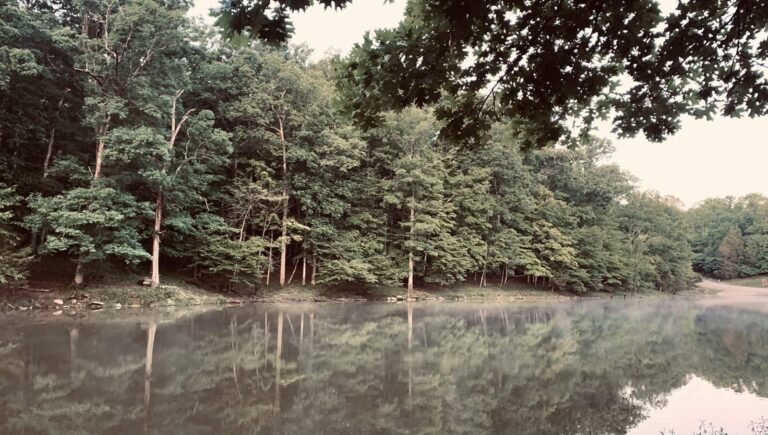
Photo: Alissa Weaver, CC0 1.0
Questions from rod-carrying guests in Georgetown
Which KDFWR-covered lake sits closest to Georgetown?
Scott County Park, about 2 miles southwest.
Is there a public boat ramp near Georgetown?
Richard O. Winder Ramp on North Fork Elkhorn Creek, 3 miles away, on North Fork Elkhorn Creek.
Is there a KDFWR fishing pier near Georgetown?
Scott County Park Lake Fishing Pier, 2 miles away (fishing pier).
Where can I buy bait near Georgetown, Kentucky?
Bill's Live Fish Farm, one of 3 listings nearby.
Which Kentucky county is Georgetown part of?
Scott County. It is also a county seat.
What license do visitors to Georgetown need?
An annual Kentucky license runs $24.31 for residents; nonresidents are charged $58.14.
Where else in Kentucky could I stay near Georgetown?
Midway (11 miles), Paris (15 miles) and Cynthiana (15 miles).
What Kentucky bass rule applies around Georgetown?
Statewide daily limit 6*, possession 12*, minimum size 12". Lakes with a special regulation differ.
Which Kentucky river is closest to Georgetown?
Elkhorn Creek lies roughly 15 miles from town.
Which FINs lake is closest to Georgetown?
Scott County Park, 2 miles away, on the FINs stocking table.
How far is the nearest dam tailwater from Georgetown?
Herrington Lake Tailwater lies roughly 32 miles from town.
Head for the water from Georgetown
River pages show KDFWR access sites and USGS flow.