Fishing in Pulaski County, Kentucky
County seat: Somerset. Census 2020 residents: 65,034.
- 2lake pages
- 21launch sites
- 1river pages
 Pick for crappiePiscifun Carbon X ultralight spinning reel28% OFFSale $57.99
Photo of Lake Cumberland: U.S. Army Corps of Engineers Nashville District, CC BY-SA 2.0
First things to know about angling in Pulaski County
The 2020 Census counted 65,034 residents in Pulaski County, whose seat is Somerset. Its Gazetteer footprint is 658 square miles of land and 19.1 of water. 2 lakes in the county carry a full write-up here, and Lake Cumberland is the largest.
KDFWR records 21 launch sites and 0 pier or bank sites across the county. Wading and floating options include Buck Creek. Paddlers can follow Buck Creek, a KDFWR Blue Water Trail.
U.S. Census Bureau, 2020 Census counts (TIGERweb) and the 2023 Gazetteer, read November 10, 2026. KDFWR Fishing Access Sites in Kentucky layer (ArcGIS service), read November 10, 2026.
Every KDFWR pin that falls in Pulaski County
KDFWR Fishing Access Sites in Kentucky layer (ArcGIS service), read November 10, 2026. Lake points are the mean of each water’s KDFWR access sites.
Lake write-ups for Pulaski County
| Lake | Size | KDFWR ramps | Kind | Fish in the KDFWR table |
|---|---|---|---|---|
| Lake Cumberland | 47,688 acres | 63 | Corps reservoir | black crappie, white crappie, largemouth bass |
| Lake Cumberland – Upper | no KDFWR figure | 10 | lake | black crappie, white crappie, largemouth bass |
Lake pages are scarce inside Pulaski County, so the nearest ones over the line follow, measured from Somerset.
| Lake | From Somerset | Size | KDFWR ramps | Kind | Fish in the KDFWR table |
|---|---|---|---|---|---|
| Liberty Reservoir | 23 miles northwest | 79 acres | 1 | lake | none in the table |
| Laurel River Lake | 23 miles east | 5,768 acres | 8 | Corps reservoir | largemouth bass, black crappie, white crappie |
| Wood Creek Lake | 25 miles east | 625 acres | 1 | lake | black crappie, rainbow trout, redear sunfish |
| Lake Linville | 25 miles northeast | 356 acres | 1 | lake | saugeye |
| Cedar Creek Lake | 27 miles north | 792 acres | 5 | lake | largemouth bass, black crappie, redear sunfish |
| Corbin City Reservoir | 28 miles east | 74 acres | 0 | lake | none in the table |
Acreage as KDFWR notes it on the this water waterbody page (KDFWR), read November 10, 2026. Waters with no KDFWR acre note print their mapped outline instead. KDFWR fishing waterbody list (app.fw.ky.gov), read November 10, 2026.
 For the crappie herePiscifun Carbon XT ultralight spinning reel25% OFFSale $59.99
Which fish KDFWR tables list most near Pulaski County
Around Somerset, 40 miles out, KDFWR singles out largemouth bass on the most lakes.
KDFWR Special Fishing Regulations tables and guide stocking tables, counted per lake page within 40 miles; a regulation list, not a catch survey. KDFWR fishing waterbody list (app.fw.ky.gov), read November 10, 2026.
Smaller KDFWR and mapped lakes in Pulaski County
Another 1 named lakes and ponds sit in Pulaski County, shown here with their mapped size.
| Water | Size | Listed by |
|---|---|---|
| Pumphouse Pond | about 10 acres of mapped outline | Named Lakes layer |
Outline area from the KDFWR Named Lakes in Kentucky layer (ArcGIS service; GIS polygon area, not a KDFWR surface-acre figure), read November 10, 2026. KDFWR fishing waterbody list (app.fw.ky.gov), read November 10, 2026.
Current-fed water in Pulaski County
- Buck CreekBlue Water Trail, 3 KDFWR access sites, 1 USGS gauge
USGS stations within Pulaski County
| USGS gauge | Latest reading | Time (ET) |
|---|---|---|
| Buck Creek Near Shopville, Ky | 1.36 ft gage height | Nov 12 6:30 pm |
US Geological Survey provisional data, retrieved Nov 12, 2026 7:33 pm ET. Provisional readings can be revised.
KDFWR fishing waterbody list (app.fw.ky.gov), read November 10, 2026. USGS Water Data for the Nation, live through the site, retrieved on page view.
Paddle trails crossing Pulaski County
- Buck Creek24.5 miles as KDFWR lists them
KDFWR fishing waterbody list (app.fw.ky.gov), read November 10, 2026. KDFWR Blue Water Trails layer (ArcGIS service; miles as KDFWR lists them), read November 10, 2026.
KDFWR-listed ramps across Pulaski County
- Bent Road Fishing Access on Buck CreekBuck Creek, carry-down launch
- Buck Creek Marina on Lake Cumberland – UpperLake Cumberland – Upper, boat ramp, paved, single lane, courtesy dock, marina
- Burnside Island State Park Ramp on Lake CumberlandLake Cumberland, boat ramp, paved, multiple lanes, courtesy dock
- Burnside Marina on Lake CumberlandLake Cumberland, boat ramp, paved, single lane, courtesy dock, marina
- Cave Creek Recreation Area Boat Ramp on Lake Cumberland – UpperLake Cumberland – Upper, boat ramp, paved, single lane
- Dahl Road Fishing Access on Buck CreekBuck Creek, carry-down launch
- David H. Godby Boat Ramp on Lake CumberlandLake Cumberland, boat ramp, paved, single lane
- Echo Point Recreation Area Boat Ramp on Lake Cumberland – UpperLake Cumberland – Upper, boat ramp, paved, single lane
- Fishing Creek Recreation Area Boat Ramp on Lake CumberlandLake Cumberland, boat ramp, paved, multiple lanes, courtesy dock
- Garland Bend Hemlock Landing on Lake Cumberland – UpperLake Cumberland – Upper, boat ramp, paved, single lane
- Hail's Haven (upper Buck Creek) Boat Ramp on Lake Cumberland – UpperLake Cumberland – Upper, boat ramp, paved, single lane
- Jasper Bend Ramp on Lake Cumberland – UpperLake Cumberland – Upper, boat ramp, paved, single lane
- Lakeview Ramp on Lake CumberlandLake Cumberland, boat ramp, paved, single lane
- Lee's Ford Dock on Lake CumberlandLake Cumberland, boat ramp, paved, multiple lanes, marina
- Old Waitsboro Crossing Boat Ramp on Lake CumberlandLake Cumberland, boat ramp, paved, single lane, courtesy dock
- Omega Recreation Area Boat Ramp on Lake Cumberland – UpperLake Cumberland – Upper, boat ramp, paved, single lane
- Poplarville Road Fishing Access on Buck CreekBuck Creek, carry-down launch
- Pulaski Co. Park Ramp #2 on Lake CumberlandLake Cumberland, boat ramp, paved, single lane, marina
- Pulaski Co. Park Ramp on Lake CumberlandLake Cumberland, boat ramp, paved, single lane, marina
- Spring Water Access on Lake CumberlandLake Cumberland, boat ramp, paved, single lane, courtesy dock
- Waitsboro Recreation Area Boat Ramp on Lake CumberlandLake Cumberland, boat ramp, paved, multiple lanes, courtesy dock
KDFWR Fishing Access Sites in Kentucky layer (ArcGIS service), read November 10, 2026. KDFWR publishes fees as yes or no and lanes as single or multiple.
Pool and release figures across Pulaski County
Lake Cumberland
USACE Nashville District reading at Wolf Creek Dam for Lake Cumberland, November 10, 2026 20:00 UTC.
USACE Nashville District via USACE Access to Water (location page), latest values at retrieval November 10, 2026. Provisional.
Kentucky creel figures for Pulaski County
Where no special regulation is printed, Pulaski County water follows the statewide table from the 2026 guide. Kentuckians 16 and up pay $24.31 for a yearly license, while visitors pay $58.14.
| Species | Daily | Possession | Minimum size |
|---|---|---|---|
| Largemouth Bass | 6* | 12* | 12" |
| Smallmouth Bass | 6* | 12* | 12" |
| Kentucky (Spotted) Bass | 6* | 12* | none |
| Coosa Bass | 6* | 12* | none |
| Rock Bass | 15 | 30 | none |
| Redear Sunfish | 20 | 40 | none |
| Walleye, Sauger, and their Hybrids | 6* | 12* | 14" |
| Muskellunge | 1 | 2 | 30" |
| Chain Pickerel | 5 | 10 | none |
| White & Hybrid Striped Bass | 15** | 30** | none** |
| Striped Bass | 5 | 10 | 15" |
| Yellow Bass | none | none | none |
Waters in Pulaski County with their own limits
- Lake CumberlandBlack Crappie: Must be 10 inches or over, Statewide creel limits apply
- Lake Cumberland – UpperBlack Crappie: Must be 10 inches or over, Statewide creel limits apply
Kentucky special-regulation waters
2026 Kentucky Fishing & Boating Guide (Regulations Summary March 2026 to February 2027, updated September 2026; KDFWR PDF), read November 10, 2026. License prices as printed in the 2026 Kentucky Fishing & Boating Guide, p. 2 (2026 CPI-adjusted fees; KDFWR PDF), read November 10, 2026.
Heavyweight catches near Pulaski County
| Species | Weight as listed | Water | Date |
|---|---|---|---|
| Striped Bass (Rockfish) | 58.25 lbs | Lake Cumberland | 12/11/1985 |
| Walleye | 21.50 lbs | Lake Cumberland | 10/01/1958 |
Kentucky state record fish as listed by KDFWR (record list), read November 10, 2026.
Kentucky bass trail stops on Pulaski County water
Organizer pages link 5 events or results to Pulaski County water, and 1 have not happened yet.
| Date | Event | Water | Organizer |
|---|---|---|---|
| April 24, 2027 | KHSAA Reg 2 | Lake Cumberland | Kentucky High School Athletic Association (KHSAA), run with SAF and MLF |
| March 22, 2025 | SAF Kentucky State Championship (2025), Lake Cumberland (result) | Lake Cumberland | Student Angler Federation (SAF) |
| date not given in the release | Phoenix BFL Mountain Division event 3, Lake Cumberland (result) | Lake Cumberland | Major League Fishing (MLF) |
| date not given in the release | Columbia PFG High School Fishing National Championship on Lake Cumberland (result) | Lake Cumberland | Major League Fishing (MLF) High School Fishing |
| date not given in the release | Phoenix BFL Mountain Division event 5 (2025), Lake Cumberland (result) | Lake Cumberland | Major League Fishing (MLF) |
Organizer schedule and results pages, checked November 2026.
Bait counters scattered around Pulaski County
Pulaski County stores for line and hooks
- Fish-N-Skibait and tackle shop, Somerset
- Paul's Discountbait and tackle shop, Somerset
- Southern Tacklebait and tackle shop, Somerset
- Lee's Ford Resort Marinamarina, Nancy
- Safe Harbor Burnsidemarina, Burnside
- Spend-A-Day Marinamarina, Bronston
South Central Kentucky tackle shops
Booking a guided trip in Pulaski County
- DC Guide Servicesfishing guide, Somerset, (800) 804-5819
- Kentucky Striper Guide Servicefishing guide, Somerset
- Stevens Guide Servicefishing guide, Somerset, (606) 677-6631
Yellow Pages and Kentucky tourism listings (city of business), read November 10, 2026.
A little past Pulaski County
Settlements across Pulaski County with town pages
- Somerset2020 count 11,924
Across the county line from Pulaski County
- Rockcastle County23 miles northeast
- Casey County24 miles northwest
- Lincoln County25 miles north
- Laurel County25 miles east
Piscifun gear a Bluegrass State angler might carry to Pulaski County


Piscifun and Amazon links are affiliate links; the site earns a commission on qualifying purchases.
Lakes, tailwaters and floatable creeks around Pulaski County, pictured
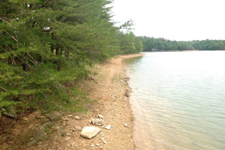
Photo: U.S. Army Corps of Engineers Nashville District, CC BY-SA 2.0
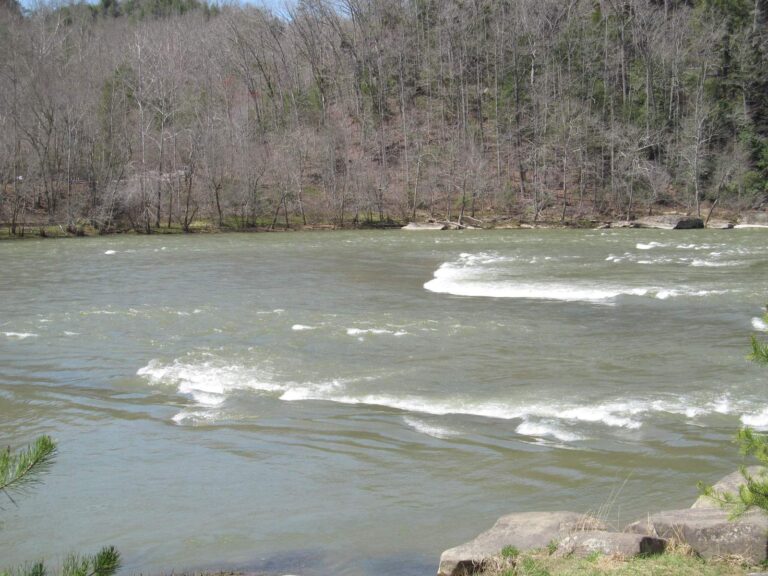
Photo: Doug Kerr, CC BY-SA 2.0
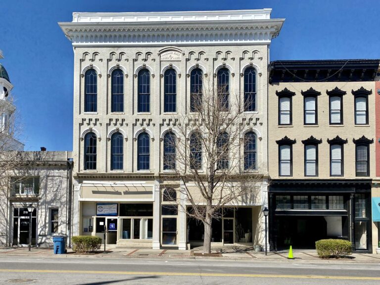
Photo: Warren LeMay, CC BY-SA 2.0

Photo: Stewart Bowman, Public domain
Sorting fact from rumor about Pulaski County fishing
Where can a bass boat go in the water in Pulaski County?
21 launch sites, each listed above.
What is the largest KDFWR-covered lake in Pulaski County?
Lake Cumberland, listed at 47,688 acres.
What fish does KDFWR single out near Pulaski County?
KDFWR tables on lakes within 40 miles name largemouth bass most often, then black crappie, white crappie and smallmouth bass.
Where do Pulaski County anglers pick up nightcrawlers?
6 listings, Fish-N-Ski among them.
Which Kentucky town holds the Pulaski County courthouse?
That is Somerset.
Which KDFWR license covers fishing in Pulaski County?
Budget $24.31 for the resident annual license or $58.14 for the out-of-state version.
What Kentucky counties are closest to Pulaski County?
Nearest first: Rockcastle County, Casey County and Lincoln County.
What is the statewide crappie limit for Pulaski County under the 2026 guide?
Statewide daily limit 20*, possession 40*, minimum size none. Special-regulation waters can differ.
Are there special limits on Pulaski County lakes?
2 waters with a page here carry their own rules, beginning with Lake Cumberland.
When is the next Kentucky weigh-in on Pulaski County water?
5 organizer entries on file; the next is KHSAA Reg 2 on Lake Cumberland, April 24, 2027.
Which Kentucky state records trace to Pulaski County?
Striped Bass (Rockfish), 58.25 lbs, from Lake Cumberland (12/11/1985).
A Commonwealth morning on Pulaski County water
Ramp pages repeat KDFWR surface, parking and directions.