Fishing in Pike County, Kentucky
County seat: Pikeville. Census 2020 residents: 58,669.
- 3lake pages
- 17launch sites
- 4river pages
 Pick for smallmouth bassPiscifun Chaos Pro CNC baitcasting reel25% OFFSale $97.99
Photo of Carr Creek Lake: Roland O'Daniel, CC BY-SA 2.0
An overview of the lakes and creeks of Pike County
Pike County, governed from Pikeville, recorded 58,669 people in the 2020 Census. Inside its lines lie 786 square miles of land and 2.3 of water, per the Gazetteer. Of the county's 3 lakes with a page, Fishtrap Lake spreads the widest.
Boaters get 17 launch sites in the KDFWR layer; shore anglers get 4 pier or bank sites. Stream anglers can look at Russell Fork, Levisa Fork of Big Sandy River and Tug Fork of Big Sandy River. For a float, KDFWR lists Levisa Fork and Russell Fork as a Blue Water Trail.
U.S. Census Bureau, 2020 Census counts (TIGERweb) and the 2023 Gazetteer, read November 10, 2026. KDFWR Fishing Access Sites in Kentucky layer (ArcGIS service), read November 10, 2026.
Where the KDFWR access points sit in Pike County
KDFWR Fishing Access Sites in Kentucky layer (ArcGIS service), read November 10, 2026. Lake points are the mean of each water’s KDFWR access sites.
Ponds and reservoirs within Pike County
| Lake | Size | KDFWR ramps | Kind | Fish in the KDFWR table |
|---|---|---|---|---|
| Fishtrap Lake | 1,038 acres | 3 | Corps reservoir | largemouth bass, smallmouth bass, black crappie |
| Grants Branch Lake | 22 acres | 0 | lake | rainbow trout |
| Pikeville City Lake | 21 acres | 1 | lake | rainbow trout, largemouth bass |
The Pike County line has more lakes just past it; distances run from Pikeville.
| Lake | From Pikeville | Size | KDFWR ramps | Kind | Fish in the KDFWR table |
|---|---|---|---|---|---|
| Dewey Lake | 19 miles northwest | 961 acres | 6 | Corps reservoir | largemouth bass, smallmouth bass, black crappie |
| Jenkins Lake | 22 miles south | 14 acres | 0 | lake | none in the table |
| Fishpond Lake | 23 miles south | 29 acres | 1 | lake | rainbow trout |
| Martin County Reservoir | 28 miles north | 15 acres | 1 | lake | rainbow trout |
| Carr Creek Lake | 31 miles southwest | 521 acres | 3 | Corps reservoir | smallmouth bass, largemouth bass, black crappie |
| Martin County Lake | 31 miles north | 3 acres | 1 | lake | rainbow trout |
Acreage as KDFWR notes it on the this water waterbody page (KDFWR), read November 10, 2026. Waters with no KDFWR acre note print their mapped outline instead. KDFWR fishing waterbody list (app.fw.ky.gov), read November 10, 2026.
 For the smallmouth bass herePiscifun AlinoX 300 low profile baitcaster34% OFFSale $104.99
Regulated species near Pike County, by lake count
Counting KDFWR tables on lakes up to 40 miles from Pikeville, rainbow trout comes first.
KDFWR Special Fishing Regulations tables and guide stocking tables, counted per lake page within 40 miles; a regulation list, not a catch survey. KDFWR fishing waterbody list (app.fw.ky.gov), read November 10, 2026.
Lakes in Pike County still thin on published facts
Beyond the paged lakes, Pike County has 2 named waters on KDFWR maps.
| Water | Size | Listed by |
|---|---|---|
| Hambley Lake | about 21 acres of mapped outline | Named Lakes layer |
| Chloe Lake | no figure | Named Lakes layer |
Outline area from the KDFWR Named Lakes in Kentucky layer (ArcGIS service; GIS polygon area, not a KDFWR surface-acre figure), read November 10, 2026. KDFWR fishing waterbody list (app.fw.ky.gov), read November 10, 2026.
River write-ups for Pike County
- Russell Forkguide trout stream, Blue Water Trail, special limits, 5 KDFWR access sites, 1 USGS gauge
- Levisa Fork of Big Sandy Riverspecial limits, state-line water, 9 KDFWR access sites
- Tug Fork of Big Sandy Riverstate-line water, 5 KDFWR access sites
- Levisa ForkBlue Water Trail, special limits, 1 KDFWR access site, 4 USGS gauges
USGS stream gauges inside Pike County
| USGS gauge | Latest reading | Time (ET) |
|---|---|---|
| Levisa Fork At Pikeville, Ky | 1,390 cfs, 8.65 ft gage height | Nov 12 6:30 pm |
| Russell Fork At Cedarville, Ky | 372 cfs, 7.21 ft gage height | Oct 15 5:45 pm Not updated since Oct 15, 2020. |
| Johns Creek Near Meta, Ky | 14 cfs, 3.31 ft gage height | Nov 12 6:30 pm |
| Grapevine Creek Near Phyllis, Ky | 1 cfs, 1.16 ft gage height | Nov 12 6:30 pm |
| Levisa Fork Below Fishtrap Dam Near Millard, Ky | 13.92 ft gage height | Nov 12 6:45 pm |
US Geological Survey provisional data, retrieved Nov 12, 2026 7:33 pm ET. Provisional readings can be revised.
KDFWR fishing waterbody list (app.fw.ky.gov), read November 10, 2026. USGS Water Data for the Nation, live through the site, retrieved on page view.
KDFWR paddling routes in Pike County
- Levisa Fork8.6 miles as KDFWR lists them
- Russell Fork7.7 miles as KDFWR lists them
KDFWR fishing waterbody list (app.fw.ky.gov), read November 10, 2026. KDFWR Blue Water Trails layer (ArcGIS service; miles as KDFWR lists them), read November 10, 2026.
Put-ins listed for Pike County
- Breaks Interstate Park Carry-Down Launch on Russell ForkRussell Fork, carry-down launch
- Carson Island Access on Russell ForkRussell Fork, carry-down launch
- Cedar Creek Canoe Access on Levisa Fork of Big Sandy RiverLevisa Fork of Big Sandy River, carry-down launch
- Fishtrap Dam RampFishtrap Lake, boat ramp, paved, multiple lanes, courtesy dock, marina
- Garden Hole Carrydown Carry-Down Launch on Russell ForkRussell Fork, carry-down launch
- Grapevine Ramp on Fishtrap LakeFishtrap Lake, boat ramp, paved, single lane
- Hatfield-McCoy Park Access on Tug Fork of Big Sandy RiverTug Fork of Big Sandy River, carry-down launch
- Island Creek Canoe Access on Levisa Fork of Big Sandy RiverLevisa Fork of Big Sandy River, carry-down launch
- Jubilee Christian Church Canoe Access on Levisa Fork of Big Sandy RiverLevisa Fork of Big Sandy River, carry-down launch
- KY-195 Bridge Access on Russell ForkRussell Fork, carry-down launch, unpaved
- Levisa Fork Fishing Access on Levisa Fork of Big Sandy RiverLevisa Fork of Big Sandy River, carry-down launch
- Lick Creek Ramp on Fishtrap LakeFishtrap Lake, boat ramp, paved, single lane
- Matewan Carrydown Carry-Down Launch on Tug Fork of Big Sandy RiverTug Fork of Big Sandy River, carry-down launch
- Pikeville City Lake RampPikeville City Lake, boat ramp, unpaved, single lane
- South Williamson Access on Tug Fork of Big Sandy RiverTug Fork of Big Sandy River, carry-down launch
- Thompson Road Canoe Access on Levisa Fork of Big Sandy RiverLevisa Fork of Big Sandy River, boat ramp, unpaved, single lane
- Williamson Carrydown Carry-Down Launch on Tug Fork of Big Sandy RiverTug Fork of Big Sandy River, carry-down launch
KDFWR bank fishing sites in Pike County
- Elkhorn City Park on Russell ForkRussell Fork, bank access
- Fishtrap Lake WMA Bank Access on Levisa ForkLevisa Fork, bank access
- Fishtrap Tailwater Bank AccessFishtrap Lake, bank access
- Grants Branch Fishing AccessGrants Branch Lake, bank access
KDFWR Fishing Access Sites in Kentucky layer (ArcGIS service), read November 10, 2026. KDFWR publishes fees as yes or no and lanes as single or multiple.
Reservoir elevations around Pike County
Fishtrap Lake
USACE Huntington District reading at Fishtrap Lake for Fishtrap Lake, November 10, 2026 20:45 UTC.
USACE Huntington District via USACE Access to Water (location page), latest values at retrieval November 10, 2026. Provisional.
The guide limits behind Pike County fishing
Statewide creel and size rows govern Pike County unless a water has an exception of its own. An annual Kentucky license runs $24.31 for residents; nonresidents are charged $58.14.
| Species | Daily | Possession | Minimum size |
|---|---|---|---|
| Largemouth Bass | 6* | 12* | 12" |
| Smallmouth Bass | 6* | 12* | 12" |
| Kentucky (Spotted) Bass | 6* | 12* | none |
| Coosa Bass | 6* | 12* | none |
| Rock Bass | 15 | 30 | none |
| Redear Sunfish | 20 | 40 | none |
| Walleye, Sauger, and their Hybrids | 6* | 12* | 14" |
| Muskellunge | 1 | 2 | 30" |
| Chain Pickerel | 5 | 10 | none |
| White & Hybrid Striped Bass | 15** | 30** | none** |
| Striped Bass | 5 | 10 | 15" |
| Yellow Bass | none | none | none |
Special-regulation waters of Pike County
- Fishtrap LakeLargemouth Bass: Must be 15 inches or over, Statewide creel limits apply
- Grants Branch LakeRainbow Trout: Statewide Regulations Apply
- Levisa ForkWalleye: 2 fish daily limit; 18- to 26-inch protective slot limit. All walleye caught from 18 to 26 inches long must be immediately released.
- Levisa Fork of Big Sandy RiverWalleye: 18-26 inch protective slot limit. All fish between 18 and 26 inches must be released. Limit 2 per angler for other sizes.
- Pikeville City LakeRainbow Trout: Statewide Regulations Apply
- Russell ForkRainbow Trout: Statewide Regulations Apply
Kentucky special-regulation waters
2026 Kentucky Fishing & Boating Guide (Regulations Summary March 2026 to February 2027, updated September 2026; KDFWR PDF), read November 10, 2026. License prices as printed in the 2026 Kentucky Fishing & Boating Guide, p. 2 (2026 CPI-adjusted fees; KDFWR PDF), read November 10, 2026.
Record-book fish with a Pike County connection
No KDFWR record names water in Pike County, so record waters within 70 miles are shown instead.
| Species | Weight as listed | Water | Date |
|---|---|---|---|
| Largemouth Bass | 14.59 lbs | Highsplint Lake | 04/19/2019 |
| Golden Redhorse | 4.31 lbs | Red River | 04/22/1998 |
| Muskellunge | 47.00 lbs | Cave Run Lake | 11/02/2008 |
Kentucky state record fish as listed by KDFWR (record list), read November 10, 2026.
Bait counters across Pike County
Where Pike County anglers buy nightcrawlers
- East Kentucky Marinamarina, Shelbiana
Yellow Pages and Kentucky tourism listings (city of business), read November 10, 2026.
Handy to Pike County
Cities of Pike County
- Pikeville2020 count 7,754
- Coal Run Village2020 count 1,669
- Elkhorn City2020 count 1,035
Bordering Pike County
- Floyd County19 miles west
- Martin County22 miles north
- Knott County31 miles west
- Johnson County34 miles northwest
Piscifun reels and line worth loading before Pike County


Piscifun and Amazon links are affiliate links; the site earns a commission on qualifying purchases.
Bluegrass State fish to recognize at Pike County

Photo: NOAA Great Lakes Environmental Research Laboratory, CC BY-SA 2.0
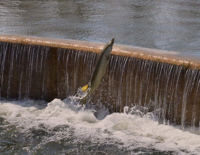
Photo: Richard Hurd, CC BY 2.0

Photo: Under the same moon, CC BY 2.0

Photo: Jeangagnon, CC BY-SA 4.0

Lakes, creeks and ramps of Pike County, asked and answered
Which KDFWR launches serve Pike County?
17 launch sites appear in the KDFWR access layer for the county.
Where is the widest KDFWR lake in Pike County?
Fishtrap Lake comes first with 1,038 acres.
What fish get regulated attention near Pike County?
KDFWR tables on lakes within 40 miles name rainbow trout most often, then largemouth bass, black crappie and smallmouth bass.
Which Pike County stores sell fishing gear for Kentucky lakes?
East Kentucky Marina heads a list of 1.
Where does Pike County keep its Kentucky courthouse?
Pikeville has it.
What does a Kentucky fishing license cost for Pike County?
Kentuckians 16 and up pay $24.31 for a yearly license, while visitors pay $58.14.
Which counties should I check near Pike County?
The closest county pages are Floyd County, Martin County and Knott County.
How many crappie may an angler in Pike County take home?
Statewide daily limit 20*, possession 40*, minimum size none. Special-regulation waters can differ.
Does the guide list exceptions for Pike County water?
6 waters with a page here carry their own rules, beginning with Fishtrap Lake.
Plan a Bluegrass day in Pike County
Lake pages carry KDFWR ramps, rule tables and any guide exception.