Fishing in McCracken County, Kentucky
County seat: Paducah. Census 2020 residents: 67,875.
- 3lake pages
- 7launch sites
- 2river pages
 Pick for rainbow troutPiscifun Carbon X ultralight spinning reel28% OFFSale $57.99
Photo of Kentucky Lake: Land Between the Lakes KY\/TN, Public domain
Fishing McCracken County in brief
With its seat at Paducah, McCracken County had 67,875 residents when the 2020 Census was taken. The 2023 Gazetteer lists 249 square miles of land and 19.2 of water. Size puts Metropolis Lake first among the county's 3 lakes with pages.
Within the county, KDFWR lists 7 launch sites and 2 pier or bank sites. Moving water with a page here includes Ohio River (West) and Clarks River. KDFWR's Fishing in Neighborhoods program stocks 1 lake here, including Lake Montgomery.
U.S. Census Bureau, 2020 Census counts (TIGERweb) and the 2023 Gazetteer, read November 10, 2026. KDFWR Fishing Access Sites in Kentucky layer (ArcGIS service), read November 10, 2026.
Plotting McCracken County water: ramps, lakes, bank sites
KDFWR Fishing Access Sites in Kentucky layer (ArcGIS service), read November 10, 2026. Lake points are the mean of each water’s KDFWR access sites.
Choosing among the lakes of McCracken County
| Lake | Size | KDFWR ramps | Kind | Fish in the KDFWR table |
|---|---|---|---|---|
| Metropolis Lake | 37 acres | 1 | lake | none in the table |
| Lake Montgomery | 6.2 acres | 0 | FINs lake | largemouth bass, rainbow trout, bluegill |
| West KY Wildlife Management Area | no KDFWR figure | 1 | WMA pond group | none in the table |
With few paged lakes in McCracken County, here are the nearest from Paducah.
| Lake | From Paducah | Size | KDFWR ramps | Kind | Fish in the KDFWR table |
|---|---|---|---|---|---|
| Mike Miller Park | 19 miles southeast | 3.9 acres | 0 | FINs lake | largemouth bass, rainbow trout, bluegill |
| Kess Creek Park Lake | 25 miles south | 2.2 acres | 0 | FINs lake | largemouth bass, rainbow trout, bluegill |
| Lake George – Marion City Lake | 34 miles northeast | 36 acres | 1 | lake | none in the table |
| Clinton Rotary Park Lake | 35 miles southwest | 1 acres | 0 | FINs lake | largemouth bass, rainbow trout, bluegill |
| Kentucky Lake | 35 miles southeast | 55,025 acres in Kentucky | 45 | Corps reservoir | largemouth bass, smallmouth bass, black crappie |
| Hematite Lake | 35 miles east | 84 acres | 1 | lake | none in the table |
Acreage as KDFWR notes it on the this water waterbody page (KDFWR), read November 10, 2026. Waters with no KDFWR acre note print their mapped outline instead. KDFWR fishing waterbody list (app.fw.ky.gov), read November 10, 2026.
 For the rainbow trout herePiscifun Carbon XT ultralight spinning reel25% OFFSale $59.99
Fish singled out by KDFWR within reach of McCracken County
Out to 40 miles from Paducah, largemouth bass shows up in more KDFWR lake tables than any other fish.
KDFWR Special Fishing Regulations tables and guide stocking tables, counted per lake page within 40 miles; a regulation list, not a catch survey. KDFWR fishing waterbody list (app.fw.ky.gov), read November 10, 2026.
Little lakes and ponds of McCracken County, listed
This list holds 23 smaller named waters of McCracken County, biggest outline first.
| Water | Size | Listed by |
|---|---|---|
| Lake Genevieve | about 20 acres of mapped outline | Named Lakes layer |
| Priester Lake | about 14 acres of mapped outline | Named Lakes layer |
| Chestnut Lake | about 14 acres of mapped outline | Named Lakes layer |
| Disabled Access Pond | about 6.4 acres of mapped outline | Named Lakes layer |
| Bob Noble Park Lake | about 6.2 acres of mapped outline | Named Lakes layer |
| Blizzard Ponds | about 4.5 acres of mapped outline | Named Lakes layer |
| Metzger's Pond | about 3.9 acres of mapped outline | Named Lakes layer |
| Coon Club Lake | about 3.4 acres of mapped outline | Named Lakes layer |
| Retriever Pond | about 3.3 acres of mapped outline | Named Lakes layer |
| Beaver Pond | about 2.9 acres of mapped outline | Named Lakes layer |
| New Pond | about 2.9 acres of mapped outline | Named Lakes layer |
| Teal Pond | about 2.9 acres of mapped outline | Named Lakes layer |
| Gravel Pit | about 2.6 acres of mapped outline | Named Lakes layer |
| Stick Pond | about 2.3 acres of mapped outline | Named Lakes layer |
| Rock Levee Lake | about 2.1 acres of mapped outline | Named Lakes layer |
| Fire Hydrant Pond | about 2 acres of mapped outline | Named Lakes layer |
| 3-Lane Pond | about 1.8 acres of mapped outline | Named Lakes layer |
| No. 2 Pond | about 1.8 acres of mapped outline | Named Lakes layer |
| 3-Lane Pond | about 1.7 acres of mapped outline | Named Lakes layer |
| Turkey Pond | about 1.6 acres of mapped outline | Named Lakes layer |
| No. 1 Pond | about 1.4 acres of mapped outline | Named Lakes layer |
| Horseshoe Pond | about 1.3 acres of mapped outline | Named Lakes layer |
| Long Hole | about 0.5 acres of mapped outline | Named Lakes layer |
Outline area from the KDFWR Named Lakes in Kentucky layer (ArcGIS service; GIS polygon area, not a KDFWR surface-acre figure), read November 10, 2026. KDFWR fishing waterbody list (app.fw.ky.gov), read November 10, 2026.
Creeks winding through McCracken County
- Ohio River (West)special limits, state-line water, 21 KDFWR access sites, 3 USGS gauges
- Clarks River3 KDFWR access sites, 1 USGS gauge
River stages across McCracken County
| USGS gauge | Latest reading | Time (ET) |
|---|---|---|
| Massac Creek Near Paducah, Ky | 3 cfs, 2.78 ft gage height | Nov 13 7:45 pm |
| Ohio River At Paducah, Ky | 15.96 ft gage height | Nov 13 8:00 pm |
US Geological Survey provisional data, retrieved Nov 13, 2026 8:32 pm ET. Provisional readings can be revised.
KDFWR fishing waterbody list (app.fw.ky.gov), read November 10, 2026. USGS Water Data for the Nation, live through the site, retrieved on page view.
City and park lakes stocked in McCracken County
| Lake as printed | County | Trout by month | Catfish by month |
|---|---|---|---|
| Lake Montgomery | McCracken | Feb 1,500, Mar 1,500, Oct 1,500 | Mar 1,100, Apr 1,100, May 1,100, Jun 1,100 |
2026 Kentucky Fishing & Boating Guide (Regulations Summary March 2026 to February 2027, updated September 2026, p. 6; KDFWR PDF), read November 10, 2026.
Public ramps in McCracken County
- Broadway Street Ramp on Ohio River (West)Ohio River (West), boat ramp, paved, multiple lanes
- Clarks River Boat RampClarks River, boat ramp, paved, single lane
- Fort Massac State Park Ramp on Ohio River (West)Ohio River (West), boat ramp, paved, single lane
- Metropolis Ferry Boat Ramp on Ohio River (West)Ohio River (West), boat ramp, paved, single lane
- Metropolis Lake RampMetropolis Lake, boat ramp, unpaved, single lane
- Paducah Ramp on Ohio River (West)Ohio River (West), boat ramp, paved, multiple lanes, courtesy dock
- West Kentucky WMA Ramp on West KY Wildlife Management AreaWest KY Wildlife Management Area, boat ramp, unpaved, single lane
Bank spots spread over McCracken County
- Lake Montgomery Bank AccessLake Montgomery, bank access
- West Kentucky WMA Fishing Pier on West KY Wildlife Management AreaWest KY Wildlife Management Area, fishing pier
KDFWR Fishing Access Sites in Kentucky layer (ArcGIS service), read November 10, 2026. KDFWR publishes fees as yes or no and lanes as single or multiple.
Guide creel rows applied to McCracken County
Most of McCracken County fishes under the guide's statewide table, shown here. KDFWR's 2026 fee list shows $24.31 for residents and $58.14 for nonresidents buying an annual license.
| Species | Daily | Possession | Minimum size |
|---|---|---|---|
| Largemouth Bass | 6* | 12* | 12" |
| Smallmouth Bass | 6* | 12* | 12" |
| Kentucky (Spotted) Bass | 6* | 12* | none |
| Coosa Bass | 6* | 12* | none |
| Rock Bass | 15 | 30 | none |
| Redear Sunfish | 20 | 40 | none |
| Walleye, Sauger, and their Hybrids | 6* | 12* | 14" |
| Muskellunge | 1 | 2 | 30" |
| Chain Pickerel | 5 | 10 | none |
| White & Hybrid Striped Bass | 15** | 30** | none** |
| Striped Bass | 5 | 10 | 15" |
| Yellow Bass | none | none | none |
Water-specific rules across McCracken County
- Lake MontgomeryLargemouth Bass: Must be 15 inches or over – Limit 1 per angler
- Ohio River (West)Hybrid Striped Bass: Limit 30 per angler of White Bass, Yellow Bass, Striped Bass and their Hybrids, singly or combined, No more than 4 fish may be over 15 inches
Kentucky special-regulation waters
2026 Kentucky Fishing & Boating Guide (Regulations Summary March 2026 to February 2027, updated September 2026; KDFWR PDF), read November 10, 2026. License prices as printed in the 2026 Kentucky Fishing & Boating Guide, p. 2 (2026 CPI-adjusted fees; KDFWR PDF), read November 10, 2026.
KDFWR record entries close to McCracken County
For McCracken County, the closest record-list waters sit inside 70 miles.
| Species | Weight as listed | Water | Date |
|---|---|---|---|
| White Bass | 5.00 lbs | Kentucky Lake | 07/11/1943 |
| Buffalo (Smallmouth) | 55.00 lbs | Kentucky Lake | 03/23/2000 |
| Yellow Perch | 1.58 lbs | Lake Barkley | 03/02/2024 |
Kentucky state record fish as listed by KDFWR (record list), read November 10, 2026.
Tackle shops and guide services of McCracken County
Shops stocking lures in McCracken County
- Dick's Sporting Goods, 5101 Hinkleville Rdbait and tackle shop, Paducah
- Gander Mountainbait and tackle shop, Paducah
Yellow Pages and Kentucky tourism listings (city of business), read November 10, 2026.
Clustered near McCracken County
Home bases for fishing McCracken County
- Paducah2020 count 27,137
- Hendron2020 count 4,774
- Massac2020 count 4,635
- Reidland2020 count 4,526
- Farley2020 count 4,374
Kentucky counties that touch McCracken County on the map
- Ballard County16 miles west
- Carlisle County20 miles southwest
- Livingston County22 miles northeast
- Graves County23 miles south
Piscifun picks that suit a trip to McCracken County


Piscifun and Amazon links are affiliate links; the site earns a commission on qualifying purchases.
Field-guide photos for fish at McCracken County
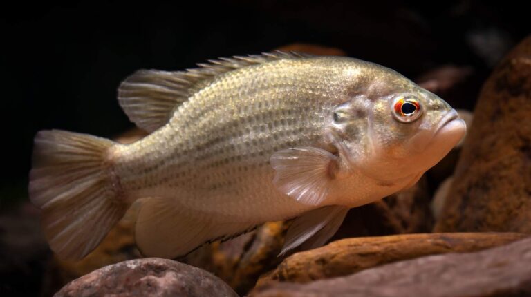
Photo: USFWS Mountain-Prairie, Public domain
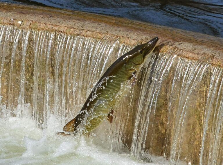
Photo: Richard Hurd, CC BY 2.0

Photo: Under the same moon, CC BY 2.0
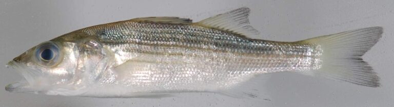
Photo: Smithsonian Environmental Research Center, CC BY 2.0

What Kentuckians ask about water in McCracken County
Can I launch a kayak or boat in McCracken County?
KDFWR lists 7 launch sites, named above with directions.
Which still water leads McCracken County on size?
It is Metropolis Lake at 37 acres.
Which fish lead the KDFWR lists near McCracken County?
KDFWR tables on lakes within 40 miles name largemouth bass most often, then redear sunfish, blue catfish and bluegill.
Is a Kentucky tackle shop listed in McCracken County?
2 in all, including Dick's Sporting Goods, 5101 Hinkleville Rd.
Which Kentucky town is the county seat of McCracken County?
The seat is Paducah.
What will fishing in McCracken County cost in license fees?
The 2026 guide prices the resident annual fishing license at $24.31 and the nonresident annual at $58.14.
Which Kentucky counties lie next to McCracken County?
By center point: Ballard County, Carlisle County and Livingston County.
Is there a crappie size limit in McCracken County?
Statewide daily limit 20*, possession 40*, minimum size none. Special-regulation waters can differ.
Where do the limits change in McCracken County?
2 waters with a page here carry their own rules, beginning with Lake Montgomery.
Are there neighborhood fishing lakes in McCracken County?
Lake Montgomery, on the FINs stocking table.
Pick a KDFWR lake or creek in McCracken County
Each launch page has a directions link and KDFWR site notes.