Des Moines River (Red Rock to Ottumwa Dam) Fishing
An Iowa river in Mahaska County and 3 other counties.
 Pick for hybrid striped bassPiscifun Viper X spinning reel50% OFFSale $39.99
Photo of Rathbun Reservoir: Anna, CC BY 2.0
The Des Moines River (Red Rock to Ottumwa Dam): the prairie-state short version
The Iowa DNR map carries the Des Moines River (Red Rock to Ottumwa Dam) in Mahaska County and 3 other counties. The DNR prints 47 miles for this reach. Ottumwa is the closest town to the DNR point, under a mile off.
Check 4 stream gauges below before wading. The atlas maps 3 access points along it. Go through its 3 rule lines ahead of any harvest.
Iowa DNR Fish Iowa record for Des Moines River (Red Rock to Ottumwa Dam) (Fish Iowa), read November 18, 2026.
U.S. Census Bureau, 2020 Census counts (TIGERweb) and the 2023 Gazetteer, read November 18, 2026.
What Fish Iowa says about the Des Moines River (Red Rock to Ottumwa Dam)
From the stream page for the Des Moines River (Red Rock to Ottumwa Dam):
4 ramps in this stretch in Monroe, Mahaska, and Wapello counties: Eveland Access, Hardfish Access, Black Hawk River Access, and Black Hawk Road Access. These ramps are all up river of the hydrodam in Ottumwa.
Fish Iowa's location note for the Des Moines River (Red Rock to Ottumwa Dam):
This stretch runs through Marion, Monroe, Mahaska, and Wapello counties with 5 accesses: Howell Station, Eveland, Hardfish, Black Hawk River, and Black Hawk Road Accesses.
Iowa DNR Fish Iowa record for Des Moines River (Red Rock to Ottumwa Dam) (Fish Iowa), read November 18, 2026.
How Fish Iowa tags the fish in the Des Moines River (Red Rock to Ottumwa Dam)
Species for the Des Moines River (Red Rock to Ottumwa Dam) come straight from the department record.
Iowa DNR Fish Iowa Popular Fish Species list (Fish Iowa), read November 18, 2026. A listed species is present by the DNR’s account, not a catch report.
 For the hybrid striped bass herePiscifun AlumiX spinning reel46% OFFSale $64.99
What the nearby Iowa gauges say on the Des Moines River (Red Rock to Ottumwa Dam)
USGS has no current reading for these gauges.
The Des Moines River (Red Rock to Ottumwa Dam) figures arrive straight from USGS when you open the page.
- Des Moines River near Pella, IAUSGS 05488110, under a mile from the DNR point
- Des Moines River near Tracy, IAUSGS 05488500, under a mile from the DNR point
- Des Moines River at Eddyville, IAUSGS 05489200, under a mile from the DNR point
- Des Moines River at Ottumwa, IAUSGS 05489500, under a mile from the DNR point
USGS Water Data for the Nation, live through the site, retrieved on page view.
Public Iowa access along the Des Moines River (Red Rock to Ottumwa Dam)
- Eddyville Boat Ramp on Des Moines River (Red Rock to Ottumwa Dam)paddling access (canoe/kayak
- Eveland Access on Des Moines River (Red Rock to Ottumwa Dam)boat ramp
- Rock Bluff Park on Des Moines River (Red Rock to Ottumwa Dam)fishing access
Each point on the Des Moines River (Red Rock to Ottumwa Dam) is listed with its DNR data and nothing more.
Iowa DNR Fishing Atlas amenities layer (ArcGIS service), read November 18, 2026.
Iowa daily limits on the Des Moines River (Red Rock to Ottumwa Dam)
The 2026 booklet names the Des Moines River (Red Rock to Ottumwa Dam) in its list of special-regulation waters, and the lines under that entry replace the standard limit for each fish they mention.
| Entry as printed | Rule line | Booklet page |
|---|---|---|
| Des Moines River, Ottumwa: northeast bank below Ottumwa Dam incl. catwalk to Jefferson St. bridge (and South Market St. bridge) | Snagging not permitted in this area. | booklet page 8 |
| Des Moines River, Fort Dodge: below hydroelectric (Big) Dam to Hawkeye Ave bridge | Snagging not permitted in this area. | booklet page 8 |
| Des Moines River, Fort Dodge: below Little Dam to Union Pacific Railroad bridge | Snagging not permitted in this area. | booklet page 8 |
Fish the entry leaves out follow the statewide table in the license and regulations section.
The rules here are from the 2026 Iowa Fishing Regulations, an Iowa DNR summary booklet that prints no effective or end date; the Iowa DNR had published no 2027 booklet or rule that this site could find when it was checked.
Anglers 16 and older need a valid Iowa fishing license; the Iowa DNR fee table prints $22 for a resident annual fishing license and $48 for a nonresident, and trout anglers add a separate trout fee.
2026 Iowa Fishing Regulations (Iowa DNR PDF), read November 18, 2026. The booklet is a summary and prints no effective or end date.
License prices from the Iowa DNR fee table (fishing licenses page, updated Oct. 26, 2026) and p. 2 of the 2026 Iowa Fishing Regulations, read November 18, 2026.
Heaviest catches on the state list for the Des Moines River (Red Rock to Ottumwa Dam)
| Species | Size as printed | Year | Place as the DNR prints it |
|---|---|---|---|
| Bighead Carp | 112.00 lbs. | 2018 | Des Moines River (Red Rock to Ottumwa Dam) |
| Northern Hog Sucker | 1.91 lbs. | 2019 | Des Moines River (Humboldt to Stratford) |
| Saugeye | 12.25 lbs. | 2000 | Des Moines River (Saylorville to Red Rock) |
| Shovelnose Sturgeon | 12.00 lbs. | 1974 | Des Moines River (Ottumwa Dam to Farmington) |
| Silver Carp | 62.00 lbs. | 2018 | Des Moines River (Red Rock to Ottumwa Dam) |
| Walleye | 14.50 lbs. | 1986 | Des Moines River (Saylorville to Red Rock) |
Iowa all-time state record fish from the Iowa DNR State Record Fish page (DNR page), page updated Sept. 29, 2026, read November 18, 2026. Angler names are not printed.
Reaches above and below on the Des Moines River (Red Rock to Ottumwa Dam)
- Des Moines River (Humboldt to Stratford)Hamilton, Humboldt and Webster counties, 53 miles
- Des Moines River (Ottumwa Dam to Farmington)Davis, Van Buren and Wapello counties, 61 miles
- Des Moines River (Saylorville to Red Rock)Marion, Polk and Warren counties, 50 miles
- Des Moines River (Stratford to Saylorville Lake)Boone County and 3 other counties, 57 miles
If the Des Moines River (Red Rock to Ottumwa Dam) is running high, try these Iowa streams
- South Skunk River (Pella to Rose Hill)20 miles north
- Chariton River (below Rathbun Lake)33 miles southwest
- South Skunk River (Cambridge to Pella)34 miles northwest
- Chariton River (above Rathbun Lake)37 miles west
- Skunk River (Rose Hill to Coppock)38 miles east
A short county-road stretch past Des Moines River (Red Rock to Ottumwa Dam)
Backup Iowa lakes when Des Moines River (Red Rock to Ottumwa Dam) is slow
- Lake Keomah20 miles north
- Rathbun Reservoir28 miles southwest
- Red Rock Reservoir39 miles northwest
- Marr Park Lake48 miles northeast
Bait and tackle counters on the county road to Des Moines River (Red Rock to Ottumwa Dam)
- Mike Bait Tacklebait and tackle shop, Ottumwa, under a mile
- Lollipop Bait Shopbait and tackle shop, Ottumwa, under a mile
- Top Notch Bait & Tacklebait and tackle shop, Albia, 20 miles
- Treasure Chestbait and tackle shop, Albia, 21 miles
- Dam Site Depotbait and tackle shop, Moravia, 26 miles
- Rathbun Lake Marinamarina, Moravia, 27 miles
Finding a bunk in farm country close to Des Moines River (Red Rock to Ottumwa Dam)
- Ottumwaunder a mile
- Bloomfield18 miles
- Albia20 miles
Iowa county write-ups naming Des Moines River (Red Rock to Ottumwa Dam)
- Mahaska Countyseat: Oskaloosa
- Marion Countyseat: Knoxville
- Monroe Countyseat: Albia
- Wapello Countyseat: Ottumwa
Piscifun gear an Iowa angler could carry to Des Moines River (Red Rock to Ottumwa Dam)


Piscifun and Amazon links are affiliate links; the site earns a commission on qualifying purchases.
Tallgrass shores and bluff-country water around Des Moines River (Red Rock to Ottumwa Dam), photographed
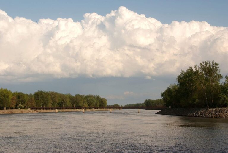
Photo: Carl Wycoff, CC BY 2.0
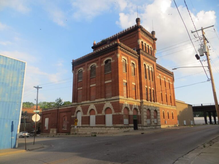
Photo: David Wilson, CC BY 2.0

Photo: Ron Reiring, CC BY 2.0
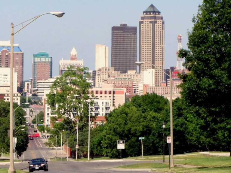
Photo: David Wilson, CC BY 2.0
Prairie-state answers about the Des Moines River (Red Rock to Ottumwa Dam) in a handful of questions
Which Iowa town is closest to the Des Moines River (Red Rock to Ottumwa Dam)?
County lines put it in Mahaska County and 3 other counties; Ottumwa, under a mile away, is the nearest Census place.
Who publishes the Des Moines River (Red Rock to Ottumwa Dam) level?
Des Moines River Near Pella, IA sits within under a mile of the DNR point; the flow band shows live readings.
What public entry does the atlas show on the Des Moines River (Red Rock to Ottumwa Dam)?
There are 3 access points, including Eddyville Boat Ramp on Des Moines River (Red Rock to Ottumwa Dam).
How much may be taken home from the Des Moines River (Red Rock to Ottumwa Dam) per day?
It has 3 rule lines, and they override the statewide numbers wherever they name a fish.
What does an Iowa license cost for the Des Moines River (Red Rock to Ottumwa Dam)?
Anglers 16 and older need a valid Iowa fishing license; the Iowa DNR fee table prints $22 for a resident annual fishing license and $48 for a nonresident, and trout anglers add a separate trout fee.
Which fish might turn up for an Iowa angler on the Des Moines River (Red Rock to Ottumwa Dam)?
The species list gives wiper (hybrid striped bass).
Is a bait and tackle stop listed near the Des Moines River (Red Rock to Ottumwa Dam)?
The list starts with Mike Bait Tackle, under a mile away.
Which nearby waters have pages beside the Des Moines River (Red Rock to Ottumwa Dam)?
Lake Keomah is the closest lake with a page here, about 20 miles away.
Does the DNR record list mention the Des Moines River (Red Rock to Ottumwa Dam)?
The department credits Des Moines River (Red Rock to Ottumwa Dam) with a bighead carp of 112.00 lbs., year 2018.
Check the flow, then head for the Des Moines River (Red Rock to Ottumwa Dam)
License prices and the dated limits are on the Iowa license page.