Fishing in Clayton County, Iowa
County seat: Elkader. Census 2020 residents: 17,043.
- 51named waters
- 11ramps
- 11river pages
 Pick for troutPiscifun Carbon X ultralight spinning reel28% OFFSale $57.99
Photo of Dubuque: Dirk DBQ, CC BY 2.0
An overview of the ponds and rivers in Clayton County
Across Clayton County, the 2020 Census tallied 17,043 residents, and Elkader is the county seat. Tables from the Census Bureau record 778 square miles of land and 14.2 square miles of water for the county. 51 waters are on file for the county, with Wood Duck Slough biggest. Moving water with a page of its own here includes Maquoketa River (above Monticello), Turkey River (below Clermont) and Volga River.
Inside the line sit 11 boat ramps and 21 other fishing points additional mapped points without a ramp. The Community Fishing program counts 1 water inside the county line. The DNR schedule and the Fish Iowa reports give stocking dates for 1 event in Clayton County. The regulation book lists special entries for 11 waters in the county.
U.S. Census Bureau, 2020 Census counts (TIGERweb) and the 2023 Gazetteer, read November 18, 2026. Iowa DNR Fishing Atlas amenities layer (ArcGIS service), read November 18, 2026.
Stocking dates logged for Clayton County
- Big LakeOct. 27, 2026, 1,000 fish printed in the report dated Nov. 11, 2026
Iowa stocking this week and the week-ahead outlook
Iowa DNR stocking information (DNR source), as of Nov. 17, 2026, read November 18, 2026. Dates are the DNR’s; counts appear only where a DNR source printed one.
 For the trout herePiscifun Carbon XT ultralight spinning reel25% OFFSale $59.99
Every mapped pond, creek and ramp across Clayton County
Iowa DNR Fishing Atlas amenities layer (ArcGIS service), read November 18, 2026. Water pins sit at the point Fish Iowa or the USGS gives for each water.
Moving Iowa water in Clayton County
- Maquoketa River (above Monticello)booklet entry, 13 access points, 1 USGS gauge
- Turkey River (below Clermont)booklet entry, 9 access points, 2 USGS gauges
- Volga River9 access points, 1 USGS gauge
- Bloody Run Creekbooklet entry, dated stocking rows
- Buck Creekdated stocking rows
- Joy Springsdated stocking rows
- Maquoketa River (trout portion)booklet entry, dated stocking rows
- North Cedar Creekdated stocking rows
- Sny Magill Creekdated stocking rows
- South Cedar Creekdated stocking rows
- Turkey Riverbooklet entry, dated stocking rows
Water-level stations in Clayton County
USGS has no current reading for these gauges.
Iowa DNR Fish Iowa record for this river (Fish Iowa), read November 18, 2026. USGS Water Data for the Nation, live through the site, retrieved on page view.
What Fish Iowa names most often in Clayton County
Bars count the 33 waters here where Fish Iowa lists the fish as present; channel catfish leads.
Fish Iowa Popular Fish Species lists, counted per water; presence in the list is not a catch survey. Iowa DNR Fish Iowa Popular Fish Species list (Fish Iowa), read November 18, 2026. A listed species is present by the DNR’s account, not a catch report.
Iowa launch ramps across Clayton County
- Bussey Lake Boat Rampboat ramp; Clayton County
- Clayton Municipal Rampboat ramp; Clayton County
- Fisher's Landing (Camp Hideaway) Accessboat ramp; Clayton County
- Guttenberg City Access on Swift Slough (Clayton County)boat ramp; Clayton County
- Iowa DNR Ramp on Swift Slough (Clayton County)boat ramp; Clayton County
- Lowell's Landing (Pirate's Pitstop) Access on Picayune Chuteboat ramp; Clayton County
- Marquette Boat Rampboat ramp; Clayton County
- McGregor Boat Rampboat ramp; Clayton County
- Sny Magill Access on Wyoming Slough (Clayton County)boat ramp; Clayton County
- The Landing Ramp on Swift Slough (Clayton County)boat ramp; Clayton County
- Willies Landingboat ramp; Clayton County
Iowa docks and piers in Clayton County
- Big Springs Fish Hatchery Fishing Area on Big Spring Trout Pondpaddling access (canoe/kayak; Clayton County
- Clayton Co. Roadside Areapaddling access (canoe/kayak; Clayton County
- Elkader Access Lower on Elkader Impoundmentpaddling access (canoe/kayak; Clayton County
- Elkader Access Upper on Elkader Impoundmentpaddling access (canoe/kayak; Clayton County
- Ferry Landing Canoe Takeoutpaddling access (canoe/kayak; Clayton County
- French Town Landingpaddling access (canoe/kayak; Clayton County
- Frieden Park on Big Spring Kids Trout Fishing Pondpaddling access (canoe/kayak; Clayton County
- Garber Access on Turkey River (below Clermont) (east)paddling access (canoe/kayak; Clayton County
- Garber Access on Turkey River (below Clermont) (west)paddling access (canoe/kayak; Clayton County
- Littleport Access on Volga Riverpaddling access (canoe/kayak; Clayton County
- Mederville Access on Volga Riverpaddling access (canoe/kayak; Clayton County
- Millville Access on Turkey River (below Clermont)paddling access (canoe/kayak; Clayton County
- Motor Mill Access on Turkey River (below Clermont)paddling access (canoe/kayak; Clayton County
- Observation Deck (east)observation deck; Clayton County
- Osborne Accesspaddling access (canoe/kayak; Clayton County
- Osborne Pond Fishing Areafishing access; Clayton County
- Osterdock Access on Turkey River (below Clermont)paddling access (canoe/kayak; Clayton County
- Point of Interestobservation deck; Clayton County
- Point of Interestobservation deck; Clayton County
- Turkey River Parkpaddling access (canoe/kayak; Clayton County
- Volga City Parkpaddling access (canoe/kayak; Clayton County
Iowa DNR Fishing Atlas amenities layer (ArcGIS service), read November 18, 2026.
Waters in Clayton County that live on this page instead of their own
Lakes, ponds and pits in Clayton County
| Water | Kind | Size | Fish the DNR lists | Access | Map pin |
|---|---|---|---|---|---|
| Wood Duck Slough | lake | about 286 acres of mapped outline | channel catfish, flathead catfish, freshwater drum | 0 | 42.6917, -90.9834 |
| Frenchtown Lake | lake | 270 acres | smallmouth bass | 1 | 42.8468, -91.1028 |
| Bussey Lake 2 m N Guttenberg | lake | 240 acres | black crappie, bluegill, bowfin, channel catfish | 1 | 42.8049, -91.1053 |
| Norwegian Lake | lake | 130 acres | bluegill, bowfin, common carp, freshwater drum | 0 | 42.9498, -91.1576 |
| Wachendorf Lake 1 mile N of North Buena Vista | lake | 130 acres | none listed | 0 | 42.6920, -90.9775 |
| Methodist Lake | lake | 120 acres | black crappie, bluegill | 0 | 42.9261, -91.1578 |
| Big Pond | pond | 90 acres | channel catfish, flathead catfish, freshwater drum, walleye | 0 | 42.7802, -91.0773 |
| Guttenberg Waterfowl Ponds | pond | 65 acres | none listed | 0 | 42.9416, -91.1603 |
| Swift Slough (Clayton County) 1/2 M E of Guttenberg | lake | 35 acres | channel catfish | 3 | 42.7837, -91.0869 |
| Elkader Impoundment Elkader | lake | 30 acres | rock bass, smallmouth bass, white sucker | 2 | 42.8564, -91.4055 |
| Conway Lake Pool 09, Mississippi River | lake | 20 acres | bluegill, northern pike | 0 | 42.7851, -91.0786 |
| Camp Klaus Pond | pond | 12 acres | none listed | 0 | 42.6621, -91.2520 |
| Harter Pond Southern most pond west of Hwy 52 in Guttenberg. | pond | 8 acres | none listed | 0 | 42.7863, -91.1033 |
| Herman Pond Northern most pond west of Hwy 52 in Guttenberg. | pond | 7.5 acres | none listed | 0 | 42.7881, -91.1041 |
| Osborne Pond Located 4.5 miles southwest of Elkader on Highway 13. | pond | 3 acres | bluegill, channel catfish, largemouth bass | 2 | 42.7971, -91.4348 |
| Big Spring Trout Pond At entrance to Big Spring Trout Hatchery, near Elkader | pond | 2.5 acres | rainbow trout | 1 | 42.9103, -91.4739 |
| Limbeck Pond Located in Guttenberg on the north side of town. It is on the east side of Hwy 52 and north of Kann Pond. | pond, Community Fishing location | 1.9 acres | common carp, green sunfish | 0 | 42.7908, -91.1043 |
| Sny Magill Ponds (3) | pond | 1 acres | none listed | 0 | 42.9544, -91.1990 |
| Kann Pond Located in Guttenberg on the north side of town. It is on the east side of Hwy 52 and south of Limbeck Pond. | pond | 0.9 acres | none listed | 0 | 42.7897, -91.1040 |
| Big Spring Kids Trout Fishing Pond On the grounds of the Big Spring Trout Hatchery | pond | 0.1 acres | rainbow trout | 1 | 42.9101, -91.4732 |
| Ackerman Cut | lake | no size printed | none listed | 0 | 42.7728, -91.0765 |
| Bluebell Creek | lake | no size printed | none listed | 0 | 42.7078, -91.0285 |
| Cassville Iowa Slough | lake | no size printed | flathead catfish, walleye | 0 | 42.7406, -91.0551 |
| Dead Lake (Clayton County) | lake | no size printed | channel catfish, smallmouth bass, walleye | 0 | 42.6918, -90.9877 |
| Ferry Slough | lake | no size printed | none listed | 0 | 42.8074, -91.0838 |
| Johnsons Slough | lake | no size printed | none listed | 0 | 42.9600, -91.1627 |
| Picayune Chute | lake | no size printed | none listed | 1 | 42.6861, -90.9554 |
| Plum Creek | lake | no size printed | none listed | 0 | 42.6745, -90.9213 |
| Spring Lake (Clayton County) | lake | no size printed | channel catfish | 0 | 42.6956, -90.9991 |
| State Line Slough | lake | no size printed | none listed | 0 | 42.8794, -91.0924 |
| Wood Duck Lake | lake | no size printed | channel catfish, flathead catfish, freshwater drum, walleye | 0 | 42.7040, -90.9966 |
| Wyalusing Slough | lake | no size printed | none listed | 0 | 42.9325, -91.1621 |
| Wyoming Slough (Clayton County) | lake | no size printed | channel catfish | 1 | 42.9332, -91.1626 |
Iowa DNR Fish Iowa record for this water (Fish Iowa), read November 18, 2026. Outline area from the USGS National Hydrography Dataset waterbody layer (NHD service; mapped polygon area, not an Iowa DNR surface-acre figure), read November 18, 2026.
Streams and river reaches in Clayton County
| Water | Kind | Size | Fish the DNR lists | Access | Map pin |
|---|---|---|---|---|---|
| Bear Creek (Bixby) Bixby State Preserve, 2 miles north of Edgewood just east of Fortune Road. | trout stream | no size printed | brown trout | 0 | 42.6739, -91.3960 |
| Hewett and Ensign Creeks (Ensign Hollow) | trout stream | no size printed | brown trout, white sucker | 0 | 42.7566, -91.5616 |
| Mossy Glen | trout stream | no size printed | brown trout, white sucker | 0 | 42.7101, -91.4264 |
| Pool 10, Mississippi River | Mississippi River pool | no size printed | black crappie, bluegill, channel catfish, common carp | 0 | 42.8082, -91.0888 |
| Trib to Volga River – Emblem Road | trout stream | no size printed | none listed | 0 | 42.7661, -91.4412 |
Iowa DNR Fish Iowa record for this water (Fish Iowa), read November 18, 2026. Outline area from the USGS National Hydrography Dataset waterbody layer (NHD service; mapped polygon area, not an Iowa DNR surface-acre figure), read November 18, 2026.
Other mapped names in Clayton County
Each of these is a USGS-mapped name without a DNR record or species list.
| Water | Kind | Size | Fish the DNR lists | Access | Map pin |
|---|---|---|---|---|---|
| Sunfish Lake | lake | about 87 acres of mapped outline | none listed | 0 | 43.0723, -91.1720 |
| Long Slough | lake | about 35 acres of mapped outline | none listed | 0 | 42.6879, -90.9348 |
Iowa DNR Fish Iowa record for this water (Fish Iowa), read November 18, 2026. Outline area from the USGS National Hydrography Dataset waterbody layer (NHD service; mapped polygon area, not an Iowa DNR surface-acre figure), read November 18, 2026.
Exceptions on the Clayton County lakes and streams in the Iowa book
The rules here are from the 2026 Iowa Fishing Regulations, an Iowa DNR summary booklet that prints no effective or end date; the Iowa DNR had published no 2027 booklet or rule that this site could find when it was checked.
- Bloody Run Creek14-inch minimum on brown trout in portions where posted; artificial lures only in posted areas. (Bloody Run Creek (Clayton) – posted portions)
- Buck Creek
- Joy Springs
- Maquoketa River (above Monticello)All black bass caught from this stream segment must be released alive immediately. (Maquoketa River (Delaware) – below Lake Delhi Dam as posted to the first county gravel road bridge)
- Maquoketa River (trout portion)All black bass caught from this stream segment must be released alive immediately. (Maquoketa River (Delaware) – below Lake Delhi Dam as posted to the first county gravel road bridge)
- North Cedar Creek
- Sny Magill Creek
- South Cedar Creek
- Turkey RiverOnly stream section where trotlines may be used in Mitchell, Howard, Winneshiek, Allamakee, Fayette, Clayton, Delaware, Dubuque and Jackson counties. (Turkey River, mouth to Elkader dam)
- Turkey River (below Clermont)Only stream section where trotlines may be used in Mitchell, Howard, Winneshiek, Allamakee, Fayette, Clayton, Delaware, Dubuque and Jackson counties. (Turkey River, mouth to Elkader dam)
- Volga River
2026 Iowa Fishing Regulations (Iowa DNR PDF), read November 18, 2026. The booklet is a summary and prints no effective or end date.
Record-book water in Clayton County
| Species | Size as listed | Water | Year | Category |
|---|---|---|---|---|
| Bowfin | 11.69 lbs. | Pool 10, Mississippi River | 1994 | Iowa all-time state record (all waters) |
| Goldeye | 2.94 lbs. | Pool 10, Mississippi River | 2004 | Iowa all-time state record (all waters) |
Iowa all-time state record fish from the Iowa DNR State Record Fish page (DNR page), page updated Sept. 29, 2026, read November 18, 2026. Angler names are not printed.
Iowa gear stores in Clayton County
Shops the Clayton County regulars swear by in Iowa
- McGregor Marina Beer & Bratz Gardenmarina, Mc Gregor
- Nauti Marinamarina, Mc Gregor
- Winegar Works Marinamarina, Guttenberg
Yellow Pages and operator listings (city of business), read November 18, 2026. Guides appear as businesses; no license or permit status is implied.
In Iowa close to Clayton County
Iowa places in Clayton County with town pages
- Guttenberg2020 count 1,817
- Monona2020 count 1,471
- Elkader2020 count 1,209
- Strawberry Point2020 count 1,155
Iowa neighbors of Clayton County
- Delaware County26 miles out, heading south
- Fayette County26 miles out, heading west
- Allamakee County30 miles out, heading north
- Dubuque County35 miles out, heading southeast
Finding bait around Clayton County
This site files the county in its northeast Iowa grouping, a map quadrant of our own and not an Iowa DNR district.
Week-ahead links for Clayton County
Iowa fishing this week
Iowa stocking by date
Iowa fish advisories
Piscifun reels and line to toss in the truck for Clayton County


Piscifun and Amazon links are affiliate links; the site earns a commission on qualifying purchases.
Farm-country ponds and river bends by Clayton County through a lens

Photo: Paul Sableman, CC BY 2.0
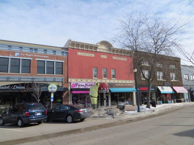
Photo: David Wilson, CC BY 2.0
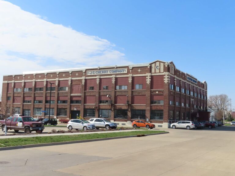
Photo: David Wilson, CC BY 2.0

Photo: Alan Light, CC BY 2.0
Fishing inside Clayton County, Iowa: the common asks
Where can I put a boat in the water in Iowa's Clayton County?
11 ramps appear in the access list further up.
Which lake is the biggest in Iowa's Clayton County?
Wood Duck Slough leads with about 286 acres of mapped outline.
What fish turn up on Iowa water records in Clayton County?
Fish Iowa lists channel catfish on the most waters in the county, then brown trout, white sucker and rainbow trout; a listing shows presence, not a catch.
Where do Iowa anglers in Clayton County go for crankbaits and line?
3 listings, McGregor Marina Beer & Bratz Garden among them.
What Iowa town serves Clayton County as its seat?
It is Elkader.
What does an Iowa fishing license cost for Clayton County?
Anglers 16 and older need a valid Iowa fishing license; the Iowa DNR fee table prints $22 for a resident annual fishing license and $48 for a nonresident, and trout anglers add a separate trout fee.
What Iowa counties are closest to Clayton County?
Nearest first: Delaware County, Fayette County and Allamakee County.
Which Iowa booklet limits govern the water of Clayton County?
Limits come from the booklet's statewide rows unless the water has its own entry, and an entry replaces the statewide limit for the fish it names; each lake and river page on this site prints its entry. The rules here are from the 2026 Iowa Fishing Regulations, an Iowa DNR summary booklet that prints no effective or end date; the Iowa DNR had published no 2027 booklet or rule that this site could find when it was checked.
Where do the ponds of Clayton County without their own page appear?
The 51 waters on file are listed here; those with no page of their own have a row and a map pin.
Does the Iowa book print line items for Clayton County water?
11 waters with a page here carry their own entry in the booklet, beginning with Bloody Run Creek.
Is stocking noted for waters in Iowa's Clayton County?
The DNR pages log 1 dated event for the county; the newest are in the stocking band above, and a count appears only where a source printed one.
Which state-record fish originate in Clayton County?
Bowfin, 11.69 lbs., from Pool 10, Mississippi River (1994).
A cornfield-edge morning in Clayton County
Stream pages carry public access and the closest USGS gauges.