Kishwaukee River Fishing
An Illinois river through McHenry County and 3 other counties.
 Pick for smallmouth bassPiscifun Chaos Pro CNC baitcasting reel25% OFFSale $97.99
Photo of Fox River: Joseph Gage, CC BY-SA 2.0
The Kishwaukee River, measured out for Illinois anglers
The Kishwaukee River winds across McHenry County and 3 other counties as a river. Allow under a mile to reach Stillman Valley.
The IDNR ramp layer maps 10 boat ramps on it. Flow is logged by 5 USGS gauges.
IDNR IFishIllinois waterbody page, ifishillinois.org, read November 4, 2026. Census 2023 places.
IDNR page details for the Kishwaukee River
- Location (IDNR)The Kishwaukee River Basin covers an area of approximately 1,218 square miles, spanning seven counties in northern Illinois, including parts of Boone, McHenry, Kane, DeKalb, Ogle, and small parts of Lee and Winnebago counties. The mainstem of the river empties into the Rock River about 3 miles south of Rockford …
- Description (IDNR)More than 60 species of fish have been found in the Kishwaukee River Basin, including several species of sport fish. The most sought after of the sport fish are the Smallmouth Bass and Channel Catfish, with both found abundantly and of good size. Panfish such as Bluegill and Rock Bass can be found in some areas of the river, along with Largemouth Bass. Northern Pike can also be found in several areas, but in …
- More from IDNRpublic, so it can only be accessed in areas where the landowner allows public access. In addition, there are many areas on the Kishwaukee that are owned by park districts and/or conservation districts. These entities DO allow boating, canoeing, and fishing on their portion of property. However, you need to be careful of where their boundary ends to avoid trespassing on private property where the owner does not …
IDNR IFishIllinois waterbody page, ifishillinois.org, read November 4, 2026.
 For the smallmouth bass herePiscifun AlinoX 300 low profile baitcaster34% OFFSale $104.99
How high and fast the Kishwaukee River is today
| USGS gauge | Latest reading | Time (ET) |
|---|---|---|
| Kishwaukee River At Marengo, Il | 78 cfs, 7.54 ft gage height | Nov 13 1:15 am |
| Kishwaukee River At Belvidere, Il | 282 cfs, 1.73 ft gage height | Nov 13 12:30 am |
| South Branch Kishwaukee River At Dekalb, Il | 107 cfs, 4.08 ft gage height | Nov 13 12:30 am |
| South Branch Kishwaukee River Nr Fairdale Il | 300 cfs, 2.81 ft gage height | Nov 13 12:45 am |
US Geological Survey provisional data, retrieved Nov 13, 2026 1:33 am ET. Provisional readings can be revised.
Stage and discharge on screen belong to Kishwaukee River at Marengo, IL, Kishwaukee River at Belvidere, IL, South Branch Kishwaukee River at Dekalb, IL and South Branch Kishwaukee River near Fairdale Il.
USGS instantaneous values, provisional; site list read November 4, 2026.
NOAA gauge readings on the Kishwaukee River
| NWS gauge | Reading | Flow | Flood category | Time (UTC) |
|---|---|---|---|---|
| Kishwaukee River near Perryville | 6.81 ft | 1.08 kcfs | no flooding | 2026-11-05 18:30:00 UTC |
NOAA National Water Prediction Service gauge readings (water.noaa.gov), read November 5, 2026; dated readings, not live (kcfs = thousand cubic feet per second).
IDNR-mapped ramps along the Kishwaukee River
- Kishwaukee River Redhorse Bend Canoe/Kayak Launchlaunch, Boone County
- Kishwaukee River County Line Canoe/Kayak Launchlaunch, Boone County
- Kishwaukee River Distillery Road Canoe/Kayak Launchlaunch, Boone County
- Kishwaukee River Burgess Street Boat Ramplaunch, Boone County
- Kishwaukee River Hickory Bill's Island Canoe/Kayak Launchlaunch, Boone County
- Kishwaukee River Baumann Park Canoe/Kayak Launchlaunch, Winnebago County
- Kishwaukee River Espenscheid FP Canoe/Kayak Launchlaunch, Winnebago County
- Kishwaukee River Kishwaukee River FP Canoe/Kayak Launchlaunch, Winnebago County
- Kishwaukee River Hinchliff Canoe/Kayak Launchlaunch, Winnebago County
- Kishwaukee River Atwood Park Canoe/Kayak Launchlaunch, Winnebago County
Public ramps and state sites are the sure way onto the Kishwaukee River.
IDNR IFishIllinois map, boat ramp and launch layer of October 2025 (KML; name, waterbody and notes as printed), read November 5, 2026.
Creel and length rules on the Kishwaukee River
| Species group | Daily limit | Statewide rule as printed |
|---|---|---|
| Alligator Gar | 1 per 24 hours | Harvest limit is 1 Alligator Gar per 24 hours. |
| Blue, Channel, and Flathead Catfish | no limit | There are no daily harvest or size limits, except as specified under Site Specific Regulations. |
| Bluegill, Redear Sunfish, Other Sunfish | no limit | There are no harvest or size limits, except as specified under Site Specific Regulations. |
| Crappie (White, Black or Hybrid Crappie) | no limit | There are no daily harvest or size limits, except as specified under Site Specific Regulations. |
| Lake Sturgeon | no possession | Protected; No possession. |
| Largemouth Bass, Smallmouth Bass, Spotted Bass | 6 (combined) | Daily harvest limit is 6 Bass, either singly or in the aggregate, except as specified under Site Specific Regulations. In rivers and streams and their tributaries statewide, except for the Mississippi, Ohio (including Golconda Marina), and Wabash Rivers, the d |
| Muskellunge, Northern Pike, and their Hybrid | muskellunge 1, northern pike 3 | All Muskellunge and Muskellunge hybrids (Tiger Muskie) taken must be 36" in total length or longer, except as specified under Site Specific Regulations. No more than 1 Muskellunge or Muskellunge hybrid (Tiger Muskie) may be taken per day, except as specified u |
| Paddlefish | 2 | Daily harvest limit is 2 Paddlefish. Please refer to Site Specific Regulations for the Mississippi River between Illinois and Iowa and the Mississippi River between Illinois and Missouri. |
| Striped Bass (Ocean Rockfish), White Bass, Yellow Bass, and their Hybrids | no limit under 17 inches; 3 at 17 inches or longer | There are no daily harvest limits or minimum size limits for Striped Bass (Ocean Rockfish), White Bass, Yellow Bass, and their hybrids, which are less than 17" in total length, except as specified under Site Specific Regulations. For these fish 17" in total le |
| Trout and Salmon | 5 (combined) | Daily harvest limit is 5 trout or salmon, either singly or in the aggregate. |
| Walleye, Sauger, or their Hybrid | 6 (combined) | All Walleye, Sauger, or their hybrid (Saugeye) taken must be 14" in total length or longer, except in the Mississippi River, Wabash River, or except as specified under Site Specific Regulations. Daily harvest limit is 6 Walleye, Sauger, or their hybrid, either |
The statewide rows are the default on the Kishwaukee River.
Digest lines that single out the Kishwaukee River
- Note: There is a closed season on Smallmouth Bass. All Smallmouth Bass
- caught between April 1 and June 15 must be immediately released alive
- and in good condition back into the waters from which they came.
- Species
- Creel Limit
- Minimum Length Limit
- Black Bass (Largemouth, Smallmouth)
- Entire river including tributaries in State of Illinois.
Site-specific regulations on the IFishIllinois page, as printed, ifishillinois.org, read November 4, 2026.
Anglers 16 and older carry an Illinois fishing license ($15 a year for residents, $31.50 for nonresidents in 2026).
IDNR 2026 Illinois Fishing Information digest (IDNR), read November 4, 2026.
The Kishwaukee River in a table with nearby rivers
South Branch Kishwaukee River (Winnebago County) sits near 9 miles away, the closest listed.
| Water | Distance | USGS gauges | Mapped ramps | First IDNR-rated fish |
|---|---|---|---|---|
| Kishwaukee River | 5 | 10 | ||
| South Branch Kishwaukee River (Winnebago County) | 9 miles east | 2 | 0 | |
| Pine Creek | 21 miles southwest | 0 | 0 | |
| South Branch Kishwaukee River (McHenry County) | 31 miles east | 2 | 0 | |
| Pecatonica River | 39 miles northwest | 2 | 7 | Smallmouth Bass |
| Fox River | 49 miles east | 12 | 49 |
USGS gauges, IDNR boat ramp layer and IDNR outlook lines; read November 4, 2026.
Around the Kishwaukee River shoreline
Other lakes an Illinois Tollway exit or two from Kishwaukee River
- Levings Lake5 miles
- Baumann Park Lake11 miles
- Four Lakes12 miles
- Pierce Lake15 miles
Buy bait on the way to Kishwaukee River
- Rockford Baitbait and tackle shop, Rockford, 6 miles
- Marina Health Care Consultants Incmarina, Rockford, 10 miles
- Angler's Edge Fishing and Marinefly shop, Loves Park, 10 miles
- Dick's Sporting Goods Rockfordsporting goods store, Rockford, 10 miles
- Rock River Outfittersbait and tackle shop, Oregon, 14 miles
Guide services listed for Kishwaukee River
- Musky Mob Guide Servicefishing guide, Richmond, (847) 833-7900
Prairie State towns that sit near Kishwaukee River
- Stillman Valley6 miles
- Davis Junction6 miles
- Winnebago7 miles
- Byron7 miles
Other Illinois rivers near the Kishwaukee River
- South Branch Kishwaukee River (Winnebago County)9 miles
- Pine Creek21 miles
- South Branch Kishwaukee River (McHenry County)31 miles
- Pecatonica River39 miles
- Fox River49 miles
Illinois counties along Kishwaukee River
- McHenry County
- Boone County
- DeKalb County
- Winnebago County
Piscifun picks ahead of a trip to the Kishwaukee River


Piscifun and Amazon links are affiliate links; the site earns a commission on qualifying purchases.
Lakes and river bends close to Kishwaukee River, in pictures
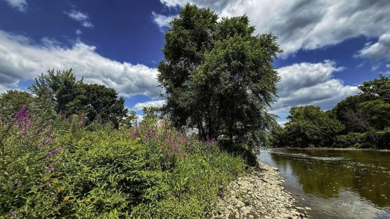
Photo: David Jakes, CC BY 4.0

Photo: Tracy, CC BY 2.0
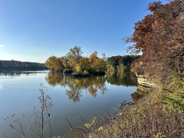
Photo: Seclusive Nature, CC BY-SA 4.0
Photo: David Wilson, CC BY 2.0
What gets asked about the Kishwaukee River around Illinois
Which Illinois counties does the Kishwaukee River touch?
The Kishwaukee River Basin covers an area of approximately 1,218 square miles, spanning seven counties in northern Illinois, including parts of Boone, McHenry, Kane, DeKalb, Ogle, and small parts of L Look around McHenry, Boone, DeKalb and Winnebago counties.
What stage is the Kishwaukee River showing this week?
Kishwaukee River at Marengo, IL and Kishwaukee River at Belvidere, IL report it; see above.
Does the IDNR layer show a ramp on the Kishwaukee River?
Kishwaukee River Atwood Park Canoe/Kayak Launch is one of 10 boat ramps.
Is there a length limit on the Kishwaukee River?
Statewide digest row for Largemouth Bass, Smallmouth Bass, Spotted Bass: Daily harvest limit is 6 Bass, either singly or in the aggregate, except as specified under Site Specific Regulations. The same row adds a separate rule for rivers and streams, quoted in the limits band. Extra digest rules apply, listed above.
Which permit do I carry on the Kishwaukee River?
Anglers 16 and older carry an Illinois fishing license ($15 a year for residents, $31.50 for nonresidents in 2026).
Which fish does IDNR expect anglers to find in the Kishwaukee River?
No IDNR species line exists for it.
Where are crawlers sold on the way to the Kishwaukee River?
Nearest in our shop file: Rockford Bait, about 6 miles away,.
Is the Kishwaukee River on private land?
Public access points are the safe bet.
Load the jon boat for the Kishwaukee River
Every fee and limit is a click away.