Fishing in Jo Daviess County, Illinois
County seat: Galena. Population 22,035.
- 1lake pages
- 3IDNR launches
- 5river pages
 Pick for bluegillPiscifun Carbon X ultralight spinning reel28% OFFSale $57.99
Photo of Rock River: Seclusive Nature, CC BY-SA 4.0
Jo Daviess County fishing, quickly sorted
With 22,035 people at the 2020 count, Jo Daviess County keeps its seat in Galena. Mississippi River, Mississippi River, Pool 13 and Mississippi River, Pool 12 counts as a border water in the digest.
1 IFishIllinois lakes here have a guide on this site, and Hanover Lake is the widest of them. IDNR layers put 3 public launches within county lines. Since 2021 the IDNR table carries 1 stocking row for waters here.
Census 2020 population; IDNR IFishIllinois waterbody pages and map; IDNR lands asset inventory (2019); IDNR stocking table; read November 4, 2026.
Every mapped launch across Jo Daviess County
IDNR IFishIllinois map launch points, IDNR asset inventory piers and IFishIllinois page points; read November 4, 2026.
Lakes in Jo Daviess County
| Lake | Acres (IDNR) | Max depth (IDNR text) | Kind | Launches | Fish named |
|---|---|---|---|---|---|
| Hanover Lake | 16 | 23 ft | lake | 0 | largemouth bass, bluegill, channel catfish |
Few Jo Daviess County lakes have a page, so nearby ones are listed by miles from Galena.
| Lake | From Galena | Acres (IDNR) | Max depth (IDNR text) | Kind | Launches | Fish named |
|---|---|---|---|---|---|---|
| Lake Le-Aqua-Na | 30 miles east | 25 ft | lake | 1 | channel catfish, redear sunfish, saugeye | |
| Lake Carlton Silt Basin | 46 miles southeast | 8 | 11 ft | lake | 0 | largemouth bass, bluegill |
| Lake Carlton | 46 miles southeast | 70 | 24 ft | lake | 1 | muskellunge, redear sunfish, saugeye |
| Centennial Park Lake | 59 miles southeast | 7 | lake | 2 | rainbow trout |
Acres as listed on the IDNR IFishIllinois page (printed only where the page text gives the same size); depth only where the IDNR text states a maximum depth. Launch counts from the IDNR map and 2019 inventory; acres left blank where the IDNR page text disagrees with its listing.
 For the bluegill herePiscifun Carbon XT ultralight spinning reel25% OFFSale $59.99
Fish IDNR rates near Jo Daviess County
Lake guides out to 100 miles from Galena were tallied by species, with bluegill on top.
IDNR fishing outlook ratings, species named on IFishIllinois pages, the IDNR stocking table and state records, counted per lake page within 100 miles; not a survey of fish numbers.
Streams that cross Jo Daviess County
- Mississippi River15 pool pages, 58 IDNR-mapped ramps, 4 USGS gauges, shared with Iowa and Missouri
- Apple RiverIFishIllinois page, 1 USGS gauge
- Mississippi River, Pool 13pool of the Mississippi River, IFishIllinois page, 5 IDNR-mapped ramps, 1 USGS gauge, shared with Iowa and Missouri
- Mississippi River, Pool 12pool of the Mississippi River, IFishIllinois page, 3 IDNR-mapped ramps, shared with Iowa and Missouri
- Sinsinawa River1 USGS gauge
Rivers of Jo Daviess County listed but not paged (9)
- East Fork Galena Riverriver
- Galena Riverriver
- Little Menominee Riverriver
- Menominee Riverriver
- Middle Fork Plum Riverriver
- Muddy Plum Riverriver
- North Fork Plum Riverriver
- South Fork Apple Riverriver
- West Fork Apple Riverriver
Stream gauges inside Jo Daviess County
| USGS gauge | Latest reading | Time (ET) |
|---|---|---|
| Apple River Near Hanover, Il | 94 cfs, 4.23 ft gage height | Nov 13 12:15 am |
| Sinsinawa River Near Menominee, Il | 17 cfs, 4.71 ft gage height | Nov 13 12:15 am |
US Geological Survey provisional data, retrieved Nov 13, 2026 12:34 am ET. Provisional readings can be revised.
IDNR IFishIllinois river and pool pages, USGS GNIS names, IDNR map launches and USGS gauges (live readings); read November 4, 2026.
Weather Service gauges around Jo Daviess County
| Gauge | Reading | Flow | Flood category | Time (UTC) |
|---|---|---|---|---|
| Sinsinawa River near Menominee | 4.77 ft | 0.0194 kcfs | not defined | 2026-11-05 18:15:00 UTC |
| Mississippi River at Bellevue | 6.02 ft | 41.7 kcfs | no flooding | 2026-11-05 18:30:00 UTC |
| Mississippi River at Dubuque (Railroad Bridge) | 8.48 ft | 42.6 kcfs | no flooding | 2026-11-05 18:30:00 UTC |
| Apple River near Hanover | 4.32 ft | 0.136 kcfs | not defined | 2026-11-05 18:15:00 UTC |
| Mississippi River at Dubuque (LD11) | 5.93 ft | 41.4 kcfs | no flooding | 2026-11-05 18:30:00 UTC |
Readings above are dated snapshots; USGS gauges on river pages update live.
NOAA National Water Prediction Service gauge readings (water.noaa.gov), read November 5, 2026; dated readings, not live (kcfs = thousand cubic feet per second).
Ramps you can back a trailer down in Jo Daviess County
- Mississippi River – Pool 12 Blanding Rec Area Boat RampMississippi River, Pool 12, IDNR note: Fee required to launch
- Mississippi River – Pool 12 East Dubuque Boat RampMississippi River, Pool 12, launch
- Mississippi River – Pool 12 Ferry Landing Boat RampMississippi River, Pool 12, launch
IDNR IFishIllinois map, boat ramp and launch layer of October 2025 (KML; name, waterbody and notes as printed), read November 5, 2026. IDNR lands asset inventory, 2019 (boating and fishing assets layer), read November 4, 2026.
Where IDNR hatchery fish went in Jo Daviess County
| Year | Water | Species (as listed) | Number | Size class |
|---|---|---|---|---|
| 2025 | Hanover Lake | Channel Catfish | 800 | Advanced Fingerling (4 – 7") |
IDNR fish stocking table on ifishillinois.org (year, water, species, size class and number as listed; no stocking dates published), read November 4, 2026; rows reach the county through the water they name.
Keeping fish in Jo Daviess County: the statewide rows
Statewide rows hold across Jo Daviess County except on the waters the digest names. Plan on $15 for a resident annual or $31.50 for the nonresident version, per IDNR.
| Species | Daily limit | Rule as printed |
|---|---|---|
| Alligator Gar | 1 per 24 hours | Harvest limit is 1 Alligator Gar per 24 hours. |
| Blue, Channel, and Flathead Catfish | no limit | There are no daily harvest or size limits, except as specified under Site Specific Regulations. |
| Bluegill, Redear Sunfish, Other Sunfish | no limit | There are no harvest or size limits, except as specified under Site Specific Regulations. |
| Crappie (White, Black or Hybrid Crappie) | no limit | There are no daily harvest or size limits, except as specified under Site Specific Regulations. |
| Lake Sturgeon | no possession | Protected; No possession. |
| Largemouth Bass, Smallmouth Bass, Spotted Bass | 6 (combined) | Daily harvest limit is 6 Bass, either singly or in the aggregate, except as specified under Site Specific Regulations. In rivers and streams and their tributaries statewide, except for the Mississippi, Ohio (including Golconda Marina), and Wabash Rivers, the d |
| Muskellunge, Northern Pike, and their Hybrid | muskellunge 1, northern pike 3 | All Muskellunge and Muskellunge hybrids (Tiger Muskie) taken must be 36" in total length or longer, except as specified under Site Specific Regulations. No more than 1 Muskellunge or Muskellunge hybrid (Tiger Muskie) may be taken per day, except as specified u |
| Paddlefish | 2 | Daily harvest limit is 2 Paddlefish. Please refer to Site Specific Regulations for the Mississippi River between Illinois and Iowa and the Mississippi River between Illinois and Missouri. |
| Striped Bass (Ocean Rockfish), White Bass, Yellow Bass, and their Hybrids | no limit under 17 inches; 3 at 17 inches or longer | There are no daily harvest limits or minimum size limits for Striped Bass (Ocean Rockfish), White Bass, Yellow Bass, and their hybrids, which are less than 17" in total length, except as specified under Site Specific Regulations. For these fish 17" in total le |
| Trout and Salmon | 5 (combined) | Daily harvest limit is 5 trout or salmon, either singly or in the aggregate. |
| Walleye, Sauger, or their Hybrid | 6 (combined) | All Walleye, Sauger, or their hybrid (Saugeye) taken must be 14" in total length or longer, except in the Mississippi River, Wabash River, or except as specified under Site Specific Regulations. Daily harvest limit is 6 Walleye, Sauger, or their hybrid, either |
Digest regulations touching Jo Daviess County (6)
| Water | Species | Rule as printed (code numbers kept) |
|---|---|---|
| Apple River | All Fish | 2 Pole and Line Fishing Only (1) |
| Apple River | Smallmouth Bass | Catch and Release Fishing Only (9) |
| Apple River | Trout | Fall Closed Season (7); Early season Catch and Release Fishing is permitted (9) Spring Closed Season (8); Early season Catch and Release Fishing is permitted (9) |
| Hanover Lake | All Fish | 2 Pole and Line Fishing Only (1) |
| Hanover Lake | Bluegill or Redear Sunfish | 25 Fish Daily Harvest Limit |
| Hanover Lake | Channel Catfish | 6 Fish Daily Harvest Limit |
| Hanover Lake | Large or Smallmouth Bass | 14 inch Minimum Length Limit; 1 Fish Daily Harvest Limit |
| Mississippi River (Between IL & IA) | Recreational Use Restrictions Spring Lake in Carroll County is closed to fishing during the 7 days prior to the regular duck season and during the regular duck and Canada goose season except in areas posted as open to fishing. All Fish While Trolling, sport fisherman must not use more than 2 poles a | |
| Mississippi River (Between IL & IA) | Bluegill or Pumpkinseed Sunfish | 25 Fish Daily Harvest Limit, singly or in aggregate |
| Mississippi River (Between IL & IA) | Large or Smallmouth Bass | 14 inch Minimum Length Limit; 5 Fish Daily Harvest Limit |
| Mississippi River (Between IL & IA) | Northern Pike | 5 Fish Daily Harvest Limit |
| Mississippi River (Between IL & IA) | Paddlefish | 33 inch (Eye to Fork) Maximum Length Limit (all Paddlefish greater than or equal to 33 inches must be immediately released back to the Mississippi River); 2 Fish Daily Harvest Limit. Snagging for Paddlefish is permitted from one half hour before sunrise to one half hour after sunset daily, March 1 t |
| Mississippi River (Between IL & IA) | Rock Bass | 25 Fish Daily Harvest Limit |
| Mississippi River (Between IL & IA) | Striped, White, Yellow, or Hybrid Striped Bass | 25 Fish Daily Harvest Limit; Statewide regulation limiting daily harvest to 3 Fish greater than or equal to 17 inches is not in effect on the Mississippi River between Illinois and Iowa |
| Mississippi River (Between IL & IA) | Walleye | 15 inch Minimum Length Limit; Protected Slot Length Limit with no possession of Fish greater than or equal to 20 inches and less than 27 inches |
| Mississippi River (Between IL & IA) | Walleye or Sauger | 6 Fish Daily Harvest Limit with no more than 1 Fish greater than or equal to 27 inches |
| Mississippi River (Between IL & IA) | White, Black, or Hybrid Crappie | 25 Fish Daily Harvest Limit |
| Mississippi River (Between IL & IA) | Yellow Perch | 25 Fish Daily Harvest Limit |
| Mississippi River (Between IL & MO) | All Nongame Species Combined 100 Total Fish | Daily Harvest Limit (Excludes endangered and threatened species and the following game species: Crappie, Channel/Blue/Flathead Catfish, Rock Bass, Warmouth, White/Yellow/Striped/Hybrid Striped Bass, Trout, Largemouth/Smallmouth/Spotted Bass, Muskellunge, Northern Pike, Chain/Grass Pickerel, Walleye, |
| Mississippi River (Between IL & MO) | Recreational Use Restrictions | Boating prohibited on refuge area (Ellis Bay) immediately upstream of Melvin Price Lock and Dam 26 overflow dike from October 15-April 15 |
IDNR 2026 Illinois Fishing Information digest (IDNR), read November 4, 2026. Site-specific regulations as printed in the 2026 Illinois Fishing Information digest (IDNR), read November 4, 2026.
IDNR record lines that name Jo Daviess County
| Species | Division | Weight | Water | Date |
|---|---|---|---|---|
| Sauger | hook and line | 5 lbs 12.5 oz | Mississippi River | July 30, 1967 |
| Gizzard Shad | bow and arrow | 3 lbs 2.2 oz | Mississippi River, Pool 13 | May 5, 2016 |
IDNR Illinois state record fish list (keeper: Illinois Department of Natural Resources; no angler names printed), read November 4, 2026.
Trail and high school events in Jo Daviess County
0 of the 2 events linked to Jo Daviess County lie ahead.
| Date | Event | Water | Organizer |
|---|---|---|---|
| May 21, 2026 | IHSA Bass Fishing Sectional at Mississippi River (Pool 13) (2025-26) | Mississippi River – Pool 13 | Illinois High School Association (IHSA) |
| May 22, 2025 | IHSA Bass Fishing Sectional at Mississippi River (Pool 13) (2024-25) | Mississippi River – Pool 13 | Illinois High School Association (IHSA) |
Organizer schedule and results pages (IDNR publishes no tournament calendar), checked November 2026.
Minnows, crawlers and guides in Jo Daviess County
Jo Daviess County tackle counters
- Frentress Lake Marine Centermarina, East Dubuque
- K & S Marine Incmarina, Apple River
- Mid-Town Marinamarina, East Dubuque
- Remm Outdoors LLCsporting goods store, Scales Mound
Yellow Pages, chain store and IDNR license vendor listings; guide and charter association pages (matched by the waters they list or their county), read November 4, 2026.
An Illinois blacktop jaunt from Jo Daviess County
Towns in Jo Daviess County
- Galenapop. 3,308
- Stocktonpop. 1,728
- East Dubuquepop. 1,505
- Warrenpop. 1,323
Neighbours of Jo Daviess County
- Carroll County25 miles southeast
- Stephenson County28 miles east
- Whiteside County45 miles south
- Ogle County51 miles southeast
Piscifun gear a Prairie State angler could stow for Jo Daviess County


Piscifun and Amazon links are affiliate links; the site earns a commission on qualifying purchases.
The ponds and rivers around Jo Daviess County, photographed
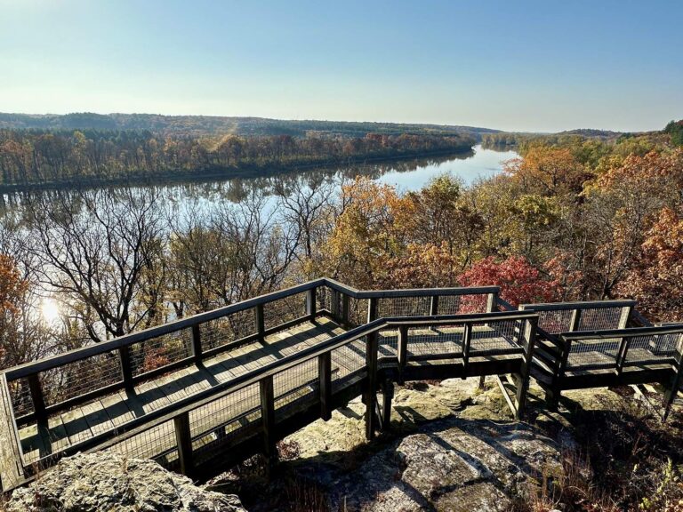
Photo: Seclusive Nature, CC BY-SA 4.0
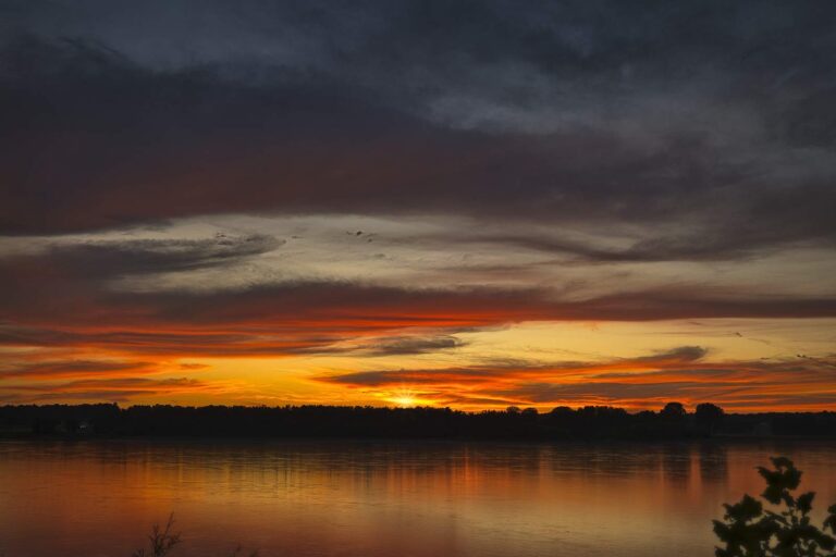
Photo: nearly almost, CC BY-SA 4.0
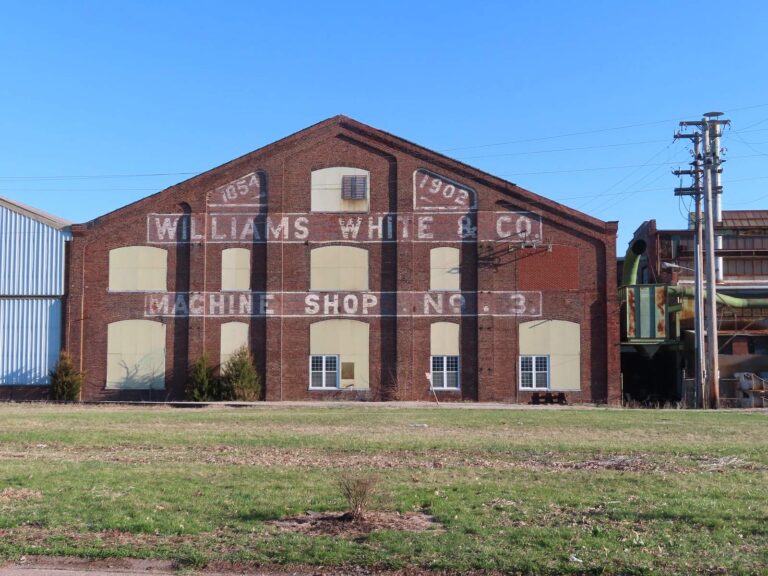
Photo: David Wilson, CC BY 2.0
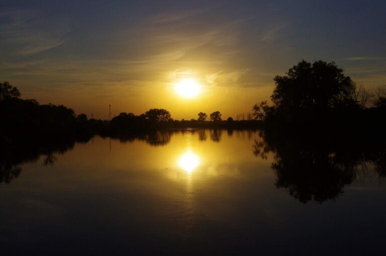
Photo: Mike Goad, CC0 1.0
The lakes and creeks of Jo Daviess County, asked and answered
Which Jo Daviess County launches are on the IDNR fishing map?
3 launches by IDNR's count, including Mississippi River – Pool 12 Blanding Rec Area Boat Ramp.
Which Jo Daviess County water gives the most acres to roam?
Hanover Lake, at 16 acres by the IDNR listing.
Which species top the IDNR lists around Jo Daviess County?
Bluegill tops the count of lake pages within 100 miles, followed by largemouth bass, channel catfish and redear sunfish.
Where can I replace lost jigs in Jo Daviess County?
Frentress Lake Marine Center is one of 4 shops here.
Can I borrow a rod for free in Jo Daviess County?
The loaner layer shows none here.
Which Illinois town keeps the Jo Daviess County courthouse doors open?
County offices are in Galena.
Which IDNR license covers a Jo Daviess County trip?
Plan on $15 for a resident annual or $31.50 for the nonresident version, per IDNR.
Which counties touch Jo Daviess County?
Start with Carroll County, Stephenson County and Whiteside County.
Do bass clubs book Jo Daviess County lakes?
Organizers posted 2 events for this county, and none is scheduled ahead yet.
Which Jo Daviess County lakes have digest exceptions?
The digest lists 6 site-specific entries for waters in or by this county, starting with Apple River; the table above shows each.
Which Jo Daviess County lakes show up in the stocking table?
The IDNR table carries 1 row; the newest lists 800 Channel Catfish, Advanced Fingerling (4 – 7") (2025) in Hanover Lake.
Has Jo Daviess County put a fish in the record book?
Sauger, 5 lbs 12.5 oz, July 30, 1967 (hook and line), from Mississippi River.
Cast the ponds and rivers across Jo Daviess County
Every lake page lists its IDNR survey ratings.