Fishing in Jersey County, Illinois
County seat: Jerseyville. Population 21,512.
- 1lake pages
- 6IDNR launches
- 2river pages
 Pick for catfishPiscifun LumiCat II catfish rod48% OFFSale $114.99
Photo of Horseshoe Lake: nearly almost, CC BY-SA 4.0
What Jersey County holds for a rod and reel
County offices for Jersey County are in Jerseyville; the last Census put the population at 21,512. Loaner rods in this county show up under the IDNR fishing map's Southern Illinois grouping on the IDNR map. Part of Mississippi River and Mississippi River, Pool 26 belongs to another state.
By IDNR acreage, Wock Lake heads the county's 1 lake pages. The IDNR fishing map and asset inventory place 6 public launches inside the county. County lakes and ponds appear in 5 stocking rows of the IDNR stocking table.
Census 2020 population; IDNR IFishIllinois waterbody pages and map; IDNR lands asset inventory (2019); IDNR stocking table; read November 4, 2026.
Jersey County ramps, piers and lakes on a pin map
IDNR IFishIllinois map launch points, IDNR asset inventory piers and IFishIllinois page points; read November 4, 2026.
Park lakes and reservoirs of Jersey County
| Lake | Acres (IDNR) | Max depth (IDNR text) | Kind | Launches | Fish named |
|---|---|---|---|---|---|
| Wock Lake | 5 | lake | 0 | largemouth bass, bluegill |
From Jerseyville, the nearest paged lakes outside Jersey County come first here.
| Lake | From Jerseyville | Acres (IDNR) | Max depth (IDNR text) | Kind | Launches | Fish named |
|---|---|---|---|---|---|---|
| Greenfield City Lake | 17 miles northeast | 59 | lake | 1 | channel catfish, largemouth bass, bluegill | |
| Gordon Moore Park Lake | 19 miles southeast | 13 | lake | 0 | largemouth bass, bluegill, channel catfish | |
| Bunker Hill Lake | 19 miles east | 11 | 28 ft | lake | 1 | black crappie, bluegill, largemouth bass |
| Beaver Dam Lake | 20 miles east | 57 | 10 ft | lake | 1 | bluegill, largemouth bass, channel catfish |
| White Hall City Lake | 23 miles north | 34 | 31 ft | lake | 1 | bluegill, channel catfish, largemouth bass |
| Belk Park Pond | 23 miles southeast | 8 | pond | 0 | largemouth bass, channel catfish, bluegill |
Acres as listed on the IDNR IFishIllinois page (printed only where the page text gives the same size); depth only where the IDNR text states a maximum depth. Launch counts from the IDNR map and 2019 inventory; acres left blank where the IDNR page text disagrees with its listing.
 For the catfish herePiscifun Chaos XS round baitcaster36% OFFSale $57.99
Species roster for water close to Jersey County
Each bar counts lake pages within 50 miles of Jerseyville naming the fish; channel catfish comes up most.
IDNR fishing outlook ratings, species named on IFishIllinois pages, the IDNR stocking table and state records, counted per lake page within 50 miles; not a survey of fish numbers.
Smaller listed waters of Jersey County
These 1 Jersey County waters are listed until IDNR publishes more on them.
| Water | Acres (IDNR) | Nearest place |
|---|---|---|
| Pere Marquette State Park Educational Fishing Pond | 0 |
IDNR IFishIllinois waterbody pages, read November 4, 2026.
Current and riffles in Jersey County
- Mississippi River15 pool pages, 58 IDNR-mapped ramps, 4 USGS gauges, shared with Iowa and Missouri
- Mississippi River, Pool 26pool of the Mississippi River, IFishIllinois page, 7 IDNR-mapped ramps, 2 USGS gauges, shared with Iowa and Missouri
What the Jersey County gauges read
| USGS gauge | Latest reading | Time (ET) |
|---|---|---|
| Mississippi River At Grafton, Il | 149,000 cfs, 15.82 ft gage height | Nov 13 12:00 am |
US Geological Survey provisional data, retrieved Nov 13, 2026 12:34 am ET. Provisional readings can be revised.
IDNR IFishIllinois river and pool pages, USGS GNIS names, IDNR map launches and USGS gauges (live readings); read November 4, 2026.
Dated river levels near Jersey County
| Gauge | Reading | Flow | Flood category | Time (UTC) |
|---|---|---|---|---|
| Mississippi River at Grafton | 15.35 ft | 118 kcfs | no flooding | 2026-11-05 18:30:00 UTC |
| Illinois River at Hardin | 19.32 ft | 8.18 kcfs | no flooding | 2026-11-05 18:30:00 UTC |
| Mississippi River at Alton | 18.59 ft | – | no flooding | 2026-11-05 18:30:00 UTC |
| Mississippi River at Mel Price (Alton) Lock and Dam | 6.28 ft | 103 kcfs | no flooding | 2026-11-05 18:30:00 UTC |
| Mississippi River at Winfield Lock and Dam 25 | 16.79 ft | 78.4 kcfs | no flooding | 2026-11-05 18:00:00 UTC |
These figures were read once from the Weather Service and carry their own time stamp.
NOAA National Water Prediction Service gauge readings (water.noaa.gov), read November 5, 2026; dated readings, not live (kcfs = thousand cubic feet per second).
Launches across Jersey County
- Illinois River – Alton Glades Boat Ramp on Illinois River, Alton PoolIllinois River, Alton Pool, launch
- Illinois River – Alton Pere Marquette State Park Boat Ramp on Illinois River, Alton PoolIllinois River, Alton Pool, launch
- Mississippi River – Pool 26 Grafton Boat RampMississippi River, Pool 26, launch
- Mississippi River – Pool 26 Piasa Creek Boat RampMississippi River, Pool 26, launch
- Mississippi River – Pool 26 Piasa Harbor Boat RampMississippi River, Pool 26, launch
- Pere Marquette Boat Ramp (north)water not named, launch
For 1 launch launches the IDNR map names a water this site has not paged yet.
County IDNR sites carry 3 boat docks as well.
IDNR IFishIllinois map, boat ramp and launch layer of October 2025 (KML; name, waterbody and notes as printed), read November 5, 2026. IDNR lands asset inventory, 2019 (boating and fishing assets layer), read November 4, 2026.
Fingerlings and catchables released in Jersey County
| Year | Water | Species (as listed) | Number | Size class |
|---|---|---|---|---|
| 2026 | Pere Marquette State Park Educational Fishing Pond | Bluegill | 1,500 | Advanced Fingerling (4 – 7") |
| 2026 | Pere Marquette State Park Educational Fishing Pond | Bluegill x Green Sunfish | 3,000 | Advanced Fingerling (4 – 7") |
| 2026 | Pere Marquette State Park Educational Fishing Pond | Channel Catfish | 30 | Adult |
| 2025 | Pere Marquette State Park Educational Fishing Pond | Bluegill | 300 | Advanced Fingerling (4 – 7") |
| 2025 | Pere Marquette State Park Educational Fishing Pond | Channel Catfish | 20 | Adult |
IDNR fish stocking table on ifishillinois.org (year, water, species, size class and number as listed; no stocking dates published), read November 4, 2026; rows reach the county through the water they name.
What may go on a Jersey County stringer
In Jersey County, start with the statewide limits and then check the site-specific list. A full year of Illinois fishing costs residents $15; visitors from other states pay $31.50.
| Species | Daily limit | Rule as printed |
|---|---|---|
| Alligator Gar | 1 per 24 hours | Harvest limit is 1 Alligator Gar per 24 hours. |
| Blue, Channel, and Flathead Catfish | no limit | There are no daily harvest or size limits, except as specified under Site Specific Regulations. |
| Bluegill, Redear Sunfish, Other Sunfish | no limit | There are no harvest or size limits, except as specified under Site Specific Regulations. |
| Crappie (White, Black or Hybrid Crappie) | no limit | There are no daily harvest or size limits, except as specified under Site Specific Regulations. |
| Lake Sturgeon | no possession | Protected; No possession. |
| Largemouth Bass, Smallmouth Bass, Spotted Bass | 6 (combined) | Daily harvest limit is 6 Bass, either singly or in the aggregate, except as specified under Site Specific Regulations. In rivers and streams and their tributaries statewide, except for the Mississippi, Ohio (including Golconda Marina), and Wabash Rivers, the d |
| Muskellunge, Northern Pike, and their Hybrid | muskellunge 1, northern pike 3 | All Muskellunge and Muskellunge hybrids (Tiger Muskie) taken must be 36" in total length or longer, except as specified under Site Specific Regulations. No more than 1 Muskellunge or Muskellunge hybrid (Tiger Muskie) may be taken per day, except as specified u |
| Paddlefish | 2 | Daily harvest limit is 2 Paddlefish. Please refer to Site Specific Regulations for the Mississippi River between Illinois and Iowa and the Mississippi River between Illinois and Missouri. |
| Striped Bass (Ocean Rockfish), White Bass, Yellow Bass, and their Hybrids | no limit under 17 inches; 3 at 17 inches or longer | There are no daily harvest limits or minimum size limits for Striped Bass (Ocean Rockfish), White Bass, Yellow Bass, and their hybrids, which are less than 17" in total length, except as specified under Site Specific Regulations. For these fish 17" in total le |
| Trout and Salmon | 5 (combined) | Daily harvest limit is 5 trout or salmon, either singly or in the aggregate. |
| Walleye, Sauger, or their Hybrid | 6 (combined) | All Walleye, Sauger, or their hybrid (Saugeye) taken must be 14" in total length or longer, except in the Mississippi River, Wabash River, or except as specified under Site Specific Regulations. Daily harvest limit is 6 Walleye, Sauger, or their hybrid, either |
Site-specific rules inside Jersey County (8)
| Water | Species | Rule as printed (code numbers kept) |
|---|---|---|
| Crull Impoundment Wildlife Management Area | Recreational Use Restrictions | Waterfowl Refuge or Hunting Area (12) |
| Glades | Recreational Use Restrictions | Waterfowl Refuge or Hunting Area (11) |
| Mississippi River (Between IL & IA) | Recreational Use Restrictions Spring Lake in Carroll County is closed to fishing during the 7 days prior to the regular duck season and during the regular duck and Canada goose season except in areas posted as open to fishing. All Fish While Trolling, sport fisherman must not use more than 2 poles a | |
| Mississippi River (Between IL & IA) | Bluegill or Pumpkinseed Sunfish | 25 Fish Daily Harvest Limit, singly or in aggregate |
| Mississippi River (Between IL & IA) | Large or Smallmouth Bass | 14 inch Minimum Length Limit; 5 Fish Daily Harvest Limit |
| Mississippi River (Between IL & IA) | Northern Pike | 5 Fish Daily Harvest Limit |
| Mississippi River (Between IL & IA) | Paddlefish | 33 inch (Eye to Fork) Maximum Length Limit (all Paddlefish greater than or equal to 33 inches must be immediately released back to the Mississippi River); 2 Fish Daily Harvest Limit. Snagging for Paddlefish is permitted from one half hour before sunrise to one half hour after sunset daily, March 1 t |
| Mississippi River (Between IL & IA) | Rock Bass | 25 Fish Daily Harvest Limit |
| Mississippi River (Between IL & IA) | Striped, White, Yellow, or Hybrid Striped Bass | 25 Fish Daily Harvest Limit; Statewide regulation limiting daily harvest to 3 Fish greater than or equal to 17 inches is not in effect on the Mississippi River between Illinois and Iowa |
| Mississippi River (Between IL & IA) | Walleye | 15 inch Minimum Length Limit; Protected Slot Length Limit with no possession of Fish greater than or equal to 20 inches and less than 27 inches |
| Mississippi River (Between IL & IA) | Walleye or Sauger | 6 Fish Daily Harvest Limit with no more than 1 Fish greater than or equal to 27 inches |
| Mississippi River (Between IL & IA) | White, Black, or Hybrid Crappie | 25 Fish Daily Harvest Limit |
| Mississippi River (Between IL & IA) | Yellow Perch | 25 Fish Daily Harvest Limit |
| Mississippi River (Between IL & MO) | All Nongame Species Combined 100 Total Fish | Daily Harvest Limit (Excludes endangered and threatened species and the following game species: Crappie, Channel/Blue/Flathead Catfish, Rock Bass, Warmouth, White/Yellow/Striped/Hybrid Striped Bass, Trout, Largemouth/Smallmouth/Spotted Bass, Muskellunge, Northern Pike, Chain/Grass Pickerel, Walleye, |
| Mississippi River (Between IL & MO) | Recreational Use Restrictions | Boating prohibited on refuge area (Ellis Bay) immediately upstream of Melvin Price Lock and Dam 26 overflow dike from October 15-April 15 |
| Mississippi River (Between IL & MO) | Blue or Channel Catfish | 20 Fish Daily Harvest Limit |
| Mississippi River (Between IL & MO) | Flathead Catfish | 10 Fish Daily Harvest Limit |
| Mississippi River (Between IL & MO) | Largemouth, Smallmouth, or Spotted Bass | 12 inch Minimum Length Limit; 6 Fish Daily Harvest Limit |
| Mississippi River (Between IL & MO) | Northern Pike | 1 Fish Daily Harvest Limit |
| Mississippi River (Between IL & MO) | Paddlefish | 24 inch (Eye to Fork) Minimum Length Limit; 2 Fish Daily Harvest Limit. Snagging for Paddlefish is permitted from September 15 through December 15 and March 15 through May 15 within a 300 yard downstream limit below locks and dams on the Mississippi River between Illinois and Missouri except for the |
IDNR 2026 Illinois Fishing Information digest (IDNR), read November 4, 2026. Site-specific regulations as printed in the 2026 Illinois Fishing Information digest (IDNR), read November 4, 2026.
Record-book fish landed around Jersey County
No Jersey County water holds an IDNR record, but these nearby ones do.
| Species | Division | Weight | Water | Date |
|---|---|---|---|---|
| Shortnose Gar | hook and line | 6 lbs 15.2 oz | Horseshoe Lake (Madison County) | May 27, 2018 |
| Flathead Catfish | hook and line | 81 lbs 6.4 oz | Sangchris Lake | Aug. 26, 2015 |
| Striped Bass | hook and line | 31 lbs 7 oz | Sangchris Lake | May 23, 1994 |
| Freshwater Drum | bow and arrow | 20 lbs 4 oz | Sangchris Lake | Feb. 20, 2023 |
IDNR Illinois state record fish list (keeper: Illinois Department of Natural Resources; no angler names printed), read November 4, 2026.
Where to borrow fishing gear in Jersey County
- Pere Marquette State Parke Lodge13653 Lodge Boulevard, Grafton, (618) 786-2331
- Jerseyville Public Library105 N. Liberty Street, Jerseyville, (618) 498-9514
Libraries and park offices on the list lend rods without a fee.
IDNR IFishIllinois map, tackle loaner site layer (KML), read November 5, 2026.
Tackle stops in Jersey County
Shops listed in Jersey County
- Bear Hollow Outfitters Incbait and tackle shop, Grafton
- Cassen's Live Baitbait and tackle shop, Grafton
Yellow Pages, chain store and IDNR license vendor listings; guide and charter association pages (matched by the waters they list or their county), read November 4, 2026.
Near Jersey County
Communities around Jersey County
- Jerseyvillepop. 8,337
Just over the Jersey County line
- Calhoun County17 miles west
- Greene County19 miles north
- Macoupin County27 miles northeast
- Madison County30 miles southeast
Piscifun reels to stow in the truck for Jersey County


Piscifun and Amazon links are affiliate links; the site earns a commission on qualifying purchases.
The ponds and rivers around Jersey County, photographed
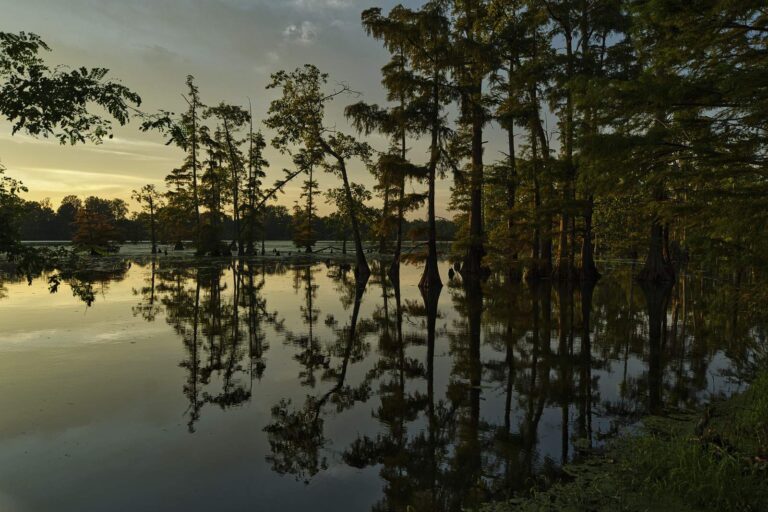
Photo: nearly almost, CC BY-SA 4.0
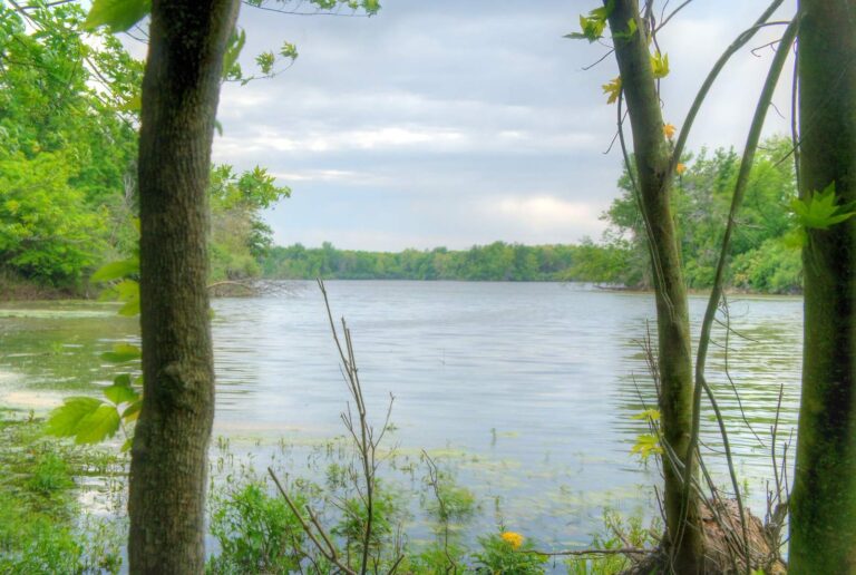
Photo: Denny Armstrong, CC BY 2.0
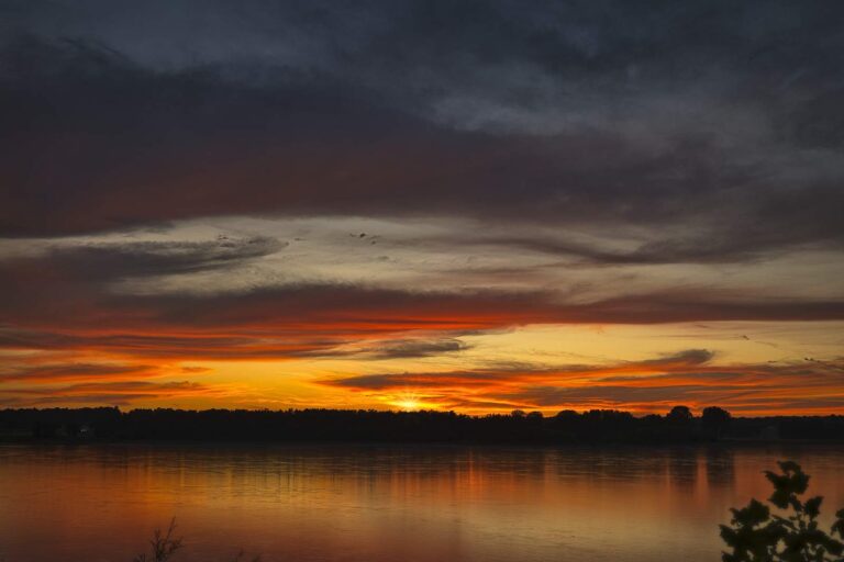
Photo: nearly almost, CC BY-SA 4.0
Photo: Paul Sableman, CC BY 2.0
Fishing inside Jersey County: common questions
Where can I back a trailer into water in Jersey County?
Count 6 launches, Illinois River – Alton Glades Boat Ramp on Illinois River, Alton Pool among them.
Which Jersey County lake has the most acres?
Wock Lake, at 5 acres by the IDNR listing.
What should a visiting angler chase in Jersey County?
Channel catfish tops the count of lake pages within 50 miles, followed by largemouth bass, bluegill and rainbow trout.
Which shops in Jersey County stock fishing gear?
2 listed, such as Bear Hollow Outfitters Inc.
Where can kids borrow tackle in Jersey County?
IDNR lists 2 loaner sites here, starting with Pere Marquette State Parke Lodge in Grafton.
Which town serves as seat of Jersey County?
Jerseyville holds the courthouse.
How much does IDNR charge to fish Jersey County water?
A full year of Illinois fishing costs residents $15; visitors from other states pay $31.50.
Which Illinois counties are a short drive from Jersey County?
Try Calhoun County, Greene County and Macoupin County.
Where do Jersey County limits differ from statewide?
The digest lists 8 site-specific entries for waters in or by this county, starting with Crull Impoundment Wildlife Management Area; the table above shows each.
Which fish did IDNR release into Jersey County lately?
The IDNR table carries 5 rows; the newest lists 3,000 Bluegill x Green Sunfish, Advanced Fingerling (4 – 7") (2026) in Pere Marquette State Park Educational Fishing Pond.
Give a dawn to the water of Jersey County
Each river page carries USGS data that updates itself.