Fishing in Custer County, Idaho
County seat: Challis. Population 4,275.
- 21lake pages
- 19launch sites
- 19river pages
 Pick for salmonPiscifun Viper X spinning reel50% OFFSale $39.99
Photo of Redfish Lake: Sheila Sund, CC BY 2.0
Reservoirs, creeks and launches of Custer County at a glance
Custer County keeps its courthouse in Challis, and the 2020 Census put 4,275 people inside the county. The IDFG Fishing Planner files 90% of the county's listed waters under the IDFG Salmon Region; drainage lines, not the county line, decide the rest. The Planner also lists 196 high mountain lakes here, most reached by trail.
Lake guides cover 21 waters totalling 3,777 acres; Redfish Lake is the biggest. Ocean-run fish show up on the game fish lists of Salmon River, Middle Fork Salmon River, East Fork Salmon River and Loon Creek. Agency maps show 19 launch sites (10 IDFG, 6 Forest Service and 3 BLM). IDFG maps 19 walk-in access sites for anglers on foot.
Census 2020 population and county seat; IDFG Idaho Fishing Planner (list of Idaho waters), read November 7, 2026. IDFG Fishing and Boating Access Sites layer (ArcGIS service), read November 7, 2026.
 For the salmon herePiscifun AlumiX spinning reel46% OFFSale $64.99
A map of Custer County launches and lake points
IDFG Fishing and Boating Access Sites, BLM and Forest Service launch points, Fishing Planner lake points (outlet) and stream midpoints. Checked November 2026.
Custer County lakes and reservoirs with their own page
| Lake | Acres | Launches | Kind | Game fish IDFG names |
|---|---|---|---|---|
| Redfish Lake | 1,505 | 2 | lake | kokanee, bull trout |
| Mackay Reservoir | 1,139 | 2 | reservoir | kokanee, rainbow trout, cutthroat trout |
| Yellow Belly Lake | 193 | 0 | lake | cutthroat trout, brook trout, rainbow trout |
| Stanley Lake | 186 | 1 | lake | kokanee, lake trout, rainbow trout |
| Toxaway Lake | 122 | 0 | high mountain lake | brook trout |
| Summit Reservoir | 97 | 0 | reservoir | |
| Imogene Lake | 77 | 0 | high mountain lake | brook trout, cutthroat trout, rainbow trout |
| Little Redfish Lake | 67 | 0 | lake | brook trout, bull trout |
| Hell Roaring Lake | 57 | 0 | high mountain lake | brook trout, bull trout, cutthroat trout |
| Mosquito Flat Reservoir | 49 | 1 | reservoir | brook trout, rainbow trout, bull trout |
| Jimmy Smith Lake | 48 | 0 | lake | rainbow trout |
| Sullivan Lake | 40 | 0 | high mountain lake | |
| Farley Lake | 33 | 0 | high mountain lake | brook trout |
| Upper Cramer Lake | 30 | 0 | high mountain lake | cutthroat trout – westslope |
| Alpine Lake | 28 | 0 | high mountain lake | |
| Quiet Lake | 28 | 0 | high mountain lake | |
| Bayhorse Lake | 25 | 0 | lake | rainbow trout, cutthroat trout – westslope |
| Little Bayhorse Lake | 17 | 0 | high mountain lake | rainbow trout, cutthroat trout, cutthroat trout – westslope |
| Herd Lake | 17 | 0 | lake | rainbow trout, tiger muskie, tiger muskellunge |
| Buster Lake | 11 | 0 | lake | brook trout |
| Carlson Lake | 9 | 0 | lake | brook trout, tiger muskie, tiger muskellunge |
Surface acres as listed in the IDFG Idaho Fishing Planner, read November 7, 2026. Game fish are the Planner’s recommended species; IDFG prints no lake depths there.
Which fish the Planner ties to water near Custer County
Out to 50 miles from Challis, rainbow trout turns up on the most lake pages.
IDFG Fishing Planner recommended game fish and stocking rows, counted per lake page within 50 miles; not a creel survey.
More named Custer County lakes on the Planner list
Another 195 named lakes in Custer County have too few published facts for a page and are listed here by size.
| Water | Acres | Kind | Nearest town |
|---|---|---|---|
| Quake Lake | 24 | high mountain lake | Sun Valley |
| Sapphire Lake | 22 | high mountain lake | Ketchum |
| Alpine Lake | 22 | high mountain lake | Ketchum |
| Mystery Lake | 20 | high mountain lake | Ketchum |
| Thompson Cirque Lake | 20 | high mountain lake | Ketchum |
| Cirque Lake | 20 | high mountain lake | Ketchum |
| Walker Lake | 20 | high mountain lake | Ketchum |
| Betty Lake | 19 | high mountain lake | Sun Valley |
| Cove Lake | 19 | high mountain lake | Ketchum |
| Horseshoe Lake | 19 | high mountain lake | Cascade |
| Heart Lake | 18 | high mountain lake | Ketchum |
| Goat Lake | 18 | high mountain lake | Sun Valley |
| Swimm Lake | 16 | high mountain lake | Ketchum |
| Lucille Lake | 16 | high mountain lake | Ketchum |
| Profile Lake | 16 | high mountain lake | Ketchum |
| Hummock Lake | 16 | high mountain lake | Ketchum |
| Crater Lake | 16 | high mountain lake | Ketchum |
| Angel Lake | 16 | high mountain lake | Sun Valley |
| Ruffneck Lake | 16 | high mountain lake | Cascade |
| Big Lake (Custer County) | 14 | high mountain lake | Sun Valley |
| Long Lake | 14 | high mountain lake | Sun Valley |
| Tin Cup Lake | 14 | high mountain lake | Ketchum |
| Lodgepole Lake | 14 | high mountain lake | Ketchum |
| Elk Lake | 13 | high mountain lake | Cascade |
| Lost Lake | 13 | high mountain lake | Cascade |
| Castle Lake | 12 | high mountain lake | Ketchum |
| Hatchet Lake | 12 | high mountain lake | Ketchum |
| Island Lake | 12 | high mountain lake | Cascade |
| Martha Lake | 12 | high mountain lake | Cascade |
| Kane Lake | 12 | high mountain lake | Sun Valley |
| Noisy Lake | 12 | high mountain lake | Ketchum |
| Pass Lake | 11 | high mountain lake | Sun Valley |
| Airplane Lake | 11 | high mountain lake | Sun Valley |
| Lonesome Lake | 11 | high mountain lake | Ketchum |
| Helldiver Lake | 11 | high mountain lake | Cascade |
| Spruce Gulch Lake | 11 | high mountain lake | Salmon |
| Calkins Lakes | 11 | high mountain lake | Ketchum |
| Boulder Lake | 10 | high mountain lake | Sun Valley |
| Rough Lake | 10 | high mountain lake | Sun Valley |
| Heart Lake | 10 | high mountain lake | Ketchum |
| Rough Lake | 10 | high mountain lake | Ketchum |
| Hidden Lake (Custer County) | 10 | high mountain lake | Ketchum |
| Rocky Lake | 9 | high mountain lake | Cascade |
| Island Lake | 9 | high mountain lake | Ketchum |
| Goat Lake | 9 | high mountain lake | Ketchum |
| Sheep Lake | 8 | high mountain lake | Ketchum |
| Deer Lakes (Upper) | 8 | high mountain lake | Ketchum |
| Gunsight Lake | 8 | high mountain lake | Ketchum |
| Fourth of July Lake | 8 | high mountain lake | Ketchum |
| Sliderock Lake | 8 | high mountain lake | Ketchum |
| North Fork Lake | 8 | high mountain lake | Ketchum |
| Merriam Lake | 7 | high mountain lake | Sun Valley |
| Scoop Lake | 7 | high mountain lake | Ketchum |
| Phyllis Lake | 7 | high mountain lake | Ketchum |
| Brockie Lake | 7 | high mountain lake | Sun Valley |
| Baldwin Creek Lake | 7 | high mountain lake | Cascade |
| Shelf Lake | 7 | high mountain lake | Ketchum |
| Fishpole Lake | 7 | high mountain lake | Bellevue |
| Stephans Lake | 7 | high mountain lake | Ketchum |
| Cutthroat Lake | 7 | high mountain lake | Cascade |
| Snow Lake | 7 | high mountain lake | Ketchum |
| Hidden Lake (Custer County) | 7 | high mountain lake | Cascade |
| Arrowhead Lake | 7 | high mountain lake | Sun Valley |
| F Eighty-Two Lake | 6 | high mountain lake | Cascade |
| Hope Lake | 6 | high mountain lake | Ketchum |
| Headwall Lake | 6 | high mountain lake | Ketchum |
| Iron Bog Lake | 6 | high mountain lake | Bellevue |
| West Shadow Lake | 6 | high mountain lake | Sun Valley |
| Middle Cramer Lake | 6 | high mountain lake | Ketchum |
| Round Lake (Custer County) | 6 | high mountain lake | Sun Valley |
| Shallow Lake | 6 | high mountain lake | Ketchum |
| Grouse Creek Lake | 6 | lake | Sun Valley |
| Lower Valley Creek Lake | 6 | high mountain lake | Cascade |
| Blue Lake (Custer County) | 6 | high mountain lake | Cascade |
| Feldspar Lake | 6 | high mountain lake | Ketchum |
| Kelly Lake | 6 | high mountain lake | Cascade |
| Lower Cramer Lake | 6 | high mountain lake | Ketchum |
| Willow Lake | 6 | high mountain lake | Ketchum |
| Lightning Lake | 5 | high mountain lake | Ketchum |
| Toxaway Lake C | 5 | high mountain lake | Ketchum |
| Elizabeth Lake | 5 | high mountain lake | Cascade |
| Castleview Lake | 5 | high mountain lake | Ketchum |
| Corral Lake | 5 | high mountain lake | Sun Valley |
| Marten Lake | 5 | high mountain lake | Cascade |
| Pipe Lake | 5 | high mountain lake | Ketchum |
| Baptie Lake | 5 | high mountain lake | Sun Valley |
| Hoodoo Lake (Custer County) | 5 | high mountain lake | Ketchum |
| Bear Creek Lake | 4 | high mountain lake | Sun Valley |
| Copper Lake | 4 | high mountain lake | Sun Valley |
| Emerald Lake (Custer County) | 4 | high mountain lake | Ketchum |
| Newman Lake | 4 | high mountain lake | Cascade |
| Elk Lake | 4 | high mountain lake | Cascade |
| Slide Lake | 4 | high mountain lake | Ketchum |
| Deer Lake Lower | 4 | high mountain lake | Ketchum |
| Edith Lake | 4 | high mountain lake | Ketchum |
| Green Lake | 4 | high mountain lake | Sun Valley |
| Bobber Lake | 4 | high mountain lake | Bellevue |
| Hourglass Lake | 4 | high mountain lake | Ketchum |
| Baker Lake | 4 | high mountain lake | Ketchum |
| Honey Lake | 4 | high mountain lake | Ketchum |
| Bench Lake | 4 | high mountain lake | Sun Valley |
| Beaver Creek Lake | 3 | high mountain lake | Cascade |
| Rainbow Lake | 3 | high mountain lake | Cascade |
| Big Creek Lake | 3 | high mountain lake | Sun Valley |
| Dioxide Lake | 3 | high mountain lake | Ketchum |
| Lake Creek Lake | 3 | high mountain lake | Cascade |
| Scree Lake | 3 | high mountain lake | Ketchum |
| Upper Swauger Lake | 3 | high mountain lake | Sun Valley |
| Clear Lake | 3 | high mountain lake | Sun Valley |
| Upper Cramer Lake A | 3 | high mountain lake | Ketchum |
| Washington Lake | 3 | high mountain lake | Sun Valley |
| East Shadow Lake | 3 | high mountain lake | Sun Valley |
| Grouse Creek Lake | 3 | high mountain lake | Sun Valley |
| Bowknot Lake | 3 | high mountain lake | Ketchum |
| Elk Lake | 3 | high mountain lake | Ketchum |
| Big Fall Creek Lake | 3 | high mountain lake | Sun Valley |
| Boulder Lake | 3 | high mountain lake | Ketchum |
| Crystal Lake (Custer County) | 3 | high mountain lake | Cascade |
| Little Redfish Lake | 3 | high mountain lake | Ketchum |
| Pinyon Lake | 3 | high mountain lake | Ketchum |
Alpine lakes make up 196 of these. Idaho high mountain lakes
IDFG Idaho Fishing Planner (list of Idaho waters), read November 7, 2026.
Rivers and trout creeks of Custer County
- Salmon RiverIDFG recommended water, steelhead or salmon listed, 4 USGS gauges, 425.3 mi Planner length
- Big Lost RiverIDFG recommended water, 6 USGS gauges, 134.9 mi Planner length
- Middle Fork Salmon RiverIDFG recommended water, steelhead or salmon listed, 105.6 mi Planner length
- Pahsimeroi RiverIDFG recommended water, 1 USGS gauge, 58.4 mi Planner length
- East Fork Salmon RiverIDFG recommended water, steelhead or salmon listed, 36.8 mi Planner length
- Loon CreekIDFG recommended water, steelhead or salmon listed, 34.8 mi Planner length
- Yankee Fork Salmon RiverIDFG recommended water, steelhead or salmon listed, 29.8 mi Planner length
- East Fork Big Lost RiverIDFG recommended water, 27.9 mi Planner length
- Valley CreekIDFG recommended water, steelhead or salmon listed, 1 USGS gauge, 27.6 mi Planner length
- North Fork Big Lost RiverIDFG recommended water, 24.6 mi Planner length
- Star Hope CreekIDFG recommended water, 17.1 mi Planner length
- Wildhorse CreekIDFG recommended water, 14.6 mi Planner length
- Antelope Creek1 USGS gauge, 31.1 mi Planner length
- Thousand Springs Creek1 USGS gauge, 13.3 mi Planner length
- Thompson Creek1 USGS gauge, 13 mi Planner length
- Warm Springs Creek1 USGS gauge, 10.8 mi Planner length
- Lower Cedar Creek1 USGS gauge, 8.3 mi Planner length
- Gold Creek5.6 mi Planner length
- Dry Creek3.5 mi Planner length
Custer County creeks the Planner names, listed here only (719)
- Dry Creek24.9 mi
- Wet Creek24.5 mi
- Challis Creek24.1 mi
- Warm Springs Creek23 mi
- Blain Canal21.4 mi
- Morgan Creek21.4 mi
- Warm Spring Creek19.9 mi
- Doublespring Creek18.8 mi
- Sawmill Creek18.7 mi
- Burnett Ditch18.6 mi
- Alturas Lake Creek18.5 mi
- Goldburg Creek17.6 mi
- Summit Creek17.5 mi
- Rapid River16.7 mi
- Knapp Creek16.6 mi
- Garden Creek16.4 mi
- Paasasikwana Naokwaide16.2 mi
- Road Creek16.2 mi
- Beaver Creek16 mi
- Mill Creek15.3 mi
- Meadow Creek15.2 mi
- Cherry Creek15.1 mi
- Germania Creek15 mi
- Marsh Creek14.4 mi
- Redfish Lake Creek14 mi
- Warm Spring Creek14 mi
- Elk Creek13.8 mi
- Grouse Creek13.8 mi
- West Fork Yankee Fork13.7 mi
- East Pass Creek13.6 mi
- East Fork Mayfield Creek13.4 mi
- Big Creek13.1 mi
- Eddy Creek12.8 mi
- Big Boulder Creek12.6 mi
- Darlington Ditch12.6 mi
- Fourth of July Creek12.6 mi
- Basin Creek12.5 mi
- Pole Creek12.1 mi
- Parsons Creek12 mi
- Summit Creek11.9 mi
- Sage Creek11.8 mi
- Stanley Lake Creek11.8 mi
- Little Loon Creek11.7 mi
- Burnt Creek11.5 mi
- Darling Creek11.1 mi
- Big Lake Creek10.9 mi
- Pass Creek10.7 mi
- Slate Creek10.7 mi
- Champion Creek10.5 mi
- Muldoon Creek10.4 mi
- Spar Canyon10.3 mi
- Sulphur Creek10.3 mi
- Long Lost Creek10.2 mi
- Alder Creek10 mi
- Baiya Naokwaide9.7 mi
- Cape Horn Creek9.7 mi
- Fisher Creek9.7 mi
- Horse Basin Creek9.7 mi
- South Fork Big Creek9.6 mi
- Trail Creek (Custer County)9.6 mi
- West Fork Morgan Creek9.6 mi
- Herd Creek9.5 mi
- Twin Bridges Creek9.3 mi
- Little Boulder Creek9.1 mi
- Bayhorse Creek9 mi
- Lake Creek8.8 mi
- Lone Pine Creek8.8 mi
- West Pass Creek8.8 mi
- Kane Creek8.7 mi
- Lake Creek8.7 mi
- Bradshaw Gulch8.6 mi
- Long Creek8.6 mi
- Corral Creek8.5 mi
- Ellis Creek8.3 mi
- Kinnikinic Creek8.3 mi
- Christian Gulch8.2 mi
- Fall Creek8.2 mi
- Soldier Creek8.2 mi
- Trapper Creek8.2 mi
- Lightning Creek (Custer County)8.1 mi
Live river readings in Custer County
| USGS gauge | Latest reading | Time (ET) |
|---|---|---|
| Salmon River Bl Yankee Fork Nr Clayton Id | 468 cfs, 2.17 ft gage height | Nov 12 5:45 pm |
| Big Lost River At Howell Ranch Nr Chilly Id | 93 cfs, 1.06 ft gage height | Nov 12 6:00 pm |
| Valley Creek At Stanley Id | 91 cfs, 0.80 ft gage height | Nov 12 6:00 pm |
| Big Lost River Bl Mackay Res Nr Mackay Id | 60 cfs, 1.48 ft gage height | Nov 12 5:45 pm |
| Yankee Fork Salmon River Nr Clayton Id | 54 cfs, 6.08 ft gage height | Nov 12 6:15 pm |
| Big Lost River Nr Leslie Id | 34 cfs, 3.94 ft gage height | Nov 12 5:45 pm |
US Geological Survey provisional data, retrieved Nov 12, 2026 6:33 pm ET. Provisional readings can be revised.
IDFG Idaho Fishing Planner (list of Idaho waters), read November 7, 2026. Stream lengths as printed in the Planner; USGS gauges live.
Where Custer County streams carry steelhead or salmon
- Salmon RiverIDFG Southwest Region
- Middle Fork Salmon RiverIDFG Salmon Region
- East Fork Salmon RiverIDFG Salmon Region
- Loon CreekIDFG Salmon Region
- Yankee Fork Salmon RiverIDFG Salmon Region
- Valley CreekIDFG Salmon Region
Steelhead and salmon seasons come from separate Fish and Game Commission proclamations, which this site could not read during the November 2026 IDFG site maintenance. Idaho steelhead and salmon rules
IDFG Idaho Fishing Planner (list of Idaho waters), read November 7, 2026.
Stocking rows for Custer County water
IDFG lists 5,740 hatchery releases into Custer County water on its Planner pages: 251,699,615 fish in 19 waters.
- Salmon RiverRainbow Trout – Triploid, 26 fish, Catchable (6+ inches), November 5, 2026
- Stanley LakeCutthroat Trout – Westslope, 18,005 fish, Fry (0-3 inches), October 13, 2026
- Salmon RiverCutthroat Trout – Westslope, 38,679 fish, Fry (0-3 inches), October 13, 2026
- Mosquito Flat ReservoirRainbow Trout – Triploid, 1,475 fish, Catchable (6+ inches), September 1, 2026
- Wildhorse CreekRainbow Trout – Triploid, 668 fish, Catchable (6+ inches), August 26, 2026
- East Fork Big Lost RiverRainbow Trout – Triploid, 380 fish, Catchable (6+ inches), August 26, 2026
- Stanley LakeRainbow Trout – Triploid, 1,312 fish, Catchable (12-14 inches), August 12, 2026
- Little Bayhorse LakeRainbow Trout – Triploid, 975 fish, Catchable (6+ inches), August 12, 2026
- Bayhorse LakeRainbow Trout – Triploid, 2,127 fish, Catchable (6+ inches), August 12, 2026
- Salmon RiverRainbow Trout – Triploid, 1,066 fish, Catchable (12-14 inches), August 11, 2026
- Stanley LakeRainbow Trout – Triploid, 1,014 fish, Catchable (12-14 inches), August 10, 2026
- Salmon RiverRainbow Trout – Triploid, 2,451 fish, Catchable (12-14 inches), August 7, 2026
Stocking rows as printed on the IDFG Fishing Planner water pages (date, species, number and size as listed), read November 7, 2026. Newest releases first.
Launches and walk-in access of Custer County
- Bayhorse Recreation Site boat ramplaunch site, IDFG, boating access, ramp, restroom, camping
- Challis Bridge Recreation Site boat ramplaunch site, IDFG, boating access, ramp, restroom
- Cottonwood Recreation Site boat ramplaunch site, IDFG, fishing access, ramp, restroom, camping
- Mackay Reservoir – Lower boat rampMackay Reservoir, IDFG, boating access, ramp, dock, restroom, camping
- Mackay Reservoir – Upper boat rampMackay Reservoir, IDFG, boating access, ramp, restroom, camping
- Mosquito Flat Reservoir boat rampMosquito Flat Reservoir, IDFG, boating access, ramp, restroom, camping
- Pennal Gulch boat ramplaunch site, IDFG, boating access, ramp, camping
- Redfish Lake launchRedfish Lake, Forest Service, lake and pond fishing
- Sandy Beach Boat Ramp – Day Use Location on Redfish LakeRedfish Lake, Forest Service, boating – motorized, ramp
- South Butte boat ramplaunch site, IDFG, boating access, ramp, restroom, camping
- Stanley Lake launchStanley Lake, Forest Service, lake and pond fishing
- Tappan boat ramplaunch site, IDFG, fishing access, ramp
- Watts Bridge boat ramplaunch site, IDFG, boating access, ramp, restroom, camping
- Yellowbelly Lake launchlaunch site, Forest Service, lake and pond fishing
- Challis Bridge Recreation Site boat ramplaunch site, BLM, boat ramp, ramp
- Dugway Dispersed Site launchlaunch site, BLM, boat launch
- Rothwell Recreation Site launchlaunch site, BLM, boat launch
- Sunbeam Dam launchlaunch site, Forest Service, lake and pond fishing
- Torrey's Hole launchlaunch site, Forest Service, boating – non-motorized
IDFG bank spots of Custer County (19)
- Antelope Creek fishing accessfishing access, camping
- Big Lost River – Lower fishing accessfishing access, restroom, camping
- Big Lost River – Upper fishing accessfishing access, camping
- Blue Mountain Pondfishing access, restroom
- Dry Creek fishing accessfishing access
- Ellis North fishing accessfishing access, camping
- Ellis South fishing accessfishing access, camping
- Ellis Walking Easement fishing accessfishing access
- Gold Creek fishing accessfishing access, camping
- Jimmy Smith Lake fishing accessfishing access, restroom, camping
- M-M (M BAR M) fishing accessfishing access
- Mackay Dam fishing accessfishing access, restroom, camping
- Marinac fishing accessfishing access
- Rothwell fishing accessfishing access, camping
- Sawtooth Kids Pondfishing access, restroom
- Sheep Bridge fishing access (north)fishing access
- South Butte Pond on Paasasikwana Naokwaide Pondfishing access
- Stennett fishing accessfishing access, restroom
- Valley Creek fishing accessfishing access
IDFG Fishing and Boating Access Sites layer (ArcGIS service), read November 7, 2026. BLM and Forest Service points as published; lanes and ramp counts are not fields in any layer.
Fish an angler may keep across Custer County
This is the IDFG Salmon Region block, since most of Custer County's listed water sits in it; special rules printed for a water come first. The annual license fee written into Idaho Code 36-416 is $28.75 for an Idahoan and $106.25 for a visitor; GoOutdoorsIdaho and vendors add processing.
| Group | Rule as printed |
|---|---|
| Bass | No bag, length, or possession limits |
| Brook Trout | Brook Trout limit is 25; Harvest allowed during any open season unless otherwise noted under Special Rules – if gear or bait restrictions are listed, they apply when fishing for Brook Trout |
| Bull Trout | Bull Trout – catch-and-release |
| Kokanee | Kokanee limit is 25 |
| Salmon | Spring and summer Chinook Salmon seasons and limits are set by the Idaho Fish and Game Commission and issued in separate brochures; Seasons and limits for fall Chinook Salmon and Coho Salmon can be found here; Sockeye Salmon fishing is illegal. Defined as ocean-run Oncorhynchus nerka longer than 14 inches in the Salmon River drainage (excluding above Mosquito Flat Dam); Fishing for salmon is prohibited unless a salmo |
| Steelhead | Defined as Rainbow Trout longer than 20 inches in the Salmon River drainage (excluding the Lemhi and Pahsimeroi rivers, lakes and reservoirs, and ponds); Fishing for steelhead is prohibited unless a steelhead season is specifically opened for that water. See fishing regulations for details |
| Sturgeon | Sturgeon – catch-and-release; Sturgeon must not be removed from the water and must be released upon landing; Barbless hooks, sliding swivel device to secure a weight, and a lighter test line to secure weight to sliding swivel device are required. See fishing regulations for details |
| Tiger Muskie | Tiger Muskie limit is 2, none under 40 inches |
| Trout | Trout limit is 6, all species combined; Chinook Salmon and steelhead placed in ponds are counted in the trout bag limit; Bull Trout and Brook Trout are listed separately |
| Whitefish | Whitefish limit is 25; Harvest allowed during any open season unless otherwise noted under Special Rules – if gear or bait restrictions are listed, they apply when fishing for whitefish |
| Protected Nongame Fish including Pacific Lamprey | May not be harvested or possessed |
| All Other Fish Species | No bag, length, or possession limits |
A few listed waters belong to the IDFG Upper Snake Region. Every region table
Custer County water carrying special rules (16)
- Big Lost RiverAll Waters Open All Year
- East Fork Big Lost RiverAll Waters Open All Year
- East Fork Salmon RiverAll Waters Open All Year
- Herd LakeTrout limit is 25
- Jimmy Smith LakeTrout limit is 25
- Loon CreekAll Waters Open All Year
- Middle Fork Salmon RiverAll Waters Open All Year
- North Fork Big Lost RiverAll Waters Open All Year
- Pahsimeroi RiverAll Waters Open All Year
- Redfish LakeJanuary 1 through August 7 – Salmon Region general rules apply
- Salmon RiverAll Waters Open All Year
- Stanley LakeTrout limit is 6, only 2 may be Lake Trout
- Star Hope CreekAll Waters Open All Year
- Valley CreekAll Waters Open All Year
- Wildhorse CreekAll Waters Open All Year
- Yankee Fork Salmon RiverAll Waters Open All Year
Region bag limits from Idaho Fishing Seasons and Rules, 2025-2027 for the Salmon Region, as printed on IDFG Fishing Planner water pages (the brochure PDF on idfg.idaho.gov was unreachable during site maintenance), read November 7, 2026. Fishing license fees as set in Idaho Code 36-416 (statute; IDFG sale prices add vendor and processing fees), read November 7, 2026.
Tackle, flies and outfitters in Custer County
Idaho tackle counters in Custer County
- Bent Rod Outdoorsbait and tackle shop, Challis
- Gone Fishing Enterprises Incbait and tackle shop, Mackay
- Lion's Den Bait & Tackle Shopbait and tackle shop, Mackay
- Stanley Fly Shopfly shop, Stanley
Guides and outfitters based in Custer County
- Sawtooth Fishing Guidesfishing guide, Stanley, (208) 774-8768
- The River Companyfishing guide, Stanley, (208) 788-5775
- Wild Idaho Outfitters, Incfishing guide, Challis, (208) 252-1053
Yellow Pages and chain store listings, guide listings (city of business); retrieved November 7, 2026.
Idaho highways leading out of Custer County
Idaho county guides sharing a line with Custer County
- Lemhi County49 miles north
- Camas County59 miles southwest
- Blaine County63 miles south
- Butte County67 miles southeast
Rods, reels and pliers from Piscifun before Custer County


Piscifun and Amazon links are affiliate links; the site earns a commission on qualifying purchases.
Benchland and bank around Custer County, seen through a lens
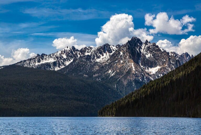
Photo: Sheila Sund, CC BY 2.0
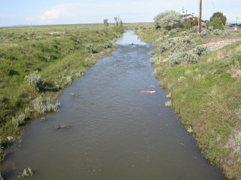
Photo: Matt Lavin, CC BY-SA 2.0


Photo: BLMIdaho, CC BY 2.0

Photo: MonikaMurren, CC BY 2.0
Brief answers on fishing Custer County
How many IDFG, BLM and Forest Service launches serve Custer County?
19 launch sites on the access layers (10 IDFG, 6 Forest Service and 3 BLM).
Which lake in Custer County does IDFG list with the most acres?
Redfish Lake, at 1,505 acres in the IDFG Fishing Planner.
Which game fish does IDFG name on water near Custer County?
Rainbow trout lead the count of lake pages within 50 miles, followed by brook trout, bull trout and cutthroat trout – westslope.
Which Custer County stores keep hooks and flies?
4 in all, starting with Bent Rod Outdoors.
How many Idaho guide listings name a Custer County town?
Count 3 guide listings with a local city.
Which Idaho town holds the Custer County county offices?
Challis is the seat.
Does fishing in Custer County need an Idaho license?
The annual license fee written into Idaho Code 36-416 is $28.75 for an Idahoan and $106.25 for a visitor; GoOutdoorsIdaho and vendors add processing.
Which Idaho county guides ring Custer County?
The nearest county pages are Lemhi County, Camas County and Blaine County.
Which IDFG region covers most Custer County water?
90% of the Planner waters sit in the IDFG Salmon Region.
Does IDFG print special rules for any Custer County water?
The Planner prints special rules for 16 county waters with a page here, starting with Big Lost River; the list above shows the first ones.
Does IDFG stock fish in Custer County?
5,740 IDFG releases listed on Planner pages, 251,699,615 fish; the newest went into Salmon River on Nov. 5, 2026.
Can I fish for salmon in Custer County?
The Planner lists steelhead or salmon on Salmon River, Middle Fork Salmon River and East Fork Salmon River. This page leaves out steelhead and salmon dates because the Commission proclamations were not reachable on the IDFG site in November 2026.
Choose an IDFG lake or river in Custer County
Open a lake for its launches, limits and releases.