Fishing in Boise County, Idaho
County seat: Idaho City. Population 7,610.
- 10lake pages
- 11launch sites
- 12river pages
 Pick for yellow perchPiscifun Carbon X ultralight spinning reel28% OFFSale $57.99
Photo of Arrowrock Reservoir: Idaho Fish and Game, CC BY-SA 2.0
Fishing Boise County from the valley floor to the high country
County government for Boise County meets in Idaho City; the 2020 count found 7,610 residents. Of the waters the Planner lists for the county, 100% sit in the IDFG Southwest Region, the region whose limits most of it follows. Hikers can aim for 48 high mountain lakes on the Planner list.
Of 10 lakes with pages, spanning 6,129 acres combined, Arrowrock Reservoir comes first by size. 11 launch sites appear on the access layers here, 5 Forest Service, 4 BLM and 2 IDFG. The IDFG layer adds 1 walk-in access site with no ramp, built for bank fishing.
Census 2020 population and county seat; IDFG Idaho Fishing Planner (list of Idaho waters), read November 7, 2026. IDFG Fishing and Boating Access Sites layer (ArcGIS service), read November 7, 2026.
Where to wet a line across Boise County, plotted
IDFG Fishing and Boating Access Sites, BLM and Forest Service launch points, Fishing Planner lake points (outlet) and stream midpoints. Checked November 2026.
Still water guides inside Boise County, biggest first
| Lake | Acres | Launches | Kind | Game fish IDFG names |
|---|---|---|---|---|
| Arrowrock Reservoir | 3,015 | 1 | reservoir | kokanee, yellow perch, mountain whitefish |
| Lucky Peak Reservoir | 2,766 | 0 | reservoir | kokanee, yellow perch, mountain whitefish |
| Ardeth Lake | 78 | 0 | high mountain lake | |
| Bull Trout Lake | 72 | 0 | lake | brook trout, rainbow trout, atlantic salmon |
| Edna Lake | 57 | 0 | high mountain lake | cutthroat trout, rainbow trout, rainbow x cutthroat trout |
| Baron Lake | 49 | 0 | high mountain lake | brook trout, cutthroat trout, rainbow trout |
| Hidden Lake (Boise County) | 40 | 0 | high mountain lake | cutthroat trout, rainbow trout |
| Vernon Lake | 31 | 0 | high mountain lake | cutthroat trout, rainbow trout, salmon and trout |
| Horseshoe Bend Mill Pond | 14 | 1 | lake | bluegill and sunfish, largemouth bass, channel catfish |
| Martin Lake | 6 | 0 | lake | brook trout, rainbow trout |
Surface acres as listed in the IDFG Idaho Fishing Planner, read November 7, 2026. Game fish are the Planner’s recommended species; IDFG prints no lake depths there.
 For the yellow perch herePiscifun Carbon XT ultralight spinning reel25% OFFSale $59.99
Most-listed game fish on water around Boise County
Lake pages up to 50 miles from Idaho City were counted by species, and rainbow trout leads.
IDFG Fishing Planner recommended game fish and stocking rows, counted per lake page within 50 miles; not a creel survey.
Alpine tarns and ponds of Boise County without a page
These 50 Boise County lakes sit on the Planner list without a guide yet.
| Water | Acres | Kind | Nearest town |
|---|---|---|---|
| Elk Lake | 21 | high mountain lake | Ketchum |
| Three Lake | 20 | high mountain lake | Ketchum |
| Upper Baron Lake | 18 | high mountain lake | Ketchum |
| Pitchfork Lake | 17 | high mountain lake | Ketchum |
| Everly Lake | 12 | high mountain lake | Ketchum |
| Virginia Lake | 12 | high mountain lake | Ketchum |
| Warbonnet Lake | 12 | high mountain lake | Ketchum |
| Three Island Lake | 11 | high mountain lake | Ketchum |
| Packrat Lake | 11 | high mountain lake | Ketchum |
| Kate Lake | 10 | high mountain lake | Ketchum |
| Benedict Lake | 10 | high mountain lake | Ketchum |
| Oreamnos Lake | 10 | high mountain lake | Ketchum |
| Cony Lake | 8 | high mountain lake | Ketchum |
| Helen Lake | 8 | high mountain lake | Ketchum |
| Pinchot Creek Lake | 8 | high mountain lake | Ketchum |
| Rock Slide Lake | 8 | high mountain lake | Ketchum |
| Trail Lake | 8 | high mountain lake | Ketchum |
| Little Baron Lake | 7 | high mountain lake | Ketchum |
| Upper Vernon Lake | 6 | high mountain lake | Ketchum |
| Blue Rock Lake | 6 | high mountain lake | Ketchum |
| Pinchot Mountain Lake | 6 | high mountain lake | Ketchum |
| Cow Lake | 5 | high mountain lake | Robie Creek |
| Home Lake | 5 | lake | Avimor |
| Jennie Lake | 5 | high mountain lake | Robie Creek |
| Temple Lake | 4 | high mountain lake | Ketchum |
| Little Warbonnet Lake | 4 | high mountain lake | Ketchum |
| Braxon Lake | 4 | high mountain lake | Ketchum |
| Arlin Lake | 4 | high mountain lake | Ketchum |
| Zumwalt Lake | 4 | high mountain lake | Cascade |
| Limber Lake | 3 | high mountain lake | Ketchum |
| Eileen Lake | 3 | high mountain lake | Ketchum |
| Linda Lake | 3 | high mountain lake | Ketchum |
| Regan Lake | 3 | high mountain lake | Ketchum |
| Bead Lake, Lower | 3 | high mountain lake | Ketchum |
| McWillards Lake | 2 | high mountain lake | Ketchum |
| Bead Lake, Upper | 2 | high mountain lake | Ketchum |
| Big River Lake | 2 | high mountain lake | Robie Creek |
| Lowman Ponds | 2 | lake | Cascade |
| Meadow Lake | 2 | high mountain lake | Ketchum |
| Lower Braxon Lake | 2 | high mountain lake | Ketchum |
| Karney Lakes | 1 | lake | Robie Creek |
| Lorenzo Creek Lake | 1 | high mountain lake | Cascade |
| Heather Lake | 1 | high mountain lake | Ketchum |
| South Fork Cub Creek Lake | 1 | high mountain lake | Robie Creek |
| Centerville Dredge Pond | 1 | lake | Robie Creek |
| Idaho City Pond | 1 | lake | Robie Creek |
| Tenmile Lake | 0 | high mountain lake | Robie Creek |
| Bear Pond | 0 | lake | Avimor |
| Mud Lake (Boise County) | 0 | high mountain lake | Emmett |
| Gates Creek Lake | 0 | lake | Cascade |
IDFG files 48 here as high mountain lakes. Idaho high mountain lakes
IDFG Idaho Fishing Planner (list of Idaho waters), read November 7, 2026.
IDFG-listed rivers with their own guide in Boise County
- Deadwood RiverIDFG recommended water, 1 launch, 1 USGS gauge, 49.1 mi Planner length
- North Fork Payette RiverIDFG recommended water
- South Fork Boise RiverIDFG recommended water
- Payette RiverIDFG recommended water, 4 USGS gauges
- North Fork Boise RiverIDFG recommended water, 50.3 mi Planner length
- Middle Fork Payette RiverIDFG recommended water, 48.2 mi Planner length
- Grimes CreekIDFG recommended water, 42.9 mi Planner length
- Mores CreekIDFG recommended water, 1 USGS gauge, 40 mi Planner length
- Scott CreekIDFG recommended water, 7.7 mi Planner length
- Alder Creek1 launch, 7.6 mi Planner length
- Deer Creek1 launch, 7.1 mi Planner length
- Crooked River (Boise County)29.7 mi Planner length
Creeks of Boise County still without an IDFG guide (448)
- Clear Creek21.4 mi
- Dry Creek21.2 mi
- Warm Spring Creek16.2 mi
- Shafer Creek16.1 mi
- South Fork Willow Creek14.5 mi
- Lightning Creek (Boise County)14.4 mi
- Bear River14.3 mi
- Elk Creek13.1 mi
- Anderson Creek12.6 mi
- Eightmile Creek12.2 mi
- Tenmile Creek11.6 mi
- Granite Creek11.4 mi
- Scriver Creek10.9 mi
- Stewart Gulch10.9 mi
- Canyon Creek10.7 mi
- Rock Creek10.6 mi
- Cottonwood Creek10.3 mi
- Harris Creek10.3 mi
- Spring Valley Creek10 mi
- Soldier Creek9.9 mi
- Baron Creek9.8 mi
- Rabbit Creek9.4 mi
- Brownlee Creek9.3 mi
- Dry Buck Creek9.2 mi
- Crane Creek (Ada County)9 mi
- Pikes Fork8.9 mi
- Hill Creek8.4 mi
- Clear Creek8.3 mi
- Porter Creek8.3 mi
- Bear Creek8.2 mi
- Goat Creek8.2 mi
- Daggett Creek8.1 mi
- Fivemile Creek7.9 mi
- Miller Creek7.9 mi
- Big Bulldog Creek7.7 mi
- Robie Creek7.7 mi
- Cottonwood Creek7 mi
- Macks Creek7 mi
- Beaver Creek6.7 mi
- Currant Creek6.7 mi
- Middle Fork Big Pine Creek6.7 mi
- French Creek6.6 mi
- Jackass Creek6.6 mi
- Little Beaver Creek6.6 mi
- Meadow Creek6.6 mi
- Big Owl Creek6.4 mi
- German Creek6.4 mi
- West Fork Clear Creek6.4 mi
- Logging Gulch6.3 mi
- Middle Fork Thorn Creek6.3 mi
- Ophir Creek6.3 mi
- Pyle Creek6.2 mi
- Howell Creek6.1 mi
- Smith Creek6.1 mi
- Granite Creek6 mi
- Cottonwood Creek5.9 mi
- Grouse Creek5.9 mi
- No Man Creek5.9 mi
- Bannock Creek5.8 mi
- East Fork Eightmile Creek5.8 mi
- Ninemile Creek5.8 mi
- Hunter Creek5.6 mi
- Wapiti Creek5.6 mi
- Warm Springs Creek5.6 mi
- Cat Creek5.5 mi
- Clear Creek5.5 mi
- Lick Creek5.5 mi
- Minneha Creek5.5 mi
- Trail Creek (Boise County)5.5 mi
- Coon Creek5.4 mi
- Danskin Creek5.4 mi
- Sawmill Creek5.4 mi
- Canyon Creek5.3 mi
- Bogus Creek5.2 mi
- East Fork Big Pine Creek5.2 mi
- Lost Creek5.2 mi
- Rock Creek5.2 mi
- Wolf Creek5.2 mi
- Jackson Creek5.1 mi
- Pinchot Creek5.1 mi
How Boise County rivers are running
| USGS gauge | Latest reading | Time (ET) |
|---|---|---|
| Payette River Nr Horseshoe Bend Id | 808 cfs, 2.68 ft gage height | Nov 13 6:30 pm |
| Boise River Nr Twin Springs Id | 315 cfs, 5.28 ft gage height | Nov 13 6:30 pm |
| South Fork Payette River At Lowman, Id | 308 cfs, 3.25 ft gage height | Nov 13 6:30 pm |
| Nf Payette River Nr Banks Id | 244 cfs, 3.92 ft gage height | Nov 13 7:00 pm |
| Middle Fork Payette River Nr Crouch Id | 100 cfs, 5.49 ft gage height | Nov 13 6:30 pm |
| Mores Creek Ab Robie Creek Nr Arrowrock Dam Id | 39 cfs, 1.94 ft gage height | Nov 13 6:30 pm |
US Geological Survey provisional data, retrieved Nov 13, 2026 7:33 pm ET. Provisional readings can be revised.
IDFG Idaho Fishing Planner (list of Idaho waters), read November 7, 2026. Stream lengths as printed in the Planner; USGS gauges live.
Recent IDFG hatchery releases in Boise County
Boise County water took 12,567,559 hatchery fish in 2,707 listed releases, spread over 18 waters.
- Horseshoe Bend Mill PondRainbow Trout – Triploid, 373 fish, Catchable (6+ inches), October 14, 2026
- Lucky Peak ReservoirRainbow Trout, 4,140 fish, Catchable (6+ inches), October 8, 2026
- Arrowrock ReservoirRainbow Trout – Triploid, 20,961 fish, Fingerling (3-6 inches), September 30, 2026
- Vernon LakeRainbow Trout – Triploid, 2,002 fish, Fry (0-3 inches), September 22, 2026
- Arrowrock ReservoirRainbow Trout – Triploid, 9,000 fish, Catchable (12-14 inches), September 22, 2026
- South Fork Boise RiverRainbow Trout – Triploid, 971 fish, Catchable (12-14 inches), August 20, 2026
- North Fork Boise RiverRainbow Trout – Triploid, 1,737 fish, Catchable (12-14 inches), August 19, 2026
- South Fork Boise RiverRainbow Trout – Triploid, 955 fish, Catchable (12-14 inches), August 13, 2026
- North Fork Payette RiverRainbow Trout – Triploid, 280 fish, Catchable (12-14 inches), August 12, 2026
- South Fork Boise RiverRainbow Trout – Triploid, 1,059 fish, Catchable (12-14 inches), August 10, 2026
- North Fork Boise RiverRainbow Trout – Triploid, 1,680 fish, Catchable (12-14 inches), August 5, 2026
- Middle Fork Payette RiverRainbow Trout – Triploid, 770 fish, Catchable (12-14 inches), August 4, 2026
Stocking rows as printed on the IDFG Fishing Planner water pages (date, species, number and size as listed), read November 7, 2026. Newest releases first.
Where to back a trailer down in Boise County
- Alder Creek boat rampAlder Creek, IDFG, fishing access
- Arrowrock Boat RampArrowrock Reservoir, Forest Service, boating – motorized, ramp
- Deadwood River Access SiteDeadwood River, Forest Service, boating – non-motorized
- Horseshoe Bend Mill Pond boat rampHorseshoe Bend Mill Pond, IDFG, fishing access, ramp, dock, restroom
- Banks Beach Picnic Area launchlaunch site, Forest Service, boating – non-motorized
- Banks River Accesslaunch site, Forest Service, boating – non-motorized
- Beehive Bend launchlaunch site, BLM, boat takeout
- Confluence launchlaunch site, BLM, boat takeout
- Deer Creek launchDeer Creek, BLM, boat launch
- Lowman Nature Ponds launchlaunch site, Forest Service, lake and pond fishing
- Parnell Recreation Site launchlaunch site, BLM, boat takeout
IDFG access sites, Boise County (1)
- Lowman Nature Pondfishing access, restroom
IDFG Fishing and Boating Access Sites layer (ArcGIS service), read November 7, 2026. BLM and Forest Service points as published; lanes and ramp counts are not fields in any layer.
Tackle stores closest to Boise County
- Tackle.io, Incbait and tackle shop, Boise, 24 miles
- Pro Salmon & Steelhead Shopbait and tackle shop, Boise, 25 miles
- Topper Tacklebait and tackle shop, Boise, 26 miles
- NW School of Fly Fishingfly shop, Boise, 26 miles
- Dick's Sporting Goods, 131 N Milwaukee Stbait and tackle shop, Boise, 27 miles
Yellow Pages and chain store listings; straight-line miles from Idaho City only for shops with an exact point.
The 2025-2027 limits behind Boise County fishing
The table below is the IDFG Southwest Region block of the 2025-2027 brochure, the one that governs most of the county's listed waters; a lake or stream in another region follows that region's block. Idaho Code 36-416 fixes the annual fishing license fee at $28.75 for residents and $106.25 for nonresidents, and IDFG vendors add their own handling charge.
| Group | Rule as printed |
|---|---|
| Bass | Bass limit is 6, both species combined; None under 12 inches |
| Brook Trout | Brook Trout limit is 25; Harvest allowed during any open season unless otherwise noted under Special Rules – if gear or bait restrictions are listed, they apply when fishing for Brook Trout |
| Bull Trout | Bull Trout – catch-and-release |
| Kokanee | Kokanee limit is 6 |
| Salmon | Spring and summer Chinook Salmon seasons and limits are set by the Idaho Fish and Game Commission and issued in separate brochures; Seasons and limits for fall Chinook Salmon and Coho Salmon can be found here; Sockeye Salmon fishing is illegal. Defined as ocean-run Oncorhynchus nerka longer than 14 inches in the Snake River drainage below Hells Canyon Dam, the Salmon River drainage (excluding above Mosquito Flat Dam) |
| Steelhead | Defined as Rainbow Trout longer than 20 inches in the Salmon River drainage (excluding lakes and reservoirs). Between Hells Canyon Dam and Oxbow Dam and the Boise River from its mouth upstream to Barber Dam during steelhead seasons, steelhead are Rainbow Trout over 20 inches with the adipose fin clipped (as evidenced by a healed scar); Fishing for steelhead is prohibited unless a steelhead season is specifically open |
| Sturgeon | Sturgeon – catch-and-release; Sturgeon must not be removed from the water and must be released upon landing; Barbless hooks, sliding swivel device to secure a weight, and a lighter test line to secure weight to sliding swivel device are required. See fishing regulations for details |
| Tiger Muskie | Tiger Muskie limit is 2, none under 40 inches |
| Trout | Trout limit is 6, all species combined; Chinook Salmon and steelhead placed in ponds are counted in the trout bag limit; Bull Trout and Brook Trout are listed separately |
| Walleye | No bag, length, or possession limits. Harvest is encouraged (Stocked illegally in this Region. May be harmful to existing fisheries.) |
| Whitefish | Whitefish limit is 25; Harvest allowed during any open season unless otherwise noted under Special Rules – if gear or bait restrictions are listed, they apply when fishing for whitefish |
| Protected Nongame Fish | May not be harvested or possessed |
| All Other Fish Species | No bag, length, or possession limits |
Exceptions printed for Boise County water (10)
- Crooked River (Boise County)All Waters Open All Year
- Deadwood RiverAll Waters Open All Year
- Grimes CreekAll Waters Open All Year
- Middle Fork Payette RiverAll Waters Open All Year
- Mores CreekAll Waters Open All Year
- North Fork Boise RiverAll Waters Open All Year
- North Fork Payette RiverAll Waters Open All Year
- Payette RiverAll Waters Open All Year
- Scott CreekAll Waters Open All Year
- South Fork Boise RiverAll Waters Open All Year
Region bag limits from Idaho Fishing Seasons and Rules, 2025-2027 for the Southwest Region, as printed on IDFG Fishing Planner water pages (the brochure PDF on idfg.idaho.gov was unreachable during site maintenance), read November 7, 2026. Fishing license fees as set in Idaho Code 36-416 (statute; IDFG sale prices add vendor and processing fees), read November 7, 2026.
Record fish IDFG announced near Boise County
The 2026 announcements name no Boise County water; these neighbours within 80 miles do.
| Species | Record | Kind | Water | Date |
|---|---|---|---|---|
| Bullhead Catfish | 17 inches | catch-and-release (length) | Cascade Reservoir | Sept. 5, 2026 |
| Lake Trout | 43.25 inches | catch-and-release (length) | Payette Lake | date not printed |
Idaho state record fish, read November 8, 2026. A partial list: records IDFG announced in 2026.
Idaho places beside Boise County worth a look
Where to sleep in Boise County
- Robie Creekpop. 1,193
Counties ringing Boise County
- Gem County34 miles west
- Elmore County43 miles south
- Ada County45 miles southwest
- Payette County51 miles west
Piscifun tackle lined up for a day on Boise County


Piscifun and Amazon links are affiliate links; the site earns a commission on qualifying purchases.
Gem State water near Boise County, on camera
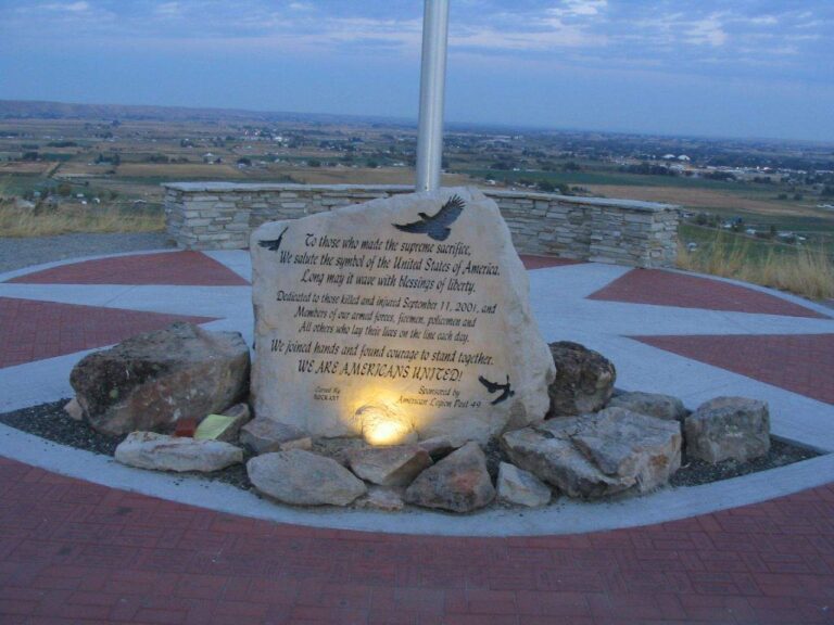
Photo: Ken Lund, CC BY-SA 2.0
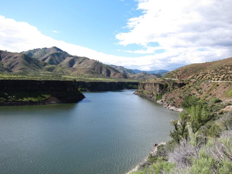
Photo: Stephen Hanafin, CC BY-SA 2.0
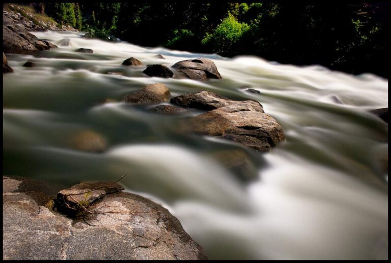
Photo: Charles Knowles, CC BY 2.0
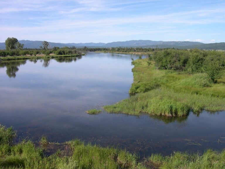
Photo: Thayne Tuason, CC BY-SA 4.0

Pinning down the details of fishing Boise County
Does IDFG manage any boat access in Boise County?
The layers hold 11 launch sites: 5 Forest Service, 4 BLM and 2 IDFG.
Which Boise County lake is largest on the IDFG Fishing Planner?
Arrowrock Reservoir, at 3,015 acres in the IDFG Fishing Planner.
What do Idaho anglers catch around Boise County?
Rainbow trout lead the count of lake pages within 50 miles, followed by bluegill and sunfish, largemouth bass and yellow perch.
Does Boise County have an Idaho fly shop or bait counter listed?
Every Yellow Pages tackle listing sits outside this Idaho county.
Which guide businesses list an address in Boise County?
Outfitters in the listings work from other counties.
In which Idaho town do Boise County commissioners sit?
The county courthouse stands in Idaho City, Idaho.
What license fee applies to Boise County anglers?
Idaho Code 36-416 fixes the annual fishing license fee at $28.75 for residents and $106.25 for nonresidents, and IDFG vendors add their own handling charge.
Which Idaho counties share a border with Boise County?
Gem County, Elmore County and Ada County lie closest.
Which IDFG region sets the limits for Boise County?
The IDFG Southwest Region, with 100% of the listed waters.
Does IDFG set special limits anywhere in Boise County?
The Planner prints special rules for 10 county waters with a page here, starting with Crooked River (Boise County); the list above shows the first ones.
Which Boise County waters get hatchery fish?
2,707 IDFG releases listed on Planner pages, 12,567,559 fish; the newest went into Horseshoe Bend Mill Pond on Oct. 14, 2026.
Plan an Idaho day on Boise County water
Launch pages give the agency, facilities and directions.