Fishing in White County, Arkansas
County seat: Searcy. Population 76,822 (2020).
- 18lake pages
- 32launches
- 7river pages
 Pick for troutPiscifun Carbon X ultralight spinning reel28% OFFSale $57.99
Photo of Heber Springs: Brandonrush, CC0 1.0
White County water in figures
Searcy serves as seat of White County, a county of 76,822 at the 2020 Census. The county holds 18 lakes with their own guide; Lake Barnett leads on size. The county reaches trout water at Greers Ferry Tailwater.
AGFC layers put 32 boat or paddle launches and 18 pier or bank sites in the county. Float or wade White River, Little Red River and Point Remove Creek, each with a page. Stocked town fishing comes from 1 program pond, such as Searcy City Lake.
U.S. Census Bureau, 2020 Census counts (TIGERweb) and the 2023 Gazetteer, read November 8, 2026. AGFC access layer (ArcGIS service), read November 8, 2026.
 For the trout herePiscifun Carbon XT ultralight spinning reel25% OFFSale $59.99
Pins for White County lakes, rivers and launches
AGFC boat-and-kayak and fishing access layers and AGFC fishing-area lake points, checked November 8, 2026.
Reservoirs to fish in White County
| Lake | Size | Ramps | Kind | AGFC target fish |
|---|---|---|---|---|
| Lake Barnett | 245 acres | 3 | reservoir | black bass, bream, catfish |
| Bald Knob City Lake | 217 acres | 1 | reservoir | black bass, bream, catfish |
| Cargile Lake | 125 acres | 2 | reservoir | black bass, bream, catfish |
| Horseshoe Lake (White County) | about 70 acres of mapped outline | 1 | lake | black bass, bream, catfish |
| Killingsworth Lake | 47 acres | 0 | lake | black bass, bream, catfish |
| Big Hurricane Lake | about 43 acres of mapped outline | 1 | oxbow or natural lake | black bass, bream, catfish |
| Whirl Lake | about 30 acres of mapped outline | 1 | lake | black bass, bream, catfish |
| Toms Lake | 23 acres | 1 | lake | black bass, bream, catfish |
| Honey Lake | 18 acres | 1 | lake | black bass, bream, catfish |
| Mallard Pond | about 11 acres of mapped outline | 1 | mapped pond | black bass, bream, catfish |
| Big Bell Lake | about 11 acres of mapped outline | 1 | oxbow or natural lake | black bass, bream, catfish |
| Willow Pond | about 9 acres of mapped outline | 0 | mapped pond | black bass, bream, catfish |
| Blue Hole Access | about 8 acres of mapped outline | 0 | lake | black bass, bream, catfish |
| Bull Creek Outdoors Pond | 7 acres | 0 | mapped pond | black bass, bream, catfish |
| Deep Bank Slough | about 6 acres of mapped outline | 1 | lake | black bass, bream, catfish |
| Searcy City Lake | 4 acres | 0 | FCFP pond | bream, catfish, trout (seasonal stocking) |
| Three Sisters Lake | about 2 acres of mapped outline | 2 | lake | black bass, bream, catfish |
| Beebe Community Pond | about 2 acres of mapped outline | 0 | mapped pond | bream, catfish, trout (seasonal stocking) |
Acreage and depth as AGFC states them in its description of this water (AGFC page), read November 8, 2026. Sizes AGFC does not state print as mapped outline area. Target fish as AGFC lists them.
Which fish AGFC names most often near White County
The bars tally 50 miles of lake pages around Searcy; catfish is named most.
AGFC public fishing area target species, counted per lake page within 50 miles; a listing, not a catch survey.
More still water on the books in White County
The maps show 13 more named lakes and ponds in White County, sorted by outline size.
| Water | Size | Kind | Nearest town |
|---|---|---|---|
| Lake Bald Knob | about 169 acres of mapped outline | lake | Bald Knob |
| Bradford Lake | about 20 acres of mapped outline | lake | Bradford |
| Higginson City Water Treatment Pond | about 7 acres of mapped outline | mapped pond | Higginson |
| Little Hurricane Lake | about 7 acres of mapped outline | lake | Augusta |
| Bald Knob Community Pond | about 3 acres of mapped outline | mapped pond | Bald Knob |
| Little Green Tom Lake | about 1 acres of mapped outline | mapped pond | Augusta |
| Judsonia City Park Lake | about 1 acres of mapped outline | mapped pond | Judsonia |
| Higginson City Pond | not stated | mapped pond | Higginson |
| Mud Pond | not stated | mapped pond | Georgetown |
| Bollie Pond | not stated | mapped pond | Augusta |
| Camp Powder Fork Pond | not stated | mapped pond | Bald Knob |
| Mud Pond | not stated | mapped pond | Hattieville |
| Mud Pond Slough | not stated | mapped pond | Hattieville |
Outline area from the USGS National Hydrography Dataset outline (GIS polygon area, not an AGFC surface-acre figure), read November 8, 2026. AGFC public fishing areas map (agfc.com), read November 8, 2026.
Float streams in White County
- White RiverAGFC trout water, 53 AGFC accesses, 15 USGS gauges
- Little Red RiverAGFC trout water, 16 AGFC accesses, 3 USGS gauges
- Point Remove Creek6 AGFC accesses
- Raft Creek6 AGFC accesses
- Cut-Off Creek4 AGFC accesses, 1 USGS gauge
- Glaise Creek2 AGFC accesses
- Departee Creek1 AGFC access
How rivers in White County are flowing
| USGS gauge | Latest reading | Time (ET) |
|---|---|---|
| White River At Georgetown, Ar | 7,590 cfs, 0.10 ft gage height | Nov 12 7:00 pm |
| Little Red River Near Dewey, Ar | 109 cfs, 3.01 ft gage height | Nov 12 6:45 pm |
| Cutoff Creek Near Rio Vista, Ar | 189.15 ft gage height | Nov 12 7:15 pm |
| Little Red River At Judsonia, Ar | 1.05 ft gage height | Nov 12 7:00 pm |
US Geological Survey provisional data, retrieved Nov 12, 2026 7:33 pm ET. Provisional readings can be revised.
AGFC public fishing areas map (agfc.com), read November 8, 2026. USGS Water Data for the Nation, live through the site, retrieved on page view.
Trout tailwater pages for White County
- Greers Ferry TailwaterLittle Red River
AGFC public fishing areas map (agfc.com), read November 8, 2026. AGFC trout waters page, read November 8, 2026.
FCFP ponds across White County
| Pond | City | Stocked with | Last stocking |
|---|---|---|---|
| Searcy City Lake | Searcy | Catfish and Trout | catfish last stocked September 29, 2026; trout last stocked December 15, 2025 |
Family and Community Fishing Program ponds
Last-stocked dates as printed on the AGFC Family and Community Fishing Program page (agfc.com; AGFC prints no numbers per pond), read November 8, 2026.
Launch sites inside White County
- Bald Knob Lake Boat Ramp on Bald Knob City LakeBald Knob City Lake, boat ramp, gravel surface, picnic tables, recreational area, restrooms
- Blue Hole Boat Rampwater not named, boat ramp, gravel surface, camping
- Deep Bank Slough Boat RampDeep Bank Slough, boat ramp, concrete surface, camping, picnic tables, recreational area
- Departee Creek Estep Unit Parking Area Boat Ramp on Horseshoe LakeHorseshoe Lake, boat ramp, camping, picnic tables, recreational area
- Georgetown Boat Ramp on White RiverWhite River, boat ramp, concrete surface
- Glaise Creek #3 Boat RampGlaise Creek, boat ramp, concrete surface, camping, rv
- Lake Barnett Boat RampLake Barnett, boat ramp, concrete surface
- Lake Barnett Primitive AccessLake Barnett, boat ramp, gravel surface
- Little Red River Boat RampLittle Red River, boat ramp, concrete surface, rv
- Mallard Pond Boat RampMallard Pond, boat ramp, dirt surface, rv
- Monaghan/Womack Hwy. 305 Access on Little Red RiverLittle Red River, boat ramp, concrete surface, restrooms
- Nimmo Boat Ramp on Little Red RiverLittle Red River, boat ramp, concrete surface
- Ramsey Boat Ramp on Little Red RiverLittle Red River, boat ramp, concrete surface, restrooms
- Reed Boat Ramp on Lake BarnettLake Barnett, boat ramp, concrete surface
- Riding Boat Ramp on Little Red RiverLittle Red River, boat ramp, concrete surface, restrooms
- Section 34 Boat Ramp on Raft CreekRaft Creek, boat ramp, paved surface
- Tom's Lake Boat RampToms Lake, boat ramp, concrete surface
- West Point Boat Ramp on Little Red RiverLittle Red River, boat ramp, concrete plank surface
- Whirl Lake Boat RampWhirl Lake, boat ramp, concrete surface, camping
- Glaise Creek #1 Boat RampGlaise Creek, boat ramp, concrete surface
- Glaise Creek #2 Boat RampGlaise Creek, boat ramp, gravel surface
- Parking Boat RampDepartee Creek WMA, boat ramp
- Public boat ramp on Big Bell LakeBig Bell Lake, boat ramp, concrete surface, camping, picnic tables, recreational area
- Public boat ramp on Big Hurricane LakeBig Hurricane Lake, boat ramp, concrete surface, camping, picnic tables, recreational area
- Public boat ramp on Honey LakeHoney Lake, boat ramp, concrete surface, camping, picnic tables, recreational area
- Public boat ramp on Raft CreekRaft Creek, boat ramp, concrete surface, rv
- Public boat ramp on Raft CreekRaft Creek, boat ramp, concrete surface
- Public boat ramp on Raft Creek (east), White CountyRaft Creek, boat ramp, concrete surface
- Public boat ramp on Raft Creek (east), White CountyRaft Creek, boat ramp, concrete surface, rv
- Public boat ramp on Raft Creek (west)Raft Creek, boat ramp, concrete surface, rv
- Public boat ramp on Three Sisters Lake (east)Three Sisters Lake, boat ramp, concrete surface
- Public boat ramp on Three Sisters Lake (west)Three Sisters Lake, boat ramp, gravel surface, camping
Shore spots inside White County
- Beebe Community PondBeebe Community Pond, bank fishing
- Bull Creek Outdoors PondBull Creek Outdoors Pond, bank fishing
- Honey Lake Camping Area Fishing AccessHoney Lake, bank fishing, camping, picnic tables, recreational area
- Killingsworth Lake Fishing AccessKillingsworth Lake, bank fishing
- Searcy City Lake PierSearcy City Lake, fishing pier, mobility-impaired
- Goose Pond Parking AreaGoose Pond, fishing area
- Hurricane Lake Camping Area Fishing Access on Glaise CreekGlaise Creek, fishing area, rv
- Hurricane Lake Camping Area Fishing Access on Willow PondWillow Pond, fishing area, rv
- Judsonia City Park LakeJudsonia City Park Lake, fishing area
- Lake Cargile Parking Area Fishing AccessCargile Lake, bank fishing
- Little Hurricane Lake Fishing AccessLittle Hurricane Lake, fishing area
- Mud Pond Parking AreaMud Pond, fishing area
- Mud Pond on Mud Pond SloughMud Pond Slough, bank fishing
- Parking Fishing Access on Little Green Tom LakeLittle Green Tom Lake, fishing area
- Public fishing access on Lake Barnett (east)Lake Barnett, fishing jetty
- Public fishing access on Lake Barnett (west)Lake Barnett, bank fishing
- Public fishing access on Little Red River (east)Little Red River, fishing pier
- Public fishing access on Toms LakeToms Lake, bank fishing
AGFC access layer (ArcGIS service), read November 8, 2026. Lanes, fees and hours are not fields in the AGFC layers.
The AGFC Code limits for White County
Statewide rows from the AGFC Code cover White County lakes and streams that have no exception of their own. Licenses run $10.50 for residents and $60 for nonresidents on the AGFC fee page.
| Species | Statewide rule as printed | Code |
|---|---|---|
| Alligator Gar | daily limit of 1 with 36-inch maximum length. | N1.01(C) |
| American Eel | daily limit of 2 fish with no length restrictions. | N1.01(D) |
| Black Bass (Largemouth, Spotted, And Smallmouth) | daily limit of 10 black bass (all species combined) with no length restrictions. Reservoir Smallmouth Bass, daily limit of 6, 12-inch minimum; Flowing Waters Smallmouth Bass, daily limit of 2, 12-inch minimum. | N1.01(E) |
| Bream | Daily limit is 50 fish over 4 inches, no limit on bream 4 inches or shorter. | N1.01(F) |
| Catfish (Except Bullhead) | daily limit of 10 catfish (all species combined) with no length restrictions. | N1.01(G) |
| Crappie | daily limit of 30 crappie (all species combined) with no length restrictions. | N1.01(H) |
| Paddlefish | daily limit of 2 Paddlefish with no length restrictions. | N1.01(I) |
| Rock Bass | daily limit of 10 Rock Bass with no length restrictions. | N1.01(J) |
| Sauger | daily limit of 6 Sauger with no length restrictions. | N1.01(K) |
| Saugeye | daily limit of 6 Saugeye with no length restrictions. | N1.01(L) |
Special-limit water in White County
- Cargile LakeCrappie: Daily limit 15, only 7 longer than 12 inches.
- Lake BarnettBlack Bass (Largemouth, Spotted, And Smallmouth): Only 1 Largemouth Bass longer than 16 inches.
- White RiverBlack Bass (Largemouth, Spotted, And Smallmouth): Daily limit of 1 Smallmouth Bass 15-inch minimum.
Every Arkansas water-specific limit
AGFC Code of Regulations (regulation library), read November 8, 2026. Fishing license prices as printed on the AGFC license descriptions and fees page (agfc.com), matching Code Addendum D1.01, read November 8, 2026.
State-record fish tied to White County water
| Species | Weight | Division | Water | Date |
|---|---|---|---|---|
| Black Bullhead | 4 lbs., 12 oz. | rod and reel | Point Remove Creek | April 11, 1986 |
| Spotted Gar | 7 lbs., 15 oz. | rod and reel | Little Red River | March 29, 2018 |
| Chain Pickerel | 7 lbs., 10 oz. | rod and reel | Little Red River | Jan. 6, 1979 |
| Gizzard Shad | 2 lbs., 14 oz. | rod and reel | White River | May 9, 1992 |
| White Sucker | 1 lb., 14 oz. | rod and reel | White River | June 16, 2025 |
| Brown Trout | 40 lbs., 4 oz. | rod and reel | Little Red River | May 9, 1992 |
| Rainbow Trout | 19 lbs., 1 oz. | rod and reel | White River | March 14, 1981 |
Arkansas state record fish as listed by AGFC (record list), read November 8, 2026.
Buying bait inside White County
Tackle and bait in White County
- Academy Sports + Outdoors, 1405 Janet Drbait and tackle shop, Searcy
- Bald Knob Bait Shopbait and tackle shop, Bald Knob
- Gat'sbait and tackle shop, Searcy
- Lelands Luresbait and tackle shop, Searcy
- M & D Wormsbait and tackle shop, Judsonia
- Norman Kyle & Angiebait and tackle shop, Pangburn
- Ole Time Bait Shop LLCbait and tackle shop, Searcy
- Tailwater Fishing Companyfly shop, Searcy
Who guides out of White County
- Guiding Life Fishing Adventuresfishing guide, Searcy, (501) 259-2393
Yellow Pages and tourism guide listings (city of business), read November 8, 2026.
A little way from White County
Towns in White County
- Searcypop. 22,937
- Beebepop. 8,437
- Bald Knobpop. 2,522
- Judsoniapop. 1,854
- Kensettpop. 1,400
Counties ringing White County
- Cleburne County27 miles northwest
- Woodruff County29 miles east
- Prairie County31 miles south
- Faulkner County34 miles west
Piscifun rods, reels and pliers to grab before White County


Piscifun and Amazon links are affiliate links; the site earns a commission on qualifying purchases.
Banks and coves around White County, through a lens
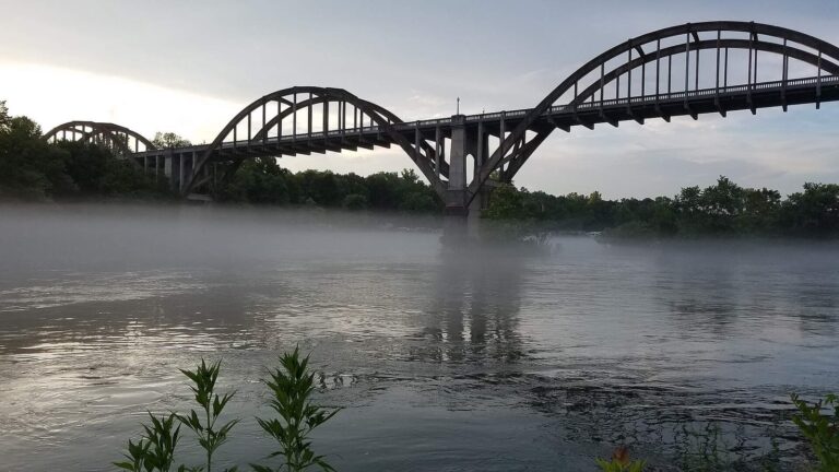
Photo: Luhsteesay, CC BY-SA 4.0

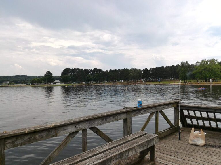
Photo: U458625, CC BY-SA 4.0

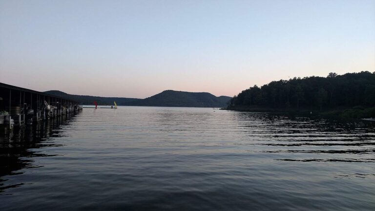
Photo: Brandonrush, CC BY-SA 4.0


Photo: Sgerbic, CC BY-SA 4.0

Questions that crop up about White County
Are there public ramps in White County?
Count 32 launches on AGFC maps.
What is the biggest body of still water in White County?
Lake Barnett, at 245 acres.
Which fish does AGFC list on lakes near White County?
AGFC lists catfish on the most lake pages within 50 miles, then bream, black bass and crappie.
Which White County stores keep crappie jigs and line on the shelf?
Academy Sports + Outdoors, 1405 Janet Dr is one of 8 listings here.
What Arkansas town serves as seat for White County?
It is Searcy.
How much is a fishing license for a White County trip?
A resident angler spends $10.50 and a nonresident $60 on the yearly AGFC license.
Which county pages are near White County?
Try Cleburne County, Woodruff County and Prairie County.
How many crappie can go in the AGFC creel in White County?
Statewide: daily limit of 30 crappie (all species combined) with no length restrictions. Waters with their own Code line differ.
Do any White County waters carry AGFC Code exceptions?
3 waters with a page here carry their own Code line, starting with Cargile Lake.
Where is the family fishing pond in White County?
Searcy City Lake: Catfish and Trout, catfish last stocked September 29, 2026; trout last stocked December 15, 2025.
Is White County water on the record list?
Black Bullhead, 4 lbs., 12 oz. (rod and reel), from Point Remove Creek.
Does White County have a trout tailwater?
Greers Ferry Tailwater, with its own trout rules and permit. Keeping trout, or fishing the tailwaters and Spring River reach listed in Code 27.01, adds a trout permit ($10 resident, $20 nonresident).
Fish the ponds and creeks of White County
Check a water's Code line before you keep fish.