Fishing in Cleburne County, Arkansas
County seat: Heber Springs. Population 24,711 (2020).
- 1lake pages
- 18launches
- 3river pages
 Pick for troutPiscifun Carbon X ultralight spinning reel28% OFFSale $57.99
Photo of Greers Ferry Lake: Brandonrush, CC BY-SA 3.0
Opening notes on fishing Cleburne County
The courthouse for Cleburne County stands in Heber Springs; 24,711 people lived in the county at the 2020 count. 1 lake with a full page sit inside the county, and Greers Ferry Lake is the largest of them. Trout anglers head to Greers Ferry Tailwater.
There are 18 boat or paddle launches and 10 pier or bank sites on AGFC maps of the county. The county's river pages cover Little Red River, Collins Creek and Middle Fork Little Red River.
U.S. Census Bureau, 2020 Census counts (TIGERweb) and the 2023 Gazetteer, read November 8, 2026. AGFC access layer (ArcGIS service), read November 8, 2026.
 For the trout herePiscifun Carbon XT ultralight spinning reel25% OFFSale $59.99
Every mapped ramp and pond in Cleburne County
AGFC boat-and-kayak and fishing access layers and AGFC fishing-area lake points, checked November 8, 2026.
Still-water pages for Cleburne County
| Lake | Size | Ramps | Kind | AGFC target fish |
|---|---|---|---|---|
| Greers Ferry Lake | 32,000 acres | 18 | Corps lake | black bass, bream, crappie |
Few lakes inside Cleburne County have pages, so the nearest ones beyond the line are listed by distance from Heber Springs.
| Lake | From Heber Springs | Size | Ramps | Kind | AGFC target fish |
|---|---|---|---|---|---|
| Lake Barnett | 19 miles south | 245 acres | 3 | reservoir | black bass, bream, catfish |
| Lake Bennett | 21 miles southwest | 40 acres | 1 | reservoir | black bass, bream, catfish |
| Guy City Park Pond | 21 miles southwest | not stated | 0 | mapped pond | bream, catfish |
| Archey Fork Park Pond | 25 miles west | not stated | 0 | mapped pond | black bass, bream, catfish |
| Stinger Lake | 25 miles north | not stated | 0 | lake | black bass, bream, catfish |
| Searcy City Lake | 26 miles southeast | 4 acres | 0 | FCFP pond | bream, catfish, trout (seasonal stocking) |
Acreage and depth as AGFC states them in its description of this water (AGFC page), read November 8, 2026. Sizes AGFC does not state print as mapped outline area. Target fish as AGFC lists them.
The Cleburne County target-fish tally
Around Heber Springs, to 50 miles out, catfish appears on the most AGFC target lists.
AGFC public fishing area target species, counted per lake page within 50 miles; a listing, not a catch survey.
Smaller Cleburne County ponds and lakes without a full page
2 further named lakes in Cleburne County appear here as a list until more is published about them.
| Water | Size | Kind | Nearest town |
|---|---|---|---|
| Southridge Retirement Village Pond | not stated | mapped pond | Heber Springs |
| Triple S Pond | not stated | mapped pond | Rose Bud |
Outline area from the AGFC lake or pond outline (GIS polygon area, not an AGFC surface-acre figure), read November 8, 2026. AGFC public fishing areas map (agfc.com), read November 8, 2026.
Moving water across Cleburne County
- Little Red RiverAGFC trout water, 16 AGFC accesses, 3 USGS gauges
- Collins Creek1 AGFC access
- Middle Fork Little Red River1 AGFC access, 1 USGS gauge
Smaller Cleburne County streams on the maps without a page (1)
- Devils Fork Little Red Riverstream
USGS stations inside Cleburne County
| USGS gauge | Latest reading | Time (ET) |
|---|---|---|
| Little Red River Near Heber Springs | 69 cfs | Oct 1 12:45 am Not updated since Oct 1, 1987. |
US Geological Survey provisional data, retrieved Nov 12, 2026 7:33 pm ET. Provisional readings can be revised.
AGFC public fishing areas map (agfc.com), read November 8, 2026. USGS Water Data for the Nation, live through the site, retrieved on page view.
Cold tailwaters below the dams in Cleburne County
- Greers Ferry TailwaterLittle Red River
AGFC public fishing areas map (agfc.com), read November 8, 2026. AGFC trout waters page, read November 8, 2026.
AGFC and Corps launches across Cleburne County
- Dripping Springs Boat Ramp on Little Red RiverLittle Red River, boat ramp, concrete surface, restrooms
- Hill Creek Boat Ramp on Greers Ferry LakeGreers Ferry Lake, boat ramp, concrete surface, camping, picnic tables, recreational area
- JFK Park Boat Ramp on Little Red RiverLittle Red River, boat ramp, concrete surface, camping, fishing pier, mobility-impaired
- Lobo Landing on Little Red RiverLittle Red River, boat ramp, concrete surface, restrooms
- Prim Bridge Boat Ramp on Little Red RiverLittle Red River, boat ramp, dirt surface
- Stewart Boat Ramp on Little Red RiverLittle Red River, boat ramp, gravel surface
- Cherokee Boat Ramp on Greers Ferry LakeGreers Ferry Lake, boat ramp, concrete surface
- Cove Creek Boat Ramp #1 on Greers Ferry LakeGreers Ferry Lake, boat ramp, concrete surface
- Cove Creek Boat Ramp #2 on Greers Ferry LakeGreers Ferry Lake, boat ramp, concrete surface
- Dam Site Boat Ramp on Greers Ferry LakeGreers Ferry Lake, boat ramp, concrete surface
- Frontier Canyon Boat Ramp on Greers Ferry LakeGreers Ferry Lake, boat ramp, concrete surface
- Heber Springs Boat Ramp on Greers Ferry LakeGreers Ferry Lake, boat ramp, concrete surface
- Mill Creek Boat Ramp on Greers Ferry LakeGreers Ferry Lake, boat ramp, concrete surface
- Narrows Boat Ramp on Greers Ferry LakeGreers Ferry Lake, boat ramp, concrete surface
- Old Highway 25 Boat Ramp on Greers Ferry LakeGreers Ferry Lake, boat ramp, concrete surface
- Public boat ramp on Greers Ferry Lake (east)Greers Ferry Lake, boat ramp, concrete surface, camping, picnic tables, recreational area
- Public boat ramp on Little Red RiverLittle Red River, boat ramp, concrete surface, restrooms
- Shiloh Boat Ramp on Greers Ferry LakeGreers Ferry Lake, boat ramp, concrete surface
AGFC fishing access in Cleburne County
- Cow Shoals Fishing Access on Little Red RiverLittle Red River, walk-in access, restrooms
- Libby Shoals Fishing Access on Little Red RiverLittle Red River, walk-in access, restrooms
- Pangburn Bridge Fishing Access on Little Red RiverLittle Red River, walk-in access, fishing pier
- Collins Creek Fishing AccessCollins Creek, walk-in access
- Public fishing access on Collins CreekCollins Creek, fishing pier, camping, mobility-impaired
- Public fishing access on Collins CreekCollins Creek, fishing pier, camping, mobility-impaired
- Public fishing access on Collins CreekCollins Creek, fishing pier, camping, mobility-impaired
- Public fishing access on Little Red RiverLittle Red River, fishing pier
- Public fishing access on Little Red River (west)Little Red River, walk-in access, restrooms
- Winkley Shoals Walk-In AccessLittle Red River Greers Ferry Tailwater, bank fishing
AGFC access layer (ArcGIS service), read November 8, 2026. Lanes, fees and hours are not fields in the AGFC layers.
How full the Cleburne County reservoirs are running
Greers Ferry Lake
USACE Little Rock District Greers Ferry Dam reading for Greers Ferry Lake, November 8, 2026.
USACE Little Rock District via USACE Access to Water (location page), latest values at retrieval November 8, 2026. Provisional.
Keeping fish across Cleburne County
Unless a water carries its own Code line, these statewide AGFC limits apply everywhere in Cleburne County. Anyone 16 or older needs a license: $10.50 for Arkansans, $60 for a nonresident year.
| Species | Statewide rule as printed | Code |
|---|---|---|
| Alligator Gar | daily limit of 1 with 36-inch maximum length. | N1.01(C) |
| American Eel | daily limit of 2 fish with no length restrictions. | N1.01(D) |
| Black Bass (Largemouth, Spotted, And Smallmouth) | daily limit of 10 black bass (all species combined) with no length restrictions. Reservoir Smallmouth Bass, daily limit of 6, 12-inch minimum; Flowing Waters Smallmouth Bass, daily limit of 2, 12-inch minimum. | N1.01(E) |
| Bream | Daily limit is 50 fish over 4 inches, no limit on bream 4 inches or shorter. | N1.01(F) |
| Catfish (Except Bullhead) | daily limit of 10 catfish (all species combined) with no length restrictions. | N1.01(G) |
| Crappie | daily limit of 30 crappie (all species combined) with no length restrictions. | N1.01(H) |
| Paddlefish | daily limit of 2 Paddlefish with no length restrictions. | N1.01(I) |
| Rock Bass | daily limit of 10 Rock Bass with no length restrictions. | N1.01(J) |
| Sauger | daily limit of 6 Sauger with no length restrictions. | N1.01(K) |
| Saugeye | daily limit of 6 Saugeye with no length restrictions. | N1.01(L) |
Where statewide limits change in Cleburne County
- Greers Ferry LakeBlack Bass (Largemouth, Spotted, And Smallmouth): Only 6 Smallmouth Bass may be included in the daily limit, Largemouth Bass and Smallmouth Bass 12-inch minimum.
Every Arkansas water-specific limit
AGFC Code of Regulations (regulation library), read November 8, 2026. Fishing license prices as printed on the AGFC license descriptions and fees page (agfc.com), matching Code Addendum D1.01, read November 8, 2026.
AGFC record fish caught near Cleburne County
| Species | Weight | Division | Water | Date |
|---|---|---|---|---|
| Hybrid Striped Bass | 27 lbs., 5 oz. | rod and reel | Greers Ferry Lake | April 24, 1997 |
| Spotted Gar | 7 lbs., 15 oz. | rod and reel | Little Red River | March 29, 2018 |
| Chain Pickerel | 7 lbs., 10 oz. | rod and reel | Little Red River | Jan. 6, 1979 |
| Brown Trout | 40 lbs., 4 oz. | rod and reel | Little Red River | May 9, 1992 |
| Lake Trout | 11 lbs., 5 oz. | rod and reel | Greers Ferry Lake | Dec. 15, 1997 |
| Walleye | 22 lbs., 11 oz. | rod and reel | Greers Ferry Lake | March 12, 1982 |
Arkansas state record fish as listed by AGFC (record list), read November 8, 2026.
Weigh-ins and team events on Cleburne County water
Organizer pages tie 7 events or results to Cleburne County water; 1 still lie ahead.
| Date | Event | Water | Organizer |
|---|---|---|---|
| April 10, 2027 | Greers Ferry | Greers Ferry Lake | Fishers of Men National Team Trail |
| April 18, 2026 | Fishers of Men Arkansas Northwest Classic, Greers Ferry Lake 2026-04 | Greers Ferry Lake | Fishers of Men National Team Trail |
| April 11, 2026 | Fishers of Men Arkansas Central Classic, Greers Ferry Lake 2026-04 | Greers Ferry Lake | Fishers of Men National Team Trail |
| May 17, 2025 | Fishers of Men Arkansas Northwest Classic, Greers Ferry Lake 2025-05 | Greers Ferry Lake | Fishers of Men National Team Trail |
| March 8, 2025 | Fishers of Men Arkansas Central Classic, Greers Ferry Lake 2025-03 | Greers Ferry Lake | Fishers of Men National Team Trail |
| not printed | Phoenix BFL Arkie Division, Greers Ferry Lake 2026 | Greers Ferry Lake | Major League Fishing |
| not printed | Phoenix BFL Arkie Division, Greers Ferry Lake 2025 | Greers Ferry Lake | Major League Fishing |
Organizer schedule and results pages, checked November 2026.
Bait shops around Cleburne County
Marinas and tackle in Cleburne County
- B & Kbait and tackle shop, Higden
- Fish 'n Stuffbait and tackle shop, Higden
- Golden Outdoorsbait and tackle shop, Heber Springs
- Parrot Bay Trading Postbait and tackle shop, Tumbling Shoals
- Red River Adventures Trout Resortbait and tackle shop, Heber Springs
- The Bait Stopbait and tackle shop, Heber Springs
- The Ozark Anglerbait and tackle shop, Heber Springs
- Eden Isle Marinamarina, Heber Springs
- Heber Springs Marina Incmarina, Heber Springs
- Narrows Marina Incmarina, Higden
- Shiloh Marinamarina, Higden
- The Dam Site Marinamarina, Heber Springs
Northeast Arkansas tackle shops
Fishing guides with a Cleburne County address
- Fish On Set Hook Guide Servicefishing guide, Heber Springs, (501) 270-0169
- Little Red River Guide Servicefishing guide, Heber Springs, (501) 507-3688
Yellow Pages and tourism guide listings (city of business), read November 8, 2026.
Minutes past Cleburne County
Communities across Cleburne County
- Heber Springspop. 6,969
Over the line from Cleburne County
- Stone County20 miles north
- Independence County27 miles east
- White County27 miles southeast
- Van Buren County29 miles west
Piscifun gear a Natural State angler might bring to Cleburne County


Piscifun and Amazon links are affiliate links; the site earns a commission on qualifying purchases.
Reservoirs, oxbows and float streams close to Cleburne County, in pictures
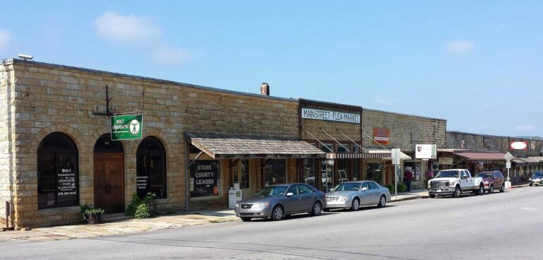
Photo: Brandonrush, CC BY-SA 4.0

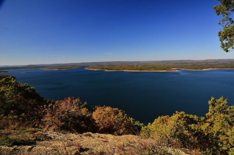
Photo: Dkbrawley, CC BY-SA 3.0

Photo: Misterhaha, Public domain

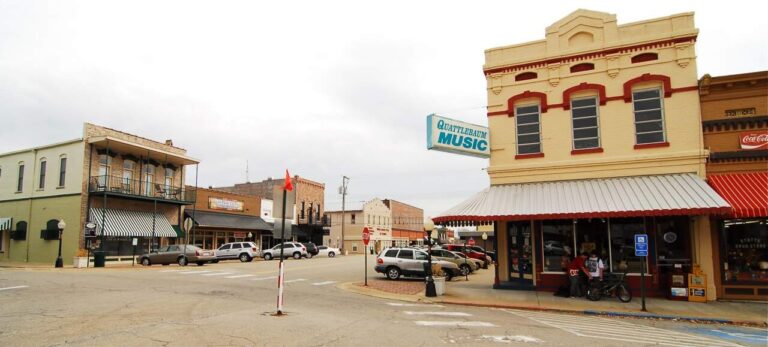
Photo: Photolitherland, CC BY-SA 3.0

Getting the facts straight on Cleburne County fishing
Where can a johnboat go in the water in Cleburne County?
AGFC maps 18 launches here.
Which Cleburne County lake spreads out the farthest?
Greers Ferry Lake, measuring 32,000 acres.
What fish are on AGFC lists around Cleburne County?
AGFC lists catfish on the most lake pages within 50 miles, then bream, black bass and crappie.
Where do Cleburne County anglers pick up minnows?
12 listings, including B & K.
Where does Cleburne County keep its county courthouse in Arkansas?
Heber Springs is the seat.
Which AGFC license covers fishing in Cleburne County?
Expect to pay $10.50 (Arkansas resident) or $60 (out of state) for a year of fishing.
What Arkansas counties sit beside Cleburne County?
By distance: Stone County, Independence County and White County.
What daily limit applies to crappie in Cleburne County?
Statewide: daily limit of 30 crappie (all species combined) with no length restrictions. Waters with their own Code line differ.
Are there special rules on Cleburne County lakes?
1 water with a page here carry their own Code line, starting with Greers Ferry Lake.
When is the next Arkansas weigh-in on Cleburne County water?
7 organizer entries on file; next is Greers Ferry on Greers Ferry Lake, April 10, 2027.
Which records were caught in Cleburne County?
Hybrid Striped Bass, 27 lbs., 5 oz. (rod and reel), from Greers Ferry Lake.
Where can I catch trout in Cleburne County?
Greers Ferry Tailwater, with its own trout rules and permit. Keeping trout, or fishing the tailwaters and Spring River reach listed in Code 27.01, adds a trout permit ($10 resident, $20 nonresident).
Spend a Natural State morning on Cleburne County water
Ramp pages carry AGFC surface notes and directions.