Lake Guntersville Fishing
A 65,603-acre reservoir in Marshall and Jackson counties, shared with Tennessee.
 Pick for striped bassPiscifun Viper X spinning reel50% OFFSale $39.99
Photo: Marshall County CVB, CC BY 2.0
First look at Lake Guntersville, Yellowhammer State style
Lake Guntersville is a reservoir of Marshall and Jackson counties; its NHD outline measures near 65,603 acres. The Tennessee line cuts through it, leaving about 98% inside Alabama. Water levels are set by TVA, the dam operator. Locals may say Guntersville Reservoir. Nearest town on the Census list: Scottsboro, roughly 2 miles away.
Boaters can use 21 public ramps from the ADCNR list. ADCNR maps 55 bank sites for fishing without a boat. The digest names it in 1 water exception. It sits under ADCNR Fisheries District I.
USGS NHD High Resolution (Alabama) outlines and flowlines, read November 1, 2026; operator and kind from the ADCNR reservoir program and dam owner listings; Census 2023 places.
Species on record for Lake Guntersville
Each fish here comes from an ADCNR page or an Alabama record naming Lake Guntersville; the list is not a survey.
ADCNR reservoir and state lake pages, Alabama state record lists; read November 1, 2026.
Getting the bass boat onto Lake Guntersville
- B.B. Comer Bridge boat ramp on Lake Guntersville1 lane, 1 dock, 30 trailer spaces, lights, paved parking
- Beech Creek boat ramp on Lake Guntersville1 lane, 1 dock, 26 trailer spaces, paved parking
- Bridgeport boat ramp on Lake Guntersville1 lane, 1 dock, 25 trailer spaces, lights, ADA access, paved parking
- Brown's Creek (Warrenton) boat ramp on Lake Guntersville3 lanes, 3 docks, 64 trailer spaces, lights, ADA access, paved parking
- Claysville boat ramp on Lake Guntersville2 lanes, 4 docks, 62 trailer spaces, ADA access, paved parking
- Crow Creek boat ramp on Lake Guntersville1 lane, 1 dock, 20 trailer spaces, lights, paved parking
- Honeycomb Creek boat ramp on Lake Guntersville1 lane, 1 dock, 50 trailer spaces, paved parking
- Langston Road (Chisenhall) boat ramp on Lake Guntersville1 lane, 1 dock, 16 trailer spaces, paved parking
- Langston boat ramp on Lake Guntersville3 lanes, 2 docks, 75 trailer spaces, ADA access, paved parking
- Long Island boat ramp on Lake Guntersville1 lane, 28 trailer spaces
- Mink Creek boat ramp on Lake Guntersville1 lane, 1 dock, 20 trailer spaces, lights, paved parking
- Minky Creek boat ramp on Lake Guntersville1 lane, 1 dock, 10 trailer spaces, paved parking
- Mud Creek (G'ville) boat ramp on Lake Guntersville1 lane, 1 dock, 26 trailer spaces, lights, paved parking
- North Sauty Creek boat ramp on Lake Guntersville1 lane, 5 trailer spaces, paved parking
- Racoon Creek boat ramp on Lake Guntersville1 lane, 1 dock, 6 trailer spaces
- Scottsboro City Park on Lake Guntersville2 lanes, 1 dock, 49 trailer spaces, lights, ADA access, paved parking
- Stevenson (Snodgrass Bridge) boat ramp on Lake Guntersville2 lanes, 1 dock, 40 trailer spaces, lights, paved parking
- Tom Jackson Park on Lake Guntersville2 lanes, 1 dock, 52 trailer spaces, lights, ADA access, paved parking
- Town Creek (G'ville) boat ramp on Lake Guntersville1 lane, 1 dock, 18 trailer spaces, paved parking
- Val Monte Rd. (Bucky Howe) boat ramp on Lake Guntersville2 lanes, 1 dock, 19 trailer spaces, lights, paved parking
- Waterfront boat ramp on Lake Guntersville2 lanes, 2 docks, 60 trailer spaces, lights, paved parking
Walk-in fishing at Lake Guntersville
- South Sauty Causeway on Lake Guntersvillebank access, AL DOT/Jackson County Commission, bridge pilings, riprap
- North Sauty (Hwy 79 causeway) on Lake Guntersvillebank access, AL DOT/Jackson County Commission, bridge pilings, riprap
- North Sauty (Hwy 72 causeway) on Lake Guntersvillebank access, AL DOT/Jackson County Commission, bridge pilings, riprap, dilapidated bridge
- Preston Island (Hwy 79 causeway) on Lake Guntersvillebank access, AL DOT/Jackson County Commission, riprap
- Mink Creek (Hwy 79 causeway) on Lake Guntersvillebank access, AL DOT/Jackson County Commission, riprap
- Mud Creek Causeway on Lake Guntersvillebank access, AL DOT/Jackson County Commission, riprap
- Crow Creek Public Boat Ramp on Lake Guntersvillebank access, ADCNR/Stevenson, No courtesy pier
- Preston Island on Lake Guntersvillebank access, TVA, Courtesy pier for boaters
- South Sauty Creek (Langston City Park) on Lake Guntersvillebank access, ADCNR/Jackson County Commission, Courtesy pier for boaters
- Langston Road on Lake Guntersvillebank access, ADCNR/Jackson County Commission, Courtesy pier for boaters
- BB Comer Bridge Boat Ramp on Lake Guntersvillebank access, ADCNR/Jackson County Commission, Courtesy pier for boaters
- Mud Creek Boat Ramp on Lake Guntersvillebank access, ADCNR/Jackson County Commission, Courtesy pier for boaters
- Raccoon Creek on Lake Guntersvillebank access, ADCNR/Jackson County Commission, No courtesy pier
- North Sauty Boat Ramp on Lake Guntersvillebank access, ADCNR/Jackson County Commission, plus a dilapidated bridge at end of road
- Stevenson (Snodgrass Bridge) on Lake Guntersvillebank access, ADCNR/Stevenson, Snodgrass Bridge Hwy 117 (NW side of bridge)
- Mink Creek on Lake Guntersvillebank access, ADCNR/Scottsboro, Courtesy pier for boaters
- Bellefonte Road Causeway on Lake Guntersvillebank access, Jackson County, No courtesy pier
- Stevenson City Park on Lake Guntersvillebank access, Stevenson, campground, ball fields, boat ramp
- Bridgeport Ferry on Lake Guntersvillefishing pier, ADCNR/Bridgeport, Old Ferry Crossing
- Jackson County Park on Lake Guntersvillefishing pier, Scottsboro, marina, campground
- Scottsboro City Park on Lake Guntersvillefishing pier, ADCNR/Scottsboro, Courtesy pier for boaters
- Goose Pond on Lake Guntersvillefishing pier, Scottsboro, causeway, riprap, piers, tackle, food, marina
- Hwy 69 Causeway on Lake Guntersvillebank access, AL DOT/Marshall County Commission, bridge pilings, riprap
- US Hwy 431 causeway on Lake Guntersville (south)bank access, AL DOT/Guntersville, bridge pilings, riprap
- US Hwy 431 causeway on Lake Guntersville (north)bank access, Guntersville, bridge pilings, riprap
- Town Creek (Hwy 227 causeway) on Lake Guntersvillebank access, AL DOT/Marshall County Commission, near by: boat rentals, tackle, snacks, licenses
- Mill Creek Hwy 79 Causeway on Lake Guntersvillebank access, AL DOT/Marshall County Commission, riprap
- Guntersville City Harborfishing pier, Guntersville, Pavilion
- Luleen B. Wallace Fishing Pier on Lake Guntersvillefishing pier, Guntersville, along Sunset Drive walking trail
- Morgan Cove on Lake Guntersvillebank access, Bucks Pocket State Park, remote; good for Kayak; birding
ADCNR WFF public boat ramp list (list), read November 1, 2026; ADCNR fish-from-the-bank map (outdooralabama.com), read November 1, 2026.
The digest limits on Lake Guntersville
| Species | Daily limit and size | Season |
|---|---|---|
| Black Bass | 10 a day | open all year |
| Walleye | 2 a day | open all year |
| Sauger | 5 a day; 15 inches TL minimum | open all year |
| White Bass | 15 a day | open all year |
| Yellow Bass | 15 a day | open all year |
| Saltwater Striped Bass and Hybrids or Combinations | 15 a day | open all year |
| Crappie | 30 a day; 9 inches TL (exemptions apply) minimum | open all year |
| Yellow Perch | No daily limit | open all year |
| Catfish (under 34 inches) | No daily limit | open all year |
| Catfish (over 34 inches) | 1 a day | open all year |
| Bream | 50 a day | open all year |
| Rainbow Trout | 5 a day | open all year |
| Alligator Gar | 1 a day | open all year |
| Sturgeon | Closed Season | Closed season (immediate release) |
| Paddlefish or Spoonbill | Closed Season | Closed season (immediate release) |
| Skipjack Herring | 50 a day | open all year |
For Lake Guntersville, the statewide limits hold except for the rules printed underneath.
How Lake Guntersville differs from statewide limits
| Water as printed | Species | Rule |
|---|---|---|
| Guntersville Reservoir and its Tributary of Town Creek | Largemouth bass, Smallmouth bass | It is illegal to possess any largemouth or smallmouth bass less than 15 inches in total length. |
Size and creel exceptions as printed in the Official 2026-2027 Alabama Hunting and Fishing Digest (ADCNR, eRegulations edition), limits page, read November 1, 2026.
Licenses on the shared water of Lake Guntersville
Alabama, Mississippi and Tennessee have a reciprocal agreement for fishing the Tennessee River. See Reciprocal Fishing License Map.
Freshwater anglers need an Alabama fishing license from 16 on ($17.45 resident, $68.20 nonresident for 2026-27); residents 65 and older are exempt.
Limits as printed in the Official 2026-2027 Alabama Hunting and Fishing Digest (ADCNR, eRegulations edition) (limits page; digest PDF), read November 1, 2026.
 For the striped bass herePiscifun AlumiX spinning reel46% OFFSale $64.99
Heaviest fish logged at Lake Guntersville
| Species | Weight | Water as printed | Angler | Date |
|---|---|---|---|---|
| Carp, Grass (White Amur) | 73 lbs., 0 oz. | Guntersville Reservoir | Bradley D. Bridges, Sr. | April 10, 2012 |
| Buffalo | 57 lbs., 0 oz. | Guntersville Reservoir | Ralph B. Lowery | April 13, 1990 |
| Crappie, White (tie) | 4 lbs., 8 oz. | Guntersville Reservoir | Jack Grant | April 4, 1974 |
| Bass, Yellow (a) | 2 lbs., 8 oz. | Guntersville Reservoir, Jackson Co. | Dennis M. Woebbeking | April 12, 2000 |
Alabama state record lists kept by ADCNR (Wildlife and Freshwater Fisheries Division for freshwater; Marine Resources Division State Record Fish Committee for saltwater) (freshwater, saltwater), read November 1, 2026.
Bass trail stops at Lake Guntersville
Schedules and winning bags from Lake Guntersville are kept together.
Five nearby lakes lined up with Lake Guntersville
Weiss Lake tops this group on size with roughly 30,200 acres.
| Lake | Distance | Acres | Kind | ADCNR ramps | Bank sites |
|---|---|---|---|---|---|
| Lake Guntersville | 65,603 | reservoir | 21 | 55 | |
| DeKalb County Public Fishing Lake | 12 miles east | 120 | State Public Fishing Lake | 0 | 1 |
| Madison County Public Fishing Lake | 25 miles northwest | 105 | State Public Fishing Lake | 0 | 1 |
| Weiss Lake | 36 miles southeast | 30,200 | reservoir | 5 | 6 |
| Neely Henry Lake | 52 miles south | 11,235 | reservoir | 4 | 9 |
| Lake Catoma | 53 miles southwest | 527 | lake | 0 | 2 |
Acres from ADCNR pages where printed, else NHD outlines; ADCNR ramp list and bank map; read November 1, 2026.
Within an easy Alabama drive of Lake Guntersville
Neighbouring Alabama lakes to Lake Guntersville
- DeKalb County Public Fishing Lake12 miles east
- Madison County Public Fishing Lake25 miles northwest
- Weiss Lake36 miles southeast
- Neely Henry Lake52 miles south
- Lake Catoma53 miles southwest
Tackle counters that serve Lake Guntersville
- Jackson County Park & Marinamarina, Scottsboro, under a mile
- Scottsboro Tackle Companybait and tackle shop, Scottsboro, 3 miles
- Zillas Outdoors and Cafebait and tackle shop, Hollywood, 6 miles
- Waterfront Grocery & Tacklebait and tackle shop, Scottsboro, 14 miles
- River Bend Marinamarina, Guntersville, 20 miles
- Alred Marinamarina, Guntersville, 22 miles
Paid trips on Lake Guntersville from our list
- SouthernCats Guide Servicecatfish guide, Decatur
- Alabama Elite Fishing Guidefishing guide, Guntersville, (256) 530-3306
- Fish Lake Guntersville Guide Servicefishing guide, Scottsboro
- Guntersville Bass Guidesfishing guide
- Tim Chandler's Lake Guntersville Guide Servicefishing guide, Guntersville
Alabama towns within a drive of Lake Guntersville
- Scottsboro2 miles
- Sylvania13 miles
- Rainsville14 miles
Which county pages list Lake Guntersville
- Marshall Countyseat: Guntersville
- Jackson Countyseat: Scottsboro
Piscifun rods and reels lined up for Lake Guntersville


Piscifun and Amazon links are affiliate links; the site earns a commission on qualifying purchases.
Telling the Lake Guntersville fish apart, by photo
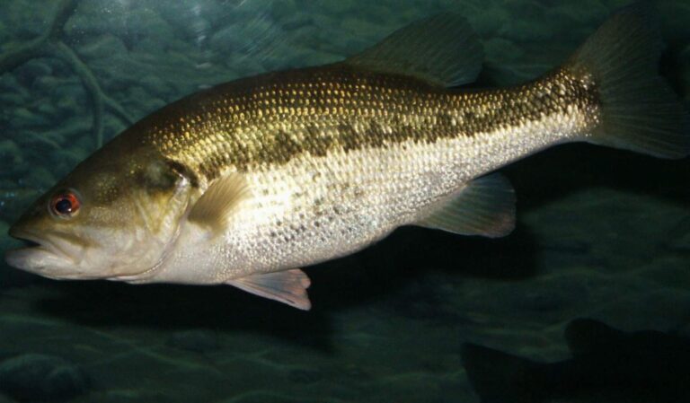
Photo: robposse, CC BY 2.0
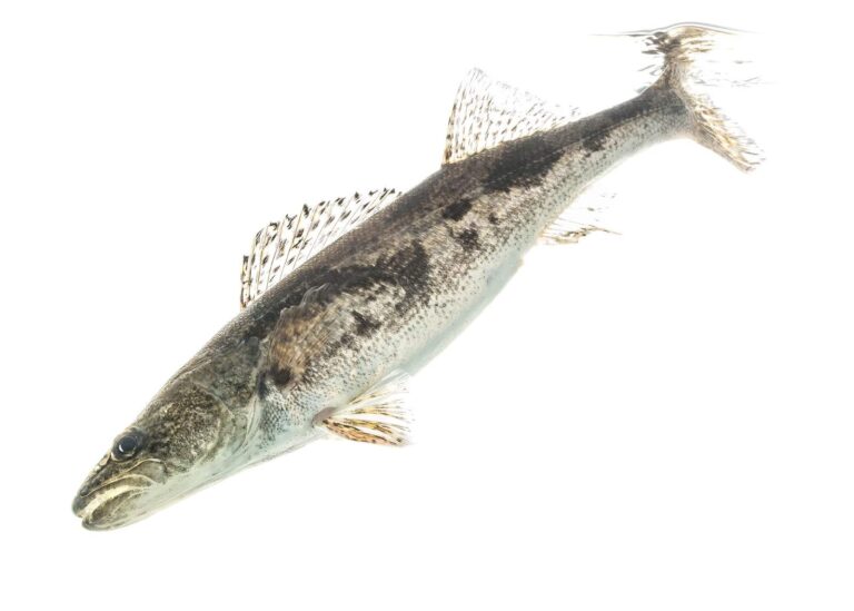
Photo: USFWS Mountain-Prairie, CC BY 2.0
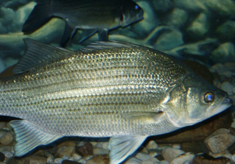
Photo: robposse, CC BY 2.0
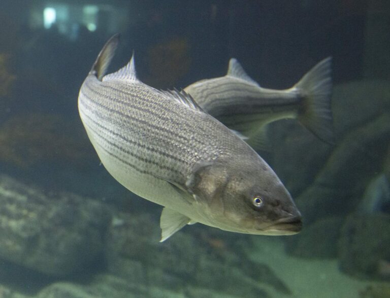
Photo: Watts, CC BY 2.0
Lake Guntersville: answers for an Alabama fishing day
In which Alabama county does Lake Guntersville lie?
The water lies inside Marshall and Jackson counties, about 2 miles from Scottsboro.
What size does the outline of Lake Guntersville reach?
About 65,603 acres mapped, about 98% of it in Alabama.
How many ADCNR ramps reach Lake Guntersville?
B.B. Comer Bridge boat ramp on Lake Guntersville is among 21 public ramps ADCNR lists.
Is Lake Guntersville a bass lake?
Look for yellow bass, buffalo, grass carp and white crappie.
Has the digest written special rules for Lake Guntersville?
Black Bass: 10 a day. Its own digest exception sits in the limits band.
Does a nonresident need a license at Lake Guntersville?
Freshwater anglers need an Alabama fishing license from 16 on ($17.45 resident, $68.20 nonresident for 2026-27); residents 65 and older are exempt. Alabama, Mississippi and Tennessee have a reciprocal agreement for fishing the Tennessee River. See Reciprocal Fishing License Map.
Is Lake Guntersville a good bet for a bank angler in Alabama?
Try South Sauty Causeway on Lake Guntersville, one of 55 bank sites.
Which Alabama tackle counter sits nearest Lake Guntersville?
Jackson County Park & Marina, under a mile away, tops our shop list.
Which record lists Lake Guntersville?
Carp, Grass (White Amur) at 73 lbs., 0 oz., caught by Bradley D. Bridges, Sr. on April 10, 2012.
Why do some maps say Guntersville Reservoir for Lake Guntersville?
Same water: Guntersville Reservoir is an alternate name.
Gas the bass boat and aim for Lake Guntersville
Every Alabama fee and creel row is one click away.