Fishing in Clarke County, Alabama
County seat: Grove Hill. Population 23,087.
- 1lake pages
- 1listed ramps
- 3river and creek pages
 Pick for striped bassPiscifun Viper X spinning reel50% OFFSale $39.99
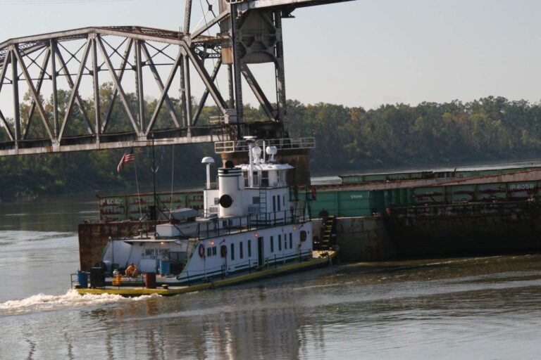
Photo of Alabama River: Ron Cogswell, CC BY 2.0
What Clarke County offers between ramp and bank
Clarke County runs its county business from Grove Hill and had 23,087 residents at the 2020 count. ADCNR places this county's mapped bank sites in ADCNR Fisheries District V.
1 lake with full guides sit at least partly in the county, Coffeeville Lake the widest of them. There are 1 listed ramp in the county on ADCNR's lists. The ADCNR bank map adds 4 bank or pier sites, 2 of them piers.
Census 2020 population; NHD lake outlines with the ADCNR reservoir program; ADCNR WFF boat ramp list, coastal boating access and fish-from-the-bank map; read November 1, 2026.
Finding a way onto the water in Clarke County
ADCNR ramp lists, bank map and public access sites; NHD lake points and river midpoints; GNIS coastal points; read November 1, 2026.
Still water with a full guide in Clarke County
| Lake | Acres (source) | Kind | ADCNR ramps | Fish named |
|---|---|---|---|---|
| Coffeeville Lake | 8,500 (ADCNR) | U.S. Army Corps of Engineers reservoir | 2 | largemouth bass, striped bass, white crappie |
These lake guides outside Clarke County are the shortest drives from Grove Hill.
| Lake | From Grove Hill | Acres (source) | Kind | ADCNR ramps | Fish named |
|---|---|---|---|---|---|
| Claiborne Lake | 14 miles southeast | U.S. Army Corps of Engineers reservoir | 0 | largemouth bass, spotted bass, striped bass | |
| Natchez State Lake | 30 miles east | 84 (NHD outline) | lake | 0 | |
| Emmit Wood Lake | 34 miles west | 80 (NHD outline) | lake | 0 | |
| Millers Ferry Reservoir | 36 miles northeast | 17,200 (ADCNR) | U.S. Army Corps of Engineers reservoir | 1 | largemouth bass, spotted bass, striped bass |
| Citronelle Lake | 54 miles southwest | 55 (NHD outline) | lake | 0 | |
| Dallas County Public Fishing Lake | 57 miles northeast | 100 (ADCNR) | State Public Fishing Lake | 0 | largemouth bass, black crappie, bluegill |
USGS NHD lake outlines (acreage of the mapped outline unless ADCNR prints one), ADCNR reservoir pages and the ADCNR WFF boat ramp list; read November 1, 2026. ADCNR publishes no lake depths.
 For the striped bass herePiscifun AlumiX spinning reel46% OFFSale $64.99
Counting species on water near Clarke County
Lake and bay pages within 50 miles of Grove Hill were tallied by fish; black crappie comes out on top.
Species named in ADCNR reservoir and species pages and the ADCNR record lists, counted per water page within 50 miles; not a fish survey.
Lakes in Clarke County listed here only
The NHD outlines hold 1 further named lakes in Clarke County, listed by acreage.
| Water | Acres (NHD outline) | Nearest place |
|---|---|---|
| South Lake | 311 | Carlton |
USGS NHD lake outlines, read November 1, 2026.
Creek and river guides in Clarke County
- Alabama RiverADCNR river page, 1 ADCNR-listed ramp, 4 bank or pier sites, 313 mi of NHD channel inside Alabama
- Tombigbee RiverADCNR river page, 2 ADCNR-listed ramps, 1 bank or pier site, 277 mi of NHD channel inside Alabama
- Cypress Creek (Clarke County)ADCNR river page, 10 mi of NHD channel inside Alabama
Lesser creeks crossing Clarke County (3)
- Bassett Creek52 mi of NHD channel inside Alabama
- Horse Creek45 mi of NHD channel inside Alabama
- Salitpa Creek43 mi of NHD channel inside Alabama
Live streamflow from Clarke County
| USGS gauge | Latest reading | Time (ET) |
|---|---|---|
| Alabama River At Choctaw Bluff, Al. | 9,880 cfs, -2.05 ft gage height | Nov 12 11:45 pm |
| Satilpa Creek Near Coffeeville Al | 13 cfs, 2.80 ft gage height | Nov 13 12:00 am |
| Bassett Creek At Us Highway 43 Nr Thomasville, Al. | 3 cfs, 3.45 ft gage height | Nov 12 11:30 pm |
US Geological Survey provisional data, retrieved Nov 13, 2026 12:34 am ET. Provisional readings can be revised.
USGS NHD flowlines and lengths, ADCNR river pages, ADCNR ramp lists and USGS gauges; read November 1, 2026.
Launching a boat in Clarke County
- Old Lock #1 boat ramp on Tombigbee RiverTombigbee River, 1 lane, 23 trailer spaces
Only ramps on the ADCNR lists appear; operator and city ramps may add more.
Walk-up fishing in Clarke County
- Bashi Creek boat ramp on Coffeeville Lakebank access, US Army Corps of Engineers
- Old Lock 1 on Tombigbee Riverfishing pier, US Army Corps of Engineers
- Parkers Lakebank access, City of Jackson
- Silver Creek boat ramp on Claiborne Lakefishing pier, US Army Corps of Engineers
ADCNR WFF boat ramp list (public.dcnr.alabama.gov), ADCNR coastal boating access, fish-from-the-bank map and public access sites layer; read November 1, 2026.
Bait counters a county over from Clarke County
- River Cat Bait Shopbait and tackle shop, Leroy, 17 miles
- Dixie Sporting Goodsbait and tackle shop, Monroeville, 30 miles
- Jj's Bait and Tackle Shopbait and tackle shop, Monroeville, 31 miles
- The Bait Shop, 170 Mosley Bridge Rdbait and tackle shop, Gilbertown, 31 miles
- Loftin's Bait Shopbait and tackle shop, Camden, 36 miles
Yellow Pages listings; straight-line miles from Grove Hill.
The 2026-27 limits across Clarke County
The statewide table governs Clarke County unless a water appears in the exception list. ADCNR sells the yearly freshwater license at $17.45 to residents and $68.20 to visitors this season.
| Species | Limit | Season |
|---|---|---|
| Black Bass | 10 a day | open all year |
| Walleye | 2 a day | open all year |
| Sauger | 5 a day; 15 inches TL minimum | open all year |
| White Bass | 15 a day | open all year |
| Yellow Bass | 15 a day | open all year |
| Saltwater Striped Bass and Hybrids or Combinations | 15 a day | open all year |
| Crappie | 30 a day; 9 inches TL (exemptions apply) minimum | open all year |
| Yellow Perch | No daily limit | open all year |
| Catfish (under 34 inches) | No daily limit | open all year |
| Catfish (over 34 inches) | 1 a day | open all year |
| Bream | 50 a day | open all year |
| Rainbow Trout | 5 a day | open all year |
| Alligator Gar | 1 a day | open all year |
| Sturgeon | Closed Season | Closed season (immediate release) |
| Paddlefish or Spoonbill | Closed Season | Closed season (immediate release) |
| Skipjack Herring | 50 a day | open all year |
Limits as printed in the Official 2026-2027 Alabama Hunting and Fishing Digest (ADCNR, eRegulations edition) (limits page; digest PDF), read November 1, 2026.
State record weights near Clarke County
| Species | Weight | Water | Date |
|---|---|---|---|
| Flathead catfish | 80 lbs., 0 oz. | Alabama River | 6/22/86 |
Alabama state record lists kept by ADCNR (Wildlife and Freshwater Fisheries Division for freshwater; Marine Resources Division State Record Fish Committee for saltwater) (freshwater, saltwater), read November 1, 2026.
Within reach of Clarke County
Towns and cities of Clarke County
- Jacksonpop. 4,748
- Thomasvillepop. 3,649
- Grove Hillpop. 1,818
Short hops from Clarke County by county
- Monroe County27 miles east
- Washington County30 miles southwest
- Choctaw County32 miles northwest
- Wilcox County37 miles northeast
Piscifun rods and reels lined up for Clarke County


Piscifun and Amazon links are affiliate links; the site earns a commission on qualifying purchases.


Common questions on lakes and rivers of Clarke County
How many ramps do ADCNR lists show in Clarke County?
1 listed ramp in total, 1 WFF ramps.
Which Clarke County lake has the most acres on its NHD outline?
Coffeeville Lake, 8,500 acres by ADCNR.
Which fish are named most near Clarke County?
Black crappie lead the count of water pages within 50 miles, then channel catfish, largemouth bass and striped bass.
Where do I find crickets and shiners in Clarke County?
None in the county; neighbours are listed above.
Could I set up a guided morning out of Clarke County?
No guide lists this county; the Alabama guides page has the rest.
Which town is home to the Clarke County courthouse?
It is Grove Hill.
Which Alabama license covers Clarke County water?
ADCNR sells the yearly freshwater license at $17.45 to residents and $68.20 to visitors this season.
Which county pages sit next to Clarke County?
By distance: Monroe County, Washington County and Choctaw County.
Does any Clarke County water hold an ADCNR state record?
Flathead catfish, 80 lbs., 0 oz., from Alabama River, Selma (6/22/86).
Tow the bass boat toward Clarke County
Check the exception table before keeping fish.