Roberts Bayou Fishing
A bayou of the Alabama coast in Baldwin County.
 Pick for redfishPiscifun Alloy S inshore spinning reelCheck price at Piscifun
Photo, nearby stand in for Roberts Bayou: Infrogmation of New Orleans, CC BY 2.0
The short version on Roberts Bayou for salt water
In Baldwin County, Roberts Bayou is a bayou on the Alabama coast. Plan on near 4 miles to Orange Beach.
There are 3 public ramps serving it. Visitors reach the water at 11 public access sites. Crews built 4 inshore reefs within 12 miles.
USGS GNIS domestic names (feature class and primary point), read November 1, 2026; ADCNR coastal layers; Census 2023 places.
Coastal ramps that reach Roberts Bayou
- Josephine Park on Roberts Bayouramps: 2, docks: 1, ~10 parking spots, Josephine Drive off Old County Road 95
- Palmetto Creek Boat Ramp on Roberts Bayouramps: 1, docks: 0, Unknown/No marked spaces, 8223 Escambia Ave (Ramp is in poor condition and very …
- Pirate's Cove boat ramp on Roberts Bayouramps: 1, business launch, docks: 2, Unknown/No marked spaces, restrooms, 6664 County Road 95
Marinas and bait shops with ramps near Roberts Bayou
- Pirate's Cove boat ramp on Roberts Bayouramps: 1, business launch, docks: 2, Unknown/No marked spaces, restrooms, 6664 County Road 95
Beach and bay access by Roberts Bayou
- Baldwin StreetWest end of Baldwin Street, Perdido Beach, Western Perdido Bay
- County Road 95 ParkSouth end of CR 95, Elberta, Gulf Frontal
- Escambia AvenueSoutheast end of Escambia Avenue, Perdido Beach, Western Perdido Bay
- Josephine Park and Boat LaunchJosephine Drive, west of Marjon Lane/Wolf Field Road, Elberta, Gulf Frontal
- Marjon LaneSouth end of Marjon Lane, Josephine, Gulf Frontal
- Mobile AvenueSoutheast end of Mobile Avenue, Perdido Beach, Western Perdido Bay
- Montgomery AvenueSoutheast end of Montgomery Avenue, Perdido Beach, Western Perdido Bay
- Orange StreetWest end of Orange Street, Perdido Beach, Western Perdido Bay
- Palmetto Creek Boat RampSouthwest end of Yupon Street, Perdido Beach, Western Perdido Bay
- Palmetto StreetSouthwest end of Palmetto Street, Palmetto Beach, Gulf Frontal
- Pensacola Avenue Water AccessSoutheast end of Pensacola Avenue, Perdido Beach, Western Perdido Bay
More ADCNR ramps close to Roberts Bayou
- Boggy Point Boat Ramp on Terry CoveTerry Cove, 3 miles southwest
- Cotton Bayou boat rampCotton Bayou, 5 miles southwest
- The Launch on Wolf BayWolf Bay, 6 miles west
- Lillian Boat Launch and Park on Perdido BayPerdido Bay, 8 miles northeast
- Canal Park on Oyster BayOyster Bay, 10 miles west
- Lagoon Park Launch on Oyster BayOyster Bay, 12 miles southwest
ADCNR coastal boating access pages and public access site layer (ADCNR GIS), read November 1, 2026; ADCNR WFF public boat ramp list (list), read November 1, 2026.
Walk-out fishing on Roberts Bayou
Places to fish on foot near Roberts Bayou
- Gulf State Park Pier on Oyster Bayfishing pier, salt water, 9 miles
- Little Lagoon Pierfishing pier, salt water, 13 miles
- Magnolia Springs Public Pierfishing pier, salt water, 15 miles
- Weeks Bay Boat Ramp and Pierfishing pier, salt water, 19 miles
- The Pines Fishing Pier and Boat Launch on Bon Secour Bayfishing pier, salt water, 22 miles
ADCNR coastal boating access pages and public access site layer (ADCNR GIS), read November 1, 2026.
Reefs an easy run from Roberts Bayou
4 inshore reefs lie within 12 miles of Roberts Bayou; each row gives year, material and listed depth.
| Reef | Placed | Material | Listed depth | Distance |
|---|---|---|---|---|
| Ross Point Reef | 2005 | Concrete pilings, bridge rubble and bridge spans | 13 ft listed depth | 1 mile east |
| Bayou St. John Reef | 2005 | Concrete pilings and Rubble and 3" X 6" limestone aggregate | 11 ft listed depth | 2 miles south |
| Rockpile | 2011 | Limestone rip rap in single row along northern boundary; roadway culverts (18" … | 9 ft listed depth | 2 miles east |
| Ono island Reef | 2005 | Concrete piling and rubble-Red claybrick from NAS Pensacola; roadway culverts (18") … | 11 ft listed depth | 3 miles southeast |
ADCNR Marine Resources Division public reef master list 2025 (KMZ; reef layer), read November 1, 2026. Coordinates are for information only, not for navigation.
Watching the tide on Roberts Bayou
- Arnica Bay, Mill Pointtide predictions, 1 mile
- Alabama Pointtide predictions, 3 miles
- Wolf Baytide predictions, 5 miles
- Gulf Shores, ICWWtide predictions, 9 miles
Predictions for Roberts Bayou are a guide; wind and runoff set the real level.
NOAA CO-OPS water level and tide prediction stations; read November 1, 2026.
Harbors that serve Roberts Bayou
- Gulf ShoresBaldwin County, 11 miles
- Orange BeachBaldwin County, 3 miles
- ElbertaBaldwin County, 7 miles
- LillianBaldwin County, 9 miles
- Perdido BeachBaldwin County, 2 miles
- Bon SecourBaldwin County, 12 miles
- FoleyBaldwin County, 11 miles
USGS GNIS domestic names (feature class and primary point), read November 1, 2026.
Inshore creel and size rules at Roberts Bayou
| Species | Daily limit and size | Waters |
|---|---|---|
| Sheepshead | 8 per person; 12" min. FL | state waters |
| Spotted Seatrout | 6 per person – one fish is allowed to be over; 15" min. TL – 22" max TL | state waters |
| Red Drum (Redfish) | 3 per person; 16" min. – 26" max TL | state waters |
| Cobia (Ling) | 1 per person, not to exceed 2 per vessel; 36" min. FL | state waters |
| Spanish Mackerel | 15 per person; no size limit | state waters |
| Florida Pompano | 3 per person; 12" min. TL | state waters |
| Striped Bass | 2 per person; 16" min TL | state waters |
| Flounder | 5 per person (Closed Season for the month of November); 14" min TL | state waters |
| Tripletail (Blackfish) | 3 per person; 18" min TL | state waters |
| Mullet | Oct. 24-Dec. 31, 25 mullet per person from the shoreline or 25 per boat. No mullet by cast net or snagging in Theodore Industrial Canal, Dog River, Fowl River, and their tributaries.; no siz | state waters |
Redfish, speckled trout and flounder rules for Roberts Bayou come first.
Which license applies follows the ADCNR line, printed on the saltwater page.
Saltwater anglers 16 and older carry an Alabama saltwater license ($30.90 resident, $66.80 nonresident for 2026-27), plus the $10 Gulf Reef Fish Endorsement to keep reef fish such as red snapper.
Limits as printed by the ADCNR Marine Resources Division recreational size, creel and possession limits for state waters (MRD limits page), read November 1, 2026.
 For the redfish herePiscifun NautiX saltwater spinning reel14% OFFSale $94.99
Where Roberts Bayou ranks along the Alabama coast
By access count, Terry Cove tops the table at 5.
| Water | Distance | Type | Ramps | Piers and banks | Access sites | Inshore reefs |
|---|---|---|---|---|---|---|
| Roberts Bayou | bayou | 3 | 0 | 11 | 4 | |
| Arnica Bay | under a mile southeast | bay | 0 | 0 | 0 | 4 |
| Bayou La Launch | 2 miles southwest | bayou | 0 | 0 | 1 | 4 |
| Bayou Saint John | 2 miles south | bayou | 0 | 0 | 0 | 4 |
| Terry Cove | 3 miles southwest | cove | 1 | 0 | 4 | 4 |
| Perdido Pass | 3 miles south | pass | 0 | 0 | 3 | 4 |
ADCNR ramp, access and reef layers, USGS GNIS; read November 1, 2026.
Inland Alabama options behind Roberts Bayou
Neighbouring Alabama lakes to Roberts Bayou
- Shelby Lakes9 miles
- Dead Lake48 miles
Alabama rivers within easy reach of Roberts Bayou
- Styx River24 miles
- Fish River27 miles
Tackle counters that serve Roberts Bayou
- Bear Point Marinamarina, Orange Beach, under a mile
- Safe Harbor Sportsmanmarina, Orange Beach, 2 miles
- Hudson Marinamarina, Orange Beach, 3 miles
- Flora-Bama Marina & Watersportsmarina, Orange Beach, 3 miles
- Barber Marinamarina, Elberta, 3 miles
- Orange Beach Marinamarina, Orange Beach, 3 miles
Paid trips on Roberts Bayou from our list
- Fish Orange Beach (Intimidator)charter, Orange Beach, 251-747-2872
- Orange Beach Fishing Associationcharter, Orange Beach, (251) 981-2300
- Orange Beach Sailing Charters and Sunset Cruisescharter, Orange Beach, (251) 981-7245
Alabama towns within a drive of Roberts Bayou
- Orange Beach4 miles
- Elberta5 miles
- Foley9 miles
- Gulf Shores11 miles
Which county pages list Roberts Bayou
- Baldwin Countyseat: Bay Minette
Piscifun rods and reels lined up for Roberts Bayou


Piscifun and Amazon links are affiliate links; the site earns a commission on qualifying purchases.
Telling the Roberts Bayou fish apart, by photo
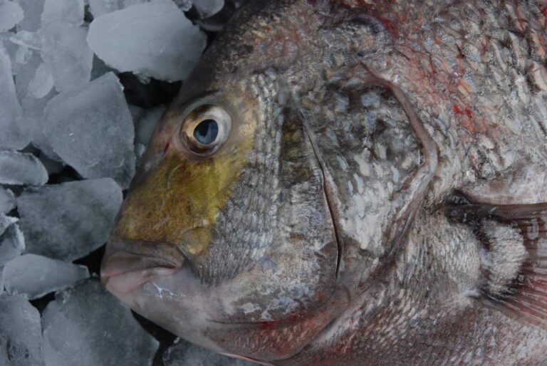
Photo: Louisiana Sea Grant College Program Louisiana State University, CC BY 2.0
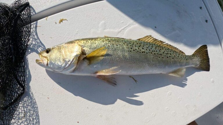
Photo: Rennair, CC BY-SA 4.0

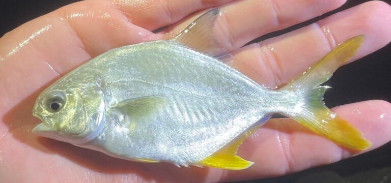
Photo: bluecrab, CC BY 4.0

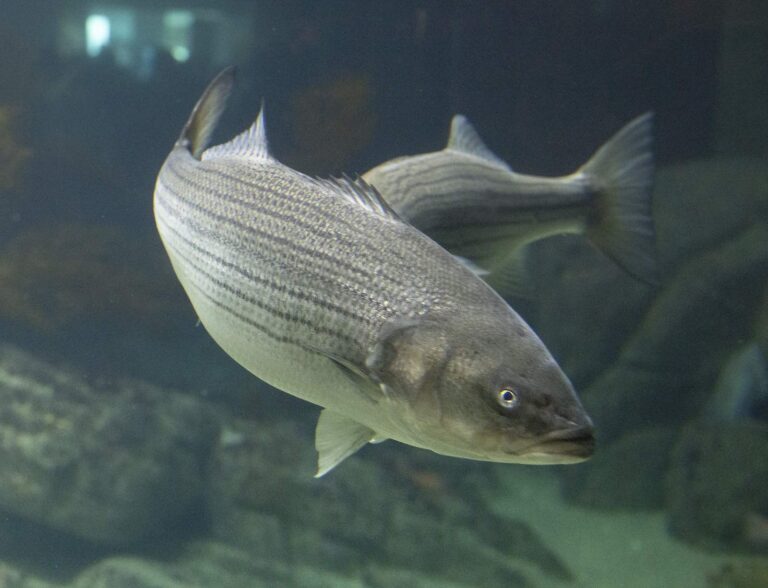
Photo: Watts, CC BY 2.0
Roberts Bayou: answers for an Alabama fishing day
Where is Roberts Bayou?
Its named point falls in Baldwin County, about 4 miles from Orange Beach.
Which license covers Roberts Bayou?
Saltwater anglers 16 and older carry an Alabama saltwater license ($30.90 resident, $66.80 nonresident for 2026-27), plus the $10 Gulf Reef Fish Endorsement to keep reef fish such as red snapper. The license line is quoted on the saltwater page.
How many ADCNR ramps reach Roberts Bayou?
Start at Josephine Park on Roberts Bayou; ADCNR lists 3 public ramps.
How many speckled trout may come home from Roberts Bayou?
Red Drum (Redfish): 3 per person; 16" min. – 26" max TL.
Where are tide predictions for Roberts Bayou?
Tide tables: Arnica Bay, Mill Point.
Can I wade Roberts Bayou?
Nearest on file: Gulf State Park Pier on Oyster Bay, 9 miles.
Which bait counter on our Alabama list serves Roberts Bayou?
Closest on our list: Bear Point Marina, under a mile away,.
Has ADCNR built reefs around Roberts Bayou?
4 inshore reefs, starting with Ross Point Reef.
Plan a Gulf Coast run to Roberts Bayou
Get the Alabama saltwater license squared away online ahead of launch day.