Western Basin of Lake Erie Fishing
Island launches, reefs, piers and limits west of the Marblehead line.
 Pick for steelheadPiscifun Viper X spinning reel50% OFFSale $39.99
Photo: James St. John, CC BY 2.0
Western Basin of Lake Erie: what to know first
This page groups the Ohio shore west of 82 degrees 30 minutes west, plus the Lucas, Wood, Ottawa and Sandusky county shore, as the Western Basin: the island country between Toledo and the Marblehead Peninsula.
In the Western Basin this page lists 62 launches, 11 piers, 99 marinas and docks, 17 more access sites, 53 islands and 27 reefs and shoals. 1 river mouth reach this part of the lake, among them Portage River.
ODNR Office of Coastal Management Lake Erie Public Access and Fish Habitat layers, ODNR Parks and Watercraft boating facilities, USGS GNIS names, retrieved October 26, 2026.
Getting a boat onto Western Basin of Lake Erie
- Crafts Lakeview Lane launch on Western Basin of Lake Erieconcrete ramp, 1 lane, 3 trailer spaces, launch fee, unlimited horsepower; Erie County, Kelley's Island
- Kelleys Island State Park on Western Basin of Lake Erieconcrete ramp, 2 lanes, no launch fee, unlimited horsepower; Erie County, Kelleys Island
- Kelleys Island State Park on Western Basin of Lake Erieboat ramp; Erie County
- SunSet Point on Western Basin of Lake Erieconcrete ramp, 1 lane, 20 trailer spaces, launch fee, unlimited horsepower; Erie County, Kelley's Island
- Belpre Dr Launch on Western Basin of Lake Erieboat ramp, no launch fee, unlimited horsepower; Lucas County, Toledo
- Cullen Park Boat Launch on Western Basin of Lake Erieconcrete ramp, 4 lanes, 111 trailer spaces, launch fee, unlimited horsepower; Lucas County, Toledo
- Hammond Dr Launch on Western Basin of Lake Erieboat ramp, no launch fee, unlimited horsepower; Lucas County, Toledo
- Lucas County – Cooley Canal Launch Ramp on Western Basin of Lake Erieboat ramp, 140 trailer spaces, no launch fee, unlimited horsepower; Lucas County, Curtice
- Meinke Marina West on Western Basin of Lake Erieconcrete ramp, 2 lanes, 65 trailer spaces, launch fee, unlimited horsepower; Lucas County, Curtice
- Metzger Marsh Launch Ramp on Western Basin of Lake Erieconcrete ramp, 2 lanes, 30 trailer spaces, no launch fee, unlimited horsepower; Lucas County, Martin
- Metzger Marsh State Wildlife Area on Western Basin of Lake Erieboat ramp; Lucas County
- President Dr Launch on Western Basin of Lake Erieboat ramp, no launch fee, unlimited horsepower; Lucas County, Toledo
- Beef Creek Marina on Western Basin of Lake Erieconcrete ramp, 2 lanes, launch fee, unlimited horsepower; Ottawa County, Oak Harbor
- Brand's Marina on Western Basin of Lake Erieconcrete ramp, 2 lanes, no launch fee, unlimited horsepower; Ottawa County, Port Clinton
- Catawba Island State Park on Western Basin of Lake Erie near Ottawaboat ramp; Ottawa County
- Catawba Island State Park on Western Basin of Lake Erie near Port Clintonconcrete ramp, 4 lanes, 133 trailer spaces, no launch fee, unlimited horsepower; Ottawa County, Port Clinton
- Channel Grove Marina on Western Basin of Lake Erieboat ramp, launch fee, unlimited horsepower; Ottawa County, Marblehead
- Chet's Place launch on Western Basin of Lake Erieconcrete ramp, 1 lane, 6 trailer spaces, launch fee, unlimited horsepower; Ottawa County, Port Clinton
- Coastal Marine II launch on Western Basin of Lake Erieboat ramp, 100 trailer spaces, launch fee, unlimited horsepower; Ottawa County, Port Clinton
- East Harbor State Park – Campground Boat Ramp on Western Basin of Lake Erieconcrete ramp, 2 lanes, 45 trailer spaces, launch fee, unlimited horsepower; Ottawa County, Lakeside
- East Harbor State Park – Marina on Western Basin of Lake Erieconcrete ramp, 1 lane, 100 trailer spaces, launch fee, unlimited horsepower; Ottawa County, Marblehead
- East Harbor State Park on Western Basin of Lake Erieboat ramp; Ottawa County
- Erie Islands Resort & Marina on Western Basin of Lake Erieconcrete ramp, 3 lanes, 24 trailer spaces, launch fee, unlimited horsepower; Ottawa County, Port Clinton
- Fenwick Marina on Western Basin of Lake Erieconcrete ramp, 6 lanes, 200 trailer spaces, launch fee, unlimited horsepower; Ottawa County, Oak Harbor
- Foxhaven Marina on Western Basin of Lake Erieconcrete ramp, 2 lanes, 40 trailer spaces, no launch fee, unlimited horsepower; Ottawa County, Port Clinton
- Harbor Haven on Western Basin of Lake Erieconcrete ramp, 1 lane, 5 trailer spaces, launch fee, unlimited horsepower; Ottawa County, Marblehead
- Inland Marina on Western Basin of Lake Erieconcrete ramp, 4 lanes, 75 trailer spaces, launch fee, unlimited horsepower; Ottawa County, Oak Harbor
- Johnnie Camp & Marina on Western Basin of Lake Erieconcrete ramp, 2 lanes, 12 trailer spaces, launch fee, unlimited horsepower; Ottawa County, Port Clinton
- Lamberjacks Marina, Campground & Cottages on Western Basin of Lake Erieconcrete ramp, 4 lanes, 30 trailer spaces, launch fee, unlimited horsepower; Ottawa County, Oak Harbor
- Mar-Lu launch on Western Basin of Lake Erieconcrete ramp, 1 lane, 5 trailer spaces, no launch fee, unlimited horsepower; Ottawa County, Marblehead
- Marblehead Harbor Marina on Western Basin of Lake Eriegravel ramp, 1 lane, 2 trailer spaces, no launch fee, unlimited horsepower; Ottawa County, Marblehead
- Marine City launch on Western Basin of Lake Erieconcrete ramp, 1 lane, 20 trailer spaces, launch fee, unlimited horsepower; Ottawa County, Marblehead
- Mazurik Access Area on Western Basin of Lake Erieboat ramp; Ottawa County
- Mazurik State Wildlife Area on Western Basin of Lake Erieconcrete ramp, 4 lanes, 172 trailer spaces, no launch fee, unlimited horsepower; Ottawa County, Marblehead
- Middle Bass Island State Park Marina on Western Basin of Lake Erieconcrete ramp, 2 lanes, 15 trailer spaces, no launch fee, unlimited horsepower; Ottawa County, Middle Bass
- Portage River Marina on Western Basin of Lake Erieconcrete ramp, 1 lane, 10 trailer spaces, no launch fee, unlimited horsepower; Ottawa County, Port Clinton
- Portage River Wildlife Access on Western Basin of Lake Erieconcrete ramp, 2 lanes, 65 trailer spaces, no launch fee, unlimited horsepower; Ottawa County, Port Clinton
- Portage View Campgrounds launch on Western Basin of Lake Erieconcrete ramp, 2 lanes, 40 trailer spaces, launch fee, unlimited horsepower; Ottawa County, Port Clinton
- Put-In-Bay Village Marina on Western Basin of Lake Erieconcrete ramp, 2 lanes, 10 trailer spaces, no launch fee, unlimited horsepower; Ottawa County, Put-In-Bay
- River Retreat Camp & Marina on Western Basin of Lake Erieconcrete ramp, 2 lanes, 12 trailer spaces, launch fee, unlimited horsepower; Ottawa County, Port Clinton
- Rocky Point Marina on Western Basin of Lake Erieconcrete ramp, 1 lane, launch fee, unlimited horsepower; Ottawa County, Marblehead
- Schmidlin Hidden Harbor on Western Basin of Lake Erieconcrete ramp, 1 lane, launch fee, unlimited horsepower; Ottawa County, Middle Bass
- South Bass Island State Park on Western Basin of Lake Erie near Ottawaboat ramp; Ottawa County
- South Bass Island State Park on Western Basin of Lake Erie near Put-In-Bayconcrete ramp, 1 lane, 21 trailer spaces, no launch fee, unlimited horsepower; Ottawa County, Put-In-Bay
- Summer Breeze Assoc. launch on Western Basin of Lake Erieconcrete ramp, 1 lane, 4 trailer spaces, launch fee, unlimited horsepower; Ottawa County, Port Clinton
- The Harbors Edge on Western Basin of Lake Erieconcrete ramp, 1 lane, 50 trailer spaces, no launch fee, unlimited horsepower; Ottawa County, Marblehead
- Tibbel's Marina on Western Basin of Lake Erieconcrete ramp, 1 lane, 20 trailer spaces, launch fee, unlimited horsepower; Ottawa County, Marblehead
- Toussaint River Marina on Western Basin of Lake Erieconcrete ramp, 6 lanes, 50 trailer spaces, launch fee, unlimited horsepower; Ottawa County, Oak Harbor
- Treasure Cove Marina on Western Basin of Lake Erieconcrete ramp, 1 lane, 100 trailer spaces, no launch fee, unlimited horsepower; Ottawa County, Port Clinton
- Turtle Creek Fishing Access on Western Basin of Lake Erieboat ramp, no launch fee, unlimited horsepower; Ottawa County, Carroll Twp
- Turtle Creek Marina & Campground on Western Basin of Lake Erieconcrete ramp, 4 lanes, 100 trailer spaces, launch fee, unlimited horsepower; Ottawa County, Oak Harbor
- Turtle Point Marina on Western Basin of Lake Erieconcrete ramp, 1 lane, 8 trailer spaces, launch fee, unlimited horsepower; Ottawa County, Oak Harbor
- Vista Villa launch on Western Basin of Lake Erieconcrete ramp, 1 lane, launch fee, unlimited horsepower; Ottawa County, Port Clinton
- West Harbor Marina on Western Basin of Lake Erieconcrete ramp, 1 lane, 1 trailer spaces, launch fee, unlimited horsepower; Ottawa County, Marblehead
- West Harbor Public Ramp on Western Basin of Lake Erieconcrete ramp, 4 lanes, 200 trailer spaces, no launch fee, unlimited horsepower; Ottawa County, Catawba Island
- West Shore Ice Ramp North on Western Basin of Lake Erieboat ramp; Ottawa County
- West Shore Ice Ramp South on Western Basin of Lake Erieboat ramp; Ottawa County
- Wild Wings Boat Harbor & Marina on Western Basin of Lake Erieconcrete ramp, 2 lanes, 60 trailer spaces, launch fee, unlimited horsepower; Ottawa County, Oak Harbor
- Memory Marina on Western Basin of Lake Erieconcrete ramp, 1 lane, 25 trailer spaces, launch fee, unlimited horsepower; Sandusky County, Fremont
- Riverfront Marina on Western Basin of Lake Erieconcrete ramp, 1 lane, 20 trailer spaces, launch fee, unlimited horsepower; Sandusky County, Fremont
- Tackle Box 2 launch on Western Basin of Lake Erieconcrete ramp, 2 lanes, 15 trailer spaces, launch fee, unlimited horsepower; Sandusky County, Freemont
- Maple Street Boat Ramp on Western Basin of Lake Erieconcrete ramp, 2 lanes, 26 trailer spaces, no launch fee, unlimited horsepower; Wood County, Perrysburg
ODNR Parks and Watercraft boating facilities (launch lanes, parking and fees as inspected), retrieved October 26, 2026.
Piers and breakwalls on Western Basin of Lake Erie
- Camp Perry Beachfishing pier, parking, restrooms, USA, Ohio National Guard
- East Harbor State Parkfishing pier, parking, restrooms, ODNR Parks and Recreation
- Waterworks Parkfishing pier, parking, City of Port Clinton
Other access sites along the Western Basin of Lake Erie
- Kelleys Island State ParkKelleys Island, Erie County, pier, ramp, shore fishing, parking, restrooms, beach, ODNR Parks and Recreation
- Metzger Marsh State Wildlife AreaJerusalem Township, Lucas County, pier, ramp, shore fishing, parking, restrooms, beach, ODNR Wildlife
- Catawba Island State ParkCatawba Island Township, Ottawa County, pier, ramp, shore fishing, parking, restrooms, beach, ODNR Parks and Recreation
- DeRivera ParkSouth Bass Island, Ottawa County, shore fishing, restrooms, transient dock, Village of Put-in-Bay
- Kuehnle State Wildlife AreaMiddle Bass Island, Ottawa County, shore fishing, ODNR Wildlife
- Lake Point ParkMarblehead, Ottawa County, shore fishing, parking, restrooms, Danbury Township
- Magee Marsh State Wildlife AreaCarroll Township, Ottawa County, shore fishing, parking, restrooms, beach, ODNR Wildlife
- Marblehead Lighthouse State ParkMarblehead, Ottawa County, shore fishing, parking, restrooms, lighthouse, ODNR Parks and Recreation
- Mazurik Access AreaDanbury Township, Ottawa County, pier, ramp, shore fishing, parking, restrooms, beach, ODNR Wildlife
- Middle Bass Island East Point PreserveMiddle Bass Island, Ottawa County, shore fishing, Put-in-Bay Township
- Middle Bass Island State ParkMiddle Bass Island, Ottawa County, ramp, shore fishing, parking, restrooms, beach, transient dock, ODNR Parks and Recreation
- North Bass Island State ParkNorth Bass Island, Ottawa County, shore fishing, restrooms, ODNR Parks and Recreation
- Oak Point State ParkSouth Bass Island, Ottawa County, shore fishing, parking, restrooms, transient dock, ODNR Parks and Recreation
- Peach Point Research FacilitySouth Bass Island, Ottawa County, shore fishing, parking, transient dock, Ohio State University
- Pebble BeachCatawba Island Township, Ottawa County, shore fishing, parking, beach, ODOT
- Perry's Victory and International Peace MemorialSouth Bass Island, Ottawa County, shore fishing, parking, restrooms, National Park Service
- Petersen WoodsMiddle Bass Island, Ottawa County, shore fishing, beach, Black Swamp Conservancy
- Port Clinton City Beach at Lakeview ParkPort Clinton, Ottawa County, shore fishing, parking, restrooms, beach, City of Port Clinton
- Put-in-Bay Aquatic Visitors CenterSouth Bass Island, Ottawa County, pier, shore fishing, parking, transient dock, ODNR Wildlife
- Put-in-Bay Village MarinaSouth Bass Island, Ottawa County, pier, ramp, transient dock, Village of Put-in-Bay
- Put-in-Bay Village Public LaunchPut-in-Bay, Ottawa County, pier, ramp, shore fishing, Village of Put-in-Bay
- South Bass Island State ParkSouth Bass Island, Ottawa County, pier, ramp, shore fishing, parking, restrooms, beach, ODNR Parks and Recreation
- Village of Put-in-Bay BeachSouth Bass Island, Ottawa County, shore fishing, parking, beach, Village of Put-in-Bay
- West Shore Ice Ramp NorthSouth Bass Island, Ottawa County, ramp, shore fishing, Put-in-Bay Township
- West Shore Ice Ramp SouthSouth Bass Island, Ottawa County, ramp, shore fishing, parking, Put-in-Bay Township
ODNR Office of Coastal Management Lake Erie Public Access layer, retrieved October 26, 2026.
Reefs and shoals in Western Basin of Lake Erie
The Western Basin holds 27 of the mapped reefs and shoals, 0 artificial, most around the islands.
| Reef or shoal | Kind | County | Depth |
|---|---|---|---|
| American Eagle Shoal | natural | Ottawa | not specified |
| Bay Point Shoal | natural | Erie | not specified |
| Big Pickerel Reef | natural | Ottawa | not specified |
| Clinton Reef | natural | Ottawa | not specified |
| Cone Reef | natural | Ottawa | 11 to 21 ft |
| Crane Reef | natural | Ottawa | not specified |
| Crib Reef | natural | Ottawa | not specified |
| East Sister Shoal | natural | Ottawa | not specified |
| Flat Rock Reef | natural | Ottawa | not specified |
| Green Island Shoal | natural | Ottawa | not specified |
| Gull Island Shoal | natural | Ottawa | 8 to 17 ft |
| Little Pickerel Reef | natural | Ottawa | 13 to 25 ft |
| Locust Point Reef | natural | Ottawa | not specified |
| Middle Bass Island East Shoal | natural | Ottawa | not specified |
| Middle Harbor Reef | natural | Ottawa | not specified |
| Mouse Island Reef | natural | Ottawa | not specified |
| Niagara Reef | natural | Ottawa | 3 to 22 ft |
| North Bass Island Shoal, R '4' | natural | Ottawa | not specified |
| Rock Shoal | natural | Ottawa | 8 to 17 ft |
| Round Reef | natural | Ottawa | not specified |
| Scott Point Shoal | natural | Ottawa | 7 to 15 ft |
| Starve Island Reef | natural | Ottawa | not specified |
| Sugar Island Shoal | natural | Ottawa | not specified |
| Toussaint Reef | natural | Ottawa | not specified |
| Turtle Reef | natural | Ottawa | not specified |
| West Reef | natural | Ottawa | not specified |
| West Sister Reef | natural | Ottawa | not specified |
Islands of Western Basin of Lake Erie
- Ballast IslandOttawa County
- Bass IslandsOttawa County
- Blue Grass IslandLucas County
- Bradys IslandSandusky County
- Butler IslandLucas County
- Buttonwood IslandWood County
- Cape Island (historical)Sandusky County
- Caseys IslandWood County
- Catawba IslandOttawa County
- Clark IslandLucas County
- Corbutt IslandLucas County
- Delaware IslandLucas County
- Eagle Island (historical)Ottawa County
- Ewing IslandLucas County
- Fox IslandLucas County
- Gilbraltar IslandOttawa County
- Granger IslandLucas County
- Grape IslandLucas County
- Grassy IslandWood County
- Grassy IslandLucas County
- Grave IslandLucas County
- Graveyard IslandSandusky County
- Green IslandOttawa County
- Hedges IslandWood County
- Hickory IslandSandusky County
- Horseshoe IslandOttawa County
- Howard IslandWood County
- Indian IslandLucas County
- Johnson IslandOttawa County
- Kelleys IslandErie County
- Marengo IslandLucas County
- Middle Bass IslandOttawa County
- Millers IslandWood County
- Missionary IslandLucas County
- Mouse IslandOttawa County
- Nagg IslandLucas County
- Negro Island (historical)Ottawa County
- North Bass IslandOttawa County
- Number 3 IslandWood County
- Otter IslandWood County
- Peach IslandSandusky County
- Presque IsleLucas County
- Rattlesnake IslandOttawa County
- Roche de BoeufLucas County
- Sheets IslandWood County
- South Bass IslandOttawa County
- Starve IslandOttawa County
- Sugar IslandOttawa County
- The Rattles IslandsOttawa County
- Turtle IslandLucas County
- West Sister IslandLucas County
- Winous IslandSandusky County
- Woodcock IslandLucas County
ODNR OCM Lake Erie Fish Habitat (reefs and shoals) and USGS GNIS island names, retrieved October 26, 2026.
Tributaries feeding Western Basin of Lake Erie
- Portage RiverOttawa County, 11 river access sites
Bays named in the Western Basin
- Big Sand BayOttawa County
- East HarborOttawa County
- Fishery BayOttawa County
- Manila BayOttawa County
- Maumee Mooring BasinLucas County
- Middle HarborOttawa County
- Muddy Creek BayOttawa County
- North BayErie County
- Oak Point HarborOttawa County
- Paynes PondLucas County
- Perry CoveOttawa County
- Potters PondLucas County
- Put-in-BayOttawa County
- Redhead CoveSandusky County
- Secor BayLucas County
- South BayErie County
- Stone CoveOttawa County
- Suzar BayLucas County
- Turtle Creek BayOttawa County
- West BayErie County
- West HarborOttawa County
Western Basin harbors and channels
- East Harbor, Ottawa County
- East Harbor Boat Entrancechannel, Ottawa County
- Entrance Channelchannel, Lucas County
- Grassy Creek Diversion Channelchannel, Wood County
- Moseley Channelchannel, Erie County
- South Passagechannel, Ottawa County
- West Harbor, Ottawa County
- West Harbor Boat Entrancechannel, Ottawa County
USGS GNIS names and ODNR OCM river access sites, retrieved October 26, 2026.
 For the steelhead herePiscifun AlumiX spinning reel46% OFFSale $64.99
Water level on Western Basin of Lake Erie
NOAA CO-OPS station 9063079 (Marblehead), IGLD85, recorded October 26, 2026; retrieved October 26, 2026. Provisional; station page.
NOAA CO-OPS station 9063085 (Toledo), IGLD85, recorded October 26, 2026; retrieved October 26, 2026. Provisional; station page.
Marblehead and Toledo are the NOAA stations closest to the Western Basin.
Keepers allowed at Western Basin of Lake Erie
| Species | Where | Daily limit and size | Season |
|---|---|---|---|
| Largemouth, Smallmouth, & Spotted Bass | Lake Erie | 5 (singly or in combination); minimum 14 inches | March 1 – April 30, 2026 |
| Largemouth, Smallmouth, & Spotted Bass | Lake Erie | 1 (singly or in combination); minimum 18 inches | May 1 – June 26, 2026 |
| Largemouth, Smallmouth, & Spotted Bass | Lake Erie | 5 (singly or in combination); minimum 14 inches | June 27, 2026 – Feb. 28, 2027 |
| Walleye, Saugeye, & Sauger | Lake Erie | 6 (singly or in combination); minimum 15 inches | March 1 – April 30, 2026 |
| Walleye | Lake Erie | 6; minimum 15 inches | May 1, 2026 – Feb. 28, 2027 |
| Walleye | Lake Erie | 6; minimum 15 inches | March 1 – April 30, 2027 |
| Striped, Hybrid, & White Bass | Lake Erie | No daily limit | Open year-round |
| Yellow Perch | Lake Erie West Zone | West Zone: 30 | March 1 – April 30, 2026 |
| Yellow Perch | Lake Erie Central Zone | Central Zone: 10 | March 1 – April 30, 2026 |
| Yellow Perch | Lake Erie East Zone | East Zone: 20 | March 1 – April 30, 2026 |
| Yellow Perch | Lake Erie West Zone | WEST ZONE DAILY BAG LIMIT: 30; minimum No minimum size for yellow perch. | May 1, 2026 – April 30, 2027 |
| Yellow Perch | Lake Erie Central Zone | CENTRAL ZONE DAILY BAG LIMIT: 10; minimum No minimum size for yellow perch. | May 1, 2026 – April 30, 2027 |
| Yellow Perch | Lake Erie East Zone | EAST ZONE DAILY BAG LIMIT: 20; minimum No minimum size for yellow perch. | May 1, 2026 – April 30, 2027 |
| Trout & Salmon | Lake Erie proper and the entire length of all Lake Erie creeks, rivers, and tributaries | 2 (singly or in combination); minimum 12 inches | March 1 – May 15, 2026 |
| Trout & Salmon | Lake Erie proper and the entire length of all Lake Erie creeks, rivers, and tributaries | 5 (singly or in combination); minimum 12 inches | May 16 – Aug. 31, 2026 |
| Trout & Salmon | Lake Erie proper and the entire length of all Lake Erie creeks, rivers, and tributaries | 2 (singly or in combination); minimum 12 inches | Sept. 1, 2026 – Feb. 28, 2027 |
| Trout & Salmon | Cold Creek upstream of State Route 2 (Erie County) | 5 (singly or in combination) | Open year-round |
Western Basin perch anglers should read the zone column: the perch bag differs between the West, Central and East zones.
Lake Erie needs no separate stamp: the Ohio license covers it, at $25.00 a year for residents 16 to 64, $76.96 for nonresidents or $52.00 for a nonresident three-day license.
Limits as printed in the 2026-27 Ohio Fishing Regulations (ODNR Division of Wildlife Publication 5085, effective March 1, 2026 to February 28, 2027) and the ODNR Lake Erie walleye and yellow perch daily limits sheet (May 1, 2026 to April 30, 2027); retrieved October 26, 2026.
Where boats tie up on Western Basin of Lake Erie
- Anchor Pointe MarinaCurtice, (419) 836-2455, fuel, pumpout, All Year
- Meinke Marina EastCurtice, (419) 836-8610, fuel, pumpout, April15-November
- Meinke Marina WestCurtice, (419) 836-7774, fuel, pumpout, April-November
- Tackle Box 2Freemont, (419) 334-4643
- Memory MarinaFremont, (419) 334-3313, fuel, May-September
- Riverfront MarinaFremont, (419) 332-2753, fuel, April-October
- Harbor View Yacht ClubHarbor View, (419) 698-8128, fuel, pumpout, April-November
- Crafts Lakeview LaneKelley's Island, (419) 746-2254, April-November
- Portside MarinaKelley's Island, (419) 746-2668, April-October
- SunSet PointKelley's Island, (419) 746-2573, May-November
- The Casino Restaurant & LoungeKelley's Island, (419) 746-2773, May-October
- Pleasant View CottagesKelleys Island, (419) 746-2282, May-October
- Seaway MarinaKelleys Island, (419) 746-2506, fuel, pumpout, May-October
- Shrocks Marina Inc.Lakeside, (419) 798-4635, fuel, pumpout, April-October
- Anchors Away MarinaMarblehead, (419) 734-1395, fuel, pumpout, April-November
- Bass Haven MarinaMarblehead, (419) 734-2544, fuel, pumpout, April-November
- Channel Grove MarinaMarblehead, (419) 732-2663, fuel, pumpout, April-October
- East Harbor State Park – MarinaMarblehead, (419) 734-2289, fuel, pumpout, April-October
- Harbor HavenMarblehead, (419) 732-3856, April-October
- Harbor Winds MarinaMarblehead, (419) 734-1356, fuel, April-October
- Lakevue MarinaMarblehead, (419) 798-5221, fuel, pumpout, April-November
- Little Teds CottagesMarblehead, (419) 520-5266, May-October
- Mar-LuMarblehead, (419) 732-3300, fuel, May-October
- Marblehead Harbor MarinaMarblehead, (419) 798-5649, fuel, pumpout, April-November
- Marina del IsleMarblehead, (419) 732-2587, fuel, pumpout, April-November
- Marine CityMarblehead, (419) 734-2228, pumpout, April-October
- Rocky Point MarinaMarblehead, (419) 987-3625, April-November
- Skippers Marina ResortMarblehead, (419) 734-3664, April-October
- The Harbors EdgeMarblehead, (419) 734-4653, April-October
- Tibbel's MarinaMarblehead, (419) 734-1143, fuel, pumpout, April-October
- West Harbor MarinaMarblehead, (419) 734-2226, fuel, pumpout, April-October
- Indian Hill Boat ClubMaumee, (419) 893-9265, pumpout, May-October
- Middle Bass Island State Park MarinaMiddle Bass, (419) 285-0311, pumpout, May-October
- Schmidlin Hidden HarborMiddle Bass, (419) 285-3813, April-October
- Beef Creek MarinaOak Harbor, (419) 898-1829, April-October
- Fenwick MarinaOak Harbor, (419) 898-7009, pumpout, April-November
- Inland MarinaOak Harbor, (419) 898-5071, pumpout, April-November
- Lamberjacks Marina, Campground & CottagesOak Harbor, (419) 898-1974, fuel
- Toussaint River MarinaOak Harbor, (419) 898-7020, fuel, May-November
- Turtle Creek Marina & CampgroundOak Harbor, (419) 898-7745, May-November
- Turtle Point MarinaOak Harbor, (419) 898-2003, fuel, April-November
- Wild Wings Boat Harbor & MarinaOak Harbor, (419) 898-2005, fuel, pumpout, May-November
- Maumee Bay State Park – MarinaOregon, (419) 836-7758, pumpout, April-October
- America's Best Value InnPort Clinton, (419) 734-2101, April-November
- Angel Bay MarinaPort Clinton, (419) 734-3803, May-November
- Brand's MarinaPort Clinton, (419) 734-4212, fuel, pumpout, April-November
- Brands MarinaPort Clinton, (419) 734-4212, fuel, pumpout, April-November
- Catawba Island Marina SouthPort Clinton, (419) 797-4414, April-November
- Catawba LandingPort Clinton, (419) 797-6000, fuel, pumpout, May-November
- Catawba MooringsPort Clinton, (419) 797-4775, fuel, pumpout, April-October
- Chet's PlacePort Clinton, (419) 898-1104, fuel, May-October
- Coastal Marine IIPort Clinton, (419) 734-3735, pumpout, April-October
- Drawbridge MarinaPort Clinton, (419) 734-4422, fuel, pumpout, April-October
- Erie Islands Resort & MarinaPort Clinton, (419) 734-9117, fuel, pumpout, May-September
- Foxhaven MarinaPort Clinton, (419) 797-4654, fuel, pumpout, April-November
- Gem Beach MarinaPort Clinton, (419) 797-4451, fuel, pumpout, April-October
- Harbor Park MarinaPort Clinton, (419) 797-2377, April-October
- Herl's HarborPort Clinton, (419) 797-2173, April-October
- Hidden HarborPort Clinton, (614) 207-8933, pumpout, May-November
- Jack Knife MarinaPort Clinton, (419) 734-3233, pumpout, April-October
- Jefferson Street Transient DocksPort Clinton, (419) 734-3735, May – Oct
- Johnnie Camp & MarinaPort Clinton, (419) 734-6566, fuel, May-October
- Lakefront MarinaPort Clinton, (800) 745-3625, fuel, pumpout, April-November
- Midway Marina IncorporationPort Clinton, (419) 747-4491, pumpout, April-November
- N.E. Port Inc.Port Clinton, (419) 797-4370, April-November
- Northwest Catawba MarinaPort Clinton, (419) 797-4680, fuel, pumpout, April-November
- Nugent Canal Yacht ClubPort Clinton, (419) 734-4530, April-November
- Portage River MarinaPort Clinton, (419) 734-4783, April-October
- Portage View CampgroundsPort Clinton, (419) 635-4479, May-December
- River Retreat Camp & MarinaPort Clinton, (419) 635-2472, April-November
- Summer Breeze Assoc.Port Clinton, (419) 734-4745, fuel, April-October
- Treasure Cove MarinaPort Clinton, (419) 797-4618, fuel, pumpout, April-November
- Vista VillaPort Clinton, (419) 690-7400, May-November
- Witterhaven MarinaPort Clinton, (419) 734-2029, May-November
- Boardwalk MarinaPut-In-Bay, (419) 285-6183, fuel, pumpout, May-October
- DeRivera ParkPut-In-Bay, (419) 285-2076, May-October
- East Point CottagesPut-In-Bay, (440) 655-9230, All Year
- Fox's DockPut-In-Bay, (419) 285-4900, May-October
- Millers MarinaPut-In-Bay, (419) 285-5902, March-November
- Put-In-Bay Village MarinaPut-In-Bay, (419) 285-2068, May-October
ODNR Parks and Watercraft motorized boating facilities (marinas and docks), retrieved October 26, 2026.
Ohio charter and guide listings near Western Basin of Lake Erie
- Hawg Alert Charterscharter, Lake Erie, Port Clinton, (419) 341-4169
- DC Charterscharter, Lake Erie, Port Clinton, (419) 341-8421
- Angel Eyes Charterscharter, Lake Erie, Port Clinton, (419) 656-1638
- A-N-J Charterscharter, Lake Erie, Port Clinton, (419) 341-0350
- Fishin Ful Myrmidon Charterscharter, Lake Erie, Port Clinton, (419) 734-9711
- Erie Drifter Sportfishingcharter, Lake Erie, Oak Harbor, (419) 349-1129
- Dr Bugs Charterscharter, Lake Erie, Oak Harbor, (419) 276-0929
- Erie Eyes Anglercharter, Lake Erie, Port Clinton, (513) 623-3095
- Fish On Charterscharter, Lake Erie, Port Clinton, (937) 594-1308
- Coe Vanna Charters & Lodgingcharter, Lake Erie, Oak Harbor, (419) 355-4732
- Erie Express Charterscharter, Lake Erie, Port Clinton, (419) 797-4828
- 'Eye-Catcher Charterscharter, Lake Erie, Lakeside Marblehead, (614) 679-2616
- Eriegardless Sportfishingcharter, Lake Erie, Lakeside Marblehead, (419) 702-0589
- Champion Charterscharter, Lake Erie, Lakeside Marblehead, (419) 732-8195
- Big Poppa's Fishing Chartercharter, Lake Erie, Lakeside Marblehead, (419) 512-4783
- Mark I Charterscharter, Lake Erie, Port Clinton, (419) 734-3016
Minnows, crawlers and line for Western Basin of Lake Erie
- Kelleys Island Seaway Marinamarina, Kelleys Island, 2 miles
- Portside Marinamarina, Kelleys Island, 2 miles
- Anchor Pointe Boat-A-Miniummarina, Curtice, under a mile
- Brenner 75 at Harrison Marinamarina, Toledo, 1 mile
- Cullen Park Drive Thru & Baitbait and tackle shop, Toledo, 1 mile
- Jockett's Marinamarina, Toledo, 1 mile
- Maumee Tacklebait and tackle shop, Maumee, 1 mile
- Meinke Marina Eastmarina, Curtice, under a mile
- Meinke Marina-Westmarina, Curtice, under a mile
- Sabrina's Hook Or Baitbait and tackle shop, Curtice, 3 miles
- Spot & spam's Bait and Tacklebait and tackle shop, Toledo, under a mile
- A-N-J Bait & Tacklebait and tackle shop, Port Clinton, 2 miles
- Al's Harbormarina, Oak Harbor, 3 miles
- Anchor's Away Marina Corpmarina, Lakeside Marblehead, 1 mile
- Bass Haven Marinamarina, Lakeside Marblehead, under a mile
- Beef Creek Marinamarina, Oak Harbor, under a mile
- Brands Dry Dock Marinamarina, Port Clinton, under a mile
- Brands Marinamarina, Port Clinton, under a mile
- Catawba Island Marinamarina, Port Clinton, under a mile
- Catawba Landingmarina, Port Clinton, under a mile
- Catawba Landing Gas Dockmarina, Port Clinton, 1 mile
- Channel Grove Marinamarina, Lakeside Marblehead, 1 mile
- Coastal Marinemarina, Port Clinton, under a mile
- Dock 421marina, Put In Bay, 2 miles
Yellow Pages charter and guide listings and Ohio shop listings, retrieved October 26, 2026.
Western Basin events on the calendar
Western Basin events are listed with every other Ohio Lake Erie tournament.
Beyond the Western Basin
- Lake Eriegreat lake
- Central Basin of Lake ErieLake Erie
- Sandusky BayLake Erie
- Maumee BayLake Erie
- Lake Erie steelhead streamstributaries
- Lake Erie reefs and shoalsreef list
- Portage Riverriver
Piscifun reels to stow for Western Basin of Lake Erie


Piscifun and Amazon links are affiliate links; the site earns a commission on qualifying purchases.
Lakes, rivers and shore close to Western Basin of Lake Erie, pictured
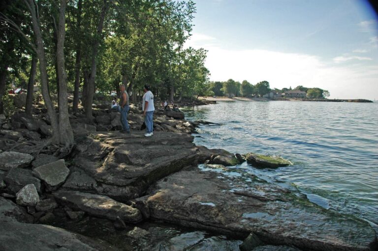
Photo: James St. John, CC BY 2.0

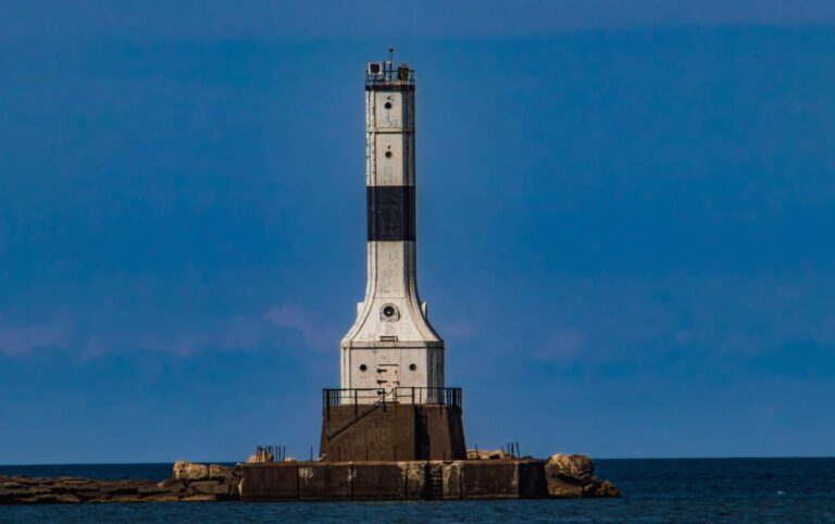
Photo: George Neat, CC BY-SA 4.0


Photo: Eric Marshall, CC BY 3.0


Photo: Unknown author Unknown author or not provided, Public domain

Questions to settle before heading for Western Basin of Lake Erie
What license do I need for the Western Basin?
Lake Erie needs no separate stamp: the Ohio license covers it, at $25.00 a year for residents 16 to 64, $76.96 for nonresidents or $52.00 for a nonresident three-day license.
How many launches serve the Western Basin?
62 in the ODNR launch inventory, such as Beef Creek Marina on Western Basin of Lake Erie, Belpre Dr Launch on Western Basin of Lake Erie and Brand's Marina on Western Basin of Lake Erie.
How many walleye may I keep in the Western Basin?
6 (singly or in combination); minimum 15 inches; March 1 – April 30, 2026.
Which perch zone applies in the Western Basin?
Lake Erie West Zone: West Zone: 30; Lake Erie Central Zone: Central Zone: 10; Lake Erie East Zone: East Zone: 20.
Where can I fish the Western Basin from shore?
11 piers and breakwalls and 17 more public access sites are listed, such as Metzger Marsh State Wildlife Area and Camp Perry Beach.
Where is the Western Basin level read?
Marblehead and Toledo, NOAA; the latest reading and its time are in the level band.
Who runs charters in the Western Basin?
16 listings, for example Hawg Alert Charters and DC Charters.
How many reefs sit in the Western Basin?
27 reefs and shoals are mapped by ODNR, 0 artificial.
How many marinas are in the Western Basin?
99 marinas and docks are in the ODNR boating facilities layer for this water.
Which islands are in the Western Basin?
53 named islands, among them Ballast Island, Bass Islands, Blue Grass Island and Bradys Island.
Head for the islands of the Western Basin
Choose a launch near the islands and check the perch zone.