South Shore of Long Island Fishing
New York access, DEC limits and charters on South Shore of Long Island.
 Pick for flounderPiscifun Alloy S inshore spinning reelCheck price at Piscifun
Photo: dans362, CC BY 3.0
South Shore of Long Island: size, shoreline and setting
On the New York side, South Shore of Long Island borders Kings County and 4 other counties; it is a ocean shore and bays. Species with DEC seasons or limits here include winter flounder, striped bass, scup, summer flounder, black sea bass and oyster toadfish.
It holds 11 DEC artificial reefs. Counted here: 54 launches, 46 piers, 151 more shore sites, 11 named harbors and 0 tributaries with pages.
USGS GNIS, DEC launch, fishing access and marine access layers, retrieved October 24, 2026.
 For the flounder herePiscifun NautiX saltwater spinning reel14% OFFSale $94.99
Putting a boat in on South Shore of Long Island
Ramps and hand launches serving South Shore of Long Island
- Albany Avenue Boat Ramphard surface ramp, parking: ample; managed by Municipal
- Argonne Road Rampboat launch, parking: very limited
- Babylon Village Boat Rampboat launch, parking: limited
- Bar Beach Parkhard surface ramp, 40 parking spaces; managed by Municipal
- Bay Avenue Rampboat launch, parking: very limited
- Bay Park Boat Rampboat launch, parking: ample
- Bay Shore Marinaboat launch, parking: ample
- Baycrest Avenue Rampboat launch, parking: very limited
- Bellport Village Marina Boat Rampboat launch, parking: limited
- Boatman's Lane Launch Siteboat launch, parking: very limited
- Captree Launchboat launch
- Champlin Creek Dock Launchboat launch, parking: limited
- Corey Beach and Marinahard surface ramp, 30 parking spaces; managed by Municipal
- Corwin Lane Rampboat launch, parking: very limited
- Curtis E. Fisher West Marinahard surface ramp, parking: limited; managed by Municipal
- East Islip Marina on Great South Bayhard surface ramp, 30 parking spaces; managed by Municipal
- Edward Warner "Old Ponquogue Bridge" Marine Parkhard surface ramp, parking: limited; managed by Municipal
- Forge River Ramp and Marinahard surface ramp, 25 parking spaces; managed by Municipal
- Garvies Point Ramphard surface ramp, 25 parking spaces; managed by Municipal
- Great River Rampboat launch, parking: very limited
- Great South Bay access, Suffolk Countyhard surface ramp, 67 parking spaces; managed by Oprhp
- Harry Tappen Beach Ramphard surface ramp, 30 parking spaces; managed by Municipal
- Heckscher Launchboat launch
- Heckscher State Parkhard surface ramp, 90 parking spaces; managed by Oprhp
- Homans Creek Dock Launchboat launch, parking: limited
- Inwood Marinaboat launch, parking: limited
- Inwood Park Boat Rampboat launch, parking: limited
- John J. Burns Parkhard surface ramp, parking: ample; managed by Municipal
- Jones Beach Inlet access, Nassau County (east)hand launch, 340 parking spaces; managed by Oprhp
- Jones Beach Inlet access, Nassau County (west)hand launch, 50 parking spaces; managed by Oprhp
- Little Neck Road Ramp on Shinnecock Bayhard surface ramp, 15 parking spaces; managed by Municipal
- Maple Avenue Ramp and Dockhard surface ramp, parking: very limited; managed by Municipal
- Maple Street Ramp and Dockboat launch, parking: ample
- Milburn Creek Boat Rampboat launch, parking: ample
- Mohawk Ave Launch Siteboat launch, parking: very limited
- Moriches Bay access, Suffolk Countyhard surface ramp, 12 parking spaces; managed by DEC
- Old Place Creek access, Richmond Countyhand launch; managed by DEC
- Orchard Neck Creek Rampboat launch, parking: very limited
- Peconic Road Rampboat launch, parking: very limited
- Pennies Landing Rampboat launch, parking: very limited
- Penniman Creek Rampboat launch, parking: very limited
- Pine Neck Boat Ramphard surface ramp, 24 parking spaces; managed by Municipal
- Rose Hill Road Rampboat launch, parking: very limited
- Seatuck Creek Ramp and Dockhard surface ramp, parking: very limited; managed by Municipal
- Shinnecock Road End Launchboat launch, parking: very limited
- Smith Point County Marinahard surface ramp, 50 parking spaces; managed by Suffolk County
- South Bay Avenue Dock and Ramp on Seatuck Cove, Moriches Bayboat launch, parking: very limited
- Tanner Marine Parkhard surface ramp, 38 parking spaces; managed by Municipal
- Venetian Shores Launchhard surface ramp, 34 parking spaces; managed by Municipal
- Village of Amityville Boat Ramp on Great South Bayboat launch, parking: ample
- Village of Quogue Recreation Area on Quantuck Bay, Shinnecock Bayboat launch, parking: very limited
- Wantagh Park Boat Rampboat launch, parking: ample
- West Islip Marina and Beach on Great South Bayboat launch, parking: ample
- Westhampton Village Marinaboat launch, parking: limited
Piers and docks on South Shore of Long Island
- Tanner Marine ParkCopaigue, Babylon
- Corey Beach and MarinaBlue Point, Brookhaven
- Forge River Ramp and MarinaMastic, Brookhaven
- Cranberry DockMastic Beach, Brookhaven
- Osprey ParkMastic Beach, Brookhaven
- Pine Neck Boat Ramp fishing access, PatchoguePatchogue, Brookhaven
- Sandspit MarinaPatchogue, Brookhaven
- Long Beach Municipal Fishing PierLong Beach, City of Long Beach
- Norman J. Levy Park and PreserveMerrick, Hempstead
- Curtis E. Fisher West MarinaPoint Lookout, Hempstead
- Green Island Fishing PierWantagh, Hempstead
- Bayport BeachBayport, Islip
- East Islip MarinaEast Islip, Islip
- Captree Fishing Pier #1Islip, NYS Parks
- Captree Fishing Pier #2Islip, NYS Parks
- Robert Moses Fishing PierBabylon, NYS Parks
- Jones Beach Fishing PiersWantagh, NYS Parks
- Edward J Warner, Sr. Old Ponquogue Bridge Marine ParkHampton Bays, Southampton
- Tiana BeachHampton Bays, Southampton
- Smith Point Fishing PierShirley, Suffolk County
- Oak Beach ParkOak Beach, Suffolk County/Town of Babylon
- Amityville BeachAmityville, Village of Amityville
- Village of Quogue Recreation AreaQuogue, Village of Quogue
- Old Ponquogue Bridge fishing access, Hampton BaysHampton Bays, Southampton
- Marine Parkway Bridge bulkhead
- Rockaway Community Park
- Harry Tappen Beach Ramp fishing pier
- Bar Beach Park fishing pier
- Curtis E. Fisher West Marina fishing pier
- Tanner Marine Park fishing pier
- Corey Beach and Marina fishing pier
- Pine Neck Boat Ramp fishing pier
- East Islip Marina fishing pier
- Smith Point County Marina fishing pier
- Forge River Ramp and Marina fishing pier
- Edward Warner "Old Ponquogue Bridge" Marine Park fishing pier
- City of Long Beach Boat Ramp fishing pier
- Bay Shore Marina fishing pier
- Homans Creek Dock fishing pier
- Milburn Creek Boat Ramp fishing pier
- Wantagh Park Boat Ramp fishing pier
- Captree State Park fishing pier
- Bay Avenue Ramp fishing pier
- South Bay Avenue Dock and Ramp fishing pier
- Bellport Village Marina Boat Ramp fishing pier
- Village of Quogue Recreation Area fishing pier
Bank and beach access on South Shore of Long Island
- Cedar Beach, BabylonShore, Babylon
- Cedar Beach MarinaDock, bank fishing, Babylon
- Overlook BeachShore, Babylon
- Venetian Shores fishing access, LindenhurstShore, Lindenhurst
- Blue Point DockDock, bank fishing, Blue Point
- Union Avenue DockDock, bank fishing, Center Moriches
- Webby's BeachShore, Center Moriches
- Maple Avenue Ramp and DockDock, bank fishing, East Moriches
- Seatuck Creek Ramp and DockDock, bank fishing, Eastport
- Great Gun BeachShore, Fire Island
- Davis Park BeachShore, Fire Island
- Shirley BeachShore, Shirley
- Ocean Beach ParkShore, Long Beach
- Atlantic Avenue BeachShore, Amagansett
- Atlantic Drive BeachShore, Amagansett
- Indian Wells BeachShore, Amagansett
- Napeague Lane BeachShore, Amagansett
- Ditch Plains BeachShore, Montauk
- Edison BeachShore, Montauk
- Kirk Park BeachShore, Montauk
- Beach Lane BeachShore, Wainscott
- Town Line BeachShore, Wainscott
- Atlantic BeachShore, Atlantic Beach
- Hewlett Point ParkShore, Bay Park
- East Atlantic BeachShore, East Atlantic Beach
- Guy Lombardo MarinaDock, bank fishing, Freeport
- Lido Beach Town ParkShore, Lido Beach
- Lido Beach Town Park WestShore, Lido Beach
- Malibu Town ParkShore, Lido Beach
- Town Park at Point LookoutShore, Lido Beach
- Marine Nature Study AreaShore, Oceanside
- Seaford DockDock, bank fishing, Seaford
- Seamans Neck ParkDock, bank fishing, Seaford
- Woodmere DockDock, bank fishing, Woodmere
- Bay Shore MarinaDock, bank fishing, Bay Shore
- Maple Avenue DockDock, bank fishing, Bay Shore
- Champlin Creek DockDock, bank fishing, East Islip
- Great River DockDock, bank fishing, Great River
- Islip BeachShore, Islip
- Maple Street Ramp and DockDock, bank fishing, Islip
- Sayville BeachShore, Sayville
- Sayville Marina ParkShore, Sayville
- West Islip Marina and BeachDock, Shore, West Islip
- West Avenue DockDock, bank fishing, West Sayville
- Bay ParkDock, bank fishing, East Rockaway
- Cow Meadow ParkShore, Freeport
- Milburn Creek ParkDock, bank fishing, Freeport
- Inwood ParkShore, Inwood
- Shell Creek ParkDock, bank fishing, Island Park
- Nickerson Beach ParkShore, Lido Beach
- North Woodmere ParkShore, North Woodmere
- Wantagh ParkDock, bank fishing, Wantagh
- Fire Island National Seashore fishing access, Fire IslandShore, Fire Island
- Moriches Bay Marine Waterway Access SiteShore, East Moriches
- Havens Point Tidal Wetlands AreaShore, East Moriches
- Timber Point Tidal Wetlands AreaShore, Oakdale
- Benton Bay-Ludlow Creek Tidal Wetlands AreaShore, Oakdale
- Johns Neck Tidal Wetlands AreaShore, Shirley
- Captree State ParkShore, Islip
- Gilgo State ParkShore, Babylon
- Robert Moses State ParkShore, Babylon
- Heckscher State ParkShore, East Islip
- Camp Hero State ParkShore, Montauk
- Hither Hills State ParkShore, Montauk
- Shadmoor State ParkShore, Montauk
- Captree Island fishing access, Oak BeachShore, Oak Beach
- Jones Beach State ParkJetty, Shore, Wantagh
- Alhambra ParkDock, Shore, Massapequa
- Anchor ParkDock, bank fishing, Massapequa
- Breezy Point ParkDock, bank fishing, Massapequa
- John J Burns ParkDock, bank fishing, Massapequa
- Philip B Healey BeachDock, bank fishing, Massapequa
- Mecox BeachShore, Bridgehampton
- Hot Dog BeachShore, East Quogue
- Dolphin Lane BeachShore, Hampton Bays
- Sand Bar BeachShore, Hampton Bays
- Ponquogue BeachShore, Hampton Bays
- Flying Point BeachShore, Water Mill
- W. Scott Cameron BeachShore, Water Mill
- Pikes BeachShore, Westhampton Beach
DEC boat launch, fishing access and marine access layers, NYS Parks launches, USGS GNIS, retrieved October 24, 2026.
Tributaries and harbors of South Shore of Long Island
- Barbadoes BasinQueens County, harbor (gnis bay)
- Bergen BasinQueens County, harbor (gnis bay)
- Hawtree BasinQueens County, harbor (gnis bay)
- Island Park HarborNassau County, harbor (gnis bay)
- Motts BasinNassau County, harbor (gnis bay)
- Norton BasinQueens County, harbor (gnis bay)
- Shell HarborNassau County, harbor (gnis bay)
- Shellbank BasinQueens County, harbor (gnis bay)
- Sommerville BasinQueens County, harbor (gnis bay)
- Thurston BasinQueens County, harbor (gnis bay)
- Vernam BasinQueens County, harbor (gnis bay)
Bays on the New York side of South Shore of Long Island
- Babylon CoveSuffolk County
- Baldwin BayNassau County
- Bannister BayNassau County
- Bay of FundyNassau County
- Bellport BaySuffolk County
- Bowery BayQueens County
- Brosewere BayNassau County
- Bushwick InletKings County
- Clam CreekSuffolk County
- Clam PondSuffolk County
- Dead Horse BayKings County
- Deep CreekKings County
- East BayNassau County
- East CoveSuffolk County
- Gateway LagoonSuffolk County
- Gilgo HeadingSuffolk County
- Gowanus BayKings County
- Grassy BayQueens County
- Great CoveSuffolk County
- Great South BaySuffolk County
- Hallets CoveNew York County
- Head of BayQueens County
- Hemlock CoveSuffolk County
- Hempstead BayNassau County
- Hendrix CreekKings County
- Hewlett BayNassau County
- Jamaica BayQueens County
- Jones BayNassau County
- Little BayQueens County
- Long CoveSuffolk County
- Maspeth CreekQueens County
- Massapequa CoveNassau County
- Mecox BaySuffolk County
- Merrick BayNassau County
- Middle BayNassau County
- Moriches BaySuffolk County
- Narrow BaySuffolk County
- Nicoll BaySuffolk County
- Parsonage CoveNassau County
- Patchogue BaySuffolk County
- Pot CoveNew York County
- Princes BayRichmond County
- Quantuck BaySuffolk County
- Randall BayNassau County
- Robinson CoveSuffolk County
- Shinnecock BaySuffolk County
- South CoveNew York County
- South Oyster BayNassau County
- The LagoonNassau County
- The RunNassau County
- Tobay HeadingNassau County
- Wallabout BayNew York County
- Wallabout Bay (historical)Kings County
- West CoveSuffolk County
- Zachs BayNassau County
USGS GNIS names, DEC Great Lakes tributary listing, retrieved October 24, 2026.
Reef sites off South Shore of Long Island
- Atlantic Beach Reef55 to 64 feet, 413 acres (2000 yards by 1000 yards)
- Fire Island Reef62 to 73 feet, 850 acres (3085 yards by 1335 yards)
- Hempstead Reef50 to 72 feet, 850 acres (3085 yards X 1335 yards)
- Kismet Reef16 to 25 feet, 10 acres; (1000 yards by 50 yards)
- McAllister Grounds48 to 53 feet, 425 acres (2036 yards X 1020 yards)
- Moriches Reef70 to 80 feet, 850 acres (2025 yards by 2025 yards)
- Rockaway Reef32 to 40 feet, 635 acres (2639 yards X 1173 yards)
- Shinnecock Reef76 to 84 feet, 850 acres (2025 by 2025 yards)
- Sixteen Fathom Reef85 to 103 feet, 850 acres (2025 yards x 2025 yards)
- Twelve Mile Reef123 to 143 feet, 850 acres (2,025 yards by 2,025 yards)
- Yellowbar Reef25 to 40 feet, 7 acres (400 yards by 85 yards)
DEC artificial reef program pages, retrieved October 24, 2026.
Sizes and bag limits on South Shore of Long Island
| Species | Daily limit and size | Season |
|---|---|---|
| Winter Flounder | 2; minimum 12" | Apr 1 – May 30 |
| Striped Bass | 1; minimum 28" to 31" (slot) | Apr 15 – Dec 15 |
| Scup (Porgy) | 30; minimum 9.5" from shore; 11" from a vessel | May 1 – Dec 31 |
| Summer Flounder (Fluke) | 3; minimum 19" | May 4 – Aug 1 |
| Summer Flounder (Fluke) | 3; minimum 19.5" | Aug 2 – Oct 15 |
| Black Sea Bass | 3; minimum 16" | May 16 – Aug 31 |
| Black Sea Bass | 6; minimum 16" | Sep 1 – Dec 31 |
| Oyster Toadfish | 3; minimum 10" | Jul 16 – May 14 |
| Tautog (Blackfish) | 2; minimum 16" | Apr 1 – Apr 30 |
| Tautog (Blackfish) | 3; minimum 16" | Oct 11 – Dec 9 |
| Tautog (Blackfish) | 2; minimum 16" | Apr 1 – Apr 30 |
| Tautog (Blackfish) | 4; minimum 16" | Oct 15 – Dec 22 |
| American Eel | 25; minimum 9" | All year |
| Atlantic Cod | 5; minimum 23" | Sep 1 – May 31 |
| Atlantic Menhaden | 100 | All year |
| Bluefish | 5 | All year |
| Cobia | 1; minimum 43" | All year |
| Haddock | No daily limit; minimum 18" | All year |
| Hickory Shad | 5 | All year |
| King Mackerel | 3; minimum 23" | All year |
| Monkfish | No daily limit; minimum 17" (11" tail length) | All year |
| Pollock | No daily limit; minimum 19" | All year |
| Red Drum | Any number under 27" | All year |
| Spanish Mackerel | 15; minimum 14" | All year |
| Weakfish | 1; minimum 16" (10" fillet, 12" dressed) | All year |
| Yellowtail Flounder | No daily limit; minimum 13" | All year |
Marine District limits from DEC apply in these state waters.
Anglers 16 and older who fish for saltwater species, or for migratory fish of the sea, enroll in the free DEC Recreational Marine Fishing Registry instead of buying a license; freshwater fishing takes the DEC license ($25.00 resident, $50.00 nonresident).
DEC recreational saltwater fishing regulations (finfish limits changed May 12, 2026), retrieved October 24, 2026, figures checked against the DEC pages October 25, 2026. All New York limits.
Captains and guides near South Shore of Long Island
- Elite Long Island Outfitterfishing guide, Long Island, Amityville
- J & L Guide Servicefishing guide, Brookhaven
- DC Outdoor Adventuresfishing guide, Farmingville
- TiDeRunnerfishing guide, Freeport
- Montauk Outfitterfishing guide, Montauk
Where boaters gas up and buy bait for South Shore of Long Island
- Long island Maritime Museummarina, Suffolk, 1 mile
- J and J Bait and Tacklebait and tackle shop, Patchogue, 3 miles
- Dicks Sporting Goods 1185sporting goods store, Patchogue, 3 miles
- Davis Park Marinamarina, Suffolk, 5 miles
- Lake Ronkonkoma Boat Launchmarina, Suffolk, 7 miles
- Bellport Village Marinamarina, Suffolk, 8 miles
- Bay Shore Marinamarina, Suffolk, 9 miles
- Dicks Sporting Goods, 620 Smithaven Mallsporting goods store, Lake Grove, 9 miles
- South Shore Bait & Tacklebait and tackle shop, Bay Shore, 10 miles
- Smith Point Bait Beach & Tacklebait and tackle shop, Shirley, 12 miles
- West Islip Marinamarina, Suffolk, 12 miles
- Dicks Bait & Tacklebait and tackle shop, Mastic Beach, 12 miles
DEC licensed guide list (business name and county), OpenStreetMap and DEC license agent shop listings, retrieved October 24, 2026.
Derbies and events on South Shore of Long Island
Further big water past South Shore of Long Island
- Tidal Hudson Rivertidal river
- Long Island Soundsound
- Peconic Baybay
- Gardiners Baybay
- New York Harborharbor
Piscifun gear worth stowing for South Shore of Long Island


Piscifun and Amazon links are affiliate links; the site earns a commission on qualifying purchases.
The water near South Shore of Long Island through a lens
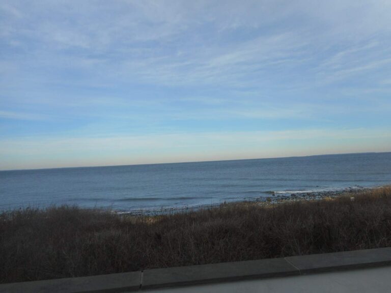
Photo: DanTD, CC BY-SA 4.0

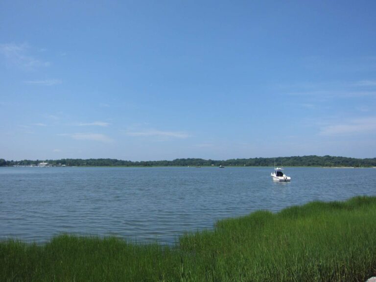
Photo: Leonard J. DeFrancisci, CC BY-SA 3.0

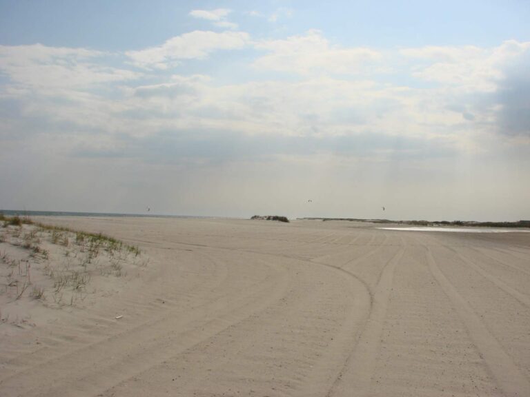
Photo: Allie_Caulfield from Germany, CC BY 2.0


Photo: Mike Peel ( www.mikepeel.net ), CC BY-SA 4.0

Trip questions for South Shore of Long Island
Is a license or registry needed for South Shore of Long Island?
Anglers 16 and older who fish for saltwater species, or for migratory fish of the sea, enroll in the free DEC Recreational Marine Fishing Registry instead of buying a license; freshwater fishing takes the DEC license ($25.00 resident, $50.00 nonresident).
At which spots do boats slide into South Shore of Long Island?
54 launches are listed on this page, among them Jones Beach Inlet access, Nassau County (west), Jones Beach Inlet access, Nassau County (east) and Garvies Point Ramp.
Which species does DEC regulate on South Shore of Long Island?
Winter flounder, striped bass, scup, summer flounder, black sea bass, oyster toadfish and tautog.
Does South Shore of Long Island have piers open to anglers?
46 piers and 151 other shore sites are listed, such as Tanner Marine Park and Corey Beach and Marina.
Can I hire a captain for South Shore of Long Island?
5 businesss from the DEC licensed guide list are shown, for example Elite Long Island Outfitter.
Is there a water level gauge for South Shore of Long Island?
No level station is matched to it on this page.
Where does South Shore of Long Island touch New York?
Kings County, Nassau County, Queens County, Richmond County and Suffolk County.
How many striped bass may I keep from South Shore of Long Island?
1; minimum 28" to 31" (slot); Apr 15 – Dec 15.
How many summer flounder may I keep from South Shore of Long Island?
3; minimum 19"; May 4 – Aug 1.
Where are the DEC reefs in South Shore of Long Island?
11 DEC reefs, among them Atlantic Beach Reef, Fire Island Reef and Hempstead Reef.
Give South Shore of Long Island a whole weekend
Choose an access site, then check the limits.