Long Island Sound Fishing
Launches, piers, limits, levels and guides for Long Island Sound on the New York side.
 Pick for flounderPiscifun Alloy S inshore spinning reelCheck price at Piscifun
Photo: Russ, CC BY 2.0
A first visit to Long Island Sound
Long Island Sound is a sound touching Bronx County and 4 other counties on the New York side. DEC rows for this water cover winter flounder, striped bass, scup, summer flounder, black sea bass and oyster toadfish.
DEC maintains 5 artificial reefs in or off it. This page lists 36 launches, 24 piers, 215 other shore sites, 44 named harbors and 0 tributary pages.
USGS GNIS, DEC launch, fishing access and marine access layers, retrieved October 24, 2026.
 For the flounder herePiscifun NautiX saltwater spinning reel14% OFFSale $94.99
Launches and marinas on Long Island Sound
Boat launches on Long Island Sound
- Amherst Road Boat Rampboat launch, parking: very limited
- Asharoken Beach Ramphard surface ramp, 54 parking spaces; managed by Municipal
- Bay View Drive Rampboat launch, parking: very limited
- Carmans River access, Suffolk Countyhand launch, 10 parking spaces; managed by DEC
- Cedar Beachhard surface ramp, 75 parking spaces; managed by Municipal
- Cold Spring Harbor Ramphard surface ramp, 12 parking spaces; managed by Municipal
- Creek Beachboat launch, parking: very limited
- Edwards Avenue Launchboat launch, parking: very limited
- Harbor Avenue Rampboat launch, parking: very limited
- Hobart Beach Ramphard surface ramp, 65 parking spaces; managed by Municipal
- Iron Pier Beachhard surface ramp, 15 parking spaces; managed by Municipal
- John Street Boat Rampboat launch, parking: very limited
- Kings Park Bluffboat launch, parking: ample
- Long Beach Town Parkboat launch, parking: ample
- Long Island Sound/Mattituck Creek access, Suffolk Countyhard surface ramp, 60 parking spaces; managed by DEC
- Long Island Sound/Nissequogue River access, Suffolk Countyhand launch; managed by Oprhp
- Manorhaven Beach Parkhard surface ramp, 50 parking spaces; managed by Municipal
- Mattituck Creek Marine Waterway Access Siteboat launch, parking: ample
- Mattituck Park District Boat Ramphard surface ramp, parking: limited; managed by Municipal
- Mill Dam Ramphard surface ramp, parking: limited; managed by Municipal
- Narrow River Road Boat Ramphard surface ramp, parking: limited; managed by Municipal
- Nissequogue River Launchhand launch; managed by Oprhp
- Nissequogue River access, Suffolk Countyhand launch, 35 parking spaces; managed by Suffolk County
- Norman E. Klipp Marine Parkhard surface ramp, parking: ample; managed by Municipal
- Oyster Bay Marine Waterway Access Sitehard surface ramp, 20 parking spaces; managed by DEC
- Oysterponds Marine Waterway Access Sitehard surface ramp, 30 parking spaces; managed by DEC
- Port Jefferson Boat Ramphard surface ramp, 90 parking spaces; managed by Municipal
- Sandy Beach Road Boat Rampboat launch, parking: limited
- Schubert's Beach Boat Rampboat launch, parking: ample
- Scudder Beachboat launch, parking: limited
- Soundview Ramphard surface ramp, 90 parking spaces; managed by Municipal
- Stepping Stone Park and Marinaboat launch, parking: very limited
- Stony Brook Boat Ramphard surface ramp, 17 parking spaces; managed by Municipal
- Village of Poquott Boat Ramp on Port Jefferson Harbor, Long Island Soundboat launch, parking: very limited
- Wading River Boat Rampboat launch, parking: limited
- West Harbor Beach on Oyster Bay Harbor, Long Island Soundboat launch, parking: ample
Fishing piers on Long Island Sound
- Cedar Beach, Mount SinaiMount Sinai, Brookhaven
- Pryibil Beach, Glen CoveGlen Cove, City of Glen Cove
- Stepping Stone Park and MarinaGreat Neck, Great Neck Parks
- Bar Beach ParkPort Washington, North Hempstead
- Mattituck Creek Marine Waterway Access SiteMattituck, Nys Dec
- Theodore Roosevelt Memorial Park and BeachOyster Bay Harbor, Oyster Bay
- Harry Tappen BeachSea Cliff, Oyster Bay
- Kings Park Bluff, Kings ParkKings Park, Smithtown
- Bay Avenue Dock/PierGreenport, Southold
- Creek BeachBayville, Village of Bayville
- West Harbor BeachBayville, Village of Bayville
- Village of Poquott Boat Ramp fishing access, PoquottPoquott, Village of Poquott
- Harborfront ParkPort Jefferson, Village of Port Jefferson
- Hunt's Point Riverside Park
- Concrete Plant Park
- Bayside Marina
- Oyster Bay Marine Waterway Access Site fishing pier
- Cedar Beach fishing pier
- Stony Brook Boat Ramp fishing pier
- Stepping Stone Park and Marina fishing pier
- Mattituck Creek Marine Waterway Access Site fishing pier
- Kings Park Bluff fishing pier
- Creek Beach fishing pier
- West Harbor Beach fishing pier
Shore fishing on Long Island Sound
- Landing Road TerminusShore, Miller Place
- Hagerman Landing Road TerminusShore, Rocky Point
- Satterly Landing ParkDock, bank fishing, Mount Sinai
- Hallock Landing Road TerminusShore, Rocky Point
- Shoreham Beach, ShorehamShore, Shoreham
- West Meadow fishing access, Stony BrookShore, Stony Brook
- Stony Brook Fishing DockDock, bank fishing, Stony Brook
- Morgan Memorial ParkShore, Glen Cove
- Crescent Beach, Glen CoveShore, Glen Cove
- Alewife Brook LandingShore, East Hampton
- Mile Hill fishing access, East HamptonShore, East Hampton
- Centerport BeachShore, Centerport
- Cold Spring Harbor RampDock, bank fishing, Cold Spring Harbor
- Hobart BeachShore, Eatons Neck
- Crab Meadow Beach, Fort SalongaShore, Fort Salonga
- Halesite MarinaDock, bank fishing, Halesite
- Asharoken BeachShore, Huntington
- Fleets Cove BeachShore, Huntington
- Crescent Beach, HuntingtonShore, Huntington
- Gold Star BeachShore, Huntington
- West Neck Beach, Lloyd HarborShore, Lloyd Harbor
- Geissler's BeachShore, Northport
- Soundview Ramp fishing access, NorthportShore, Northport
- Bailie Beach ParkShore, Mattituck
- Breakwater Beach, MattituckJetty, Shore, Mattituck
- Manorhaven Beach ParkShore, Manorhaven
- Town DockDock, bank fishing, Port Washington
- Northwest Harbor Tidal Wetlands AreaShore, East Hampton
- Flax Pond Tidal Wetlands AreaShore, Old Field
- Oyster Ponds Marine Waterway Access SiteShore, Orient
- Long Beach Bay Tidal Wetlands AreaShore, Orient
- Oyster Bay Marine Waterway Access SiteShore, Oyster Bay
- Nissequogue River State Park, Kings ParkShore, Kings Park
- Caumsett State ParkShore, Lloyd Harbor
- Hallock State Park PreserveShore, Northville
- Sunken Meadow State Park, Smithtown 1Shore, Smithtown
- Wildwood State Park, Wading RiverShore, Wading River
- Centre Island Beach, BayvilleShore, Bayville
- Stehli BeachShore, Bayville
- Charles E Ransom BeachShore, Bayville
- Beekman Beach, Oyster Bay 1Shore, Oyster Bay
- Meetinghouse Creek ParkDock, bank fishing, Aquebogue
- Edwards Avenue fishing access, Baiting HollowShore, Baiting Hollow
- Oakleigh Avenue Terminus fishing access, Baiting HollowShore, Baiting Hollow
- Iron Pier BeachShore, Riverhead
- Roanoke Avenue Terminus fishing access, RiverheadShore, Riverhead
- Reeves BeachShore, Riverhead
- Hulse Landing Road TerminusShore, Wading River
- Wading River Beach, Wading RiverShore, Wading River
- Shell BeachShore, Shelter Island
- Callahans BeachShore, Fort Salonga
- Schubert's BeachShore, Nissequogue
- Long Beach Town ParkShore, Nissequogue
- Short Beach, NissequogueShore, Nissequogue
- Foster Memorial (Long Beach)Shore, Noyac
- Conscience Point ParkDock, Shore, Southampton
- Towd Point Road DockDock, bank fishing, Southampton
- Bullhead Bay RampDock, bank fishing, Southampton
- Little Neck Road Ramp fishing access, SouthamptonShore, Southampton
- Mason Drive Terminus fishing access, CutchogueShore, Cutchogue
- Pequash Avenue BeachShore, Cutchogue
- West Road Terminus fishing access, CutchogueDock, bank fishing, Cutchogue
- Duck Pond Road TerminusShore, Cutchogue
- Aquaview Road Terminus fishing access, East MarionShore, East Marion
- East Gillette Drive Terminus fishing access, East MarionShore, East Marion
- Shipyard Lane Terminus fishing access, East MarionShore, East Marion
- Bay Avenue Terminus, East MarionShore, East Marion
- Silvermere Road Terminus fishing access, GreenportShore, Greenport
- Sound Road Terminus fishing access, GreenportShore, Greenport
- Norman E. Klipp Marine ParkDock, Shore, Greenport
- Pipes Neck Road Terminus fishing access, GreenportShore, Greenport
- 6th Street Terminus fishing access, GreenportShore, Greenport
- 5th Street Terminus fishing access, GreenportShore, Greenport
- Inlet Drive Terminus fishing access, MattituckJetty, Shore, Mattituck
- Sound Beach Drive TerminusShore, Mattituck
- Goldsmith Inlet ParkShore, Mattituck
- Fifth Street Terminus fishing access, New SuffolkShore, New Suffolk
- Fourth Street Terminus fishing access, New SuffolkShore, New Suffolk
- Old Harbor Road TerminusShore, New Suffolk
- Harbor River Road TerminusShore, Orient
DEC boat launch, fishing access and marine access layers, NYS Parks launches, USGS GNIS, retrieved October 24, 2026.
Harbors and creek mouths on Long Island Sound
- Acabonack HarborSuffolk County, harbor (gnis bay)
- Centerport HarborSuffolk County, harbor (gnis bay)
- Cherry HarborSuffolk County, harbor (gnis bay)
- Coecles HarborSuffolk County, harbor (gnis bay)
- Cold Spring HarborNassau County, harbor (gnis bay)
- Cutchogue HarborSuffolk County, harbor (gnis bay)
- Dering HarborSuffolk County, harbor (gnis bay)
- Duck Island HarborSuffolk County, harbor (gnis bay)
- East HarborSuffolk County, harbor (gnis bay)
- East HarborSuffolk County, harbor (gnis bay)
- Eastons Neck BasinSuffolk County, harbor (gnis bay)
- Greenport HarborSuffolk County, harbor (gnis bay)
- Hay HarborSuffolk County, harbor (gnis bay)
- Hempstead HarborNassau County, harbor (gnis bay)
- Horseshoe HarborWestchester County, harbor (gnis bay)
- Huntington HarborSuffolk County, harbor (gnis bay)
- Inner HarborNassau County, harbor (gnis bay)
- Larchmont HarborWestchester County, harbor (gnis bay)
- Little Harbor SoundWestchester County, harbor (gnis bay)
- Lloyd HarborSuffolk County, harbor (gnis bay)
- Majors HarborSuffolk County, harbor (gnis bay)
- Mamaroneck HarborWestchester County, harbor (gnis bay)
- Milton HarborWestchester County, harbor (gnis bay)
- Mount Sinai HarborSuffolk County, harbor (gnis bay)
- North Sea HarborSuffolk County, harbor (gnis bay)
- Northport BasinSuffolk County, harbor (gnis bay)
- Northport HarborSuffolk County, harbor (gnis bay)
- Northwest HarborSuffolk County, harbor (gnis bay)
- Orient HarborSuffolk County, harbor (gnis bay)
- Oyster Bay HarborNassau County, harbor (gnis bay)
- Plum Gut HarborSuffolk County, harbor (gnis bay)
- Port Chester HarborWestchester County, harbor (gnis bay)
- Port Jefferson HarborSuffolk County, harbor (gnis bay)
- Sag Harbor BaySuffolk County, harbor (gnis bay)
- Sag Harbor CoveSuffolk County, harbor (gnis bay)
- Setauket HarborSuffolk County, harbor (gnis bay)
- Stirling BasinSuffolk County, harbor (gnis bay)
- Stony Brook HarborSuffolk County, harbor (gnis bay)
- Threemile HarborSuffolk County, harbor (gnis bay)
- Upper Sag Harbor CoveSuffolk County, harbor (gnis bay)
Named bays and coves of Long Island Sound
- Barleyfield CoveSuffolk County
- Barretto CoveNew York County
- Baxter Creek Inlet (historical)Bronx County
- Bear Gutter InletWestchester County
- Bennett CoveSuffolk County
- Bostwick BaySuffolk County
- Broadwater CoveSuffolk County
- Bullhead BaySuffolk County
- Burnett CreekSuffolk County
- Cedar Beach CreekSuffolk County
- Cedar Island CoveSuffolk County
- Cedar Island InletWestchester County
- Chocomount CoveSuffolk County
- Congdons CreekSuffolk County
- Conscience BaySuffolk County
- Corey CreekSuffolk County
- Crab CreekSuffolk County
- Croton BayWestchester County
- Delancey CoveWestchester County
- Dickerson CreekSuffolk County
- Eastchester BayBronx County
- Echo BayWestchester County
- Fish CoveSuffolk County
- Fishers Island SoundSuffolk County
- Georgica CoveSuffolk County
- Goose CreekSuffolk County
- Greens CoveWestchester County
- Gull PondSuffolk County
- Hands CreekSuffolk County
- Hart CoveSuffolk County
- Hayground CoveSuffolk County
- Haywater CoveSuffolk County
- Hog Neck BaySuffolk County
- Horseshoe CoveSuffolk County
- Huntington BaySuffolk County
- Kniffins CoveWestchester County
- Lents CoveWestchester County
- Little BayQueens County
- Little BaySuffolk County
- Little BaySuffolk County
- Little Neck BayQueens County
- Long Beach BaySuffolk County
- Louden CoveWestchester County
- Manhasset BayNassau County
- May Newburger CoveNassau County
- Menantic CreekSuffolk County
- Middle PondSuffolk County
- Mill CreekSuffolk County
- Mill CreekSuffolk County
- Moneyboque BaySuffolk County
- Monroe InletWestchester County
- Morris CoveSuffolk County
- Mosquito CoveNassau County
- Mott CoveNassau County
- Moyle CoveSuffolk County
- Northport BaySuffolk County
- Old Fort PondSuffolk County
- Oyster BayNassau County
- Palmer InletBronx County
- Parks CoveWestchester County
USGS GNIS names, DEC Great Lakes tributary listing, retrieved October 24, 2026.
DEC artificial reefs in Long Island Sound
- Huntington/Oyster Bay Reef47 to 53 feet, 50 acres (500 yards x 500 yards)
- Matinecock Reef30 to 40 feet, 41 acres (800 yards X 250 yards)
- Mattituck Reef72 to 100 feet, 50 acres (500 yards x 500 yards)
- Port Jefferson/Mount Sinai Reef88 to 94 feet, 50 acres (500 yards x 500 yards)
- Smithtown Reef30 to 40 feet, 31 acres (511 yards by 299 yards)
DEC artificial reef program pages, retrieved October 24, 2026.
Today’s level on Long Island Sound
NOAA CO-OPS tide station reading for Kings Point (MLLW), recorded October 24, 2026; retrieved October 24, 2026. Values are provisional.
NOAA CO-OPS stations on the New York shore of Long Island Sound print their latest reading with time and datum.
DEC creel limits for Long Island Sound
| Species | Daily limit and size | Season |
|---|---|---|
| Winter Flounder | 2; minimum 12" | Apr 1 – May 30 |
| Striped Bass | 1; minimum 28" to 31" (slot) | Apr 15 – Dec 15 |
| Scup (Porgy) | 30; minimum 9.5" from shore; 11" from a vessel | May 1 – Dec 31 |
| Summer Flounder (Fluke) | 3; minimum 19" | May 4 – Aug 1 |
| Summer Flounder (Fluke) | 3; minimum 19.5" | Aug 2 – Oct 15 |
| Black Sea Bass | 3; minimum 16" | May 16 – Aug 31 |
| Black Sea Bass | 6; minimum 16" | Sep 1 – Dec 31 |
| Oyster Toadfish | 3; minimum 10" | Jul 16 – May 14 |
| Tautog (Blackfish) | 2; minimum 16" | Apr 1 – Apr 30 |
| Tautog (Blackfish) | 3; minimum 16" | Oct 11 – Dec 9 |
| Tautog (Blackfish) | 2; minimum 16" | Apr 1 – Apr 30 |
| Tautog (Blackfish) | 4; minimum 16" | Oct 15 – Dec 22 |
| American Eel | 25; minimum 9" | All year |
| Atlantic Cod | 5; minimum 23" | Sep 1 – May 31 |
| Atlantic Menhaden | 100 | All year |
| Bluefish | 5 | All year |
| Cobia | 1; minimum 43" | All year |
| Haddock | No daily limit; minimum 18" | All year |
| Hickory Shad | 5 | All year |
| King Mackerel | 3; minimum 23" | All year |
| Monkfish | No daily limit; minimum 17" (11" tail length) | All year |
| Pollock | No daily limit; minimum 19" | All year |
| Red Drum | Any number under 27" | All year |
| Spanish Mackerel | 15; minimum 14" | All year |
| Weakfish | 1; minimum 16" (10" fillet, 12" dressed) | All year |
| Yellowtail Flounder | No daily limit; minimum 13" | All year |
These are DEC Marine and Coastal District rows; federal rules can be stricter beyond state waters.
Anglers 16 and older who fish for saltwater species, or for migratory fish of the sea, enroll in the free DEC Recreational Marine Fishing Registry instead of buying a license; freshwater fishing takes the DEC license ($25.00 resident, $50.00 nonresident).
DEC recreational saltwater fishing regulations (finfish limits changed May 12, 2026), retrieved October 24, 2026, figures checked against the DEC pages October 25, 2026. All New York limits.
Guide businesses listing Long Island Sound
- Elite Long Island Outfitterfishing guide, Long Island, Amityville
- J & L Guide Servicefishing guide, Brookhaven
- DC Outdoor Adventuresfishing guide, Farmingville
- TiDeRunnerfishing guide, Freeport
- Montauk Outfitterfishing guide, Montauk
Marinas and bait counters close to Long Island Sound
- Port Jefferson Marinamarina, Suffolk, under a mile
- Long Beach Marinamarina, Suffolk, 6 miles
- The Kings Park Bluffmarina, Suffolk, 7 miles
- Dicks Sporting Goods, 620 Smithaven Mallsporting goods store, Lake Grove, 7 miles
- Lake Ronkonkoma Boat Launchmarina, Suffolk, 9 miles
- Dicks Sporting Goods 1185sporting goods store, Patchogue, 12 miles
- J and J Bait and Tacklebait and tackle shop, Patchogue, 13 miles
- Dick's Sporting Goods, Incsporting goods store, Commack, 15 miles
- Bellport Village Marinamarina, Suffolk, 15 miles
- Seymour's Boatyardmarina, Northport, 15 miles
- Woodbine Marinamarina, Suffolk, 15 miles
- Northport Village Dockmarina, Suffolk, 15 miles
DEC licensed guide list (business name and county), OpenStreetMap and DEC license agent shop listings, retrieved October 24, 2026.
Other waters near Long Island Sound
- Tidal Hudson Rivertidal river
- South Shore of Long Islandocean shore and bays
- Peconic Baybay
- Gardiners Baybay
- New York Harborharbor
Piscifun reels matched to Long Island Sound


Piscifun and Amazon links are affiliate links; the site earns a commission on qualifying purchases.
A field guide in photos for Long Island Sound
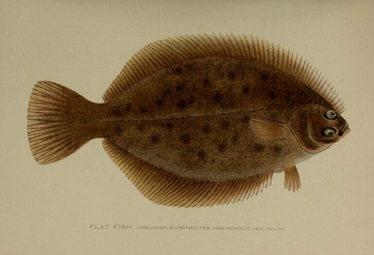
Photo: New York (State). Forest, Fish and Game Commission, Public domain

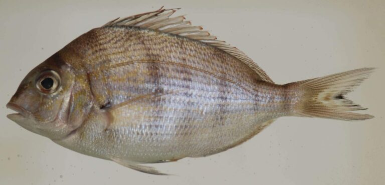
Photo: Smithsonian Environmental Research Center, CC BY 2.0

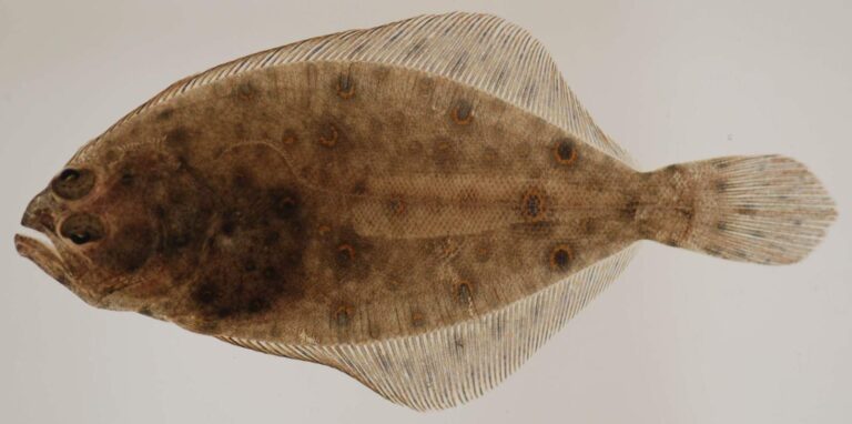
Photo: Smithsonian Environmental Research Center, CC BY 2.0

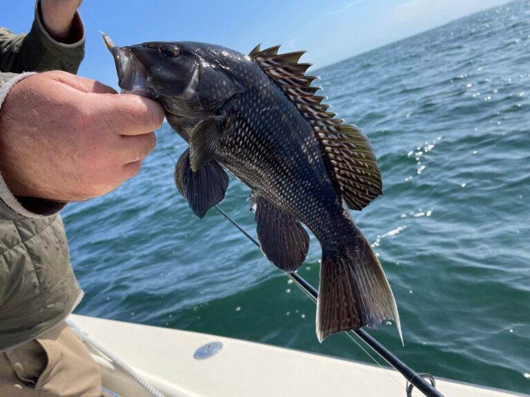
Photo: (c) Jim Arrigoni, some rights reserved (CC BY), CC BY 4.0

Quick replies on Long Island Sound
Which DEC paperwork fits a trip onto Long Island Sound?
Anglers 16 and older who fish for saltwater species, or for migratory fish of the sea, enroll in the free DEC Recreational Marine Fishing Registry instead of buying a license; freshwater fishing takes the DEC license ($25.00 resident, $50.00 nonresident).
How many public launches serve Long Island Sound?
36 launches are listed on this page, among them Manorhaven Beach Park, Oyster Bay Marine Waterway Access Site and Carmans River access, Suffolk County.
What do anglers catch in Long Island Sound?
Winter flounder, striped bass, scup, summer flounder, black sea bass, oyster toadfish and tautog.
Where can I stand on land and cast into Long Island Sound?
24 piers and 215 other shore sites are listed, such as Cedar Beach, Mount Sinai and Pryibil Beach, Glen Cove.
Which guides or charters work Long Island Sound?
5 businesss from the DEC licensed guide list are shown, for example Elite Long Island Outfitter.
Which NOAA station tracks the level of Long Island Sound?
1 NOAA station print their latest reading in the water level band.
Which counties border Long Island Sound in New York?
Bronx County, Nassau County, Queens County, Suffolk County and Westchester County.
What is the striped bass limit on Long Island Sound?
1; minimum 28" to 31" (slot); Apr 15 – Dec 15.
What is the summer flounder limit on Long Island Sound?
3; minimum 19"; May 4 – Aug 1.
Are there artificial reefs in Long Island Sound?
5 DEC reefs, among them Huntington/Oyster Bay Reef, Matinecock Reef and Mattituck Reef.
Spend a full New York day out on Long Island Sound
Pick a launch above and read the DEC table first.