Tallapoosa River Fishing
Haralson County and Paulding County, designated trout water.
 Pick for troutPiscifun Carbon X ultralight spinning reel28% OFFSale $57.99
Photo, nearby stand in for Tallapoosa River: National Trails Office ( US National Park Service ), Public domain
Quick look at the Tallapoosa River
NHD mapping traces the Tallapoosa River, a river, through Haralson County and Paulding County. Its Georgia mileage on the NHD comes to roughly 47 miles. Tallapoosa is the nearest Census town, about 3 miles from the mapped midpoint.
Trout designation covers close to 19.8 miles. Live readings arrive from 1 live gauge. There are 4 public ramp or put-ins on its banks.
 For the trout herePiscifun Carbon XT ultralight spinning reel25% OFFSale $59.99
Trout water on the Tallapoosa River
Georgia keeps designated trout water open all year, with a daily limit of 8 trout (brook, rainbow, brown and hybrids) statewide.
Designated trout water needs the $10 resident trout license (nonresidents $25) on top of the Georgia fishing license ($15 resident, $50 nonresident).
WRD Trout Fishing layer (designated trout streams) and the 2026-2027 Georgia Hunting and Fishing Regulations trout section. Georgia trout streams.
What anglers catch in the Tallapoosa River
Georgia sources link these species to the Tallapoosa River.
WRD Water Access Points species flags, WRD trout layer and forecasts.
What the Tallapoosa River gauges read right now
Current discharge and height for the Tallapoosa River, from USGS.
| USGS gauge | Latest reading | Time (ET) |
|---|---|---|
| Tallapoosa River At Us 78, Near Tallapoosa, Ga | 48 cfs, 1.20 ft gage height | Nov 13 7:00 am |
US Geological Survey provisional data, retrieved Nov 13, 2026 7:33 am ET. Provisional readings can be revised.
Ramps and put-ins on the Tallapoosa River
- Poplar Springs Canoe Launchcarry-in launch, Haralson County
- GA Hwy 100 Canoe Launchcarry-in launch, Haralson County
- Broad Street Canoe Launchcarry-in launch, Haralson County
- Lazy River Rentals Boat Rampcarry-in launch, fee, Haralson County
WRD Water Access Points, Georgia water trails layer, USGS gauges.
Daily creel and length rules for the Tallapoosa River
| Species | Daily limit and size | Season |
|---|---|---|
| Black bass (all species combined) | 10 in total, only 5 of which may be Altamaha, Bartrams, Chattahoochee, Coosa, Shoal, Smallmouth, Suwannee, Tallapoosa | Open all year |
| Largemouth bass | Counts toward 10 black bass total; minimum length 12 inches statewide (exceptions on listed lakes and PFAs) | Open all year |
| Spotted bass | Counts toward 10 black bass total; no statewide minimum length (14 inches on Lake Lanier) | Open all year |
| Shoal bass | Counts toward 10 black bass total (only 5 may be shoal and other listed bass); minimum length 15 inches statewide (Flint River below Warwick Dam slot) | Open all year |
| Smallmouth bass | Counts toward 10 black bass total; only 5 of the 10 may be smallmouth and other listed bass; no minimum length | Open all year |
| Striped, white and hybrid bass | 15 in total, only two of which can be 22 inches or longer | Open all year |
| Crappie | 30 | Open all year |
| Bream (sunfish) | 50 in total | Open all year |
| Catfish | No limit | Open all year |
| Walleye | 8 | Open all year |
| Pickerel | 15 | Open all year |
| American and hickory shad | 8 | Open all year |
Limits from the 2026-2027 Georgia Hunting and Fishing Regulations guide; every Georgia limit on one page.
Spots by the Tallapoosa River
Lakes that pair well with the Tallapoosa River
- American Legion Lake4 miles
- John Tanner State Park Lake A14 miles
- John Tanner State Park Lake B15 miles
- J.L. Lester Lake15 miles
Gear and bait a short hop from the Tallapoosa River
- All Natural Worm Castingsbait and tackle shop, Bremen, 15 miles
- Bait Shopbait and tackle shop, Cedartown, 18 miles
- North-27 Bait & Tacklebait and tackle shop, Carrollton, 18 miles
- McKenzie Bait & Tacklebait and tackle shop, Temple, 20 miles
- Barnes Storebait and tackle shop, Carrollton, 20 miles
Nearby towns for a the Tallapoosa River trip
- Tallapoosa3 miles
- Buchanan8 miles
- Waco9 miles
- Bremen10 miles
Neighboring creeks and rivers of the Tallapoosa River
- Mann Creek3 miles
- Flat Wood Creek5 miles
- Little Creek, Haralson County8 miles
- Big Creek, Haralson County8 miles
the Tallapoosa River, county by county
A Piscifun reel lineup for the Tallapoosa River


Piscifun and Amazon links are affiliate links; the site earns a commission on qualifying purchases.
Know what you hooked at Tallapoosa River
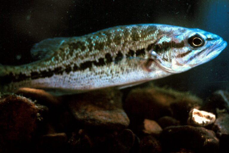
Photo: Dick Biggins, USFWS, Public domain

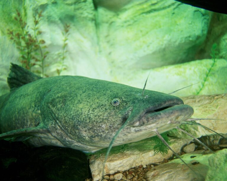
Photo: Engbretson, Eric / U.S. Fish and Wildlife Service, Public domain


Photo: Brian Gratwicke, CC BY 2.0

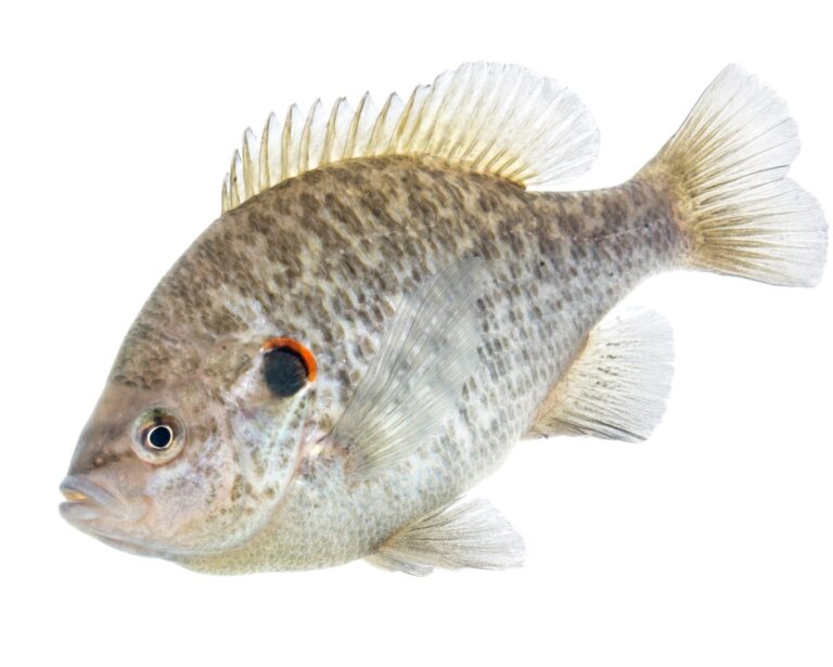
Photo: USFWS Mountain Prairie, Public domain

Before a float or wade on the Tallapoosa River
What part of Georgia holds the Tallapoosa River?
It flows across Haralson County and Paulding County.
Do I need a trout license on the Tallapoosa River?
It holds about 19.8 designated miles.
Does USGS run a live gauge on the Tallapoosa River?
USGS runs 1 USGS gauge; values are above.
Where do anglers launch on the Tallapoosa River?
4 public ramps; Poplar Springs Canoe Launch is one.
Are striped bass rules different on the Tallapoosa River?
Statewide freshwater limits apply, such as 10 black bass and 30 crappie a day.
Can a nonresident fish the Tallapoosa River?
Designated trout water needs the $10 resident trout license (nonresidents $25) on top of the Georgia fishing license ($15 resident, $50 nonresident).
Where are crickets sold near the Tallapoosa River?
Drive 15 miles to All Natural Worm Castings.
What might a Georgia angler hook in the Tallapoosa River?
Listed: largemouth bass, spotted bass, tallapoosa bass, channel catfish, flathead catfish and yellow bullhead.
Which Georgia town makes a handy base for the Tallapoosa River?
Use Tallapoosa, roughly 3 miles off.
A float on the Tallapoosa River starts here
Read the posted rules and check the river level.