Oconee River Fishing
Laurens County and 11 other counties.
 Pick for catfishPiscifun LumiCat II catfish rod48% OFFSale $114.99
Photo of Ocmulgee River: Michael Rivera, CC BY-SA 4.0
First things to know about the Oconee River
The Oconee River is a Georgia river running through Laurens County and 11 other counties. Roughly 220 miles flow inside the state line. Plan around Uvalda, around 6 miles from the river. Part of it is mapped as Lower Oconee River Water Trail and Upper Oconee Water Trail.
There are 6 live gauges along the channel. WRD maps 16 public ramp or put-ins along it.
WRD fishing forecast for the Oconee River
These lines on the Oconee River come from the WRD forecast.
“The Oconee River is formed by the confluence of the Middle Oconee River and North Oconee River just south of Athens and flows southwest for about 265 miles where it joins the Ocmulgee River to form the Altamaha River.”
The forecast picks Bream, Catfish, Largemouth Bass on the Oconee River.
| Species | WRD prospect (quoted) |
|---|---|
| Black Bass | Both Largemouth and Altamaha bass are available along with the occasional spotted bass and potentially a shoal bass as well. Hybrid Black Bass have been documented in this river as well. The lower section of the river holds good amounts of Largemouth, especially in the Dublin area. |
| White Bass | March through April are the best months to target White Bass, as they make spawning runs up the Oconee and Apalachee rivers. |
| Catfish | Sampling efforts in the summer of 2025 revealed decent of smaller channel and white catfish throughout the river. While flathead catfish numbers seem to have stabilized, blue catfish have continued to expand their population and several 15-plus pound Blues were captured during DNR sampling efforts. |
| Bream | During fall electrofishing surveys on the lower Oconee River in 2025 Region 4 Fisheries Management staff captured good numbers of a variety of Sunfish (Bream) species. |
| Crappie | Good numbers of harvestable-size Crappie were observed in the 2025 fall sampling efforts. Fish from February through April for large numbers and larger fish. A new river record Black Crappie was caught in December of 2024, weighing in at 1lb. 11.6 oz. |
| Bowfin | The Oconee River also holds some substantial size Bowfin. The recent river record (7lb & 6 oz) was caught in July of 2023. Biologists have sampled 10 to 12 lb specimens in the river, so the current record can be surpassed. |
Georgia WRD fishing forecast (Fishing Forecast – Oconee River), updated February 9, 2026. Full forecast.
 For the catfish herePiscifun Chaos XS round baitcaster36% OFFSale $57.99
The Oconee River species list
The Oconee River list combines access point flags with forecast and record entries.
WRD Water Access Points species flags, WRD trout layer and forecasts.
The Oconee River gauges today
Check these USGS numbers for the Oconee River before wading or launching.
| USGS gauge | Latest reading | Time (ET) |
|---|---|---|
| Oconee River Near Penfield, Ga | 168 cfs, 2.79 ft gage height | Nov 13 9:00 am |
| Oconee River At Milledgeville, Ga | 329 cfs, 7.12 ft gage height | Nov 13 9:15 am |
| Oconee River At Avant Mine, Near Oconee, Ga | 378 cfs, 1.38 ft gage height | Nov 13 8:45 am |
| Oconee River Near Oconee, Ga | 421 cfs, 1.20 ft gage height | Nov 13 8:45 am |
| Oconee River At Dublin, Ga | 533 cfs, 1.36 ft gage height | Nov 13 8:45 am |
| Oconee River Near Mount Vernon, Ga | 624 cfs, 0.55 ft gage height | Nov 13 9:00 am |
US Geological Survey provisional data, retrieved Nov 13, 2026 9:33 am ET. Provisional readings can be revised.
Put-ins for boats and kayaks on the Oconee River
- Redlands (SR15) Boat Ramp2 lanes, dock, restroom, Greene County
- Dyar Pasture Boat Ramp1 lane, dock, restroom, fee, Greene County
- Sinclair Dam Boat Ramp2 lanes, Baldwin County
- Milledgeville (SR22) Boat Ramp2 lanes, Baldwin County
- Central State Boat Ramp2 lanes, Baldwin County
- Balls Ferry State Park2 lanes, restroom, fee, Wilkinson County
- Beaverdam WMA Boat Ramp2 lanes, Wilkinson County
- Deep Creek Boat Ramp1 lane, Laurens County
- Blackshear Ferry Landing1 lane, Laurens County
- Buckeye Landing2 lanes, Laurens County
- Shady Field Landing2 lanes, restroom, Laurens County
- Dead River Landing1 lane, Treutlen County
- Soperton Bridge Landing1 lane, Wheeler County
- Mt. Vernon Bridge (US280) Boat Ramp2 lanes, Wheeler County
- Clark Bluff Landing1 lane, Wheeler County
- Bell's Ferry Boat Ramp2 lanes, Montgomery County
The Oconee River as a water trail
- Lower Oconee River Water Traildeveloping, 141 mi
- Upper Oconee Water Traildeveloping, 145.8 mi
WRD Water Access Points, Georgia water trails layer, USGS gauges.
Harvest rules in force along the Oconee River
For the Oconee River, the 2026-2027 Georgia Hunting and Fishing Regulations prints these exceptions.
| Water as printed | Rule |
|---|---|
| Oconee River (downstream of GA Hwy 22 in Milledgeville) | Striped bass, white bass and hybrid white-striped bass: limit is two fish, both of which must be 22 inches in length or longer (includes tributaries to these river sections). |
| Species | Daily limit and size | Season |
|---|---|---|
| Black bass (all species combined) | 10 in total, only 5 of which may be Altamaha, Bartrams, Chattahoochee, Coosa, Shoal, Smallmouth, Suwannee, Tallapoosa | Open all year |
| Largemouth bass | Counts toward 10 black bass total; minimum length 12 inches statewide (exceptions on listed lakes and PFAs) | Open all year |
| Spotted bass | Counts toward 10 black bass total; no statewide minimum length (14 inches on Lake Lanier) | Open all year |
| Shoal bass | Counts toward 10 black bass total (only 5 may be shoal and other listed bass); minimum length 15 inches statewide (Flint River below Warwick Dam slot) | Open all year |
| Smallmouth bass | Counts toward 10 black bass total; only 5 of the 10 may be smallmouth and other listed bass; no minimum length | Open all year |
| Striped, white and hybrid bass | 15 in total, only two of which can be 22 inches or longer | Open all year |
| Crappie | 30 | Open all year |
| Bream (sunfish) | 50 in total | Open all year |
| Catfish | No limit | Open all year |
| Walleye | 8 | Open all year |
| Pickerel | 15 | Open all year |
| American and hickory shad | 8 | Open all year |
Limits from the 2026-2027 Georgia Hunting and Fishing Regulations guide; every Georgia limit on one page.
Georgia state records from the Oconee River
| Species | Weight | Date | Method |
|---|---|---|---|
| Striped Bass | 63 lb, 0 oz | May 30, 1967 | hook and line |
WRD state record list; angler names left out.
Short drives from the Oconee River
Georgia lakes in the same area as the Oconee River
- Little Ocmulgee Lake18 miles
- Lake Mayers19 miles
- Dunns Lake23 miles
- Cotton Patch Pond24 miles
Crickets, shiners and line near the Oconee River
- Dennis Sport Shopbait and tackle shop, Lyons, 16 miles
- Jiffy Jigsbait and tackle shop, Vidalia, 17 miles
- 4-J Gun Smithbait and tackle shop, Tarrytown, 19 miles
- Big Buck Bait & Tacklebait and tackle shop, Mc Rae Helena, 21 miles
Places to stay close to the Oconee River
- Uvalda6 miles
- Alston8 miles
- Lumber City9 miles
- Mount Vernon10 miles
More Georgia rivers near the Oconee River
- Little Ocmulgee River9 miles
- Ohoopee River30 miles
- Little Ohoopee River32 miles
- Seventeen Mile River52 miles
County pages that include the Oconee River
- Laurens County
- Greene County
- Baldwin County
- Wheeler County
- Montgomery County
- Putnam County
- Wilkinson County
- Washington County
Piscifun tackle chosen with the Oconee River in mind


Piscifun and Amazon links are affiliate links; the site earns a commission on qualifying purchases.
Pictures of the fish at Oconee River
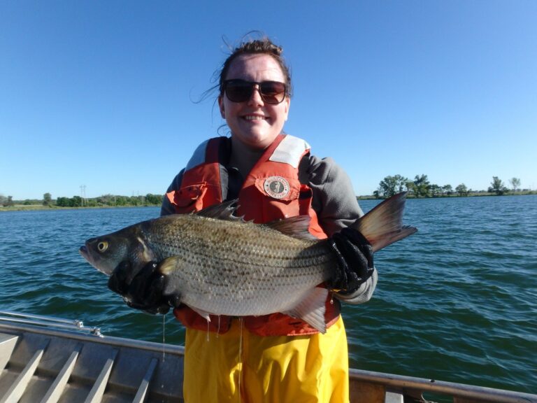
Photo: USFWS Mountain Prairie, Public domain

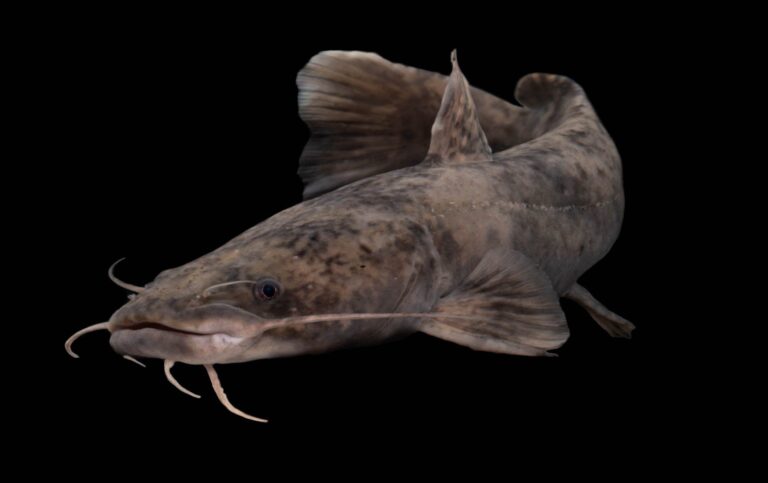
Photo: USFWS Mountain Prairie, Public domain

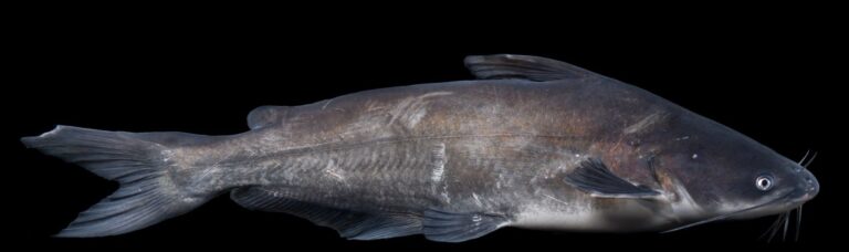
Photo: USFWS Mountain Prairie, Public domain

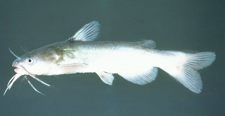
Photo: Unknown author, CC BY-SA 2.5

The Oconee River: quick answers for anglers
Which Georgia counties does the Oconee River cross?
Look in Laurens County and 11 other counties.
How many trout miles does the Oconee River have?
It is not on the trout layer.
Is the Oconee River up or down today?
Readings from 6 USGS gauges appear on this page.
How many public launches does WRD map on the Oconee River?
16 public ramps, including Mt. Vernon Bridge (US280) Boat Ramp.
How many fish may I keep from the Oconee River?
Oconee River (downstream of GA Hwy 22 in Milledgeville): Striped bass, white bass and hybrid white-striped bass: limit is two fish, both of which must be 22 inches in length or longer (includes tributaries to these river sections).
What does it cost to fish the Oconee River?
Georgia asks anglers 16 and older for a fishing license: $15 for residents and $50 for nonresidents, each good for 365 days from purchase.
Where do I pick up bait on the way to the Oconee River?
Closest listing: Dennis Sport Shop, 16 miles.
What does WRD say swims in the Oconee River?
largemouth bass, white bass, channel catfish, bluegill, black crappie and bowfin, per WRD.
Which Georgia town sits near the Oconee River?
Uvalda, about 6 miles from the midpoint.
Pack the waders for the Oconee River
Look at flow and the rules first.