Flint River Fishing
Baker County and 17 other counties.
 Pick for shoal bassPiscifun Chaos Pro CNC baitcasting reel25% OFFSale $97.99
Photo: Michael Rivera, CC BY-SA 4.0
Meet the Flint River
The Flint River winds through Baker County and 17 other counties as a river. The mapped Georgia length is close to 343 miles. Supplies are in Newton, near 7 miles off. Some of it is part of Flint River Water Trail.
USGS runs 6 live gauges on it. Put in at one of 17 public ramp or put-ins.
Biologist notes on the Flint River
The Wildlife Resources Division outlook for the Flint River reads as follows.
“The Upper Flint River is one of Georgia's most treasured natural resources and home to a unique and productive sport fishery. It provides the most suitable habitat anywhere for the shoal bass, one of Georgia's signature species. In 2020, the shoal bass was officially named Georgia's Native Riverine Sportfish. Characteristics of the Flint River make it especially suitable for canoe and kayak float trips.”
For the Flint River, the forecast points to Shoal Bass, Spotted Bass, Redbreast Sunfish, Channel Catfish, Flathead Catfish.
| Species | WRD prospect (quoted) |
|---|---|
| Shoal Bass | 15-inch minimum length limit for shoal bass from the Flint River and its tributaries upstream of Warwick Dam. Shoal bass are considered the signature species of the Flint River and current size structure indicates good reproductive success, with quality fishing expected for the next couple of… |
| Spotted Bass | Spotted bass were illegally introduced into the upper Flint several years ago and they are now slightly more abundant than shoal bass in the Piedmont above Highway 96. Spotted bass presently reach maximum lengths of 16 – 17 inches, compared to 20 – 22 inches for shoal bass. |
| Catfish | Channel and flathead catfish are numerous in both the Piedmont and Coastal Plain sections of the upper Flint River, and larger channel catfish in the 5-7 pound range are presently common. Also expect the occasional 40-plus pound flathead, so come prepared with stout gear. |
| Bream | In addition to shoal bass, redbreast sunfish are another angler favorite. The Flint is known for its hand-sized redbreast and the larger fish are presently abundant. Over 30% are in the 6-7 inch class. |
| Other Species | Other species also common in both Piedmont and Coastal Plain sections of the upper Flint River are largemouth bass, bluegill, redear sunfish (shellcrackers) and crappie. |
Georgia WRD fishing forecast (Fishing Forecast – Upper Flint River), updated March 10, 2026. Full forecast.
 For the shoal bass herePiscifun AlinoX 300 low profile baitcaster34% OFFSale $104.99
What bites in the Flint River
Species for the Flint River come from WRD access point flags, its forecast and the record lists.
WRD Water Access Points species flags, WRD trout layer and forecasts.
Water height and flow along the Flint River
Below are the newest USGS readings from gauges on the Flint River.
| USGS gauge | Latest reading | Time (ET) |
|---|---|---|
| Flint River At Ga 85, Near Forest Park, Ga | 4 cfs, -1.28 ft gage height | Nov 11 12:45 am |
| Flint River Near Lovejoy, Ga | 27 cfs, 1.27 ft gage height | Nov 11 12:45 am |
| Flint River At Woolsey Road, Near Woolsey, Ga | 30 cfs, 38.58 ft gage height | Nov 11 12:45 am |
| Flint River Near Griffin, Ga | 46 cfs, 2.37 ft gage height | Nov 11 12:45 am |
| Flint River Below Big Branch, Near Molena, Ga | 101 cfs, 4.51 ft gage height | Nov 11 1:00 am |
| Flint River Near Thomaston, Ga | 193 cfs, 2.76 ft gage height | Nov 11 1:15 am |
US Geological Survey provisional data, retrieved Nov 11, 2026 1:32 am ET. Provisional readings can be revised.
Launch points along the Flint River
- Meriwether Landing1 lane, Meriwether County
- Sprewell Bluff East WMA Boat Ramp2 lanes, restroom, fee, Upson County
- Big Lazer Hand Launch 2carry-in launch, Talbot County
- Big Lazer Hand Launchcarry-in launch, Talbot County
- Big Lazer Creek WMA, Po Biddy Rd Boat Ramp1 lane, Upson County
- Hwy 80/3 Bridge Boat Ramp1 lane, Taylor County
- HWY 128 Bridge Boat Ramp2 lanes, Crawford County
- Hwy 96 Bridge Boat Ramp1 lane, Crawford County
- Crooks Landing2 lanes, Macon County
- George Hooks (SR49) Boat Ramp2 lanes, Macon County
- Reeves Landing1 lane, Sumter County
- Camper's Haven Marina1 lane, dock, restroom, fee, Dooly County
- State Highway 32 Boat Ramp2 lanes, Lee County
- Marine Corps Ditch Boat Ramp2 lanes, Dougherty County
- Punks Landing1 lane, Mitchell County
- Newton (SR37) Boat Ramp2 lanes, Mitchell County
- Norman's Ferry Boat Ramp1 lane, Baker County
- Flint River WMAbank fishing area
Paddle trails along the Flint River
- Flint River Water Traildeveloping, 342.8 mi
WRD Water Access Points, Georgia water trails layer, USGS gauges.
Rules covering the Flint River
Listed exceptions on the Flint River replace statewide numbers where they apply.
| Water as printed | Rule |
|---|---|
| Flint River downstream of Warwick Dam (Lake Blackshear) | Shoal bass between 15 and 20 inches must be released immediately. All others may be kept. |
| Flint River (Albany Georgia Power Co. dams to US Hwy 84 bridge) and tributaries | CLOSED to striped bass fishing and spear fishing from May 1 – October 31 each year. |
| Species | Daily limit and size | Season |
|---|---|---|
| Black bass (all species combined) | 10 in total, only 5 of which may be Altamaha, Bartrams, Chattahoochee, Coosa, Shoal, Smallmouth, Suwannee, Tallapoosa | Open all year |
| Largemouth bass | Counts toward 10 black bass total; minimum length 12 inches statewide (exceptions on listed lakes and PFAs) | Open all year |
| Spotted bass | Counts toward 10 black bass total; no statewide minimum length (14 inches on Lake Lanier) | Open all year |
| Shoal bass | Counts toward 10 black bass total (only 5 may be shoal and other listed bass); minimum length 15 inches statewide (Flint River below Warwick Dam slot) | Open all year |
| Smallmouth bass | Counts toward 10 black bass total; only 5 of the 10 may be smallmouth and other listed bass; no minimum length | Open all year |
| Striped, white and hybrid bass | 15 in total, only two of which can be 22 inches or longer | Open all year |
| Crappie | 30 | Open all year |
| Bream (sunfish) | 50 in total | Open all year |
| Catfish | No limit | Open all year |
| Walleye | 8 | Open all year |
| Pickerel | 15 | Open all year |
| American and hickory shad | 8 | Open all year |
Limits from the 2026-2027 Georgia Hunting and Fishing Regulations guide; every Georgia limit on one page.
Heaviest Georgia fish from the Flint River
| Species | Weight | Date | Method |
|---|---|---|---|
| Shoal Bass | 8 lb, 5 oz | April 16, 2022 | hook and line |
| Shadow Bass | 0 lb, 10 oz | June 1, 2016 | hook and line |
WRD state record list; angler names left out.
Around the Flint River on the map
Other lakes a short haul from the Flint River
- Tired Creek Lake22 miles
Where to grab bait close to the Flint River
- Chapman Bait And Tackle Incbait and tackle shop, Colquitt, 23 miles
- American Bandit Incbait and tackle shop, Bainbridge, 23 miles
- Hi Way Bait & Tackle 2bait and tackle shop, Cairo, 24 miles
- Westside Bait And Tacklebait and tackle shop, Bainbridge, 25 miles
Towns to bunk in for a the Flint River weekend
- Newton7 miles
- Camilla11 miles
- Pelham16 miles
- Baconton18 miles
Nearby moving water to the Flint River
- Chickasawhatchee Creek13 miles
- Cypress Creek24 miles
- Kiokee Creek26 miles
- Little Ochlockonee River27 miles
County guides covering the Flint River
- Baker County
- Decatur County
- Macon County
- Upson County
- Dougherty County
- Crawford County
- Clayton County
- Pike County
Spinning and baitcast picks from Piscifun for the Flint River


Piscifun and Amazon links are affiliate links; the site earns a commission on qualifying purchases.
Telling apart the fish of Flint River
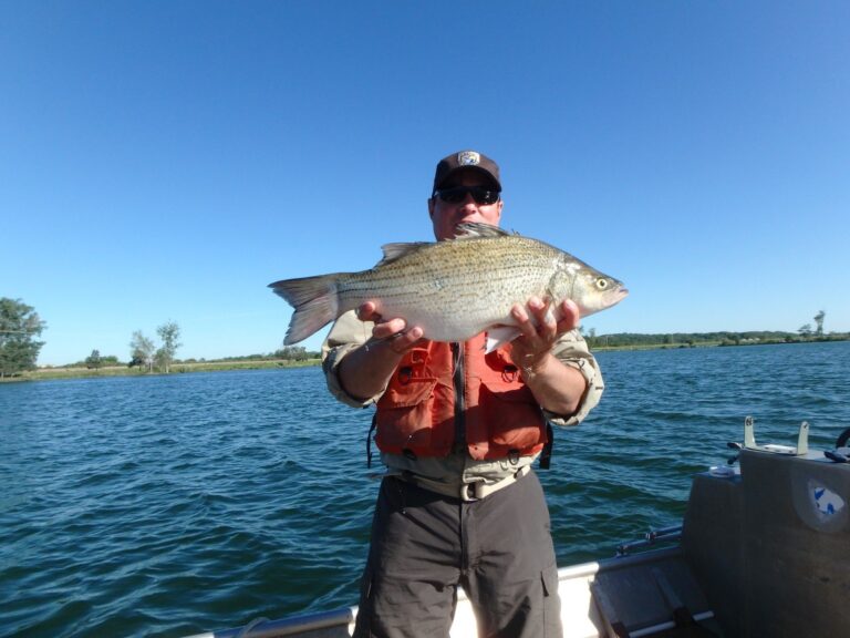
Photo: USFWS Mountain Prairie, Public domain

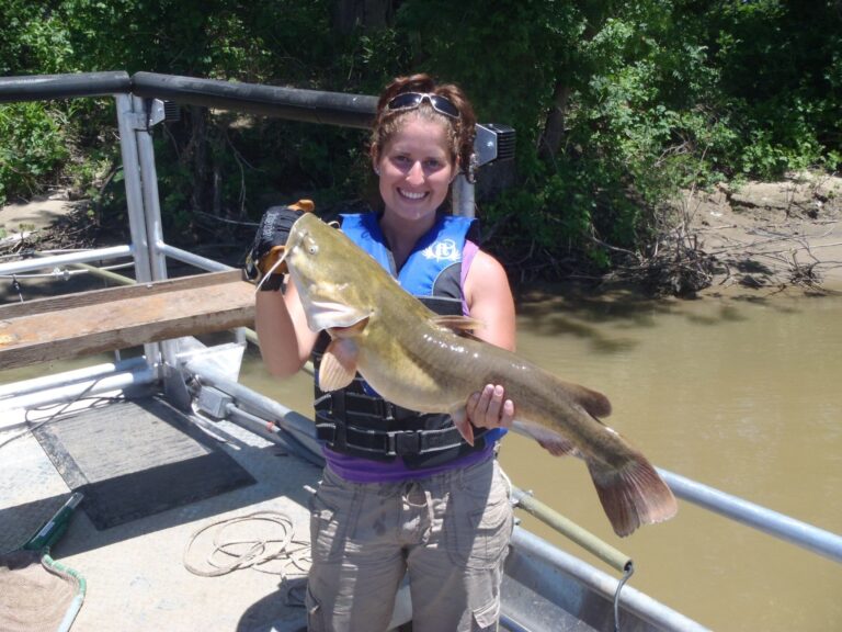
Photo: USFWSmidwest, Public domain


Photo: Brian Gratwicke, CC BY 2.0

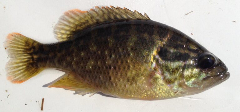
Photo: Fredlyfish4, CC BY-SA 3.0

What gets asked most about the Flint River
How do I find the Flint River on a Georgia map?
It runs through Baker County and 17 other counties.
Does WRD stock trout in the Flint River?
No, WRD gives it no trout designation.
Where do I look up current flow for the Flint River?
Scroll up for 6 USGS gauges.
Where would I slide a boat into the Flint River?
WRD lists 17 public ramps; try Big Lazer Creek WMA, Po Biddy Rd Boat Ramp.
What creel limits does Georgia set on the Flint River?
Flint River downstream of Warwick Dam (Lake Blackshear): Shoal bass between 15 and 20 inches must be released immediately. All others may be kept.
What do visitors pay to fish the Flint River?
Georgia asks anglers 16 and older for a fishing license: $15 for residents and $50 for nonresidents, each good for 365 days from purchase.
Who sells crickets and worms near the Flint River?
Chapman Bait And Tackle Inc, about 23 miles away.
Is the Flint River good for bass?
Look for shoal bass, spotted bass, channel catfish, bluegill, largemouth bass and white bass.
Which town works as a base camp for the Flint River?
The nearest town is Newton, 7 miles.
Set a date for the Flint River
Buy the license and trout license online first.